Okehampton, East Okement River, Lower Halstock, East Hill and West Okement River
A ramble through hills, woodland and riversides to a romantic ruin
Google Maps Open Source Maps| Statistics and Files | ||
|---|---|---|
| Start: Okehampton | Distance: 5.2 miles (8.3 km) | Climbing: 227 metres |
| Grid Ref: SX 58659 95323 | Time: 2-3 hours | Rating: Moderate |
| GPX Route File | Google Earth File | About Okehampton |
| Statistics | |
|---|---|
| Start: Okehampton | Distance: 5.2 miles (8.3 km) |
| Climbing: 227 metres | Grid Ref: SX 58659 95323 |
| Time: 2-3 hours | Rating: Moderate |
| GPX Route File | Google Earth File |
Ordnance Survey Explorer Map (1:25,000)
The Walk:
Okehampton lies roughly at the midpoint between Exeter, the administrative capital of Devon, and Launceston, the ancient capital of Cornwall. It owes its importance to its strategic position on the main road route through the two counties, today's A30. Tucked below the tors marking the northern limits of Dartmoor, Okehampton has seen centuries of traffic pass through its pretty streets; its many pubs and hotels are testimony to that.
As cars increased in popularity, this traditional gateway to the south-west became a barrier to it; holiday traffic frequently choked the town to a standstill. Okehampton became a byword for bottlenecks. Now, the A30 has been re-routed to it bypasses the old town.
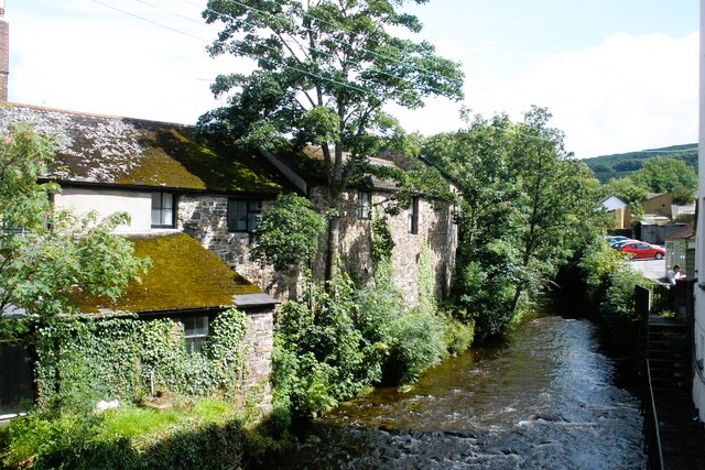 East Okement River
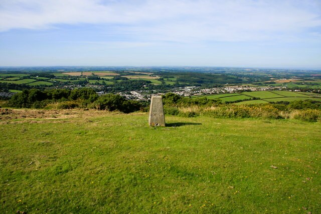 Trig Point on East Hill with the view to Okehampton
There is plenty to see and do in Oakhampton before starting on the walk. The Museum of Dartmoor Life has exhibits that reveal the fascinating relationship between the moor and those who made their home there in days gone by.
From the museum, it is just a short stroll to Town Mills on the edge of the town. Formerly a grist and woollen mill, it was still working in the 1950's, but is now private houses. However, the old mill wheel still turns, driven by a leat from the East Okement River.
From the mill to the halfway point of the walk, the route never strays far from the little river, whose voice grows louder and more exuberant at each upstream stretch. Mixed woodland cloaks the valley sides and in August the green is startingly punctuated by the scarlet berries of rowan, or mountain ash.
Squirrels abound here, and nuthatches betray their presence by hammering on nuts wedged in tree bark, while furtive jays utter their harsh curses from a safe distance.
The imposing stone viaduct at Fatherford has carried a railway for over a century. It is still used, but only to transport stone from a nearby quarry. Beyond the viaduct, the river and landscape become noticeably wilder as the path enters the upper valley of the East Okement River. While in the lowest stretches, there was a variety of trees, now there are only widely spaced moss covered oaks. Great slabs of rock erupted along the valley side.
The river is at its most splendid here, running fast and shallow, and noisy with gushing water. The climb out of the wood reveals a brief taste of the delicious panorama to come as a path opens to cross the bracken covered slopes towards Lower Halstock Farm.
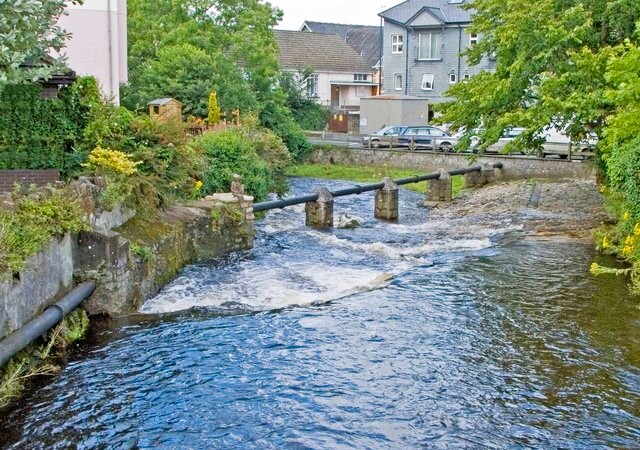 West Okement River
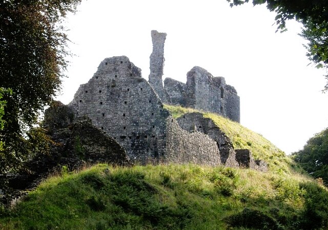 Okehampton Castle
A made up track presents you with a long, gentle ascent to the highest point of the walk. From this open shoulder of the moorland edge on the rim of East Hill, the views to the left, right and ahead are limited only by the light. It is worth the short detour to access the hill top and touch the trig point to gain the best of the panoramic view on offer. This includes a great view northwards to Okehampton and its varied rooftops.
The return route is downhill all the way. Beyond the bridges over the A30 and the railway, the keep of Okehampton Castle peeks over the trees, as yet giving no sign that it was part of Devon's largest castle.
The Norman Castle was begun by Baldwin de Brionne, but most of it dates from a reconstruction in the early 1300's. In 1538, Henry VIII had the owner, Lord Exeter, beheaded and partly dismantled his castle.
Close to the castle, the route crosses the West Okement River on its way to the East Okement River, and returns to the centre of the town.
Acknowledgments: Text derived from the Out and Out Series; Discovering the Countryside on Foot. Pictures courtesy of Wikipedia.


