Langport, River Parrett Trail and Muchelney Abbey
A riverside walk across the Somerset Levels to an historic abbey
Google Maps Open Source Maps| Statistics and Files | ||
|---|---|---|
| Start: Langport | Distance: 5.0 miles (8.0 km) | Climbing: 20 metres |
| Grid Ref: ST 41948 26696 | Time: 2-3 hours | Rating: Easy |
| GPX Route File | Google Earth File | About Langport |
| Statistics | |
|---|---|
| Start: Langport | Distance: 5.0 miles (8.0 km) |
| Climbing: 20 metres | Grid Ref: ST 41948 26696 |
| Time: 2-3 hours | Rating: Easy |
| GPX Route File | Google Earth File |
Ordnance Survey Explorer Map (1:25,000)
The Walk:
There were no less than 23 monastic foundations in Somerset at the Dissolution. The oldest, largest, and by far the wealthiest, was Glastonbury Abbey. The second oldest was at Muchelney, just to the south of the Polden Hills.
This walk to the abbey begins in Langport, an ancient town that was a key site in King Alfred's defence of Wessex against the Danes in the 9th century. Langport remained an important town until the 19th century, as it lay on the main road between London, Taunton and Exeter, and was a busy port set on the tidal limit of the River Parrett.
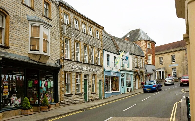 Cheapside, Langport
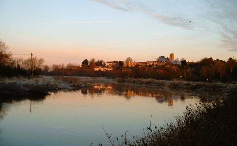 View to Langport from the River Parrett
The town exported the produce of the moors, where geese were kept in huge numbers. Flocks of 3,000 were common. The birds were sold for meat and plucked annually for down, and for quills. Eels caught in the rhines were also exported, while coal came in from South Wales, the Forest of Dean and Shropshire.
The walk follows Cheapside, the old market street, and climbs The Hill to All Saints Church, focus of the old town. The church, which is often locked, has some good stained glass and there is a fine Norman relief over the south door.
The view south across the moor from the churchyard makes it easy to appreciate the strategic position of the town, which was well fortified in the Middle Ages. The route leads through a remnant of these fortifications, Eastgate. Above the gate is the plain Hanging Chapel, formerly the guild chapel, or corporation chapel, of the town.
Less than a half mile down the hill is Huish Episcopi. St Mary's Church has some good 12th and 14th century work and a Berne-Jones window, but is famed for its 100 foot (30.5 metre) tower, with its three elaborately decorated stages topped by pierced battlements and a forest of slender pinnacles.
The route follows the edge of the Parrett as the river winds lazily through rich pastures. The silt of the riverbed is home to large pearl bearing freshwater mussels.
Ahead is Muchelney, set on a slight rise (the name Muchelney means 'big island). A Benedictine abbey was set up there in AD 939 on the site of an 8th century foundation. The surrounding farms once served the abbey, but were sold, or leased off, in the early 16th century to raise money for new buildings. The abbey's income dwindled, and it closed in 1538, just before it was due to be dissolved.
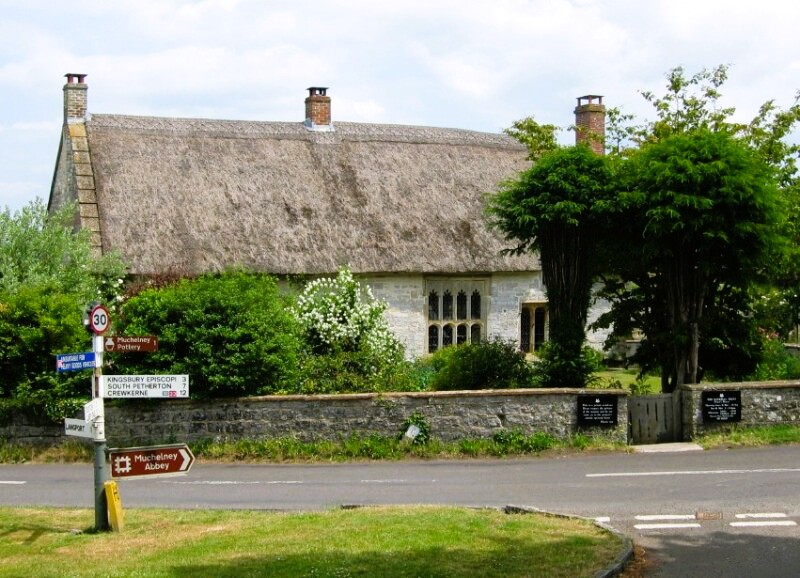 The village of Muchelney
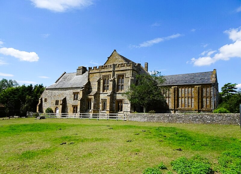 Muchelney Abbey
The newly built Abbot's House became a farmhouse, which ensured its survival. It is now owned by English Heritage. The main attraction is the magnificent fireplace on the first floor. The only other abbey building still standing is the stone reredorter (the monks lavatories), which was used as a barn. The rest exists only as exposed foundations excavated in 1873.
Right beside the site of the abbey church is Muchelney's church - the two stood just three feet apart at one point. The latters main feature is the nave and charming paintings on the nave roof, which picture angels in the clouds, and probably date from the 17th century.
Opposite the church entrance is the thatched Priest's House, a rare survival from the 14th century. It is owned by the National Trust. There are many other delightful old buildings to be seen in the village, many of them incorporating parts of the old abbey. The best example of this is Court House Farm. Even brick buildings, such as School Farm House, have stone mullioned windows.
The return route follows the opposite bank of the River Parrett, with fine views back across the meadows to Muchelney, and ahead to Langport and Huish Episcopi.
Acknowledgments: Text derived from the Out and Out Series; Discovering the Countryside on Foot. Pictures courtesy of Wikipedia.


