Totnes, River Dart, Harper's Hill, Windmill Down and Totnes Castle
Architectural delights and old lanes in a period-piece town
Google Maps Open Source Maps| Statistics and Files | ||
|---|---|---|
| Start: Totnes | Distance: 5.2 miles (8.4 km) | Climbing: 210 metres |
| Grid Ref: SX 80919 59663 | Time: 2-3 hours | Rating: Moderate |
| GPX Route File | Google Earth File | About Totnes |
| Statistics | |
|---|---|
| Start: Totnes | Distance: 5.2 miles (8.4 km) |
| Climbing: 210 metres | Grid Ref: SX 80919 59663 |
| Time: 2-3 hours | Rating: Moderate |
| GPX Route File | Google Earth File |
Ordnance Survey Explorer Map (1:25,000)
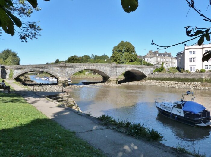
The Walk: Totnes can surprise the visitor from the start. This is the lowest crossing point of the tidal River Dart, but it is not particularly wide, and does not look very deep. Yet high water brings ocean going ships upriver to the town's doorstep. Opposite Steamer Quay, where the walk begins, large freighters can be seen unloading cargoes of timber. This is not an industrial scene though, no docks blight the waterfront, and the commercial activity blends easily with the leisure craft and passenger cruisers that ply regularly between Totnes and Dartmouth.
 River Dart, Totnes
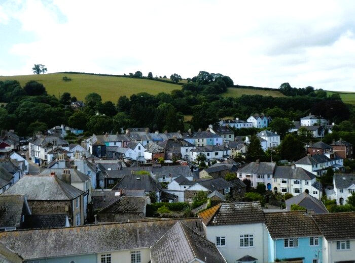 Harper's Hill, Totnes
Crossing Totnes Bridge brings you the first glimpse of the many architectural delights of one of the finest small towns in England. The broad street called The Plains opens to the left, bounded on one side by carefully converted warehouses, and on the other by elegantly restored Georgian buildings.
The openness of The Plains is in sharp contrast to narrow Fore Street, which rises steeply through the heart of the town. The small shops lining the street are discreetly built into the frontages of the old buildings. A timbered top storey overhangs the bottom one; and it is always worthwhile looking up at the top storeys to see intriguing architectural delights.
The arch of the East Gate, the town's best known landmark, straddles the street near the top of the rise. This medieval gateway was almost lost in 1990 when fire, traditionally a scourge in Totnes's close packed streets, caused serious damage. The gateway has now been fully restored, at vast expense.
Just off Fore Street, beyond the East Gate, is the Church of St Mary. Its unusually red sandstone is almost incandescent on a bright day. The stone rood screen inside is one of the finest in Britain.
Beside the church stands Totnes Guildhall, on the site of the refractory of an 11th century Benedictine priory dedicated to St Mary. The town's mayors have been chosen here for over 400 years.
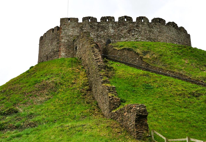 Totnes Castle
 A typical Totnes street
As you head away from the centre, the narrow street closes in further. A bypass marks the boundary of the built up area; crossing it marks a sudden break. Only few strides into Harper's Hill, the hubbub fades into silence. The tarmac lane gives way to a broken stony track which rises relentless for half a mile over Windmill Down. Until the mid 18th century, this lonely green lane was the Plymouth road.
From the top of the hill, Dartmoor fills the horizon to the distance north and west. Here and there, where the arable land has been freshly broken, patches of rich red earth show through against the green.
The return to town is along another old lane. Copland Lane is often wet and overgrown; clumps of great plantain cover the ground around pools of standing water.
Totnes Castle lies towards the end of the walk's circuit. The 15 foot (4.5 metre) thick walls of its circular keep are remarkably intact, largely because no serious battles took place here. As a viewpoint over the town and surrounding area, though, the castle is as dominant as it ever was. It is managed by English Heritage and open to the public, and there is no better place from which to survey Totnes before returning to the start of the walk.
Acknowledgments: Text derived from the Out and Out Series; Discovering the Countryside on Foot. Pictures courtesy of Wikipedia.


