Fforest Coal Pit, Partrishow and Cwmyoy
A visit to two ancient churches hidden in the shadow of the Black Mountains
Google Maps Open Source Maps| Statistics and Files | ||
|---|---|---|
| Start: Fforest Coal Pit | Distance: 6.2 miles (9.9 km) | Climbing: 483 metres |
| Grid Ref: SO 28531 21083 | Time: 3 hours | Rating: Moderate |
| GPX Route File | Google Earth File | About the Black Mountains |
| Statistics | |
|---|---|
| Start: Fforest Coal Pit | Distance: 6.2 miles (9.9 km) |
| Climbing: 483 metres | Grid Ref: SO 28531 21083 |
| Time: 3 hours | Rating: Moderate |
| GPX Route File | Google Earth File |
Ordnance Survey Explorer Map (1:25,000)
The Walk: In the very heart of the Black Mountains lies the remote Grwyne Fawr valley, where the walk begins. Woods, rivers and streams abound, and the walk climbs up to ridges which give some excellent views of the hills and valleys. The highlight of the walk is visiting two little churches dating back to medieval times, each with something unique to offer. The entrance to the valley is at Fforest Coal Pit. This hamlet takes its name not from a coal mine, but from the wooded nature of the valley and the fact that charcoal burning took place here.
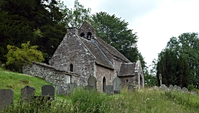 Church of St Issui, Partrishow
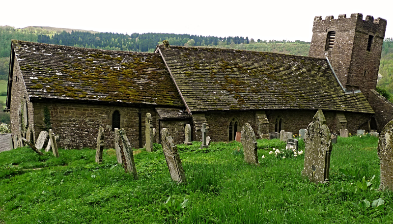 St Martin's Church, Cwmyoy
Not far from the start you cross the ancient packhorse bridge known as Pont Escob (the Bishop's Bridge). It is named after Archbishop Baldwin of Forde who came this way in 1188 while on a tour of Wales to recruit men to fight in the Holy Land of the Third Crusade. Situated in the sheltered valley of Nant Mair (Mary's Brook) lies a little stone covered well commemorating St Patricio. His name, anglicised to Partrishow, has been given to the surrounding area. Near here, the holy man built a simple cell and one day he gave shelter to a traveller who repaid his kindness by murdering him. Some years later a rich pilgrim suffering from leprosy came here seeking a cure. The holy water did the trick and he left a hatful of gold for a church to be built. An inscribed cross on a stone just above the well marks the spot where Archbishop Baldwin stood to preach to the local people.
The church of Partrishow stands alone. There is no surrounding village. It dates back to 1060 and in the 13th century the chancel and west chapel were added. Its greatest treasure is a beautiful 15th century rood screen, carved from Irish oak. The intricate designs include the dragon as a symbol of evil, devouring a vine which represents goodness. On the west wall is a gruesome doom figure - a skeleton holding a scythe, spade and hourglass, depicting the coming of the Day of Judgement.
Another unusual church is found at in the parish of Cwmyoy, clinging to a hillside at a perilous angle. When you enter it, the effect is very disconcerting, destroying any sense of balance. In fact, St Martin's Church, which has been called the most crooked church in Great Britain is subject to slippage. The church chancel has been described as a remarkable example of a "weeping chancel", where the nave represents Christ's body and the deflected chancel his head fallen sideways in death. At St Martin's Church not only the axis but the whole chancel slews sideways.
This part of the Black Mountains is Old Red Sandstone which on high ground breaks down into a limeless soil supporting bilberries and heather. Mountain ash covers the hills and its berries provide food for a range of upland birds including the ring ouzel. Other birds to be seen in the area include kestrels, buzzards, red kites, peewits and skylarks.
Acknowledgment: Text derived from the Out and Out Series; Discovering the Countryside on Foot. Pictures courtesy of Wikipedia.


