Dinas Mawddwy and Meirion Mill
Overlooking the battle site of Camlann on the edge of Snowdonia
Google Maps Open Source Maps| Statistics and Files | ||
|---|---|---|
| Start: Dinas Mawddwy | Distance: 2.7 miles (4.3 km) | Climbing: 255 metres |
| Grid Ref: SH 86147 13655 | Time: 2 hours | Rating: Moderate |
| GPX Route File | Google Earth File | About Dinas Mawddwy |
| Statistics | |
|---|---|
| Start: Dinas Mawddwy | Distance: 2.7 miles (4.3 km) |
| Climbing: 255 metres | Grid Ref: SH 86147 13655 |
| Time: 2 hours | Rating: Moderate |
| GPX Route File | Google Earth File |
Ordnance Survey Explorer Map (1:25,000)
The Walk: Step into the Celtic twilight of the 6th century, where the legendary King Arthur defeated his rebellious nephew Mordred at the Battle of Camlann. The battlefield stretches down to the sinuous River Dyfi, and can be seen from a height of 800 feet (240 metres) after an ascent past conifer trees and an old slate quarry. Descent to where Arthur may have received his grievous wound and cross the river where a Roman road hastened the opposing armies. A more gradual climb allows fine views of Dinas Mawddwy from the slopes of Cefn Coch.
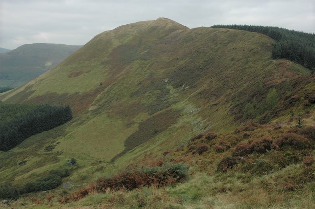 Foel Dinas
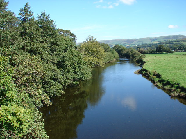 Afon Dyfi
The mighty bulks of Craig y Gammell and Foel Dinas conceal a vast slate quarry, where around 160 men worked in the late 19th century, producing about 240 tons of slate a month. When the men joined the army to fight in the Great War in 1914, the quarry died, with the exception of its cutting shed used to store ammunition.
Nant-y-Gammell (meaning ‘crooked stream’) flows across Maes-y-Camlan to join the River Dyfi. A local bard recorded the details of King Arthur’s last battle here. Mordred’s Saxon allies came from the direction of the Midlands along a Roman road (with a similar route to the A458). They camped beside a stream named after them (Nany-y-Saeson) about five miles east of Mallwyd, where the church was founded by Arthur’s nephew St Tydecho.
The Welsh Annals record Arthur’s battle with Mordred in 537. The internecine dispute allowed the Saxons to recover from the defeats earlier inflicted on them by Arthur and to conquer what we now know as England.
Between 1868 and 1951 you could have travelled here by train, although Sunday School specials were the only passenger trains after 1930. The Meirion Mill now occupies the old station area. The mill is well renowned in the area and visited from miles around for its quality local craft products. The 17th century packhorse bridge, Pont Minllyn, can be viewed from river level by going down the steps opposite the old station.
Acknowledgment: Text derived from the Out and Out Series; Discovering the Countryside on Foot. Pictures courtesy of Wikipedia.


