Aberystwyth and Constitution Hill
A walk along the cliff tops then through woods above Aberystwyth
Google Maps Open Source Maps| Statistics and Files | ||
|---|---|---|
| Start: Castle Grounds | Distance: 4.7 miles (7.5 km) | Climbing: 276 metres |
| Grid Ref: SN 57966 81416 | Time: 2 hours | Rating: Moderate |
| GPX Route File | Google Earth File | About Aberystwyth |
| Statistics | |
|---|---|
| Start: Castle Grounds | Distance: 4.7 miles (7.5 km) |
| Climbing: 276 metres | Grid Ref: SN 57966 81416 |
| Time: 2 hours | Rating: Moderate |
| GPX Route File | Google Earth File |
Ordnance Survey Explorer Map (1:25,000)
The Walk: Choose a clear day to enjoy this walk as the views from the cliff-top on Constitution Hill are exceptional. They extend to Strumble Head in the south to Bardsey Island, off the tip of the Lleyn Peninsula, in the north. After overlooking the valley of the River Clarach, you return through attractive oak woodland.
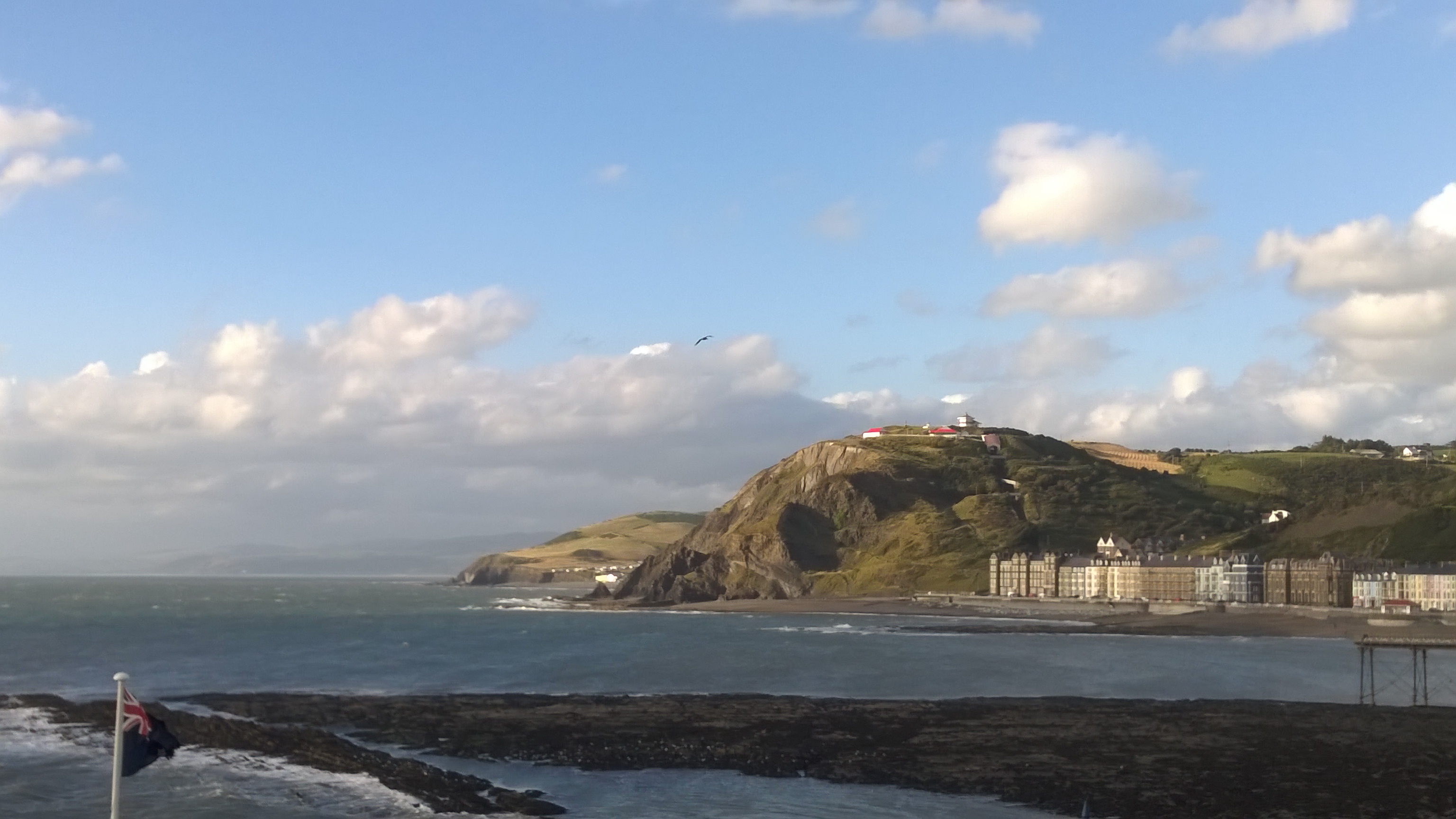 Aberystwyth Bay and Constitution Hill
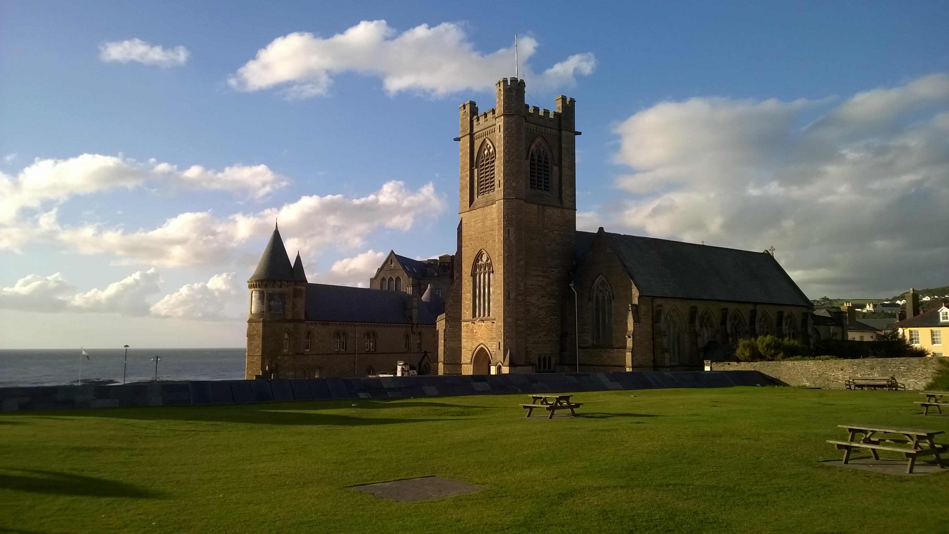 St Michael's Church, Aberystwyth
The walk starts by the ruins of Aberystwyth Castle which are worth taking some time to explore. The view south from the castle to Pen Dinas and the Wellington Monument which sits on top of the hill are sublime. As is the view of the coastline extending south into the distance. You will be looking with eyes wide open for a while at that view. After tearing yourself away from the beautiful spectacle the walk extends on an enjoyable promenade stretch beside Aberystwyth's coastline, past the seafront buildings of Aberystwyth University and past the Royal Pier, continuing along Marine Terrace, extending to Victoria Terrace and eventually reaching the foot of the climb of Constitution Hill.
You may be tempted to avoid the 400 feet (120 metre) climb by the Cliff Railway, if it is open, but avoid the temptation and take the climb. You will feel better for it. The cliff railway leads to the Camera Obscura. This is an octagonal tower in which the entrance fee gives you access to a 14 inch (35-cm) lens system to focus detailed views on a screen in a darkened viewing gallery.
After Penglais Woods, there is a view across Aberystwyth. The most eye catching buildings of the town can be identified including the university buildings, St Michael's Church and notably the National Library of Wales. An Englishman, Stuart Rendel, gave the land for it in 1897. This splendid building houses millions of books, maps, pictures and manuscripts, including the 12th century Welsh 'Black Book of Carmarthen'.
A trip to Aberystwyth would not be complete without a ride on the Vale of Rheidol Narrow Gauge Steam Railway. Opened in 1902 to serve the lead mines, it runs inland for nearly 12 miles (19.2 km) at a gradient of 1:48 to Devil's Bridge. Trains run from the station. This is also the terminus of the standard gauge line from Shrewsbury.
Acknowledgment: Text derived from the Out and Out Series; Discovering the Countryside on Foot. Pictures courtesy of Wikipedia.


