Montgomery, Town Hill and Ffridd Faldwyn
A monument, a hill fort, and a ruined castle at a Georgian border town
Google Maps Open Source Maps| Statistics and Files | ||
|---|---|---|
| Start: Broad Street | Distance: 3.6 miles (5.8 km) | Climbing: 245 metres |
| Grid Ref: SO 22062 96608 | Time: 2 hours | Rating: Moderate |
| GPX Route File | Google Earth File | About Montgomery |
| Statistics | |
|---|---|
| Start: Broad Street | Distance: 3.6 miles (5.8 km) |
| Climbing: 245 metres | Grid Ref: SO 22062 96608 |
| Time: 2 hours | Rating: Moderate |
| GPX Route File | Google Earth File |
Ordnance Survey Explorer Map (1:25,000)
The Walk: Montgomery has been of strategic importance since at least the Iron Age. Roman and Norman military commanders also recognised the site's potential importance, and it remained a significant point to control during the English Civil War. After peace was restored, its border defences became obsolete, but it continued to prosper as a county town, particularly in Georgian times. Its further development largely halted at that point, nearby Newtown and Weshpool were much better sited for communication routes, by canal and later by rail. The result of not having direct transport hubs is that Montgomery remains largely Georgian, and the whole town is a conservation area, with an active Civic Society, entrusted to preserving the towns unique character.
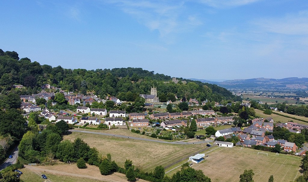 The town of Montgomery
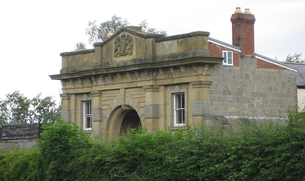 Old Gaol, Montgomery
The walk encompasses the town, its castle, and the hills to the west, which give fine views over Shropshire and to the mountains of mid Wales. You start in Broad Street and climb the hill behind the Town Hall, passing the House of Correction or the Old County Gaol. This lane leads to the castle.
The castle was the last fortification built at Montgomery. It was preceded by a hill fort, visited later on the walk, the Roman Forden Gaer and a Norman motte and bailey at Hen Domen, both situated to the north of the town. All four were built to control the main route into mid Wales. The border hills, which at that time were covered in forest, presented an obstacle for any army - but the River Severn cuts through this obstruction and deep into the Welsh heartland, and could be forded here.
The medieval stone castle, on its commanding rocky outcrop, was built between 1223 and 1225. It was besieged by the Welsh on more than one occasion but did not fall. Its end came in 1649 when as a Royalist stronghold it fell to the Parliamentarians during the English Civil War. After its fall, the victorious Parliamentarian army ordered its destruction.
You now retrace your steps to climb the local viewpoint of Town Hill. The route crosses the remains of the town ditch, part of the castle fortifications which encompass the town. At the summit of Town Hill is a war memorial and a panoramic view indicator. To the east and south are the Long Mynd, the Stiperstones and Corndon Hill, and to the west Kerry Hill, Cadair Idris and Aran Fawddwy. All and more besides are visible on a clear day.
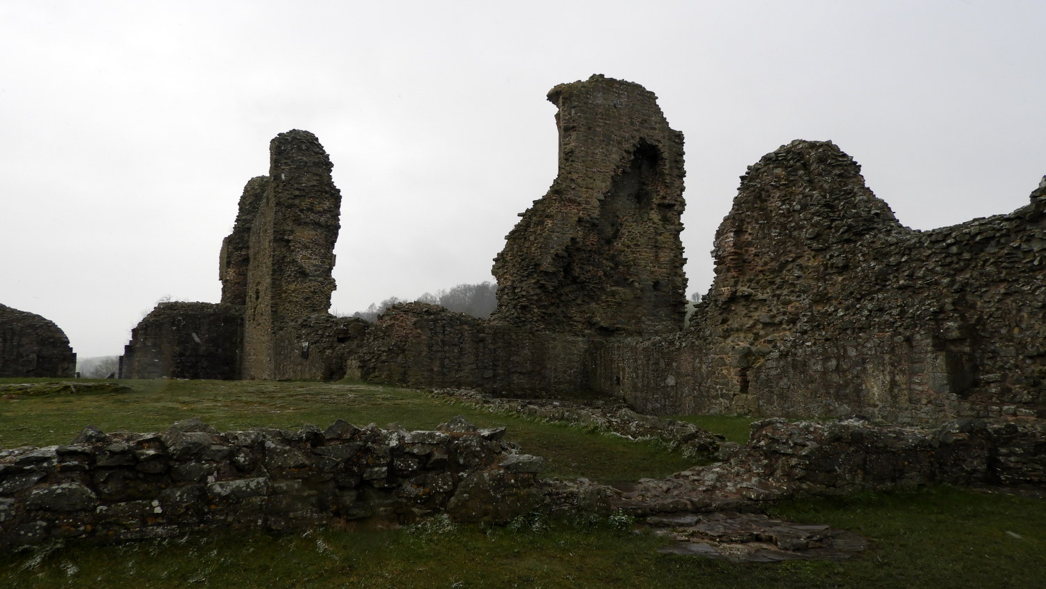 Ruins of Montgomery Castle
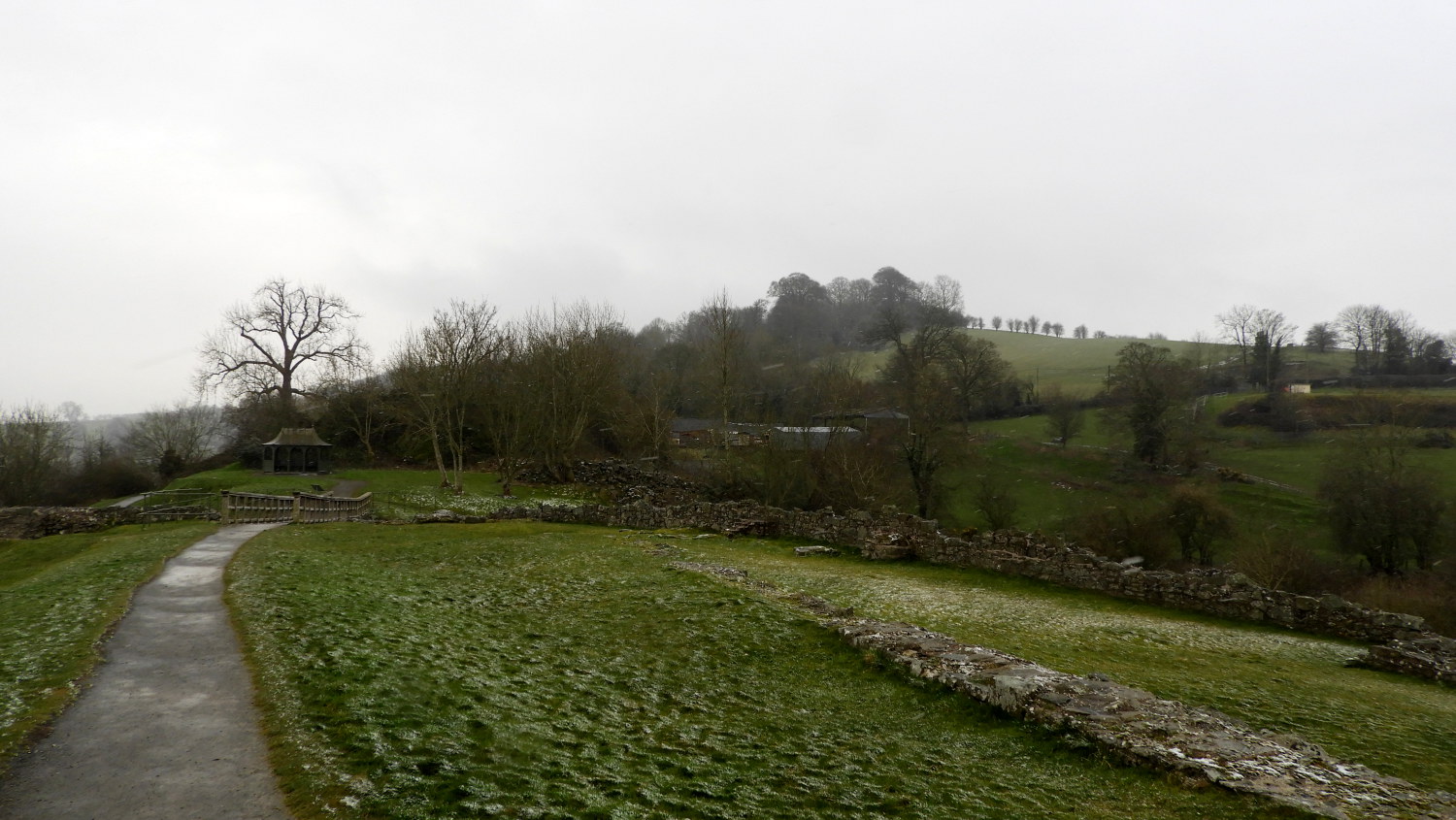 View to Ffridd Faldwyn from the castle
From here you walk to the hill fort of Ffridd Faldwyn. he impressive earthworks date from the late Iron Age, but within these are the remains of an earlier habitation from Neolithic times. From the hill fort the descent back into town is made through Balwyn's Wood. Baldwin de Boulers was the Norman lord during the ties of Henry I, and the Welsh name for the town, Trefaldwyn, derives from his name. The English name comes from Roger de Montgomery, the Norman earl responsible for building the motte and bailey castle at Hen Domen.
Back in town, the route passes the imposing front of the County Gaol, which was built in 1830 to replace the House of Correction. The facade was added to the building in 1865, after the Prison Reform Act, to impress upon would be offenders the full majesty of the law.
You continue past the school to come to the Church of St Nicholas which is home to the tomb of Richard Herbert, Lord of Cherbury. The Robber's Grave in the churchyard is of a John Davies, who was hanged in 1821 as a highwayman. He declared that he was innocent and that no grass would grow on his grave for at least one generation. Which proved to be the case.
It is a short walk from the churchyard back to the starting point of the walk in Broad Street. If you have time, there are permanent exhibitions relating to both the medieval Hen Domen and Norman Montgomery Castles and their archaeological excavations (with scale models of both castles) in The Old Bell Museum in Arthur Street.
Acknowledgment: Text derived from the Out and Out Series; Discovering the Countryside on Foot. Pictures courtesy of Wikipedia.


