Skenfrith, Llanrothal, Afon Mynwy and St Maughan's
Discover the architectural heritage of the Monnow valley
Google Maps Open Source Maps| Statistics and Files | ||
|---|---|---|
| Start: Skenfrith | Distance: 6.9 miles (11.1 km) | Climbing: 245 metres |
| Grid Ref: SO 45642 20272 | Time: 3 hours | Rating: Moderate |
| GPX Route File | Google Earth File | About Skenfrith |
| Statistics | |
|---|---|
| Start: Skenfrith | Distance: 6.9 miles (11.1 km) |
| Climbing: 245 metres | Grid Ref: SO 45642 20272 |
| Time: 3 hours | Rating: Moderate |
| GPX Route File | Google Earth File |
Ordnance Survey Explorer Map (1:25,000)
The Walk: For much of its length, the River Monnow forms the natural boundary of Wales. Many centuries of conflict between the Welsh and the succession of invaders - Romans, Saxons and, in particular Normans - has left a rich heritage in this now peaceful borderland area. This walk explores a landscape of woods, hills and streams that have changed very little since the days of Llywelyn the Great and Owain Glyndwr.
 Skenfrith Church
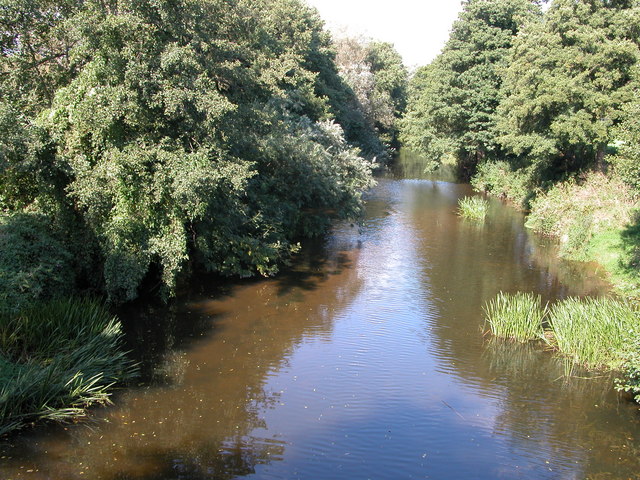 Afon Mynwy at Tregate Bridge
The valley contains some of the oldest villages in Britain. Among these is Skenfrith, which guards one of the rare gaps in the deeply incised Monnow Valley. A few cottages and houses line one side of the green while the villages most obvious feature, Skenfrith Castle, dominates the other. The green itself covers part of the filled-in moat.
The castle dates from around 1200. The curtain walls enclose an unusual circular keep built on a distinct mound which was possibly the site of an earlier wooden castle. It was constructed for Hubert de Burgh, a Duke of Kent who was a favourite of King John, and it was only in use for about 200 years.
The River Monnow acted as a natural moat on one side of the castle. Once peace was established in the valley, a large wheel was built to broach the river and supply water to Castle Mill, which was built in the filled-in moat. The mill is still busy today. Its great water wheel, which is visible from near the War Memorial, works hoists, lifts and grindstones that produce flour and animal feed stuffs.
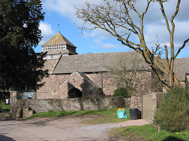
The village’s glory is the beautiful little St Bridget’s church, which dates from around the same time as the castle. The small tower is topped by a dovecote, while the spacious stone-flagged interior houses a number of delights. These include wall paintings, a minstrels box, the splendid family pew and relief tomb of the Morgan family, who were one time Lords of the Manor, and a medieval embroidered corp (cloak), which was used as an altar cloth before its true worth was realised.
The route sets off downwards, darting in and out of woodland and thick undergrowth. The woods are home to a wide variety of birds of prey, including a surprisingly large number of Buzzards.
The Monnow is one of Britain’s cleanest rivers, a quiet isolated stretch supports several Otter holts, though you are far more likely to see a semi-webbed paw print in riverside silt than the animal itself. This timid creature has slowly built up its numbers since the 1960’s when an extremely active pack of Otter hounds hunted virtually the whole length of the river. Mink are also now well established in the area, much to the chagrin of river keepers and fishermen.
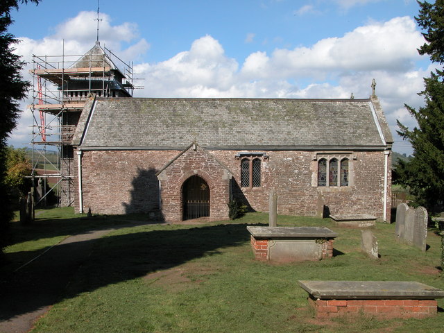 St Maughan's Church
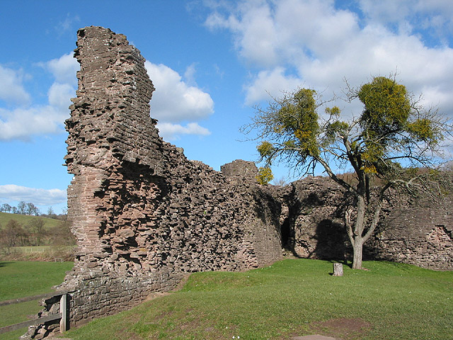 Skenfrith Castle
Further along is the chapel of St John the Baptist, virtually all that remains of an abandoned medieval village. It succumbed not to the Black Death, but to a climatic aberration that led to a series of crop failures around 1400.
The chapel dates from the early 13th century and is now in the care of the Redundant Churches Fund. Half of it is simply, almost puritanically furnished with old movable wooden pews, or settles, a carved pulpit and an ancient altar. There is no access to the other half, which is visible through small windows on the south side and is totally unrestored. It was in this parish and possibly in this church that the last recorded Latin mass was delivered after the Reformation.
Another peaceful stretch of river, its sandbanks home to Kingfishers and colonies of Sand Martins, leads to the narrow old Tregate Bridge, built on an ancient routeway at the site of a ford. Below the bridge, a broken old weir can prove a good vantage point for watching Salmon leap during their late Autumn run.
Nearby, a substantial motte and bailey, the mount of which is easily seen from beside the bridge, guarded the ford and offered protection for members of the Nunnery and a Priory that once stood in the woods in the folded hills beyond the castle.
You climb gently out of the valley along lanes and pathways rich in wild flowers to the 13th century St Maughan’s Church, dedicated to one of the seemingly endless supply of Celtic Saints. The massive timber pillars holding up the barrel vaulted roof are nearly 600 years old, and replaced the original stone ones destroyed when Owain Glyndwr laid waste to the church.
The return route from the church backed into Skenfrith is a pleasant, gentle stroll through open fields, lanes and woodland.
Acknowledgment: Text derived from the Out and Out Series; Discovering the Countryside on Foot. Pictures courtesy of Wikipedia.


