Welshpool, Montgomery Canal and Powis Castle
Through the wildlife corridor of a canal and castle parkland
Google Maps Open Source Maps| Statistics and Files | ||
|---|---|---|
| Start: Welshpool | Distance: 6.8 miles (10.8 km) | Climbing: 203 metres |
| Grid Ref: SJ 22576 075534 | Time: 3 hours | Rating: Moderate |
| GPX Route File | Google Earth File | About Welshpool |
| Statistics | |
|---|---|
| Start: Welshpool | Distance: 6.8 miles (10.8 km) |
| Climbing: 203 metres | Grid Ref: SJ 22576 075534 |
| Time: 3 hours | Rating: Moderate |
| GPX Route File | Google Earth File |
Ordnance Survey Explorer Map (1:25,000)
The Walk: Welshpool is an ancient town that now forms the gateway to Wales for visitors from the English Midlands. It must give an attractive first impression with its half timbered buildings and places to visit. Time will be at a premium with the canal, the castle and the light railway all vying for your attention. This fairly gentle walk takes you to all three and brings some relaxing views over the rolling countryside of the former county of Montgomeryshire.
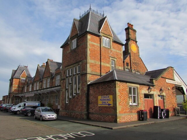 The Old Railway Station at Welshpool
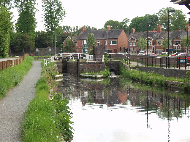 Montgomery Canal at Welshpool
The tourist information centre at the start of the walk is built on the site of the old track of the Welshpool and Llanfair Light Railway. Trains used to clank through the town, crossing Church Street, and from 1903 to 1956 the fireman would get down from his engine to stop the traffic with his red flag before the train went across the street.
Y Lanfa Powysland Museum and Welshpool Library is housed in a restored historic warehouse beside the Montgomery Canal with Welshpool Library on the ground floor and Powysland Museum upstairs. The museum depicts the archaeology and social history of Montgomeryshire. The Montgomery Canal connected the industrial potential of Newtown with the Llangollen Canal at Frankton Junction. In 1821, upon completion, it was about 35 miles long. The advent of the railways led to its decline, and the canal was officially abandoned in 1944. The threat of its loss, under a proposed bypass, reminded the locals of their neglected asset and this section of the canal was restored in 1969. The girder bridge used to carry the Welshpool and Llanfair Light Railway to its terminus beside the main line station.
The canal is piped under the A 483 at Gallowstree Bank. This name refers to the fact that Welshpool's gallows once stood here. Reeds make the canal an attractive haven for wildlife and waterfowl today.
Buttington Wharf was a major centre for the line burning industry, which was the mainstay of the Montgomeryshire Canal. Limestone was brought from quarries above Llanymynech and coal came from Ruabhon, unloaded by hand at the wharf. It was tipped into the tops of the three lime kilns, to be carried to local farms by horse and cart. In 1830, when the acid upland soils were first brought into cultivation, 2,000 tons of lime were burned here.
Enjoy a ride on the Welshpool and Llanfair Light Railway. Today the ‘Llanfair Train’ sits in the platform at Welshpool Raven Square and invites the traveller a wonderful ride along a country by-way. The train negotiates a viaduct and river bridge, climbs the notoriously steep Golfa Bank and steams serenely through beautiful countryside. From the window the observant passenger may spot the occasional heron, goosander, woodpecker or buzzard. As the train runs through the Powis Estate, pheasant and deer can be seen and everywhere a wide variety of wild flowers. The line follows a river valley, twists round a mill and runs through the middle of farms. This was how our great grandparents travelled and it is a real pleasure to be able to recreate it all for you today. (Excerpt: Welshpool and Llanfair Light Railway)
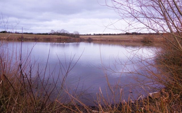 The Flash, Welshpool
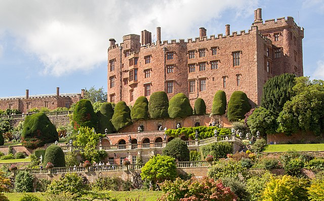 Powis Castle
Welshpool's High Street is full of interesting old buildings. One of these, number 31 houses the office of the Campaign for the Protection of Rural Wales. Across the street is a 16th century timber frame structure, number 11. And numbers 9 and 10 were already standing when the building was recorded as the townhouse of the notorious Highwayman Kynaston the Wild, during the reign of Henry the VIII. Another house is the Butter, number 8. It was formally the Cross Keys Inn and stagecoaches used to run from here. Park Lane House at number seven is a listed building of the Regency style.
The highlight of this walk is Powis Castle, so divert along the drive to see this fortress turned mansion. In 1274, Gwynedd's Llewellyn the Last raised the fortress of Gruffudd, the son of Gwenwynwyn, Prince of Powys, to the ground. Eventually, in 1286, Owain, the son of Gruffudd, acknowledged the English conquest of Wales by renouncing the title of Prince of Powys and paying homage to Edward I as Baron de la Pole. The new surname was derived from the name of the town Poole. Because of the existence of a Poole in Dorset, the town soon became known as Welshpool. The newly created Baron was also responsible for the building of the then new Powis Castle.
Christ Church was built in the 19th century, on the site of the old market and fairground. The Town Hall was completed in 1804 and enlarged in 1873. it has avoided the fate of its predecessors, whose floors would regularly give way during trials. Six spectators were trampled to death when this happened to the Old Hall during the Court of Great Session in 1758.
Acknowledgment: Text derived from the Out and Out Series; Discovering the Countryside on Foot. Pictures courtesy of Wikipedia.


