Amlwch, Bull Bay and Anglesey Coast Path
A clifftop walk where the East Mouse islet wrecked a liner
Google Maps Open Source Maps| Statistics and Files | ||
|---|---|---|
| Start: Amlwch | Distance: 2.3 miles (3.7 km) | Climbing: 54 metres |
| Grid Ref: SH 44387 92913 | Time: 1 hour | Rating: Easy |
| GPX Route File | Google Earth File | About Amlwch |
| Statistics | |
|---|---|
| Start: Amlwch | Distance: 2.3 miles (3.7 km) |
| Climbing: 54 metres | Grid Ref: SH 44387 92913 |
| Time: 1 hour | Rating: Easy |
| GPX Route File | Google Earth File |
Ordnance Survey Explorer Map (1:25,000)
The Walk: The north coast of Anglesey is sure to provide you with a view of a ship sailing to or from Liverpool. The port of Amlwch was of the greatest importance in its own right as the world's largest copper port around 1800. Its wealth came from Parys Mountain, just to the south. This association with industry fails to detract from the magnificent stretch of coastline here. The jagged rocks demand a price for their features, wrecking a superb ocean-going liner in 1877.
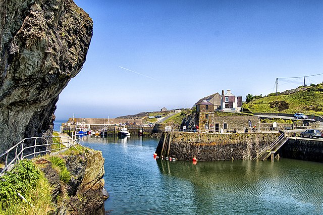 Amlwch Harbour
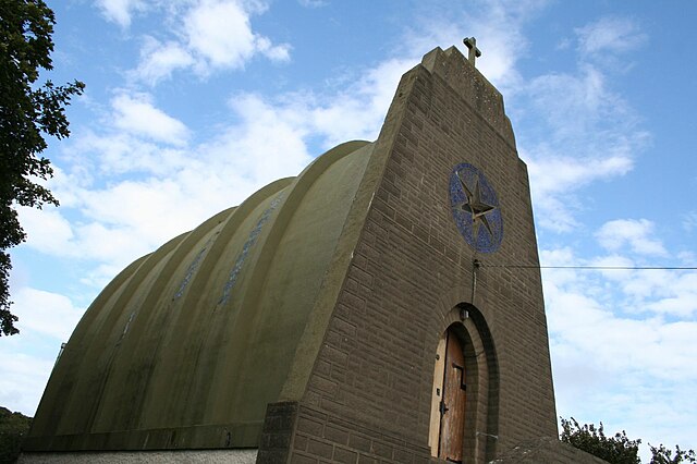 Our Lady Star of the Sea and St Winefride
Copper was of enormous importance after the invention of cannons in the late Middle Ages. The Romans had extracted copper from Parys Mountain, but with the help of technological advances in industry, the whole of this 147 metre high hill's insides were taken away in the late 18th and early 19th centuries. At their peak, the mines produced 44,000 tonnes of ore a year.
The tiny fishing hamlet of Amlwch became a town, with 6,000 people served by 1,025 ale houses. Copper was shipped from its port to all parts. The resulting prosperity was reflected in the construction of St Helens Church by the Parys Mining Company in 1800. It contrast with the modern Catholic Our Lady Star of the Sea and St Winefride Church, which is built in the shape of an upturned boat.
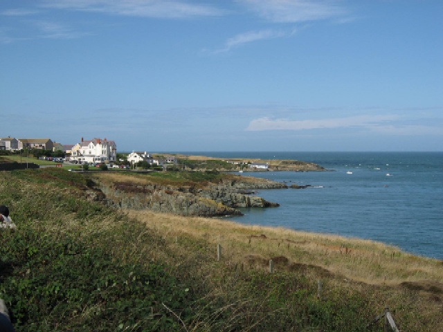 Bull Bay
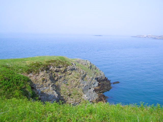 View to East Mouse Islet
Not far away, just offshore in Bull Bay, lies the wreck of a fine ship. This was the Dakota built at Newcastle upon Tyne in 1874. This steamer was intended to challenge for the Blue Ribbon (The award given to a passenger vessel making the Atlantic crossing in the shortest time). Her boilers proved unfit for the task, but she was heading for New York from Liverpool when disaster struck on the 9th May 1877.
The 4,332 ton liner was steaming at 14 knots, two miles offshore, when the course was changed to take her further from land. Instead, her steering sent her in the opposite direction and the Dakota was wrecked by rocks between the Chemical Works and East Mouse. The 218 passengers were soon rescued in a series of trips by the Bull Bay Lifeboat. They were followed by the mail being carried to America and much of the 2,000 tonnes of general cargo. The iron hull of the ship had to be abandoned however, and the wreck is now a favourite site for divers.
Returning to Amlwch, notice the railway crossing. This line was built as the Anglesey Central Railway from Gaerwen, on the main line to Amlwch (a distance of 19 miles) in 1866. It closed to passengers in 1964 but the freight traffic to the chemical works saved the track. In 1993 the freight activity was all transferred to road vehicles, and use of the line ceased. The rails were not lifted however, leaving open the prospect that the line could be restored as a tourist and local transport facility for Amlwch. This remains the case with a local enthusiasts group active to this day.
Acknowledgment: Text derived from the Out and Out Series; Discovering the Countryside on Foot. Pictures courtesy of Wikipedia.


