Cardigan, Afon Teifi and Tygwyn
A walk from historic castle sites overlooking a once-bustling river
Google Maps Open Source Maps| Statistics and Files | ||
|---|---|---|
| Start: Cardigan Bridge | Distance: 5.7 miles (9.2 km) | Climbing: 188 metres |
| Grid Ref: SN 17772 45841 | Time: 2-3 hours | Rating: Easy |
| GPX Route File | Google Earth File | About Cardigan |
| Statistics | |
|---|---|
| Start: Cardigan Bridge | Distance: 5.7 miles (9.2 km) |
| Climbing: 188 metres | Grid Ref: SN 17772 45841 |
| Time: 2-3 hours | Rating: Easy |
| GPX Route File | Google Earth File |
Ordnance Survey Explorer Map (1:25,000)
The Walk: Cardigan is known as Aberteifi in Welsh, meaning the mouth of the Teifi. Its English name reflects that it was once the county town of Cardiganshire, now swallowed up in Dyfed. Cardigan is a corruption of Ceredigion, the land of Ceredig. He was the son of Cunedda, who was responsible for reasserting British rule in north and west Wales in the 5th century when the area appeared likely to become an Irish colony.
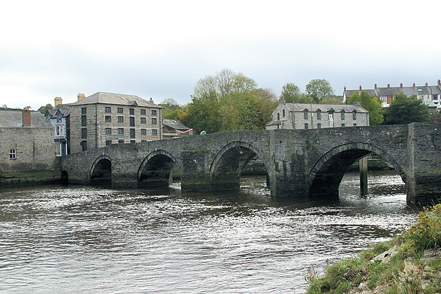 Cardigan Bridge and Afon Teifi
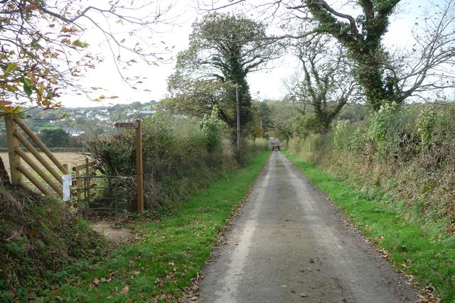 Track leading to Old Castle Farm
Cardigan is a bustling little market town today. It was once a major port though and warehouses crowded around the bridge, which dates from 1726. Herring was an important product with vast quantities of salt brought here from Liverpool in order to preserve the fish. Ships also came with seed corn, tallow and limestone. Leaving the port would be slate from Cilgarron (just upstream), ale from Cardigan and local salmon and oak. Inns added to the exotic flavour, some being notorious for thieves and cutpurses.
Ships were built here until 1877 and 292 vessels with a total weight of about 10,000 tonnes were registered here in the 1820's Most of the ships were shared ownership by local farmers. Many emigrants left here for new Brunswick in Canada or for New York. The railway finally came to Cardigan on the opposite Bank of the River Teifi in 1885. Its arrival and the silting up of the river hastened the decline of the port and the town was forced to seek a new future as a base for fishing and tourism.
The picturesque view across the River Teifi includes St Dogmaels. The remains of the old abbey here, established by the Welsh in the 7th century, is well worth exploring. The abbey was sacked by the Vikings, rebuilt by the Normans in the 12th century, and finally fell into ruin during Tudor times. The parish church contains an old ogham stone and the water mill still produces wholemeal flour. St Dogmaels still has a fishing industry based on sea trout, and salmon fishing is now mainly centred on the River Teifi.
On this side of the river is Old Castle Farm, in whose private grounds is the site of Din Geraint, an Iron Age Fort. When the Normans, under Roger de Montgomery, swept across Wales in 1093 they erected a small castle here. This simple motte and bailey structure was soon dismantled by the Welsh. There was a record of a Din Geraint being built near the estuary of the Teifi by Gilbert FitzRichard in 1110, when Henry I dispossessed the Welsh Lord Cadwgan of his lands.
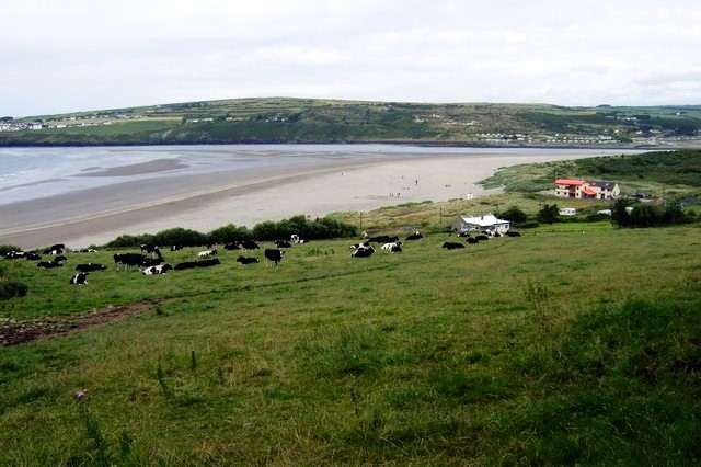 Poppit Sands and Cardigan Bay
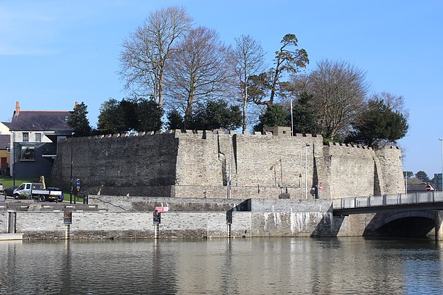 Cardigan Castle
The bridge over the Teifi is overlooked by Cardigan Castle, which is of historical interest, especially to lovers of Welsh culture. Whether or not the Din Geraint of 1110 was built here or downstream, there was a castle on this spot in 1136. The Welsh had still not been conquered, so they gathered to deal with the affront of a Norman castle in their midst. The Normans, led by William and Morris, two sons of Gerald de Windsor, led their men out of the castle to fight the Welsh at a place called Crug Mawr. They were defeated, and the English colony around the castle was set on fire. The Normans fled across the bridge back to their castle, but the weight of horses and armoured men broke it, and the river was full of bodies The castle survived though and was not taken by the Welsh until Rhys ap Gruffydd, the Great Lord Rhys, drove the Normans out in 1164.
Beyond Cardigan Castle, the Teifi soon flows into a broad estuary bounded by saltmarsh and dunes. The continual movement of underwater sandbanks made the mouth of the estuary a problem for sailors to negotiate. Waders positively love the mud flats however, while other birds abound.
Further along the estuary, and less than a quarter of a mile offshore lies Cardigan Island, a nature reserve belonging to the Dyfed Wildlife Trust. In 1934 a ship being towed to a scrap yard snapped its line in the storm and was wrecked on this tiny island. The four crew scrambled ashore to safety, and true to form, so did the rats. At the time, there was a puffin colony on the island but by the 1940's the birds had left. Their eggs, which are laid in burrows, had fallen prey to the ferocious appetite of the invading rats. Nowadays, though the rats have been eradicated, puffins have never returned to the island. However, guillemots, razorbills, cormorants, shags, fulmars and a variety of sea-gulls all nest on the island instead.
Acknowledgment: Text derived from the Out and Out Series; Discovering the Countryside on Foot. Pictures courtesy of Wikipedia.


