Porth yr Ogaf Cave and Sgwd yr Eira Waterfall Walk
A fascinating adventure to some of Wales most beautiful waterfalls
Google Maps Open Source Maps| Statistics and Files | ||
|---|---|---|
| Start: Porth yr Ogof | Distance: 4.4 miles (7.1 km) | Climbing: 261 metres |
| Grid Ref: SN 92839 12408 | Time: 2 hours | Rating: Moderate |
| GPX Route File | Google Earth File | Waterfall Country |
| Statistics | |
|---|---|
| Start: Porth yr Ogof | Distance: 4.4 miles (7.1 km) |
| Climbing: 261 metres | Grid Ref: SN 92839 12408 |
| Time: 2 hours | Rating: Moderate |
| GPX Route File | Google Earth File |
Ordnance Survey Explorer Map (1:25,000)
The Walk: In this unique and beautiful corner of the Brecon Beacons National Park, several rivers drain from the moorland heights of Fforest Fawr to flow through wooded and rocky gorges, where the forces of nature have created a remarkable series of waterfalls and cave systems. The walk starts just above the entrance to Porth yr Ogof Cave. Measuring sixteen feet high and fifty-seven feet wide, it is the largest cave entrance in Wales.
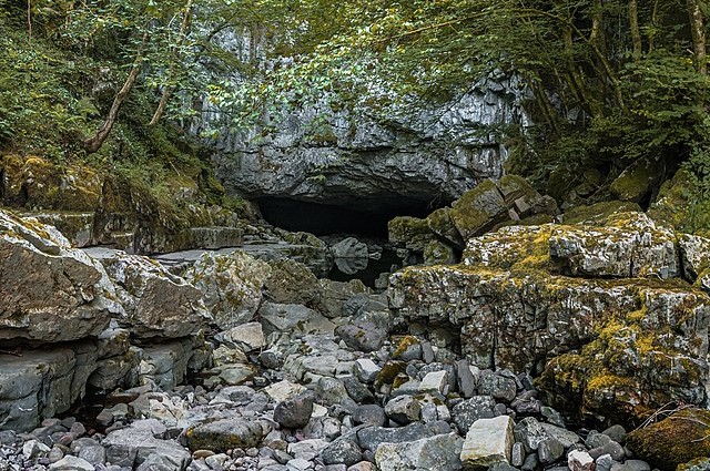 Porth yr Ogof
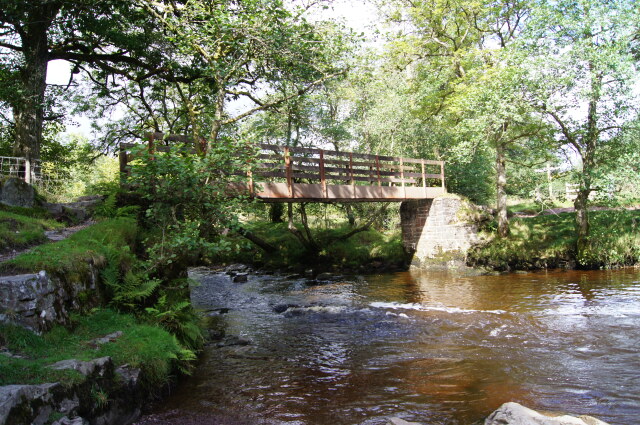 Footbridge over Afon Mellte
There are no less than 14 different entrances to the cave, but these should only be used by agile and experienced cavers - the casual visitor should just walk a short distance into the main entrance. About 100 feet inside the cavern, you may glimpse a calcite streak on the rock ahead of you, which resembles a horse's head. At one time, it used to be known as White Horse Cave due to this natural feature.
Just a little further on the route, a path leads you along a river bed. Here you can see the original route of the River Mellte before it took to its underground course. This often happens in limestone areas and the resulting water channels are concealed from view until their roofs collapse and a series of caverns is transformed into a gorge.
After a while, you will come to a rocky platform. This is where the River Mellte emerges from its underground journey about 300 yards from the main entrance of the cave. The beautiful pool in the river at this point is known as the Blue Pool.
Shortly afterwards, you will catch a glimpse of the first waterfall, Sgwd Clun-gwyn, along the route. Generally referred to as the 'Upper Fall', this is a spectacular sight and a taste of what is to come.
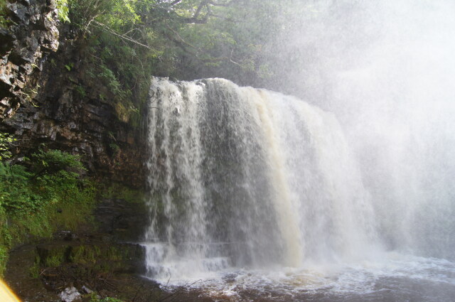 Sgwd yr Eira
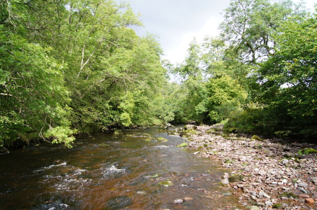 Afon Mellte
Further up river you reach Sgwd Isaf Clun-gwyn waterfall. This is often called the 'Middle Fall' and is the widest of the waterfalls in this area. It is sometimes said to resemble a miniature Niagara Falls with the water cascading over a curved platform of rock.
The last fall on River Mellte is Sgwd y Pannwr. Also referred to as the 'Lower Clun-gwyn Fall', This is a smaller fall than the others, but split into several cascades, it can be just as beautiful.
Although less accessible than the others, the best known waterfall in the area is undoubtedly the Sgwd yr Eira or 'Spout of Snow'. Its greatest attraction is that it is possible to follow a path behind the falling water, which is thrown clear of the ledge by an over hanging rock.
Acknowledgment: Text derived from the Out and Out Series; Discovering the Countryside on Foot. Pictures courtesy of Wikipedia.


