Denbigh, Dr Johnson's Cottage and Galch Hill
Through woodland and meadow around a beautiful Welsh castle
Google Maps Open Source Maps| Statistics and Files | ||
|---|---|---|
| Start: Denbigh | Distance: 5.4 miles (8.7 km) | Climbing: 186 metres |
| Grid Ref: SJ 05379 66217 | Time: 2-3 hours | Rating: Easy |
| GPX Route File | Google Earth File | About Denbigh |
| Statistics | |
|---|---|
| Start: Denbigh | Distance: 5.4 miles (8.7 km) |
| Climbing: 186 metres | Grid Ref: SJ 05379 66217 |
| Time: 2-3 hours | Rating: Easy |
| GPX Route File | Google Earth File |
Ordnance Survey Explorer Map (1:25,000)
The Walk: Denbigh is a fine example of a medieval walled town. Its castle stands on a hilltop with the Clwydian Range as its backdrop. According to legend, Denbigh's name originated in the Middle Ages when one Sion Bodiau (John of the thumbs, of which he had two on each hand) killed a Dragon near the castle. 'Dim bych' shouted the people, meaning 'no more dragons'. This was corrupted to Dinbych. The less romantic may prefer to point out the Dimbych means 'small fortified place'.
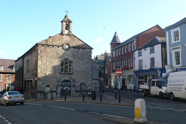 Denbigh Town Hall
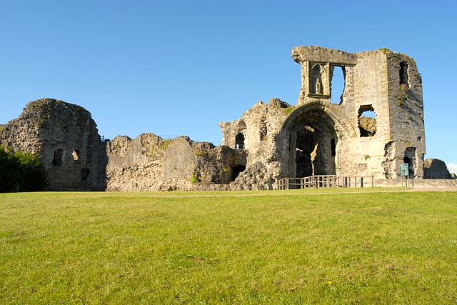 Denbigh Castle
The walk begins in the town centre. As you turn the corner along Bull Lane, notice the North Eastern Tower. The town wall has a break in it where you bear left to pass the site of Lord Leicester's Church on your left. Robert Dudley, Earl of Leicester, was one of Queen Elizabeth I's favourites and was Lord of Denbigh from 1563 until his death in 1588. The foundation stone was laid in 1578 and this was to be the first great new church to be built in Protestant Britain. The building was never finished, but tradition has it that Leicester meant it to replace the Cathedral Church of nearby St Asaph. Its first vicar was William Morgan, renowned for translating the Bible into Welsh.
The tower below the castle did not belong to Leicester's church, but to the 13th century garrison and town chapel of St Hilary's, the church it was meant to replace. Between St Hilary's Tower and the main entrance of Denbigh Castle stood the birthplace of one of the most interesting figures of the Victorian era, Henry Morton Stanley, the explorer and journalist.
Stanley was born here in 1841 as John Rowlands, the illegitimate son of Elizabeth Parry and John Rowlands. He suffered a dreadfully harsh childhood spending eight years in St Asaph workshop. Fortunately, he managed to get an education there and he later worked briefly there as a teacher. In 1859 he crossed the Atlantic to New Orleans as a cabin boy. There he met Henry Morton Stanley, the benefactor whose name he was to adopt. It was on the 10th of November 1871. that he walked into the history books with a famous words "Doctor Livingstone, I presume".
The walk passes below Denbigh Castle, which stands in ruins today, but still gives the impression of might. There was probably a native Welsh fort on this site before Edward I of England conquered Wales and gave the newly created Lordship of Denbigh to Henry De Lacy, Earl of Lincoln. The castle was practically complete by the time of the Earl's death in 1311.
Henry Percy (Shakespeare's Hotspur) held the castle in 1403 and joined forces with Owain Glyndwr against Henry the IV in 1468. Jasper Tudor burned down the town during the Wars of the Roses, while in 1646 the defending Royalists were besieged there for six months before surrending to the Parliamentarians. The castle is now in the care of Cadw and is open to the public.
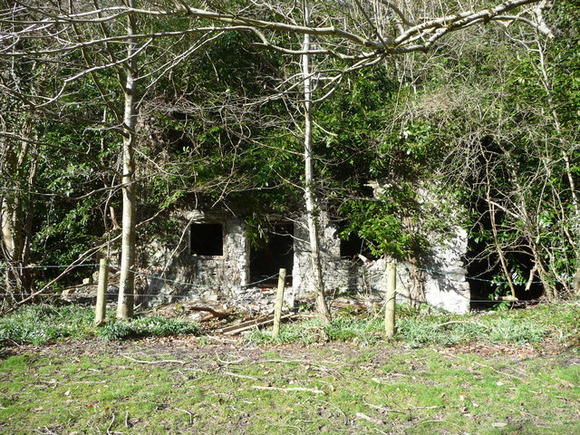 Remains of Dr Johnson's Cottage
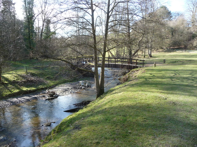 Afon Ystrad
Dr Samuel Johnson also came this way. He is said to have stayed in the ruined cottage passed on the walk. The nearby memorial to Dr Johnson was erected by the local clergyman, Mr Myddleton, during Dr Johnson's lifetime and to his great annoyance. On one side is carved 'This spot was often dignified by the presence of Samuel Johnson LLD, whose moral writings exactly conformable to the Precepts of Christianity, give ardour to Virtue and Confidence to Truth'.
Gwaenynog was also visited by Dr Johnson, who described it as a gentleman's house below the second rate, perhaps below the third, built of stone roughly cut. The rooms were low, and the passage above the stairs gloomy, but the furniture was good. The table was well supplied, except that the fruit was bad. It was truly the dinner of a country gentleman. Notice the Ha-Ha ditch around the house.
Further along the route is the black and white Tudor farmhouse of Galch Hill, the birthplace of Sir Thomas Myddleton, who bought Chirk Castle in 1595 and became Lord Mayor of London in 1613.
Back into town, the Hand Inn took its name from the legend of a race being held to settle the dispute about an inheritance. A supporter of the runner lying second cut off the first man's hand to prevent it making the winning touch. It became the Myddleton coat of arms.
Acknowledgment: Text derived from the Out and Out Series; Discovering the Countryside on Foot. Pictures courtesy of Wikipedia.


