Llanthony Priory and Hatterrall Ridge
Early Christian sites and the Black Mountains feature in this walk
Google Maps Open Source Maps| Statistics and Files | ||
|---|---|---|
| Start: Llanthony | Distance: 5.0 miles (8.1 km) | Climbing: 380 metres |
| Grid Ref: SO 28902 27782 | Time: 2-3 hours | Rating: Moderate |
| GPX Route File | Google Earth File | About Llanthony |
| Statistics | |
|---|---|
| Start: Llanthony | Distance: 5.0 miles (8.1 km) |
| Climbing: 380 metres | Grid Ref: SO 28902 27782 |
| Time: 2-3 hours | Rating: Moderate |
| GPX Route File | Google Earth File |
Ordnance Survey Explorer Map (1:25,000)
The Walk: The peaceful 'Vale of Ewyas', where the walk takes place, is situated at the eastern edge of the Brecon Beacons National Park. On the east bank of the River Honddu, which flows through the valley, lies an ancient site associated with St David, Patron Saint of Wales. It is here that the walk begins, continuing along an old packhorse route that gives splendid views of the surrounding countryside.
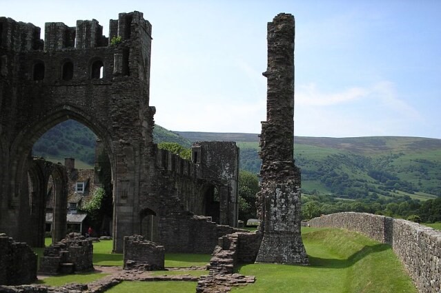 Llanthony Priory
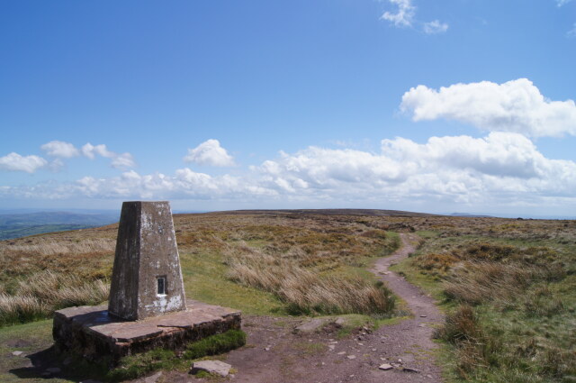 Trig Point on Hatterrall Ridge
In the 12th century, an impressive priory for Augustinian monks was founded on the ancient site. This was Llanthony Priory, and it gave the Vale of Ewyas an alternative name, Llanthony Valley. The name of Llanthony came from the Welsh Llandewi Nant Honddu, meaning the 'church of St David by the Honddu River'.
Tradition claims that St David came to this valley in the 6th century and built a small mud and wattle hut where he lived as a hermit in prayer and meditation for several years. He established many churches throughout Wales and a monastery at St David's in Pembrokeshire.
Romantically situated in the heart of the Black Mountains, the Priory is a memorable building . From the western door the Priory church is 200 feet in length, and with the 2 aisles, it measures 50 feet in breadth. The massive square tower in the centre was originally 100 feet high, supported by bold, pointed arches, opening onto the choir, nave and transept. On the south side of the Priory is an archway giving access to a vaulted room with two floral bosses and carved capitals. This may have been the library.
Beside the Priory is a little church dedicated to St David. This Norman church was built on the site of the Saints cell. It is a very simple structure with an open timbered roof. Of special interest is the fact that it is orientated for the first day of March, St Davids Day. The axis of the church points directly to that part of the heavens where the sun rises on St David's Day. Near the church is the old gatehouse to the Priory. It has been converted into a barn and its great gateway walled up.
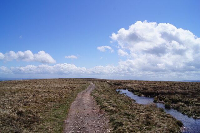 Hatterrall Ridge
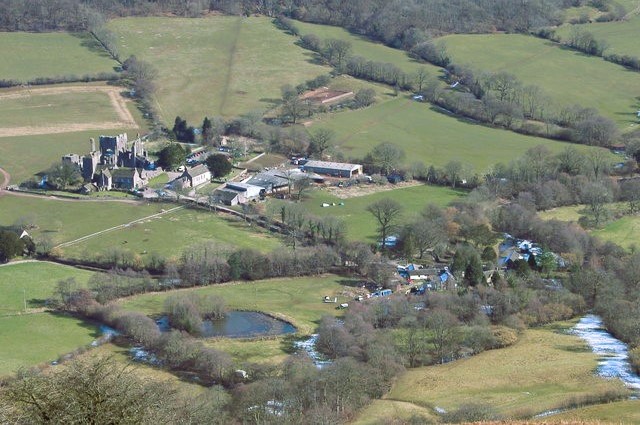 View to Llanthony from Loxidge Tump
After leaving the Priory and its environs, the walk continues along the Rhiw Cwrw. This is an ancient track which, like many in the Black Mountains, was established by farmers to provide an access route onto the Hatterrall Ridge, where their sheep grazed. Rhiw Cwrw translates as 'beer track', and it is believed to have been used by the monks for transporting casks of ale between Llanthony and Longtown in the next valley.
The path along the crest of the ridge marks the boundary between England and Wales and is part of Offa's Dyke Long Distance Path. Starting at Chepstow and finishing at Prestatyn in North Wales, this 168 mile long route follows for much of its length, an earthwork built by as a boundary in the 8th century by Offa, the King of Mercia.
The path follows the Hatterrall Ridge, and there are wonderful views from it. To the right are the pretty patchwork fields of Herefordshire and immediately below lies St Clydawg's church in Clodock and the long straggling village of Longtown, whose name aptly describes it. In clear weather it is possible to see the Malvern Hills.
At the beginning of the 19th century, Llanthony Priory was bought by the poet Walter Savage Landor. Among the grandiose plans he had, one must to build himself a mansion in the woods overlooking the Priory. It was called 'Y Siarpal (The Sharple)' and although the building was started, it was never completed. Today, it lies in ruins.
The solitude and peacefulness of the valley encourages bird life, which is quite varied. In the early spring, the ring ouzel and the wheatear arrive, the former to nest later in the year amongst the heather and the latter amongst the boulders and old walls. Peewit and green plover are frequently seen and meadow pipits abound. Stonechats and whinchats may also be heard. And overhead you may observe a hovering kestrel or hear the croak of a passing raven.
Acknowledgment: Text derived from the Out and Out Series; Discovering the Countryside on Foot. Pictures courtesy of Wikipedia.


