Ogmore Castle, Candleston Castle and Merthyr Mawr
Across stepping stones and dunes to castles near the coast
Google Maps Open Source Maps| Statistics and Files | ||
|---|---|---|
| Start: Ogmore Castle | Distance: 4.0 miles (6.5 km) | Climbing: 118 metres |
| Grid Ref: SS 88139 76869 | Time: 2 hours | Rating: Easy |
| GPX Route File | Google Earth File | About Bridgend |
| Statistics | |
|---|---|
| Start: Ogmore Castle | Distance: 4.0 miles (6.5 km) |
| Climbing: 118 metres | Grid Ref: SS 88139 76869 |
| Time: 2 hours | Rating: Easy |
| GPX Route File | Google Earth File |
Ordnance Survey Explorer Map (1:25,000)
The Walk: This varied walk offers an opportunity to visit two ruined castles and what has been described as the most picturesque village in the Vale of Glamorgan. By contrast, the walk also crosses the edge of the highest sand dunes in the country, with plenty to interest archaeologists.
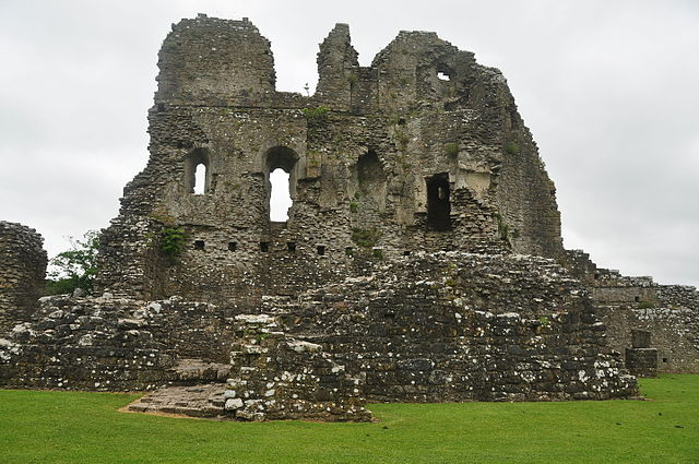 Ogmore Castle
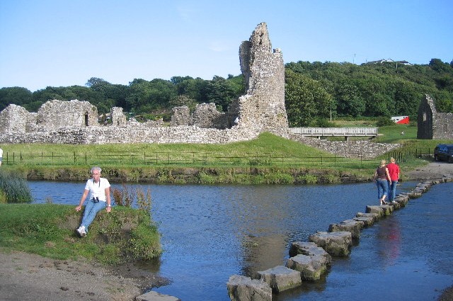 Ogmore Stepping Stones
Built to command a ford on Afon Ewenni, Ogmore Castle was built by William de Londres, one of the Norman Conquerors. Ogmore formed a triangle of defence with the castles of Coity and Newcastle (Bridgend), guarding the fertile lands of the Vale of Glamorgan.
The ancient stepping stones set in the bed of Afon Ewenni, are known locally as St Teilo's Steps. And it is possible that they were used by this 6th century saint when he had a wattled cell where the church at Merthyr Mawr now stands.
The pretty village of Merthyr Mawr, with its thatched cottages, dates back to the 14th century. Long ago, there was an inn on the east side of the village, which was kept by a notorious character called Cap Goch (Red Cap), because he always wore a red cap. A gruesome story relates that, in 1870, when the inn was demolished, a smuggler's hoard was discovered and partly decomposed bodies were found in the garden. Local legend claims that the ghost of Shoni of the Red Cap still haunts the road nearby, inviting travellers to spend a night at his inn. Afon Ogwr passes south of Merthyr Mawr before discharging into Afon Ewenni beside Ogmore Castle.
Dedicated to St Teilo, the present church was built in 1649, but traces of the foundations of an earlier structure are visible inside. The octagonal font is probably from the older church and outside is a churchyard cross and several ancient stones inscribed in Latin.
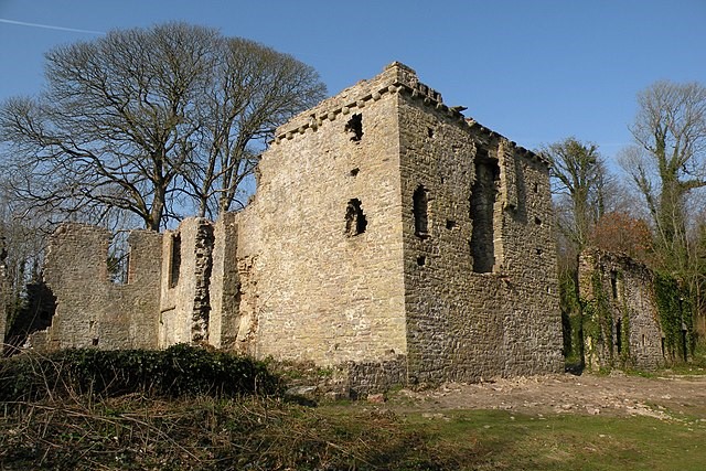 Candleston Castle
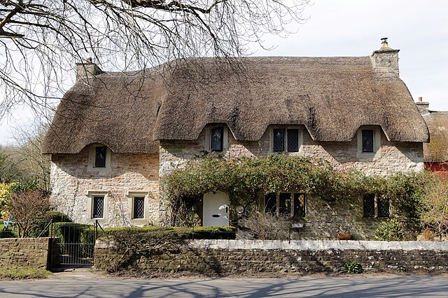 Thatched cottage in Merthyr Mawr
Further along the walk, situated in a wooded valley on the edge of the sand dunes, is Candleston Castle. This fortified Manor House was built in the early 15th century. It has a 15th century rectangular tower with a later hall adjoining it and is surrounded by the remnants of a battlemented curtain wall. The name Candleston is a corruption of Cantelupe's Town and the castle was once owned by a branch of the powerful Cantelupe family.
The extensive sand warrens of the Merthyr Mawr Sand Dunes stretch between the Ogmore Estuary and Porthcawl. Some of these dunes rise to a height of 250 feet and are said to be the highest in the country.
Many prehistoric finds have been revealed in the sand by the powerful winds blowing in from the Atlantic. Iron Age, Bronze Age and also many Romano-British tools and ornaments have been discovered, as well as a tumulus of the Beaker Fork. The tumulus measuring 500 feet in diameter and 21 feet high contained six burial chambers and the finds of the excavation are now in the Royal Institution of South Wales at Swansea.
Acknowledgment: Text derived from the Out and Out Series; Discovering the Countryside on Foot. Pictures courtesy of Wikipedia.


