Wynd Cliff, 365 Steps, Eagle's Nest, Penterry Church and Gaer Hill
A challenging walk up steps to a stone parapet with breathtaking views
Google Maps Open Source Maps| Statistics and Files | ||
|---|---|---|
| Start: Wynd Cliff | Distance: 3.6 miles (5.8 km) | Climbing: 192 metres |
| Grid Ref: ST 52418 97274 | Time: 2 hours | Rating: Hard |
| GPX Route File | Google Earth File | Monmouthshire |
| Statistics | |
|---|---|
| Start: Wynd Cliff | Distance: 3.6 miles (5.8 km) |
| Climbing: 192 metres | Grid Ref: ST 52418 97274 |
| Time: 2 hours | Rating: Hard |
| GPX Route File | Google Earth File |
Ordnance Survey Explorer Map (1:25,000)
The Walk: This Wye Valley walk begins with a fairly steep climb up a flight of steps traditionally known as 'The 365 Steps'. They originally commenced from the rear of Moss Cottage, which was a thatched stone building that used to stand near this point. Here, tourists were able to buy refreshments and would then pay a small fee to walk through the garden and ascend the steps to the top of the Wyndcliff to admire the magnificent views. A certain Osmond Wyatt, the stewart of the 6th Duke of Beaufort, constructed the steps in 1828 and it is assumed that he probably built Moss Cottage as well. Restoration of the steps was carried out in 1972 by the Lower Wye Valley Preservation Society.
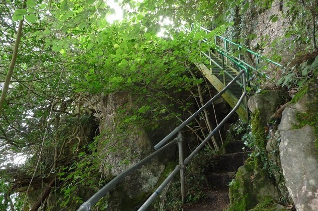 The 365 Steps
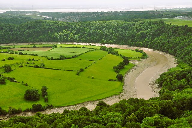 View of the Wye and Severn from Eagle's Nest
Prepare yourself, the walk starts with a steep climb up the 365 steps to the Eagle's Nest viewpoint, though the modern number of steps is closer to 300. The less ready of you may be thankful for the reduced number of treads on the sky ladder.
The Eagle's Nest is a semicircular stone parapet on the very edge of Wyndcliff. It is 700 feet (213 metres) above the River Wye and was constructed as a viewpoint in the 19th century. The view has been described and praised by many authors of books on the Wye Valley and it used to be claimed that nine counties, before the new country boundaries were redrawn, could be seen from here. One writer observed "What a cathedral is amongst churches, the Wyndcliff is among prospects". Below the River Wye sweeps around the graceful Lancaut Peninsula and the wooded grounds of Piercefield Park, which contains Chepstow Racecourse. Further on, the Severn Estuary is spanned by the Severn Bridge.
From the Eagles nest viewpoint, man made depressions in the ground can be seen. These are old iron workings, originally worked by the Romans. They are set on the slope of a hill, half hidden by trees.
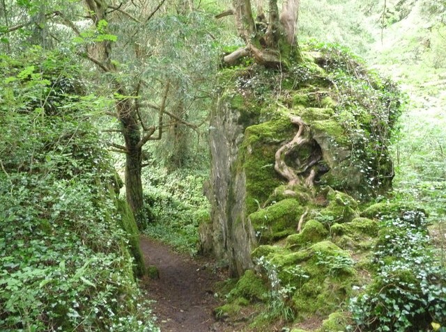 The path leading from Wynd Cliff
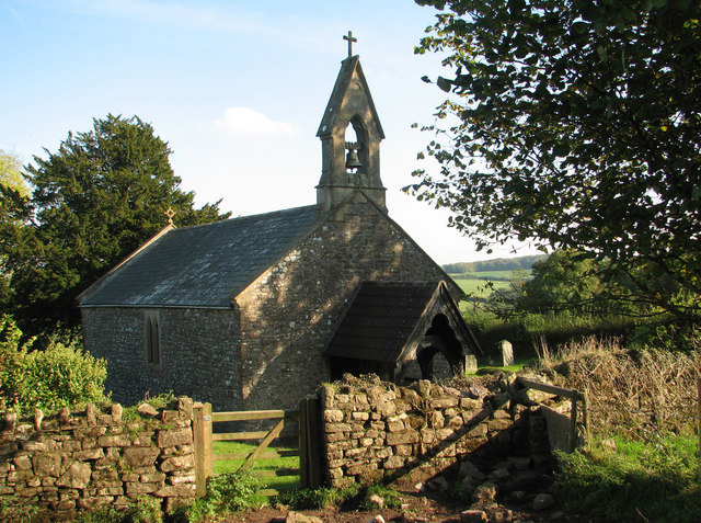 Penterry Church
The isolated and picturesque little church at Penterry stands on an ancient site, although the present building dates almost entirely from Victorian times. It was once a possession of the great abbey of Tintern and is dedicated to St Mary. This pretty church is visited during the walk.
The oval Iron Age hillfort of Gaer Hill stands 800 feet (245 metres) above sea level and measures about 300 by 200 yards (278 x 180 metres) in area. Traces of its outer embankment, with an entrance visible on the east side, can be seen. The inner defence and the outer western embankment have long since vanished. From this vantage point there are panoramic views of Wyndcliff, Tidenham Chase, the Wye Valley, the Severn Estuary and the Sugar Loaf, Skirrid Fawr and the Black Mountains.
Acknowledgment: Text derived from the Out and Out Series; Discovering the Countryside on Foot. Pictures courtesy of Wikipedia.


