Tal-y-Llyn Lake
A walk above and around a lake at the foot of Cadair Idris
Google Maps Open Source Maps| Statistics and Files | ||
|---|---|---|
| Start: Tal-y-Llyn | Distance: 3.8 miles (6.2 km) | Climbing: 209 metres |
| Grid Ref: SH 71044 09417 | Time: 2 hours | Rating: Easy |
| GPX Route File | Google Earth File | About Tal-y-Llyn |
| Statistics | |
|---|---|
| Start: Tal-y-Llyn | Distance: 3.8 miles (6.2 km) |
| Climbing: 209 metres | Grid Ref: SH 71044 09417 |
| Time: 2 hours | Rating: Easy |
| GPX Route File | Google Earth File |
Ordnance Survey Explorer Map (1:25,000)
The Walk: Enchanting views from both lakeside and ridge offer the prospect of magical reflections of the surrounding mountains in a long, rift valley lake on this walk, which is rich in both scenery and wildlife. Like Llyn Tegid at the Bala end of this geological fault, the lake has a legend of a monster. In 1981 it certainly had an aggressive swan known locally as Harry. Harry's mate was killed by vandals, and his subsequent vicious attacks on humans made national headlines, finally causing his removal to a bird sanctuary. Now, however, peace and tranquillity are the order for this walk with a hint of Welsh magic thrown in for good measure.
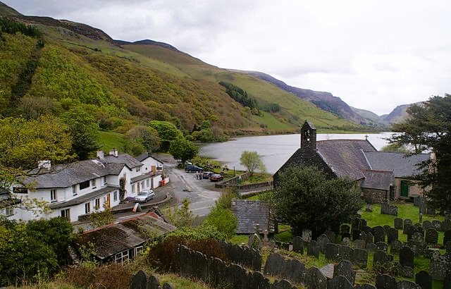 Tal-y-Llyn village
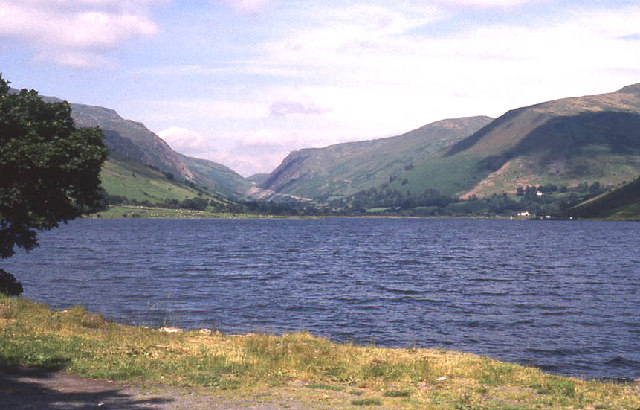 Tal-y-Llyn Lake
St Mary's Church in the village of Tal-y-Llyn stands on an ancient site. Part of the present building dates back to the 13th century with interest in old painted panels above the altar. There are also two very old fonts and some interesting graves outside.
It is the site and the name of the church that are the most interesting, the cada idris and Talidlin Lake area is magical with stories of strange lights, enormous skeletons were found near here in 1684 given substance to the tales of giants.
Hazel rods were found with the bones. It is not clear whether these were for dowsing and the skeletons the remains of the dodmen who surveyed the ley lines in prehistoric times. Dowsers now find that ley lines have male and female lines coiled around them. Female lines are marked by churches dedicated to St Mary, as here, and not far away in Saint Michael's, marking the male line. The two cross at Devil's Rock, once famous for fertility rights.
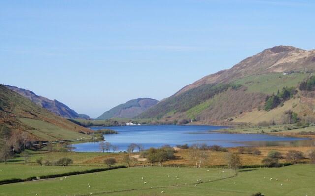 View to Tal-y-Llyn Lake from the A487
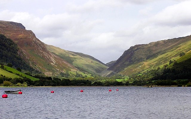 Looking north-east up the Bwlch Llyn Bach pass
The proper Welsh name for Tal-y-Llyn Lake is Llyn Mwyngil, which means 'pleasant, enjoyable lake with a maidenly sense'. And Tal-y-Llyn means lakeside in English.
Look out for common sandpipers, dippers, grey wagtail and dabchick at the west end of the lake. Above the tree line, you may see buzzards, kestrels, sparrowhawks and red kites. The marshland at the east end is noted for tufted duck, coot, pochard, goldeneye, great crested grebe and cormorant.
While walking the natural silence may be broken by low flying aircraft soaring overhead. Tal-y-llyn lies on the Mach Loop (also known as the Machynlleth Loop, Welsh: Dolen Mach) which is a series of valleys in the United Kingdom in west-central Wales, notable for their use as low-level training areas for fast aircraft. The system of valleys lies 13 km (8 mi) east of Barmouth between the towns of Dolgellau to the north and Machynlleth to the south, from the latter of which it takes its name. The training area is part of the United Kingdom Low Flying System and lies within Low Flying Area 7 (LFA7), which covers all of Wales.
Acknowledgment: Text derived from the Out and Out Series; Discovering the Countryside on Foot. Pictures courtesy of Wikipedia.


