Rhewl, Moel y Gaer, Llantysilio Mountain and Moel y Gamelin, Maesyrchen Mountain
Where an Eagle fell to earth on Moel y Gaer hillfort
Google Maps Open Source Maps| Statistics and Files | ||
|---|---|---|
| Start: Rhewl | Distance: 4.5 miles (7.2 km) | Climbing: 537 metres |
| Grid Ref: SJ 18282 44949 | Time: 2-3 hours | Rating: Hard |
| GPX Route File | Google Earth File | About Rhewl |
| Statistics | |
|---|---|
| Start: Rhewl | Distance: 4.5 miles (7.2 km) |
| Climbing: 537 metres | Grid Ref: SJ 18282 44949 |
| Time: 2 hours | Rating: Hard |
| GPX Route File | Google Earth File |
Ordnance Survey Explorer Map (1:25,000)
The Walk: Moel y Gaer literally means 'fort on a bare hill'. Ascending to a height of 1,655 feet, (504 metres) might seem forbidding, but this walk is well within nearly every one's capabilities and can only be described as a moderate climb. Since Rhewl, at the beginning of this walk lies at a height of 400 feet (120 metres), the actual ascent is only 1,250 feet (384 metres). In addition, the paths on this walk are good and offer easy access to the tops of the hills.
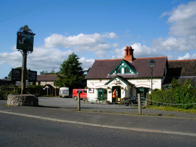 Drovers Arms, Rhewl
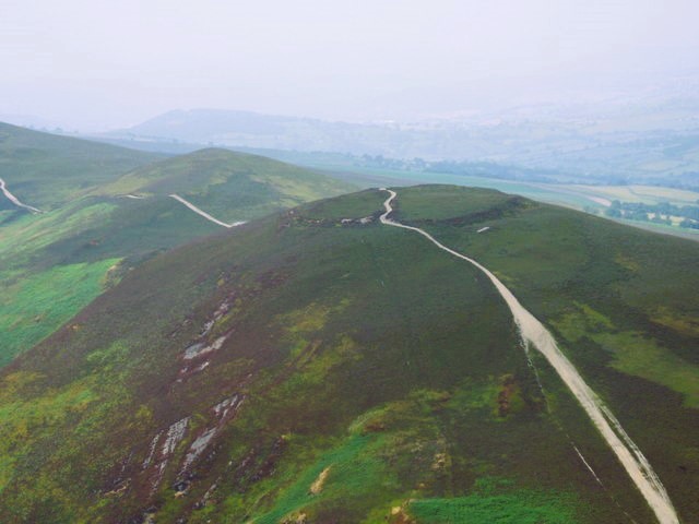 Moel y Gaer
The climb up to Moel y Gaer affords real mountain views - over the Berwyn Range to the south and the Clwydian Range to the north - that deserve a clear day to be appreciated. The heather and bracken covered hills are magnificent. Although the aspect can sometimes be stark because of the lack of trees, the valleys are clad in deciduous woodland and the conifer plantations support a variety of wildlife.
The hamlet of Rhewl lies on the edge of the River Dee, or Afon Dyfrdwy, which flows from Llyn Tegid at Bala to its estuary just north of Chester. Llyn Tegid (Bala Lake) lies about 12 miles (19 kilometres) to the west. It is the largest natural lake in Wales and rich in a wide variety of fish.
Llantysilio Mountain, just north of the rugged Berwyn Hills, lies in the heart of Owain Glyndwr country. The legendary Welsh hero took his name from the nearby village of Glyndyfrdwy. He was Lord of Sycarth and Glyndyfrdwy. Not far away is Glyndwr's Mount, the site of one of his halls, where the sustained Welsh revolt against the oppressive English began on 16th September 1400, and where Glyndwr was proclaimed Prince of Wales.
Talk to the locals at the Sun Inn, the 14th century drovers inn near the start of the walk in Rhewl and some may remember the tragedy that happened on Moel y Gaer in 1942. The event has given the hill a new name, Moel y Dakota.
Starting at Rhewl, the walk leads past the inn and then up hedge lined tracks until you reach Bwlch-y-garnedd, a cottage in the valley encircled by the purple and russet mountains. It was the home of Harry Roberts, a shepherd. In August 1942 he was enjoying a quiet after- lunch stroll around the fields when there was the sound of an aircraft crashing on Moel y Gaer - confirmed by an engine bouncing down the cliff to land in some nearby trees. Taking the narrow path to the top, Harry Roberts met an airman stumbling down the hill. Using uprooted heather, he beat out the flames that engulfed him. Harry sat the airmen on a rock beside the path and entered the mist to reach the summit. The rocky summit of Moel y Gaer hillfort - one of the highest Iron Age settlements in Britain - was strewn with blazing wreckage. The wingtip of the C47 Skytrain, more commonly known as a Dakota, had clipped the ramparts of the hillfort. Thanks to the shepherd's prompt action at effecting a rescue, the airman survived. Unfortunately, the other eleven crew and passengers died.
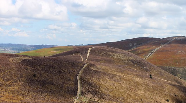 The path across Moel y Gaer and Moel y Gamelin
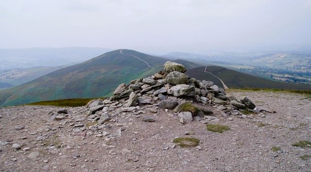 Moel y Gamelin
Walkers on Moel y Gaer today are unlikely to have the quiet of the mountain shattered by such a dramatic landing. This is essential a quiet walking area and you may have the paths to yourself. If you do, enjoy the lovely high rolling walk between Moel y Gaer on Llantysilio Mountain and Moel y Gamelin on Maesyrchen Mountain. Which is an absolute delight.
Please take care if you visit the area in the autumn or the peace of your walk may be interrupted by a more sinister character. Blackberries abound near the end of the walk, but do not pick them after September; for legend has it - if you do, they belong to the Devil who guards them jealously.
Even in spring and summer, bird life can be sparse on the hills, but look out for buzzards circling in the sky above. And for kestrels and sparrowhawks hovering, ready to swoop on unsuspecting prey. The open terrain of these lands is ideal for these stealthy hunters.
Acknowledgment: Text derived from the Out and Out Series; Discovering the Countryside on Foot. Pictures courtesy of Wikipedia.


