Newborough Warren and Llanddwyn Island
A walk through forest and sand dunes to a rocky isle
Google Maps Open Source Maps| Statistics and Files | ||
|---|---|---|
| Start: Nature Reserve Car Park | Distance: 3.8 miles (6.0 km) | Climbing: 100 metres |
| Grid Ref: SH 40579 63367 | Time: 2-3 hours | Rating: Easy |
| GPX Route File | Google Earth File | About Llanddwyn Island |
| Statistics | |
|---|---|
| Start: Nature Reserve Car Park | Distance: 3.8 miles (6.0 km) |
| Grid Ref: SH 40579 63367 | Time: 2-3 hours |
| Climbing: 100 metres | Rating: Easy |
| GPX Route File | Google Earth File |
Ordnance Survey Explorer Map (1:25,000)
The Walk: The destination of this walk is Llanddwyn Island in the south-east corner of Anglesey at the entrance to the Menai Strait. Formed of 600 million year old rock, among the oldest of in the British Isles, it is a Nature Reserve with several sites of historical and religious interest.
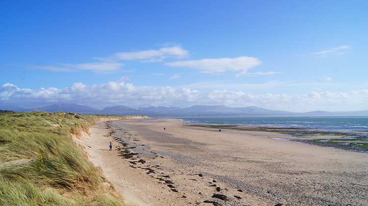 Newborough Beach
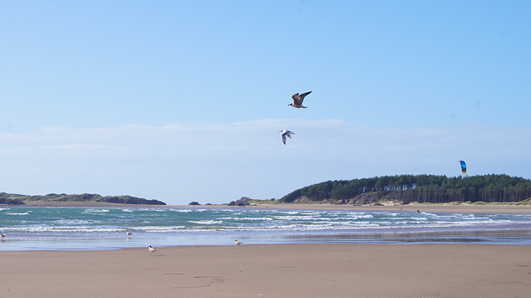 Llanddwyn Bay
The island is reached by a walk through Newborough Forest, planted on half of a 1,500 acre sand dune system, one of the largest in the country. Tree planting began in 1947 to stabilise the dunes. Most of the trees are Corsican Pine with Sitka Spruce in the damper areas. The shade of the trees and their carpet of needles prevent flowering plants from flourishing, except along the rides and in dune slacks (moist hollows) left free of trees. The ground is covered with creeping willow and round-leaved wintergreen, along with rarer plants like dune helliborine. The pine cones attract crossbills and siskins as well as the red squirrel. Scattered within the forest are the remains of several 14th century homesteads, buried for hundreds of years under the sand, and excavated late last century.
 View across Llanddwyn Bay to Snowdonia
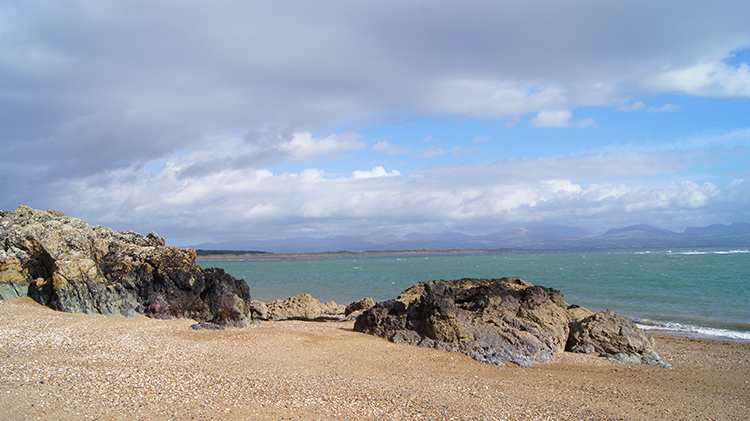 Pillow Lava outcrops at Porth y Cwch
The other half of the dunes is Newborough Warren, so named because of the many thousands of rabbits that once inhabited it. The dunes up to 60 feet high, have been formed over 600 years by sand blowing off the foreshore of Caernarfon Bay by the prevailing westerlies. Before that, it was rich agricultural land, until a series of unusually violent storms in the Middle Ages overwhelmed it with sand. To stabilise the dunes, Queen Elizabeth I introduced laws to encourage the planting of Marram Grass. This created a flourishing local industry in mat, rope and basket weaving with the grass, which survived into the 1930's. Until 1954 and the introduction of myxomatosis, between 80,000 and 100,000 rabbits were caught on the warren every year. Today they are partially replaced by Soay sheep. Walking across Newborough Warren on the designated track to Abermenai Point during a hot summer has been likened to walking in the Sahara! But the path is partly shaded by the trees after noon.
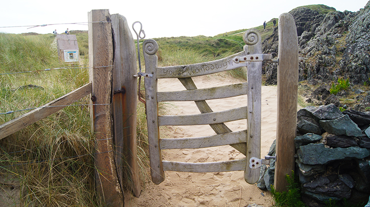 Heritage Gate on Llanddwyn Island
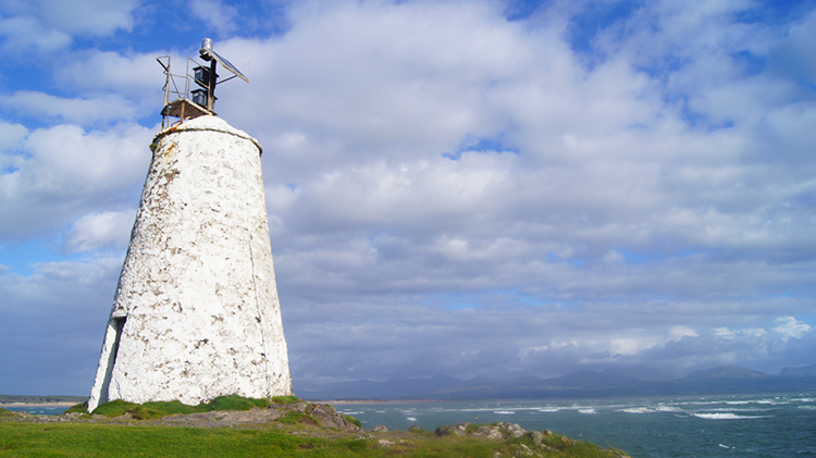 Tŵr Bach lighthouse
Apart from the marram grass, the dunes are alive with flowers. Dune pansies, sea spurge, sand's catstail and mouse-ear chickweed grow near the sea, with ladies smock, meadow saxifrage, birds foot trefoil and wild thyme proliferating further inland. There are also several varieties of orchid. In the hollows where the water table is near the surface, the sand is colonised by creeping willow, creeping bent grass, plantain, sand sedge, buck's horn and grass of Parnassus. Hawthorn and birch shrubs have established themselves where grazing has been suppressed, and even one or two self-sown pines have appeared. Left alone, the area of dunes of the warren could well become the type of woodland it was before trees were felled to provide farmland before the 13th century. Toads spawn on the dunes in spring, and oystercatchers, lapwings, curlews, skylarks and meadow pipits nest there. To see all this wildlife, it is a good idea to carry a pair of good binoculars on the path alongside the forest, since it is forbidden to walk on the dunes themselves.
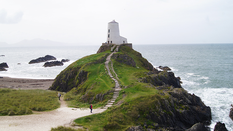 Tŵr Mawr lighthouse
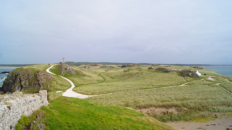 View of Llanddwyn Island from Tŵr Mawr
Fronting the forest and the warren is a 3.5 mile long sandy beach, Traeth Llanddwyn. The walk from the forest to Llanddwyn Island (Ynys Llanddwyn) goes along this beach. The island is easily reached, except at high water spring tides, when the sand and a rock causeway are both underwater - although if there is no onshore wind it is possible to wade across in Wellington boots. In the height of summer, it is best to visit the island early in the morning, or the evening, before the crowds get there
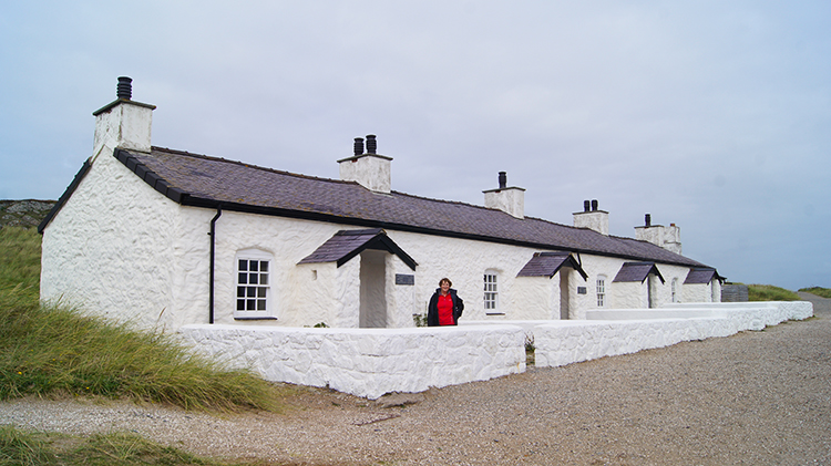 Pilot's cottages
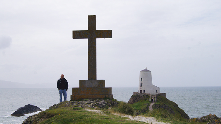 Cross on Llanddwyn Island
The north-west coast, to the right of the path, is the succession of sharply indented bays and tiny fjords of black and red jagged rock. When westerlies blow, it is indeed a wild coast. Here, a large variety of seaweeds can be found with the delicate fern like spleenworts clinging to the more sheltered rock surfaces. The southern end of the island breaks up into three prongs with outliers around, which at most times, the sea spouts and spumes. The southeast coast is a series of rock girt, but normally well-sheltered sandy coves were visiting yachts are often seen at anchor The character of the island is rugged with rocky knolls rising upwards of 50 feet above sea level, covered with course grass and bramble scrub. There is also plenty of other plant life. The pale blue spring squill blooms in spring, and this is one of the very few places in Britain where it does. There is also creeping willow and masses of sea pink. Oystercatchers and a few ringed plovers nest on the island, and the emperor moth and pearl bordered fritillary are found in abundance.
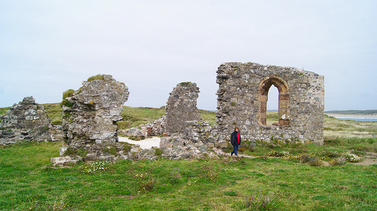 St Dwynwen's Church
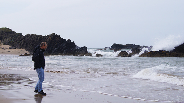 Down in a secluded west cove of the island
In the centre of the island is the ruin of St Dwynwen's Church, built in the 16th century on the site of the saints 5th century oratory, and the convent that she founded after a broken love affair. She is the Welsh patron saint of lovers who were wont to make pilgrimages to her wishing well on the north shore - now no more than a few rocks forming a hollow. The island is named after her.
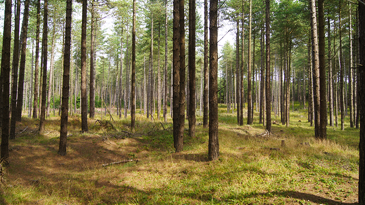 Newborough Forest
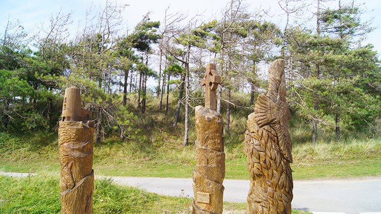 Wood carvings near the car park
A stone pepper pot shaped tower was built on the south prong in 1800 as a navigational mark, and it now has a flashing light. Then, in 1837, Twr Mawr lighthouse was built on the 40 foot hill on the north prong, with its light housed in a ground floor room. From both sites there are good views over the rocks with their shags and cormorants below. By the pepper pot are the ruins of the old lifeboat station. The cannon, which was fired to launch the lifeboat, today stands outside a row of restored pilots cottages built in the early 19th century. These have recently been renovated and furnished as they were in 1900.
Acknowledgment: Text derived from the Out and Out Series; Discovering the Countryside on Foot. Pictures courtesy of Wikipedia.


