Castell Coch, Fforest-fawr and Thornhill
A hilltop walk taking in the woods surrounding Castell Coch
Google Maps Open Source Maps| Statistics and Files | ||
|---|---|---|
| Start: Castell Coch | Distance: 5.9 miles (9.5 km) | Climbing: 308 metres |
| Grid Ref: ST 13250 82684 | Time: 3 hours | Rating: Moderate |
| GPX Route File | Google Earth File | About Castell Coch |
| Statistics | |
|---|---|
| Start: Castell Coch | Distance: 5.9 miles (9.5 km) |
| Climbing: 308 metres | Grid Ref: ST 13250 82684 |
| Time: 3 hours | Rating: Moderate |
| GPX Route File | Google Earth File |
Ordnance Survey Explorer Map (1:25,000)
The Walk: The walk begins at the magnificent mock medieval castle of Castle Coch, the 'Red Castle', and most of the route leads through attractive broad leaved woodland.
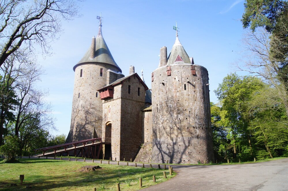 Castell Coch
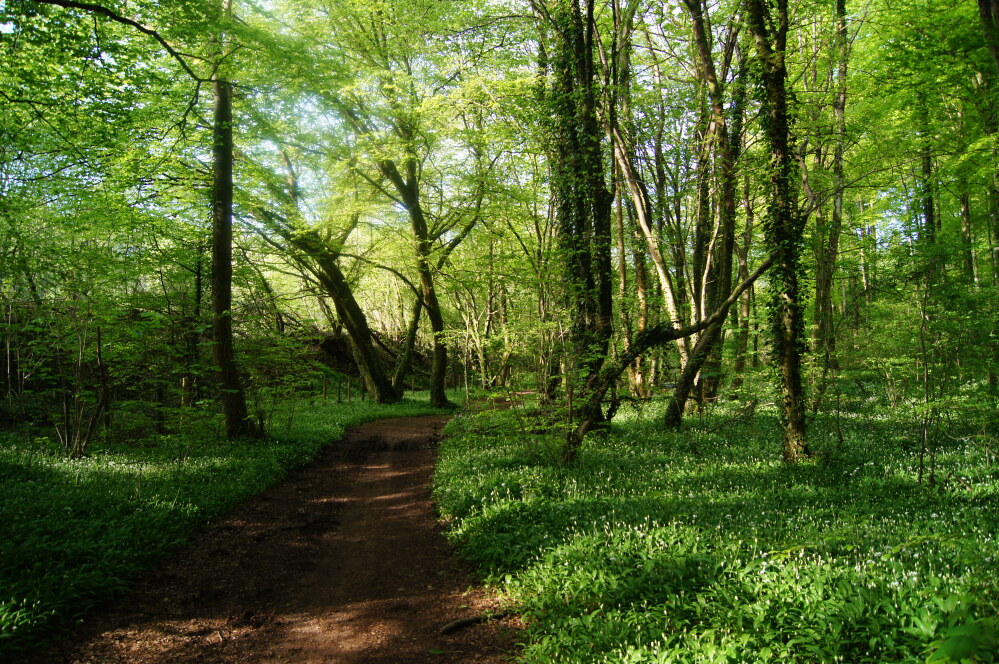 The path in Fforest-fawr
Castell Coch is one of the most extraordinary buildings in Britain. There was a castle on the site, but when the third Marquess of Bute decided on its restoration in the late 19th century, it was a complete ruin. He turned to the American architect, William Burges, with whom he had already worked on the rebuilding of Cardiff Castle. An enthusiastic medievalist, Burges set about building this magnificent edifice though its array of round turrets might look more at home overlooking the River Rhine rather than River Taff. It is well worth spending time here for the interior is, if anything, even more sumptuous than the exterior.
The first part of the walk passes through Fforest-fawr, still dominated by broadleaf trees, particularly Beech and Birch, instead of the popular conifers. On either side of the track, you can see curious humps and hollows, suggesting that at some time in the past, there must have been mining or quarrying in the area.
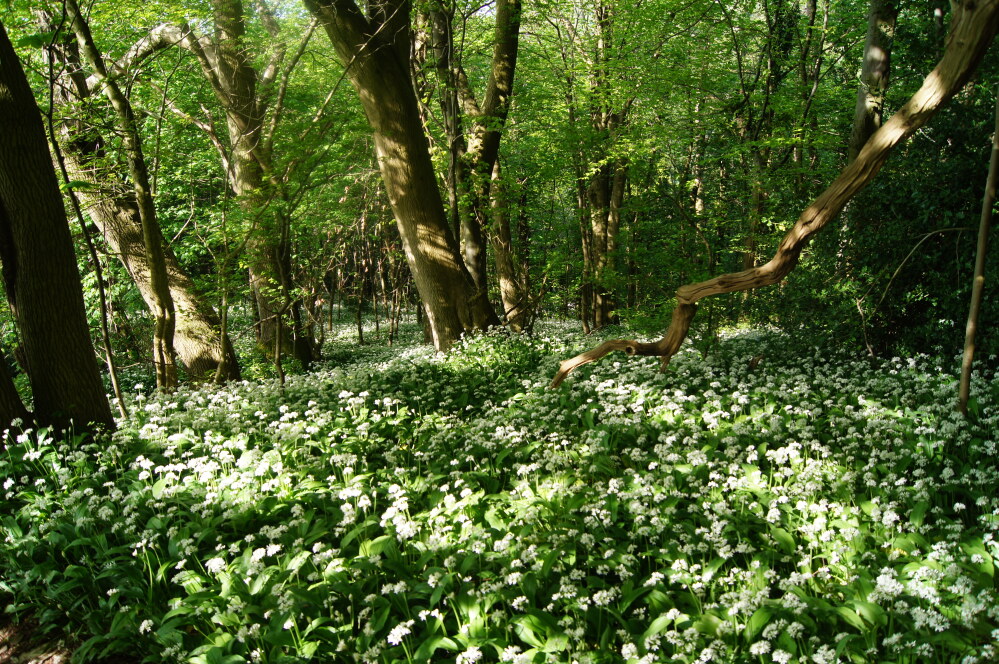 Blossoming wild garlic in Fforest-fawr
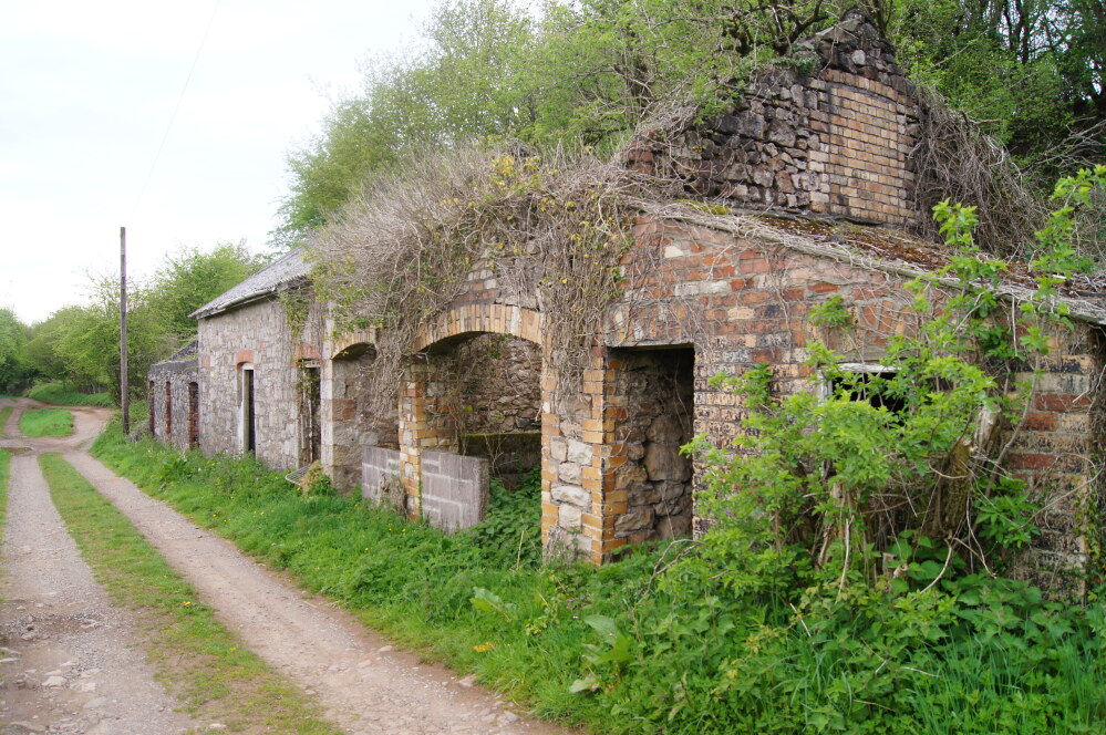 Disused store houses near Thornhill
The wooded path ends, but the walk remains very much in the woodland setting. For a short way, it follows a quiet country road where it is accompanied by a noisily splashing stream. Then the route turns back to footpaths and bridleways. There is a brief walk along the pavement to Thornhill and the attractive Traveller's Rest pub of pink washed stone and thatch, before you turn back onto a minor road and then head off again for a footpath across the fields. Here are some of the best views of the walk, looking out across the deep wooded valley.
The route back to the start is barred by the little river at the bottom of the valley, but this is easily crossed at the small ford via conveniently placed stones. From here, the path runs up past the side of a small reservoir to join the last short road section of the walk. Turning off the road back on to the footpath brings you once again into the woods, and you will emerge at the end of the walk at the driveway of Castle Coch, looking up to the tall round towers with their pointed tops.
Acknowledgment: Text derived from the Out and Out Series; Discovering the Countryside on Foot. Pictures courtesy of Wikipedia.


