Clytha Castle, Bettws Newydd and River Usk
A walk including a Gothic castle, an Iron Age hillfort and a beautiful river
Google Maps Open Source Maps| Statistics and Files | ||
|---|---|---|
| Start: Clytha Castle | Distance: 6.2 miles (9.8 km) | Climbing: 231 metres |
| Grid Ref: SO 36111 08532 | Time: 2-3 hours | Rating: Moderate |
| GPX Route File | Google Earth File | About Bettws Newydd |
| Statistics | |
|---|---|
| Start: Clytha Castle | Distance: 6.2 miles (9.8 km) |
| Climbing: 231 metres | Grid Ref: SO 36111 08532 |
| Time: 2-3 hours | Rating: Moderate |
| GPX Route File | Google Earth File |
Ordnance Survey Explorer Map (1:25,000)
The Walk: This circular walk passes through the beautiful unspoilt countryside of the Usk Valley. It includes a remarkable romantic folly - a Gothic style castle built by a broken hearted landowner as a memorial to his departed wife - and an Iron Age hillfort. From this hill-top citadel, you descend into the valley to visit an exceptionally pretty little church, and then you return along a waymarked path that forms part of the Usk Valley Walk.
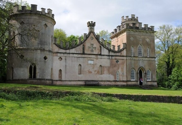 Clytha Castle
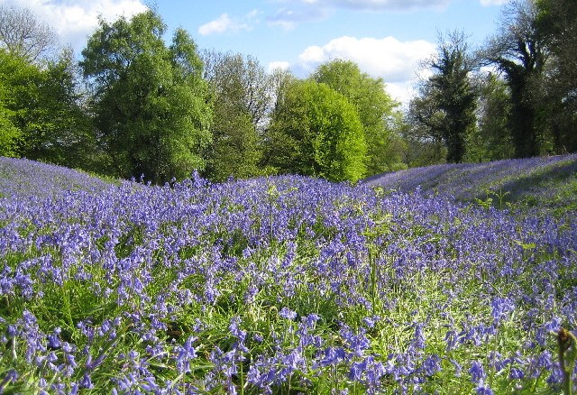 Bluebells at Coed y Bwnydd hillfort
Clytha Castle, the first point of interest on the walk, is perched on a hillside. You can see its ornate battlements through the trees. It was constructed in the Gothic style in 1790 by William Jones of Clytha House as a memorial to his wife, and a plaque on the side of the folly informs you that: 'this building. was erected in the year 1790 by William Jones of Clytha House, Esq., fourth son of John Jones of Llanarth Court, Monmouthshire Esq., and Husband to Elizabeth the last surviving Child of Sir William Morgan of Tredegar, K.B. and Grand-daughter of the most noble William, Second Duke of Devonshire. It was undertaken for the purpose of relieving a Mind. Sincerely afflicted by the loss of a most excellent wife.'
After walking through the fields, you reached the fortified hilltop of Coed y Bwnydd. According to one local legend, it was once the site of a castle built by a giant named Clytha - but it is in fact the site of an Iron Age hill fort. It is roughly oval in shape and covers an area of about eight acres. A single rampart has been formed on the steep north and north-west sides. However, three trenches protect the other sides and a tumulus guard to the entrance to the fort.
The name Coed y Bwnydd is variously translated as 'wood of the gentry' or 'wood of spearheads', and it would seem that it was occupied and strengthened by the Romans in the middle of the 1st century AD. It is now owned by the National Trust.
The historian William Coxe travelled here in 1798 and later described his visit in his book, Coxe's Tours in Monmouthshire. Recalling the fort, he said that: "the western side overhangs the meandering Usk and commands a beautiful view of the northern parts of the county, which will amply repay the traveller for the trouble of ascending the summit". Today we are unable to enjoy the view that he saw because the trees have grown tall and dense. Nevertheless, you will be well rewarded if you come here in the bluebell season when the summit is richly carpeted in blue.
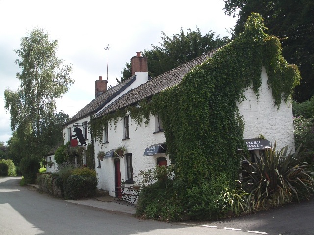 The Black Bear Inn, Bettws Newydd
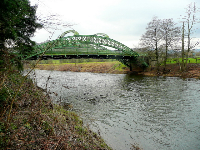 Pont-Kemeys Chain Bridge spanning the River Usk
After a short walk, you reach Bettws Newydd Church. The first church on this site was founded in a 1188 by Aeddan, who was the son of Gwaethfoed, Prince of Cardigan, and related by marriage to the King of Gwent. He also founded churches in nearby Bryngwyn and Clytha in honour of the visit of Baldwin, Archbishop of Canterbury. The Archbishop was on a tour of Wales at the time, bringing news of the Third Crusade.
Bettws Newydd Church was reconstructed between 1480 and 1520; and in 1872 the interior was restored. Its greatest treasure is, without doubt, the carved screen and rood loft - the most complete example of its kind in Wales. It fills the whole space from the floor to the open roof, dividing the chancel from the nave. It is in perfect condition and represents a unique example of 15th century craftsmanship adorned with carvings of grapes, oak leaves and acorns, and with a balustrade deeply cut with rich tracery.
On the west side of the church is an oak door studded with handmade iron nails, mounted on two heavy iron hinges. In the wall on either side are recesses for a slip bar which could be placed in position to barricade the door from the inside - a reminder that churches often served as places of refuge in troubled times.
The Usk Valley Walk is a waymarked route starting from the Ship Inn at Old Caerleon and you follow this on the return leg of the walk. It is marked with yellow arrows all the way through the Vale of Usk to Abergavenny, and then follows the towpath of the Brecon and Abergavenny Canal to Brecon - a route of some 50 miles. This stretch of the walk along the River Usk is beautiful, and includes, if you back track a little bit, a view of the Pont-Kemeys Chain Bridge which spans the river near the southern extremity of the walk.
Acknowledgment: Text derived from the Out and Out Series; Discovering the Countryside on Foot. Pictures courtesy of Wikipedia.


