Goodwick, Carreg Wastad Point and Llanwnda
A walk along a coast famed for its wildlife and adventures
Google Maps Open Source Maps| Statistics and Files | ||
|---|---|---|
| Start: Goodwick | Distance: 5.0 miles (8.1 km) | Climbing: 287 metres |
| Grid Ref: SM 94737 38813 | Time: 2 hours | Rating: Moderate |
| GPX Route File | Google Earth File | About Goodwick |
| Statistics | |
|---|---|
| Start: Goodwick | Distance: 5.0 miles (8.1 km) |
| Climbing: 287 metres | Grid Ref: SM 94737 38813 |
| Time: 2 hours | Rating: Moderate |
| GPX Route File | Google Earth File |
Ordnance Survey Explorer Map (1:25,000)
The Walk:
The Pembrokeshire Coast is renowned for its plant life. In May or June, the coastline is bright with colour and even in January there may be up to 50 species in bloom. Buzzards and kestrels are common sights, while the sheltered woodland provides cover for warblers, blackcap and chiffchaff.
This walk out to Carreg Wastad Point includes a stretch of wild and treacherous coastline, the site of many shipwrecks and a French invasion. Harbour Village, on the edge of Goodwick and Fishguard, was built at the beginning of the 20th century to house railway and port workers, and had things gone according to plan, the harbour would have become full of transatlantic liners.
 Pen Anglas
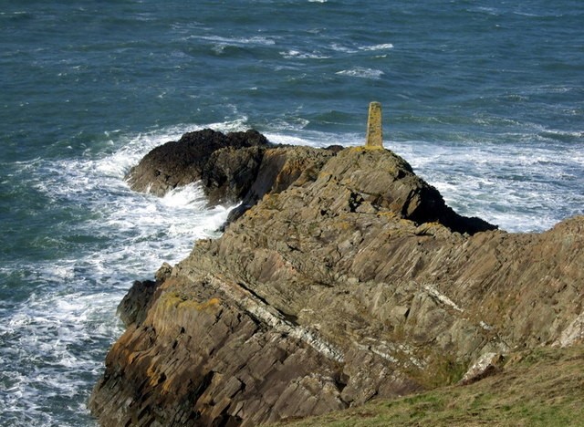
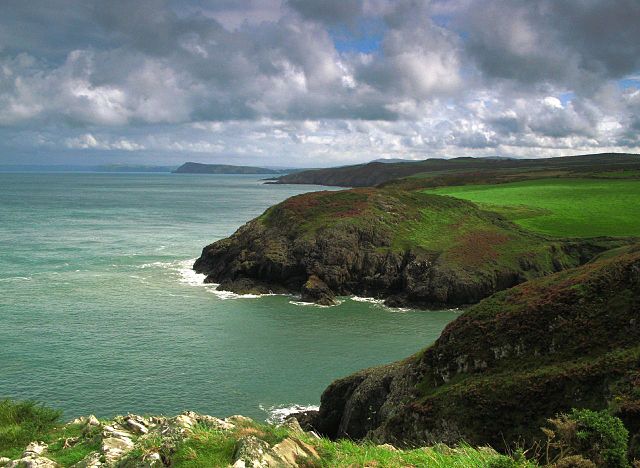 Carreg Wastad Point
An incredible two million tons of rock were blasted from the cliffs at Goodwick to be used in the 2,000 foot long North Breakwater. The quarry floor became the railway terminus in 19O6 and the port opened soon after for transatlantic liners. The ill-judged building of East Breakwater was to bring an end to the whole scheme in 1913. It caused silting so that the bigger ships were unable to dock.
Many vessels have foundered in these treacherous waters, and the first record of a lifeboat station dates from 1822. Needle Rock is the last resting place of the Dutch motor schooner Hermina, which foundered in December 1920. The wreck of the coaster Gramsbergenlies east of Needle Rock, where it sank in November 1954.
From here, the walk continues to Pen Anglas, the Welsh version of the Giants Causeway in Northern Ireland. Then the route follows the Pembrokeshire Coast Path as far as the memorial on Carreg Wastad Point, erected in 1897 to mark the centenary of an attempted invasion by the French in 1797.
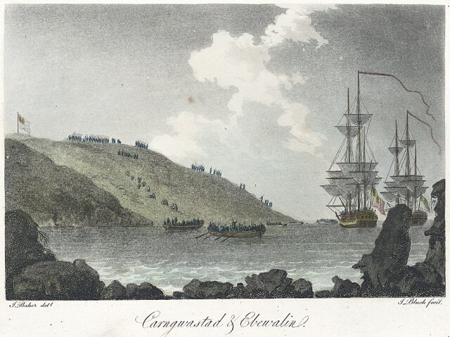 The Battle of Fishguard
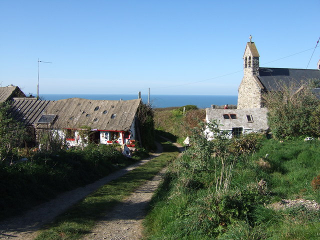 Llannwnda
The French believed that the people of the United Kingdom were ready to rise up against the crown and sent four ships to help them. They disembarked at Carreg Wastad Point on the night of the 22nd February, 1797. Next morning, they commanded the heights of Garnwnda, but were soon overpowered in what is known as 'The Battle of Fishguard'.
After this, you turn inland, passing through the ancient settlement of Llanwnda. Saint Gwyndaf's church is named after a Celtic saint from Brittany. It has a typical Celtic bellcote tower.
To the south of Llandwna can be seen the craggy volcanic outcrop of Garndwnda, the site of a Neolithic burial chamber. Its capstone is 11 feet long by 10.5 feet wide. A small urn containing calcified bones was found here around 1900.
Acknowledgment: Text derived from the Out and Out Series; Discovering the Countryside on Foot. Pictures courtesy of Wikipedia.


