Cwm Cywarch, Bryn Hafod, Aran Fawddwy and Drysgol
A stiff climb in a rugged landscape to a mountain summit
Google Maps Open Source Maps| Statistics and Files | ||
|---|---|---|
| Start: Cwm Cywarch | Distance: 7.8 miles (12.6 km) | Climbing: 817 metres |
| Grid Ref: SH 85363 18452 | Time: 3-4 hours | Rating: Hard |
| GPX Route File | Google Earth File | Aran Fawddwy |
| Statistics | |
|---|---|
| Start: Cwm Cywarch | Distance: 7.8 miles (12.6 km) |
| Climbing: 817 metres | Grid Ref: SH 85363 18452 |
| Time: 3-4 hours | Rating: Hard |
| GPX Route File | Google Earth File |
Ordnance Survey Explorer Map (1:25,000)
The Walk: Wales is famous for its mountains, but the highest peak south of the Snowdon range remains very little known: Aran Fawddwy. This is a real mountain, not a grassy hill, so it should be approached with caution. Rock is the principal ingredient in this landscape and the precipice to the east of the summit is to be avoided by all but the most experienced climbers. Most of your path will be a natural rise, taking you step by step to the summit. The hardest part is the first mile which will test your stamina so allow plenty of time for frequent rests. You will be rewarded by the most exhilarating views.
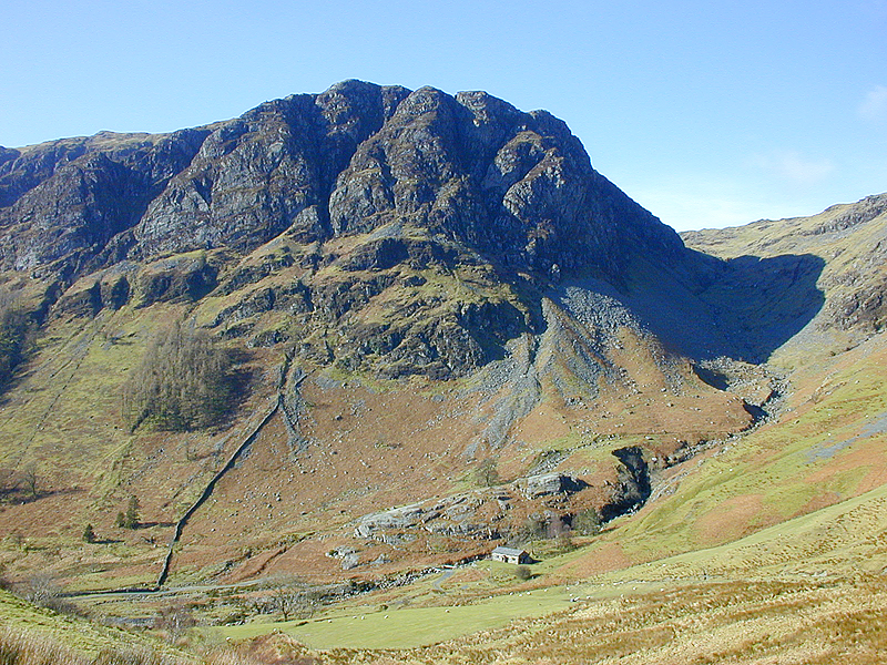 View from near the start at Cwm Cywarch
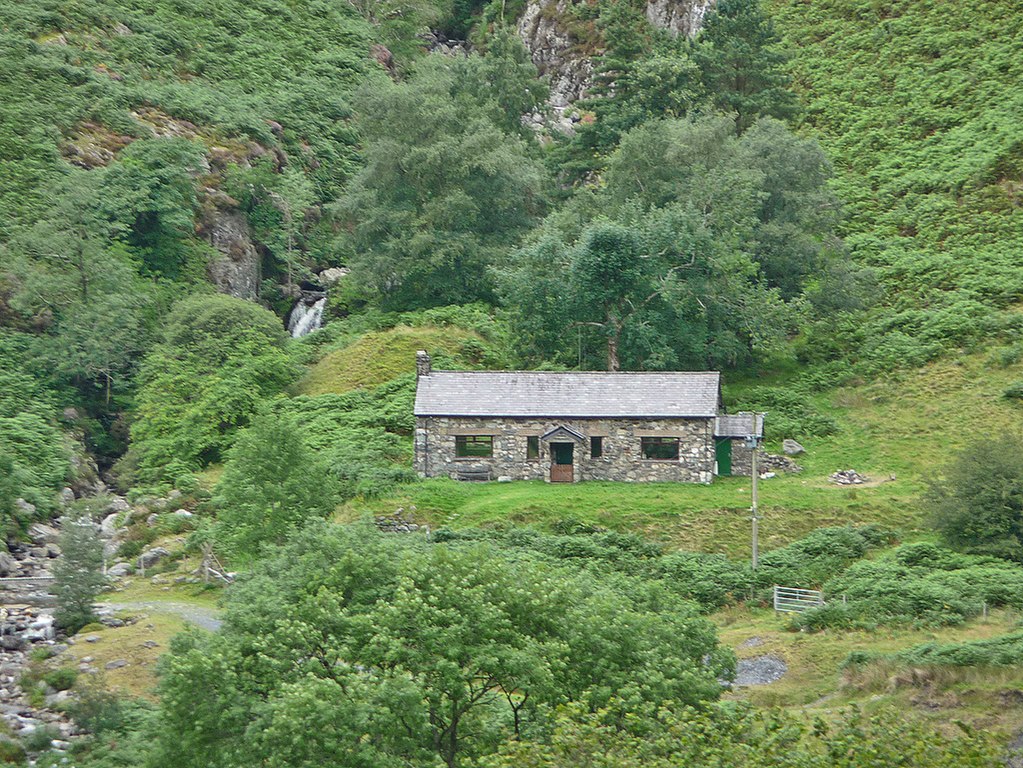 Bryn Hafod Mountain Hut
Mighty walls hem you in at the start. Craig Cywarch is popular with rock climbers. They stay at the Bryn Hafod Mountain Hut, which was opened in 1965. Miners formally frequented this area. Cowarch Mine was worked before 1770, but the amount of lead was too small to encourage investment in machinery, until a London company paid £7,500 for the privilege of raising just 349 tons from 1845 until 1862. The crusher house, down near the Mountain Club Hut, still contains its machinery, but the older mines where the Romans may have extracted lead and copper are nearer to the route of the walk.
After crossing the footbridge, climb the waymarked path to a spot where it returns to the stream. Here is Eve's Heel, a smooth flat rock about four inches deep and rounded at the bottom. Just across the fence is the ruin of a 'hafod' an old summer dwelling where the shepherd would live and perform tasks such as tail cutting.
Climbing further you pass Tyllau Mwn, the shafts of Friar's Coat mine, so-called by the intrepid Elizabeth Baker, who came here in 1770 in search of copper, but also suspected the presence of iron and silver. The metals that constitute what is called the 'Friar's Coat. Iron ore was raised here in 1878 and again around 1910. But the mine seems to have produced little else.
As you gain height, the first of Aran Fawddwy's air crash sites is on your right. The plane, a De Havilland Mark IX Photo Reconnaissance Mosquito, crashed here on the 9th February 1944, while on a cross country exercise from RAF. Benson in Oxfordshire. The crew of two, including a Polish pilot, were killed. Much nearer the summit, a Republic P47 Thunderbolt plane and its pilot came to grief on the 16th September 1944, with the pilot losing his life.
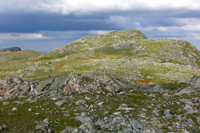 The summit area of Aran Fawddwy
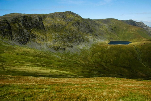 Aran Fawddwy and Creiglyn Dyfi
Aran Fawddwy is a relatively undiscovered peak. Its ridge forms the southern bastion of Snowdonia and overlooks the River Dyfi, the traditional boundary between North Wales and South Wales. It is well away from the tourist hordes that throng Snowden yet at 2,970 feet (905 metres), it is the highest peak in Britain south of the Snowdon range. This fact comes as a surprise to many who assume that Cader Idris 2,930 feet (893 metres) is the highest in this area.
Descending from the peak to Drws Bach, the 'little door', pause at the memorial to Mike Aspain of RAF St Athan mountain rescue team. He was killed by lightning near here while on duty on 5th June 1960. You are invited to open the heavy box at the base of the cairn to sign the book and leave a few coins for charity. On your left, admire the view of Aran Fawddwy and Creiglyn Dyfi, the lake that is the source of the River Dyfi.
Beyond the lake, notice the grassy slopes of Erw y Ddafad-ddu. These were the home of a black sheep that gained fame by turning up again some months after it had been taken to market and sold in England. On your right can be seen the pencil thin peak of Pen Main, literally 'slender top'.
The return route from Aran Fawddwy's summit to Cwm Cywarch is part of the Dyfi Valley Way, a 108 mile walking route leading from Aberdyfi over the Arans (the word Aran is Welsh for 'high place'), coming back to the sea at Borth. It is waymarked in places by a special salmon symbol formed by the initials DVW.
Acknowledgment: Text derived from the Out and Out Series; Discovering the Countryside on Foot. Pictures courtesy of Wikipedia.


