Garn Fawr, Pembrokeshire Coast Path and Strumble Head
Glorious untamed coastal scenery around Strumble Head
Google Maps Open Source Maps| Statistics and Files | ||
|---|---|---|
| Start: Garn Fawr | Distance: 5.9 miles (9.5 km) | Climbing: 396 metres |
| Grid Ref: SM 89908 38811 | Time: 3 hours | Rating: Moderate |
| GPX Route File | Google Earth File | Strumble Head |
| Statistics | |
|---|---|
| Start: Garn Fawr | Distance: 5.9 miles (9.5 km) |
| Climbing: 396 metres | Grid Ref: SM 89908 38811 |
| Time: 3 hours | Rating: Moderate |
| GPX Route File | Google Earth File |
Ordnance Survey Explorer Map (1:25,000)
The Walk: Stupendous cliff scenery is the hallmark of this walk. Strumble Head is the Pembrokeshire coast at its wildest. It is also an excellent, excellent location for birdwatchers, especially in the spring and autumn, when choughs and fulmars abound. Pwll Deri was once famous for its grey seals, whose breeding season is in September and October.
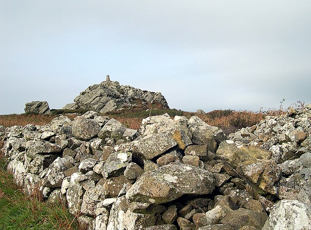 Garn Fawr
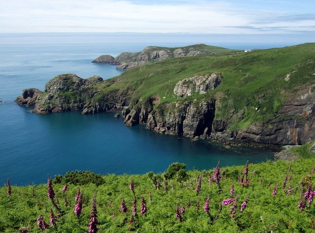 Pwll Deri and Dinas Mawr
The sea-cliff vegetation of Strumble Head is also of particular botanical value. The head is a fine, hard promontory that has stood the test of time against the elements, while softer rocks have been eroded away to leave bays. Come in May and see the varied flora on the cliff top with cowslips and early purple orchids blooming among the heather. Spring squill, kidney vetch and the hairy greenweed add to the headland's colour, while large ferns flourish down the wet gullies. In Britain the perennial centuary plant is found only here and in Cornwall and Devon. The wide variety of plants and wildlife reflects the complexity of the soil. This is composed of ancient shales dating from the Cambrian and Ordovician periods - about 500 million years ago - and of lavas and coarse balsaltic rock.
The path from the car park takes the easy route to Pwll Deri, but the adventurous should divert to the 699 foot (213 metres) summit of Garn Fawr. There is a magnificent view of the route from the summit, including one of the Strumble Head lighthouse. The treeless windswept nature of the landscape enhances its ruggedness. The rock strewn summit of Garn Fawr bears the remains of an Iron Age fort. The memorial stone is for the poet Dewi Emrys (1879 - 1952).
The Pembrokeshire Coast Path was officially opened on the 16th May 1970, by Wynford Vaughan Thomas, the broadcaster, who was then president of the Council for the Protection of Rural Wales. It runs for 168 miles, (270 kilometres) between Poppit Sands and Amroth. Walking the route is no easy feat - it has been calculated that the total amount of climbing involved is greater than the height of Mount Everest. Now a national trail, the route is famous for its wildlife, in particular its flowers and birds.
The short diversion to Dinas Mawr brings you to the site of an Iron Age Promontory Fort, perhaps dating from 100 BC. The old Ministry of Defence buildings near Pen Brush may provide useful shelter as well as being landmarks. Pwll Arian means Silver Cove or Treasure Cove. This is the delightful spot where a small valley runs down to the sea. The turf is springy and there are plenty of reed beds and copses of bushes.
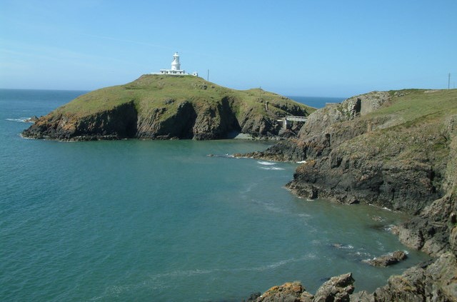 Strumble Head
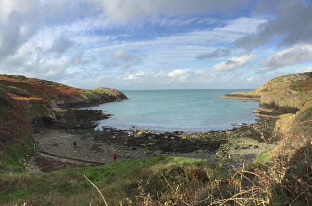 Porthsychan
The Strumble Head Lighthouse stands trim and white on the island of Ynys Meicel. It is accessible via a footbridge. The present lighthouse was erected in 1908 at a cost of £40,000. Near to the lighthouse is the Coastguard Station. This overlooks a glorious wild stretch of the Welsh coast, which is savagely impressive during storm conditions.
Around the other side of Strumble Head, at Pwll Bach, lies the wreck of the Salus. The three masted barquentine of 264 tons was attempting to sail around the head in a force 9 gale on 25th September 1896. The ship was soon driven onto rocks and all the crew were swept away within four minutes. The time it took for rescuers to reach the ship.
Notice the pillow shaped lava cliffs. These are the result of lava cooling rapidly as it was thrown out by volcanoes onto what was the sea bed, in the Ordovician period. Carreg Gybi is named after St Cybi, a Cornishman who sailed up this coast to Caergybi (Holyhead).
Acknowledgment: Text derived from the Out and Out Series; Discovering the Countryside on Foot. Pictures courtesy of Wikipedia.


