Nash Point, Marcross and St Donat's
Through a valley to two churches and a castle, returning along cliffs
Google Maps Open Source Maps| Statistics and Files | ||
|---|---|---|
| Start: Car Park | Distance: 4.5 miles (7.2 km) | Climbing: 118 metres |
| Grid Ref: SS 91652 68359 | Time: 2 hours | Rating: Easy |
| GPX Route File | Google Earth File | About St Donat's |
| Statistics | |
|---|---|
| Start: Car Park | Distance: 4.5 miles (7.2 km) |
| Climbing: 118 metres | Grid Ref: SS 91652 68359 |
| Time: 2 hours | Rating: Easy |
| GPX Route File | Google Earth File |
Ordnance Survey Explorer Map (1:25,000)
The Walk: This varied walk takes in a section of the Glamorgan Heritage Coastal Path and provides an opportunity to see Atlantic College, housed in an impressive impressive castle and two interesting churches. It begins with a walk up a wooded valley to the village of Marcross, whose church was constructed in the 12th century. It was extended in the 14th century, with the addition of a chancel and a tower with a 'saddle-back' roof. The Norman font in the nave is decorated with cable moulding.
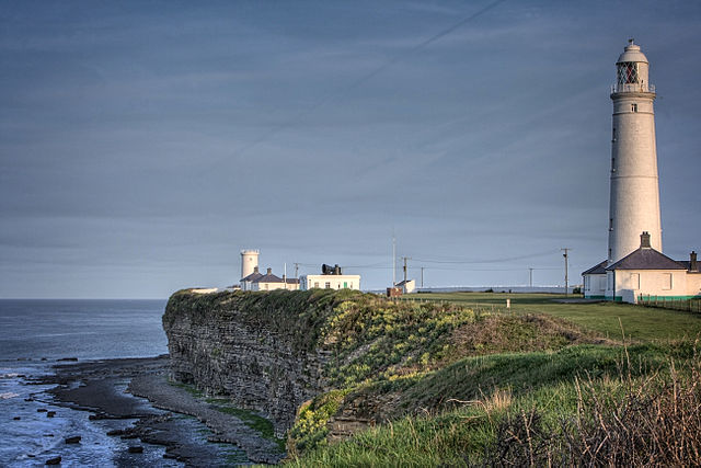 Nash Point Lighthouse
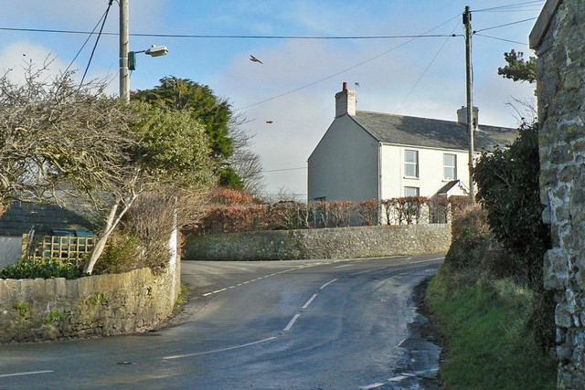 Marcross/ Marcroes
From Marcross, the route follows a road and a farm track to a wooded valley below St Donat's Castle. Past a clearing with a ruined cottage is St Donat's Church, an ancient but modest building, which has benefited from the patronage of the Stradling family, whose chapel contains many fine tombs. On the south side of the churchyard, there is a late 15th century cross carved with an image of the crucifixion.
The walk then skirts the grounds of St Donat's Castle, for 500 years the seat of the Stradling family. In 1925 it was acquired by the American newspaper millionaire, William Randolph Hearst, who spent a fortune on restoring it. But in the following years he spent only one month there. Since 1962 the castle has been known as Atlantic College, and accommodates 300 young men and women of sixth-form age from all over the world.
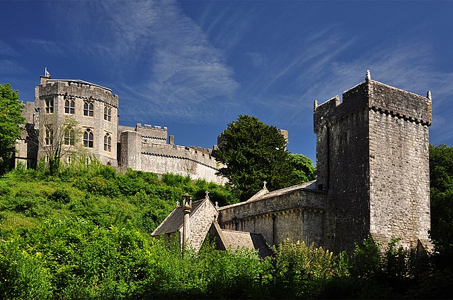 St Donat's Church and Castle
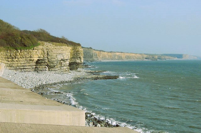 St Donat's Bay
The final part of the walk follows the clifftop with good views up and down the coast, and across the Bristol Channel towards Exmoor. The path dips down at St Donat's Bay, where there is a lifeboat station, and later passes two lighthouses, the second of them disused.
Acknowledgment: Text derived from the Out and Out Series; Discovering the Countryside on Foot. Pictures courtesy of Wikipedia.


