Aberaeron, Ceredigion Coast Path and Henfynyw
Through a regency town to clifftops overlooking Cardigan Bay
Google Maps Open Source Maps| Statistics and Files | ||
|---|---|---|
| Start: Aberaeron | Distance: 4.4 miles (7.1 km) | Climbing: 225 metres |
| Grid Ref: SN 45905 62878 | Time: 2 hours | Rating: Moderate |
| GPX Route File | Google Earth File | About Aberaeron |
| Statistics | |
|---|---|
| Start: Aberaeron | Distance: 4.4 miles (7.1 km) |
| Climbing: 225 metres | Grid Ref: SN 45905 62878 |
| Time: 2 hours | Rating: Moderate |
| GPX Route File | Google Earth File |
Ordnance Survey Explorer Map (1:25,000)
The Walk: The mouth of Afon Aeron (River Aeron) has seen the growth of a tidy, unspoilt little town. The humble fishing village of Aberaeron was transformed in the early 19th century, when it was laid out to a set plan. Before the Methodists protested, the locals were noted for bathing naked in the sea on Saturdays. Now, holidaymakers resort to its safe beaches. From 1911 to 1951 (when the line was closed) they could have used the railway, but since then the modern world has not been allowed to intrude too much on this place.
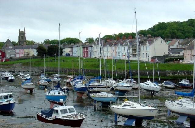 Aberaeron Harbour
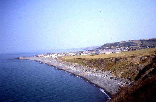 Ceredigion Coast and Aberaeron
Alban Square was completed in 1840 and named after Alban Thomas Jones Gwynne, who was bequeathed the estate of Lewis Gwynne of Mynachdy. He put the bequest to good use by laying out a neat, spacious town. The Regency architect John Nash, who lived in the area at the time, is said to have taken an interest in the project.
The builders had to conform to a general policy with large buildings at the ends and centre of each terrace, to avoid monotony. A terracotta lime wash had to be painted on the walls of every dwelling at two yearly intervals, while pebbles from the beach were used to cobble the pavements. These can still be seen in Belle Vue, as you walk towards the harbour.
The harbour is full of colour. There are small fishing boats and many yachts. Aberaeron became a flourishing port after breakwaters was constructed in 1807 and 1811. Butter, corn, cattle and wool were exported while lime to dress the fields was a vital import. Local oaks also provided timber for shipbuilding.
The harbour is a popular feeding place for gulls, while cormorants can be seen diving for fish. Small house martins flutter around at low tide to gather mud to build their nests under the eaves of nearby houses.
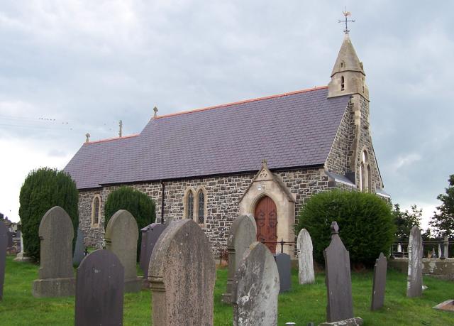 Henfynyw Church
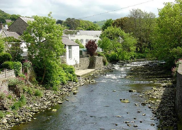 Afon Aeron
The attractive footpath along the shale cliffs is part of the coastal path that has been developed into the countrywide Wales Coast Path. This section is also a stretch of the Ceredigion Coast Path.
The path twice drops down into delightful, verdant, glaciated river valleys. Soon after the second of these, you strike out inland, passing the parish church of Henfynyw, which is dedicated to St David, and was, according to some experts, the site of a 6th century church.
The route then follows a road and clear path to take you back down into Aberaeron. A small part of this section of the walk is alongside Afon Aeron. When back in Aberaeron, if you have time, you may like to divert down Market Street, then left along Cadwgan Place and right along Quay Parade to the fascinating Sea Aquarium.
Acknowledgment: Text derived from the Out and Out Series; Discovering the Countryside on Foot. Pictures courtesy of Wikipedia.


