Dyserth Falls and Graig Fawr
From a waterfall with healing powers to Offa's Dyke Path
Google Maps Open Source Maps| Statistics and Files | ||
|---|---|---|
| Start: Dyserth Falls | Distance: 4.8 miles (7.7 km) | Climbing: 270 metres |
| Grid Ref: SJ 05606 79273 | Time: 2 hours | Rating: Moderate |
| GPX Route File | Google Earth File | About Dyserth |
| Statistics | |
|---|---|
| Start: Dyserth Falls | Distance: 4.8 miles (7.7 km) |
| Climbing: 270 metres | Grid Ref: SJ 05606 79273 |
| Time: 2 hours | Rating: Moderate |
| GPX Route File | Google Earth File |
Ordnance Survey Explorer Map (1:25,000)
The Walk: Up in this north-eastern corner of Wales, the Clwydian range of hills terminates in a limestone escapement overlooking the coastal resorts of Rhyl and Prestatyn. Over the centuries, this escarpment has been an easy site to defend in troubled times and a useful source of lime and lead. Now it is a tourist attraction with fine views.
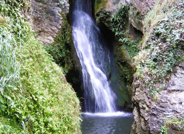 Dyserth Falls
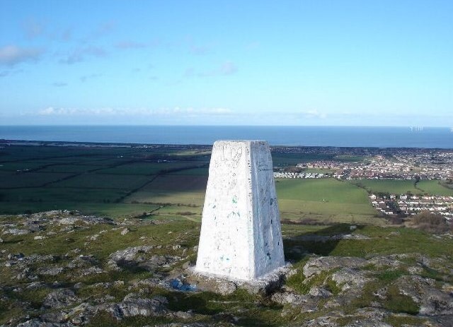 Graig Fawr Trig Point
Dyserth Falls were once a centre for pilgrimages, as the waters were reputed to have healing qualities. Later, the falls provided power for the flour mill that stood behind the present Waterfalls Shop. The shop itself was originally the stables of Y Llew Coch (the Red Lion pub). Until the advent of the railway in the 19th century, Dyserth was accessible only by coach or on horseback.
Further on, a steep craggy hill on the right was originally the site of an Iron Age hill-fort, but the remains of this were largely destroyed by quarrying in the mid 19th century. Stone and lime were excavated at Ochr-y-foel and this was a major reason for the opening of the railway line from Prestatyn in 1869. As the quarries became more important, the railways were extended to meet the workings.
From the disused railway bridge, there are views of Dyserth Station on the left, and the extended railway siding bearing right towards the quarry. A few fields further on is a fine view of the site of Dyserth Castle, built by Henry III in 1241.
 View to Prestatyn Hillside from Graig Fawr
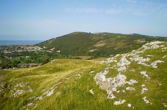
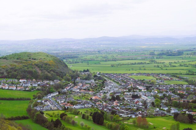 Meliden and Graig Fawr
The short climb to the summit of Graig Fawr is well worth it, for the spectacular views towards Rhyl and Prestatyn. Underneath this hill, lead mines used to provide work for the Victorian inhabitants of the village of Meliden. Now the site is a designated conservation area for many species of limestone loving flowers such as wild thyme, kidney vetch, birds-foot trefoil and common rock-rose.
The next section of the walk includes part of the Offa's Dyke Path. The dyke itself actually ran eastwards of here. Built by Offa, an 8th century Mercian king, as a boundary to his kingdom, this earth wall is nearly 150 miles long and runs from the Irish Sea southwards to the Bristol Channel.
At the foot of the escapement, the old railway track bed passes the Graig Fawr Quarry and the Talaroch Lead Mine. Although the railway was originally built for freight, it opened for passenger traffic in 1905. At the time, Prestatyn was fast developing as a seaside resort and rail trips to see Dyserth Falls were a popular attraction for tourists.
Acknowledgment: Text derived from the Out and Out Series; Discovering the Countryside on Foot. Pictures courtesy of Wikipedia.


