Precipice Walk
Along a nature trail around Snowdonia's Foel Cynwch
Google Maps Open Source Maps| Statistics and Files | ||
|---|---|---|
| Start: Car Park | Distance: 3.5 miles (5.7 km) | Climbing: 125 metres |
| Grid Ref: SH 74585 21159 | Time: 2 hours | Rating: Easy |
| GPX Route File | Google Earth File | About Nannau |
| Statistics | |
|---|---|
| Start: Car Park | Distance: 3.5 miles (5.7 km) |
| Climbing: 125 metres | Grid Ref: SH 74585 21159 |
| Time: 2 hours | Rating: Easy |
| GPX Route File | Google Earth File |
Ordnance Survey Explorer Map (1:25,000)
The Walk: The route is around the Precipice Walk, a circular Nature Forest Trail, with scenic views across Snowdonia's forests and mountains. On the first section of the walk you catch a view of Nannau, a settlement which developed around a house, originally built by a descendant of the Prince of Powys, around the year 1200. When there was much ill feeling between the Welsh and their English conquerors. After the Nanney family collaborated with the English, their house was burned down by Owain Glyndwr, supposedly as a reprisal.
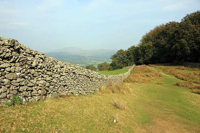 Drystone wall on Foel Cynwch
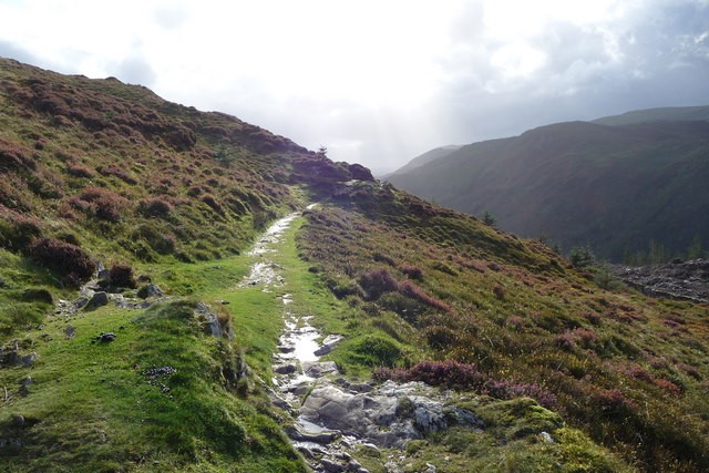 Precipice Walk on Foel Cynwch
According to a more colourful version of the story, Hywel Sele, the 8th Lord of Nannau, attempted to kill Owain while they were hunting together, in order to settle a quarrel. Hywel's aim was true, but his arrow glanced off the breastplate under Owains tunic. Glyndwr killed Hywel and hid his body in a hollow tree. Then he returned to the house and burned it to the ground. Some 40 years later, a skeleton was found in this tree, and it became known as the 'Demons Hollow Tree'.
The Nanney family survived this setback and subsequently gained a reputation for being cultured. They were noteworthy patrons of the bards. The current house was built by Colonel Huw Nanney in 1693. The Vaughans, who farm the estate today, and owned Nannau House until 1966, are direct descendants. The house is now a hotel.
After the walk begins to skirt the hillside, a forest extends before you. Once known as the Vaughan Forest, after its owners, it was renamed Coed y Brenin (Forest of the King) in 1935 to commemorate George V's Silver Jubilee. Managed since 1922 by the Forestry Commission, it is mainly planted with conifers. The native red squirrel, pine marten and otter can be found in the quieter parts of the forest.
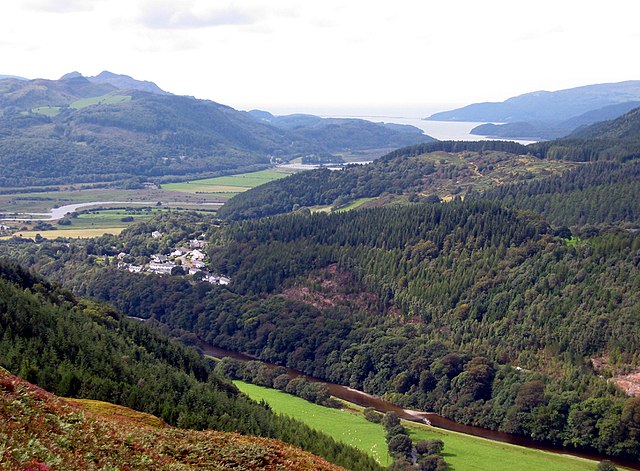 The view from the precipice
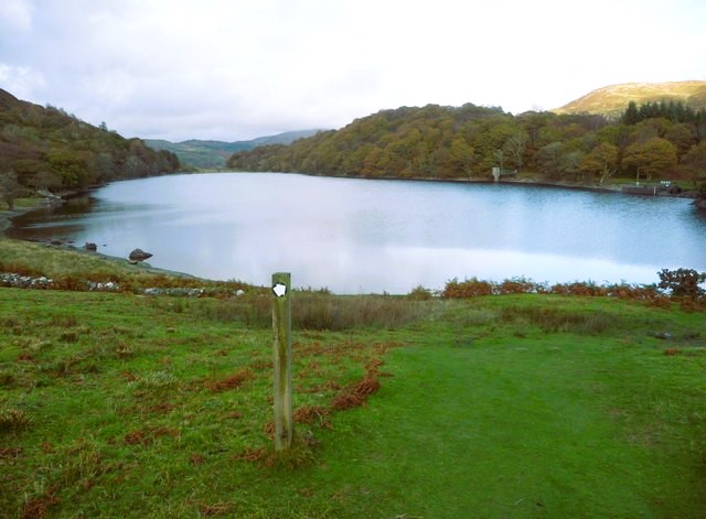 Llyn Cynwch
Forestry is not just a recent development here. In the 17th century, Huw Nanney felled 10,000 oaks. He was fined £1,000 pounds for this act, and refusing to pay, was imprisoned. He was eventually released in 1612 after agreeing to a payment of £800.
On the west side of the hill, you can see how the Precipice Walk gets its name, as the ground drops away steeply to the Mawddach valley, 1,000 feet (320 metres) below.
At the southern end of the hill is a viewpoint that gives a wonderful prospect over the Mawddach Estuary and to the sea at Barmouth. The mighty bulk of Cader Idris also overlooks the whole scene. This viewpoint was probably once a lookout post; Foel Faner, the summit immediately behind it, was the site of an ancient settlement.
The eastern side of the hill is graced by Llyn Cynwch. It is a natural lake, although it now has a wall at the outflow and is used as a reservoir. The lakeside trees provide an enjoyable contrast to the open spaces on the hills western side.
The wood on the opposite bank of the lake is known as Coed y Moch (Pig Wood). Legend has it that this was once the haunt of an enormous serpent that ate people and animals with equal relish, having first mesmerised them.
Acknowledgment: Text derived from the Out and Out Series; Discovering the Countryside on Foot. Pictures courtesy of Wikipedia.


