Cwmtydu Beach, Castell Bach and Church of St Tysilio
Prehistoric sites and the haunt of smugglers on the Ceredigion coast
Google Maps Open Source Maps| Statistics and Files | ||
|---|---|---|
| Start: Cwmtydu | Distance: 2.2 miles (3.6 km) | Climbing: 184 metres |
| Grid Ref: SN 35590 57467 | Time: 1-2 hours | Rating: Moderate |
| GPX Route File | Google Earth File | About Llandysiliogogo |
| Statistics | |
|---|---|
| Start: Cwmtydu | Distance: 2.2 miles (3.6 km) |
| Climbing: 184 metres | Grid Ref: SN 35590 57467 |
| Time: 1-2 hours | Rating: Moderate |
| GPX Route File | Google Earth File |
Ordnance Survey Explorer Map (1:25,000)
The Walk: This walk explores some fine coastal scenery that lies just to the south-west of the resort of New Quay. It begins from the car park at Cwmtydu, a cove at the mouth of the Afon Ffynnon-Ddewi. On occasions, storms throw up pebbles from the shingle beach to form a natural dam across the mouth of the river. Once the storm has passed, children delight in paddling in the large, freshwater pool that the river forms. But children and adults enjoy exploring the rugged sides of the cove, which are riddled with caves and exposed rock formations.
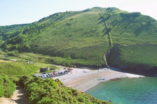 Cwmtydu Beach
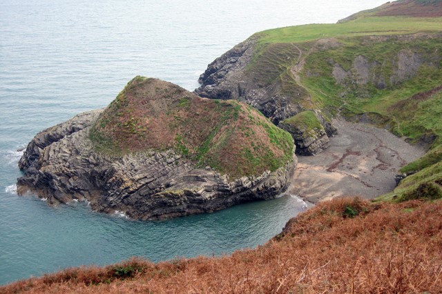 Castell Bach
In the 18th century, this spot had a more sinister reputation. Smugglers used the cove to land French brandy, which was brought in via Ireland. Despite all the best efforts of the excise men, the smugglers leader, known as Sion Cwilt because of the patchwork coat he always wore, was never captured.
A stiff climb up the side of the cove leads to cliff tops from where porpoises and seals can sometimes be seen, sporting in the waters below. Inland, there are stands of yellow gorse which attract a variety of butterflies in summer, including painted ladies, small tortoiseshells and common skippers.
Further along the route on your left is the site of the ancient settlement of Castell Bach. This Iron Age earthwork occupies a huge vantage point, and commands sweeping views that would have given plenty of warning of the approach of any aggressor. The earthen banks, once topped by timber fences, enclosed an inner circle of thatched ground huts and storage places, while cattle were kept in and out of the compound. The settlement on this exposed but lovely site was occupied between 300 BC and 100 AD, and it is thought that as many as 40 people lived here at any one time.
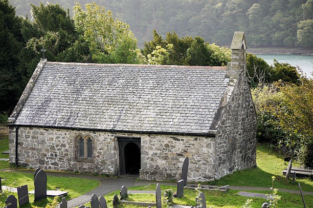 Church of St Tysilio
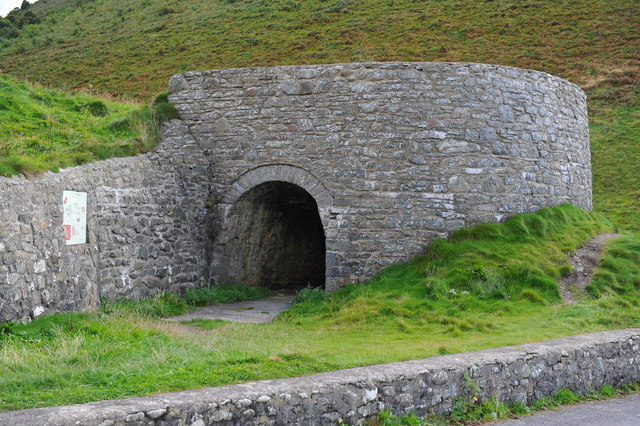 Cwmtydu Limekiln
Below Castell Bach, the path descends into a wooded valley, and climbs again to the remote Church of St Tysilio (Eglwys Llandysiliogogo), which is set within an ancient stone circle.
There have been two saints by the name of Tysilio. One is thought to have been the son of Brochwel, the Prince of Powys. He was born at Pengwern, the Shrewsbury of today, which was then part of Wales - in around 575 AD and, on becoming a monk, moved to a monastery in Brittany. The other Tysilio was probably the son of Corun, descended from Ceredig and Cunedda Wledig before him. One of the two - though it is not known which - came to this spot, already a sacred site, to preach Christianity.
Renovation work carried out in 1890 led to the discovery that the pulpit had been sited on a stone so massive, that the builders of the church were unable to remove it and were forced to incorporate it into the fabric of the building.
From here, your route leads back through narrow lanes and along the valley road, following the stream back to the beach car park. Shortly before the beach, you pass an old limekiln. This is a reminder of a more legitimate form of coastal tradition that took place here in the 18th century, alongside the smuggling.
Acknowledgment: Text derived from the Out and Out Series; Discovering the Countryside on Foot. Pictures courtesy of Wikipedia.


