Morfa Nefyn, Pont Edern, Groesffordd and Porth Dinllaen
Tranquil countryside and the rocky coastline of the Llyn Peninsula
Google Maps Open Source Maps| Statistics and Files | ||
|---|---|---|
| Start: Morfa Nefyn | Distance: 5.9 miles (9.5 km) | Climbing: 214 metres |
| Grid Ref: SH 28172 407237 | Time: 3 hours | Rating: Easy |
| GPX Route File | Google Earth File | Llyn Peninsula |
| Statistics | |
|---|---|
| Start: Morfa Nefyn | Distance: 5.9 miles (9.5 km) |
| Climbing: 214 metres | Grid Ref: SH 28172 407237 |
| Time: 3 hours | Rating: Easy |
| GPX Route File | Google Earth File |
Ordnance Survey Explorer Map (1:25,000)
The Walk: This walk explores part of the southern end of the Llyn Peninsula, lying beyond the mountain fastnesses of Snowdonia. This is a remote holiday area with small communities and a varied coastline of coves and bays.
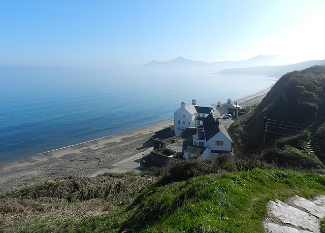 Beachside cottages at Morfa Nefyn
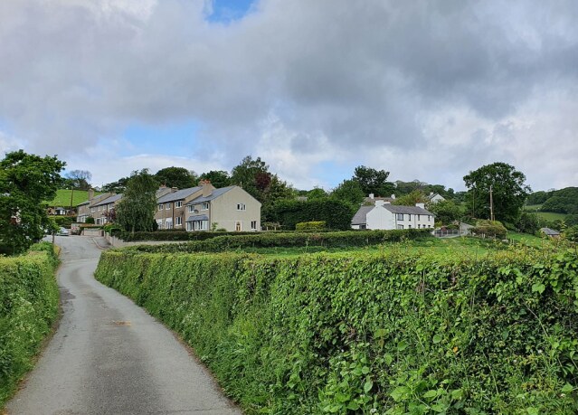 Groesffordd
The walk begins in a clifftop car park situated to the north west of the small town of Morfa Nefyn. From here, the walk skirts the Nefyn and District golf course and goes through pasture to pick up the B4417 through the pleasant village of Edern. On the other side of the village, you take to a quiet country lane leading past the scattered houses and farms of Groesffordd. The lane does not take you all the way to the Heritage Coast. One of the reasons this area remains so unspoilt is that there is no coastal access for cars to reach it. You follow a wide, grassy path.
At the sea, you head north along the coast, climbing through two tiny coves, where streams spill into the sea. At the larger inlet of Aber Geirch, there is a ruined cottage.
Beyond this point, a path takes you between the lower cliff top and the north-west edge of the golf course. Plants such as thrift clothe the cliffs, while which are a riot of colour in the early summer. Oystercatchers, gulls and shags are often to be seen on the rocks or in the sea.
Soon, you come to a peninsula where you pass between a collapsed cave roof on your right and its sea entrance on your left. On the broad headland beyond there is a disused coastguard look out. Cormorants fish the water and perch on the rock of Carreg Ddu. Grey seals can be seen patrolling the coastline.
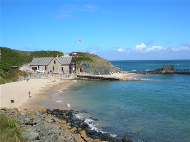 Porth Dinllaen Lifeboat Station
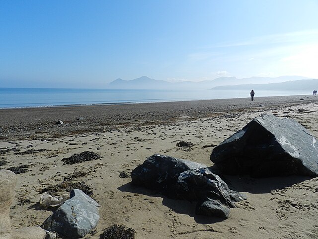 Porth Dinllaen Beach
As you round the headland, the shoreline changes character, as the exposed rocks give way to a broad bay edged with golden sands. Here there is a choice of paths. You can either take a pretty walk down past the lifeboat station and along the shore, or continue along the cliff top; the former route is not recommended in wet or stormy weather.
Either way leads you to Porth Dinllean, a natural harbour that has been in use since at least the 16th century. Sailing ships were once built here, and in the 18th century it was used by smugglers. In the middle of the 19th century it was put forward as the terminal for the rail ferry to Ireland, but Holyhead was chosen instead.
Nowadays, the settlement consists of just a few houses and the pub, which contains some interesting relics and photographs. A popular spot with bathers and boaters, it is an idyllic spot in summer, so much so that a picture of it has been used on the cover of the local Ordnance Survey Landranger Map. From here, you stroll along a service road past a coastguard station before retracing your steps back to the car park.
Acknowledgment: Text derived from the Out and Out Series; Discovering the Countryside on Foot. Pictures courtesy of Wikipedia.


