Loggerheads Country Park, Cilcain and Moel Famau
Through limestone country to a spectacular Clwydian Hills viewpoint
Google Maps Open Source Maps| Statistics and Files | ||
|---|---|---|
| Start: Visitor Centre | Distance: 10.5 miles (16.9 km) | Climbing: 603 metres |
| Grid Ref: SJ 19817 62614 | Time: 4-5 hours | Rating: Hard |
| GPX Route File | Google Earth File | Clwydian Hills |
| Statistics | |
|---|---|
| Start: Visitor Centre | Distance: 10.5 miles (16.9 km) |
| Climbing: 603 metres | Grid Ref: SJ 19817 62614 |
| Time: 4-5 hours | Rating: Hard |
| GPX Route File | Google Earth File |
Ordnance Survey Explorer Map (1:25,000)
The Walk: This walk begins in Loggerheads Country Park, a long established beauty spot that is popular with both those seeking rural peace and those whose interest is industrial archaeology. Loggerheads in principle, if not in name, was a pioneer of the concept of a country park. Industry had virtually ceased here by the twentieth century and in 1926 the Crosville Motor Bus Company bought the land to develop as a tourist venue for their bus trips. A tea house, bandstand, boating lakes and kiosks were installed, and gardens were laid out in the style of an urban park. It was extremely popular in the 1930's when the hourly bus service brought the crowds from nearby towns. The land was bought by Clwyd in 1974, and turned into a country park proper, with a fine nature trail and an industrial trail.
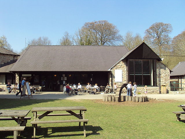 Loggerheads Country Park Visitor Centre
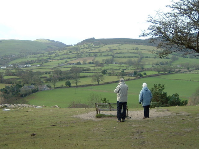 Countryside view from Loggerheads Country Park
The area got its unusual name from an acrimonious dispute over boundaries in the 18th century. The block headed behaviour of the parties involved were satirised in the sign of the inn across the road from the park entrance. It depicts two figures back to back, clearly not on speaking terms. This sign is attributed to Richard Wilson, an early landscape painter who lived locally.
The River Alyn runs along a glaciated valley through the heart of the Country Park and its course is followed for about the first 2 miles of the walk.
This is limestone country covered with woodland. Ash, alder, hazel and sycamore favour the riverside area with ferns, lichens and woodland flowers growing beneath the tree canopy. Treecreepers, jays and nuthatches live in the woods, while grey wagtails, dippers and grey herons haunt the river.
On the steep slopes of the valley sides, oak, beech and silver birch mingle with conifers, while shrubs and undergrowth provide a healthy environment for a wide variety of bird life. More than 50 bird species nest in the country park.
This woodland paradise was once an industrial environment. Mills are found all along the valley, Pentre Mill, at the start of the walk, dates from the 1820s, though there was probably an earlier building on the site. Initially it produced flour and animal feed for local consumption, though a saw pit was added when it was bought by a carpenter. Flour milling ceased in 1920 when the mill wheel was attached to a dynamo to provide electricity for nearby dwellings.
Shortly after crossing the River Alyn you come to a place where it seasonally dries up. The river floor decreases steadily as you go. The water disappears into swallow holes, natural fissures in the limestone that have been enlarged by erosion, and runs underground through caves.
Further on, along the section known as the Leete Walk, you can see great caves and fissures in the rock. Some of these features which may have been natural originally, have been exploited by man because the area was the centre for lead mining up to the 1870's.
Mining in this type of rock presented some problems, as water seeped down through the cracks to flood the deeper levels. One answer was to use pumps powered by water wheels. However, the wheels themselves needed a constant supply which the disappearing river could not provide. The answer was to build the leat. The route follows its course until you cross the river at Pont Newydd. This artificial channel took its supply from the river above the swallow holes and carried it downstream to the wheel pits, working the pumps to keep the keep the water level as high as possible. The leat had a lesser gradient than the river, so the path gets higher above the river as you go along it.
 Summit of Moel Famau
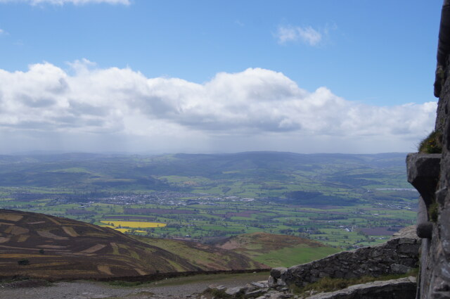 View to Vale of Clwyd from Moel Famau
At Pont Newydd you leave the valley of the River Alyn, first to follow the course of a tributary stream, Nant Gain. This section of the walk takes you past the village of Cilcain which is a convenient spot for a break at the White Horse Inn. You will need to fuel up anyway. Afterwards, you will be climbing into the Clwydian range of hills.
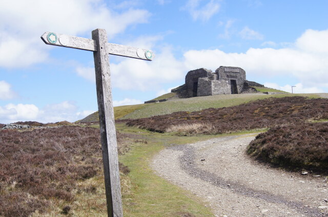
You begin the ascent by climbing steadily through farmland and over moors to Moel Famau, at 1,818 feet (554 metres), this is the highest point of the Clwydian Range. These hills run from Prestatyn on the north coast of Wales to Llandegla, south of here, to link up with the Berwyn Hills.
The land to the east and west is comparatively low lying, so the views from the summit are extensive. Runcorn Bridge, spanning the River Mersey, and the sprawl of Liverpool are away to the north-east. On the western horizon, it is possible to pick out the distinctive outlines of Cader Idris and Yr Wyddfa (Mount Snowdon). To the north is the coastal resort of Rhyl and beyond it, Blackpool Tower. The mountains of the Lake District and the Isle of Man are occasionally visible, but only in the clearest of conditions.
The summit of Moel Famau is crowned by the remains of the Jubilee Tower, on which the four points of the compass are shown. The tower stands some 30 feet high and covers an area of 40 yards. This is not the original tower, which was built in 1810 to mark the 50th year of King George II's reign. The foundation ceremony was attended by around 3,000 people. The original 115 foot high tower was never quite completed because funds were insufficient. In 1862 the top was destroyed by a storm. Plans for a repair were drawn up for Queen Victoria's Golden Jubilee in 1887 but there was insufficient interest.
In 1897, the subject of the tower arose again, when an ambitious plan was mooted to route the railway from Ruthin through the hill and an underground station under the summit was proposed, with a lift to carry tourists to the tower. This too came to nothing and no more was done until European Conservation year in 1970 when the remains were made safe. Bonfires have been lit on the summit on important occasions, such as Queen Elizabeth II's Coronation in 1953, and the investiture of the Prince of the Wales, the future King Charles the third, in 1969.
The return route allows you to climb the opposite side of the valley, from which there are fine views back to Moel Famau. You also have the opportunity to walk through the Devil's Gorge to complete the nature trail before returning to the start.
Acknowledgment: Text derived from the Out and Out Series; Discovering the Countryside on Foot. Pictures courtesy of Wikipedia.


