Llanberis, Afon Arddu, Dinas Ty-du Hill Fort and Ceunant Mawr Waterfall
A waterfall and hill top views on the flanks of Yr Wyddfa (Snowdon)
Google Maps Open Source Maps| Statistics and Files | ||
|---|---|---|
| Start: Llanberis | Distance: 4.1 miles (6.6 km) | Climbing: 250 metres |
| Grid Ref: SH 58266 59795 | Time: 2 hours | Rating: Moderate |
| GPX Route File | Google Earth File | About Llanberis |
| Statistics | |
|---|---|
| Start: Llanberis | Distance: 4.1 miles (6.6 km) |
| Climbing: 250 metres | Grid Ref: SH 58266 59795 |
| Time: 2 hours | Rating: Moderate |
| GPX Route File | Google Earth File |
Ordnance Survey Explorer Map (1:25,000)
The Walk: The village of Llanberis, at the foot of Yr Wyffda (Snowden), teems with walkers ready to tackle the paths that climb towards the 3,560 foot (1,085 metres) high peak of the mountain. This walk is less ambitious; its goal is a hill fort just 1,076 feet (328 metres) above sea level. The total ascent is just 820 feet (250 metres). There is still much inspiring scenery though, as you pass a scenic waterfall and look back down the rocky slopes to the valley floor and lakes.
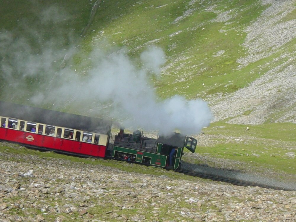 Snowdon Mountain Railway
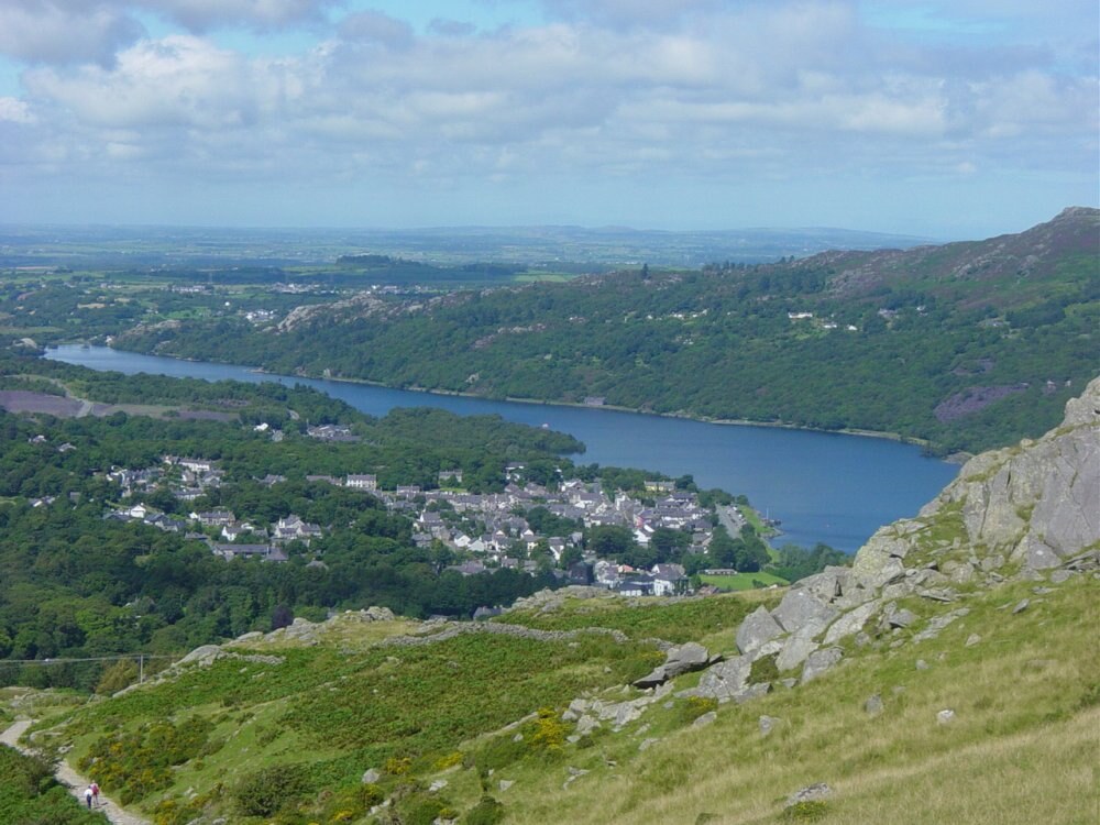 Llanberis and Llyn Padarn
The walk begins at the terminus of the Snowdon Mountain Railway, completed in 1894. This is the only rack railway in Britain. The rack which you follow in the initial stages of the walk has a narrow gauge of two feet 7.5 inches.
The line goes all the way to the summit, but you part company with it soon after the Ceunant Mawr waterfall. Lynn Padarn occupies the bottom of the valley that was hollowed out and deepened by a glacier in the last Ice Age. The mountain streams that run into it cascade down the steep sides of mountain and hill sides from hanging valleys.
The falls of Ceunant Mawr are created by the little Afon Arddu. There are actually two separate falls. The first is a 40 foot plunge into a pool, and the second an 80 foot oblique angled slide down a rock face.
You continue the steady climb a little further and follow roads and tracks across the floats towards the Iron Age hill fort of Ty-du.
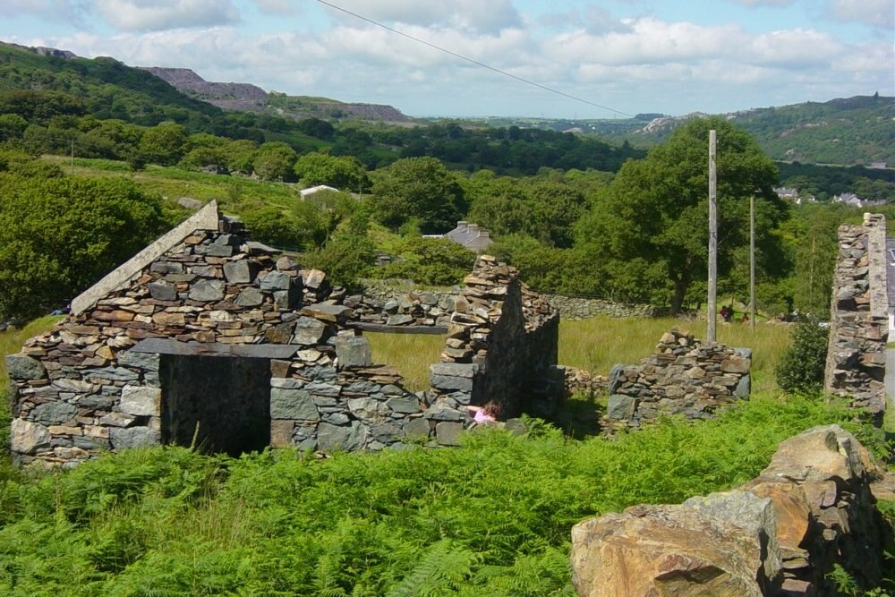 Abandoned homestead at Hafod Lydan
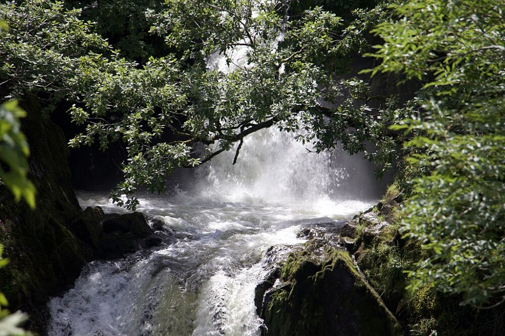 Ceunant Mawr Waterfall
Ty-du (Black House City) is reached by a winding, sometimes rough path. There is very little here to remind you of the past, just a few scattered stones. The point of the visit to the hill fort though is the view from the site.
Llanberis is set out before you with Llyn Padarn to its left and Llyn Peris to its right. On the slopes to the north, there are grey scars of the old slate quarries, some of which have now found use as reservoirs. Mountains fill the horizons in all directions, save the west, where you can see across to Anglesey and the Irish Sea.
The descent tracks across the slopes lower down, heading through a network of small walled fields before rejoining the outward route just above the waterfall.
Acknowledgment: Text derived from the Out and Out Series; Discovering the Countryside on Foot. Pictures courtesy of Wikipedia.


