Trefin, Pen Castell-coch, Abercastle and Carreg Sampson
A quiet and ancient corner of the Pembrokeshire coast
Google Maps Open Source Maps| Statistics and Files | ||
|---|---|---|
| Start: Trefin | Distance: 4.7 miles (7.6 km) | Climbing: 223 metres |
| Grid Ref: SM 83898 32508 | Time: 2 hours | Rating: Easy |
| GPX Route File | Google Earth File | About Trefin |
| Statistics | |
|---|---|
| Start: Trefin | Distance: 4.7 miles (7.6 km) |
| Climbing: 223 metres | Grid Ref: SM 83898 32508 |
| Time: 2 hours | Rating: Easy |
| GPX Route File | Google Earth File |
Ordnance Survey Explorer Map (1:25,000)
The Walk: This walk is at its best in summer, when the cliff-tops and hedgerows bustle with wild flowers, but it has other features that will appeal all year round. There are cliffs that fascinate geologists, an old port, and an island to which you can cross; as well as sea birds, seals and an ancient burial chamber.
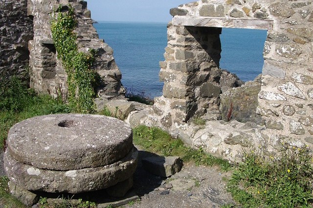 Remains of Aberfelin Mill
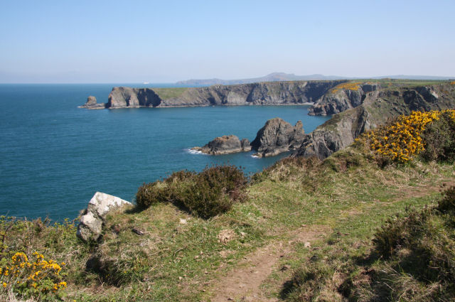 Coast between Trefin and Abercastle
You begin in the village of Trefin. Many of the houses here have cement wash roofs and coloured walls. In the main square, which is a slab of bare rock, stands a working long handled pump.
A well signed posted path leads to the Pembrokeshire Coast Path, and three deep bays framed by cliffs of 500 million year old Ordovicion rock. These are folded and faulted into fascinating shapes, and wave action has eroded arch platforms and pinnacles, visible from the winding cliff path. Fulmars nest on high rock ledges and seals sometimes swim in the clear waters. Also on the coast path here is the ruined Aberfelin Watermill, which was used for grinding wheat and barley. It remained in use until 1918 and has recently been restored.
Beyond the bays is the bleak headland of Castell Coch which means 'Red Castle'. The banks and ditches that protect the neck of this high peninsula are best seen before brambles and gorse claim the site in summer. The earthworks date from around 300 BC and were made by tribes fleeing Roman rule in Gaul.
This type of fort suited new arrivals. There are two more Castell Coch's along the coast, within five miles of this one. The settlers soon moved inland, or joined forces to hold largest sites like Garn Fawr which was occupied for up to 1,000 years and dominates the north-eastern horizon throughout the walk.
The route follows the rocky headland around to the old port of Abercastle. This natural harbour was once known as 'Bay of Boats' from the days when sloops plied the coastal trade. Locals exported wool, slate, beeswax and preserved fish, and imported essentials such as coal and limestone. A set of derelict lime kilns still lines the quayside. On the other side of the cove, the path climbs past former fisherman's cottages, one of which has several specimens of a rare wild tree mallow growning in its sheltered garden.
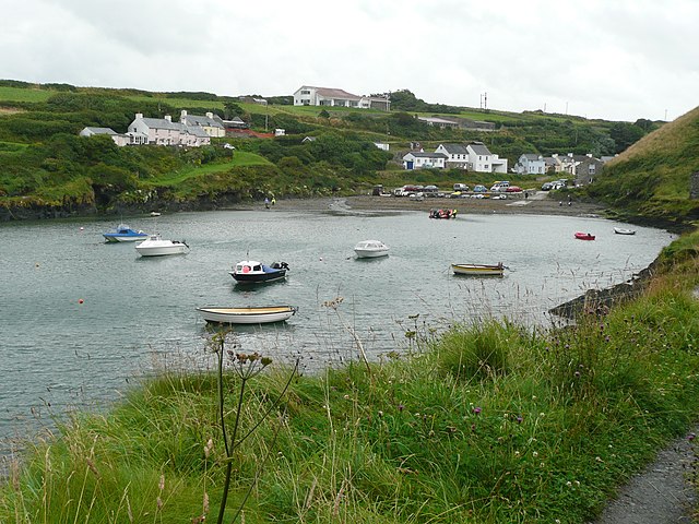 Abercastle Harbour
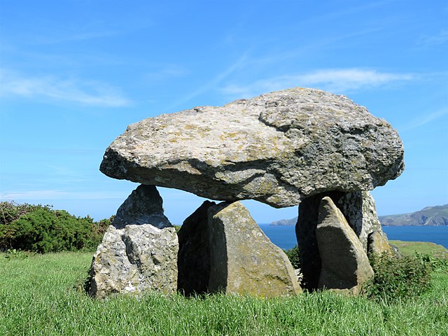 Carreg Sampson
If the tide permits, it is worth crossing the rocky causeway to Ynys y Castell and scrambling to the top. In season, the slopes are carpeted with wild flowers, and to the south-west there is a fine view of Carreg Sampson (Sampson's Stone), which resembles a giant tortoise crawling up a hill. This cromlech was built about 5,000 years ago, by people of a New Stone Age culture that once covered western Europe. It was originally covered with smaller stones, earth and turf, but the shell has been eroded away. Now only the bare stones remain; massive, sculptural and mysterious.
Legend attributes Carreg Sampson to a local boy made good. Saint Sampson was a Celtic Christian who died around 600 AD. When most of Britain was still pagan, he was Abbott of Caldey Island, near Tenby, and another monastery in Brittany. A great missionary, his fame spread as far as Switzerland and Italy, where some of his bones remain as holy relics.
Sampson supposedly placed the three ton capstone in position using only faith and his little finger. This prodigious digit is said to lie buried on the island opposite. The story dates from the 10th century when the Celtic and Catholic churches merged, and the Celts needed to claim miracles on behalf of their saints to maintain their status.
Beyond the stone circle is Longhouse Farm, whose core structure was once a longhouse, where family and livestock shared the shelter of a single roof. This form of habitation is a legacy from the centuries when Pembrokeshire was colonised by Norseman.
The hedgerows bordering the paths on your return to Trefin are equally ancient. Stones from the fields have been added to their broad banks. Archaeologists claim that some are parts of the original Celtic field systems which were hundreds of years old by the time of Christ.
Acknowledgment: Text derived from the Out and Out Series; Discovering the Countryside on Foot. Pictures courtesy of Wikipedia.


