Bont Newydd, Afon Cynfal and Rhaeadr y Cwm Waterfall
A walk beside a mountain stream to a breathtaking view
Google Maps Open Source Maps| Statistics and Files | ||
|---|---|---|
| Start: Bont Newydd | Distance: 4.2 miles (6.8 km) | Climbing: 227 metres |
| Grid Ref: SH 71425 40899 | Time: 2 hours | Rating: Easy |
| GPX Route File | Google Earth File | About Ffestiniog |
| Statistics | |
|---|---|
| Start: Bont Newydd | Distance: 4.2 miles (6.8 km) |
| Climbing: 227 metres | Grid Ref: SH 71425 40899 |
| Time: 2 hours | Rating: Easy |
| GPX Route File | Google Earth File |
Ordnance Survey Explorer Map (1:25,000)
The Walk: The Afon Cynfal, tumbling and swirling over his rocky bed, is your companion for much of this walk. At the start of the route, it is like many other Welsh mountain streams - very active without being particularly spectacular - but there is a surprise in store.
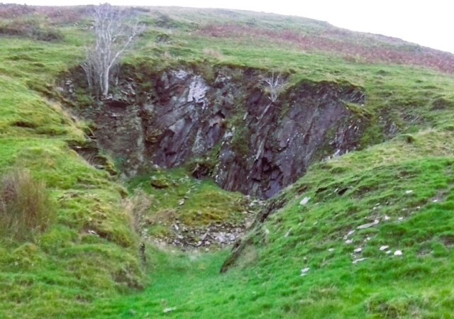 Local quarrying in Cwm Cynfal
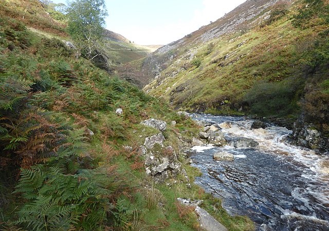 Afon Cynfal
The walk starts off on a fairly well surfaced road, which part way up a steep bank besides the river becomes a rough slate track. The trees are encrusted with mosses and lichens, testimony to the quality of the air. Those on this side of Cwm Cynfal are relatively widely spaced, those on the opposite bank form an impenetrable forest.
The track eventually comes to an end at the door of the lonely Cwm Farm, which was built in 1492, and has undergone little alteration since. The farmhouse stands by the river, over which two large slate slabs form a bridge, forming an island. This is the farmer's shortcut to his nearest neighbour, one mile away in the forest.
The walk continues across two fields used as sheep pasture, then rises steeply past a pair of small cascades and curves around a high solitary hill. On the other side of the hill, a little way to the right of the track, the ground falls away almost vertically into a narrow ravine, at the head of which is Rhaeadr y Cwm, a 600 foot mares tail of cascading white water.
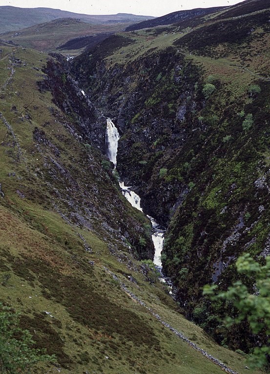 Rhaeadr y Cwm
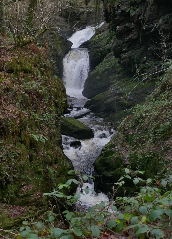 Rhaeadr y Cwm up close
Rhaeadr y Cwm is made up of six falls in all, appearing and disappearing in steep crevices at times, until it drops into a rocky gorge. Take time to enjoy the spectacle. It is an awesome sight, particularly a few hours or so after heavy rainfall.
The track continues up hill towards the Festiniog to Betws y Coed road. As you climb, you can hear and sometimes catch a glimpse of the waters. But once you are on the road, the walk back towards Festiniog takes you past two memorable viewpoints.
The first is a small stone-walled platform through a gap in the wall lining the road. This provides a high oblique view of the Rhaeadr y Cwm cataracts.
The second viewpoint a little further along, is much larger and has a car park. There is a spectacular panoramic view, which includes the Vale of Festiniog, the sea glinting in Tremadog Bay, and the southern mountain peaks of Snowdonia National Park. It is a scene of richly wooded hills and distant craggy mountains, of green trees and greener fields speckled with white sheep. In the foreground are the ruins of two farmsteads perched precariously on the lip of the valley top.
The walk continues along the road, then heads across country past another isolated farm, Bron Erw, down to the valley bottom to meet up again with Afon Cynfal, which is followed back to the start.
Acknowledgment: Text derived from the Out and Out Series; Discovering the Countryside on Foot. Pictures courtesy of Wikipedia.


