Abergwesyn, Llyn Brianne, Cefn Blaencwmbenog and Irfon Forest
A drovers road through the bare and isolated hills of mid Wales
Google Maps Open Source Maps| Statistics and Files | ||
|---|---|---|
| Start: Abergwesyn | Distance: 9.4 miles (15.1 km) | Climbing: 600 metres |
| Grid Ref: SN 85367 52505 | Time: 4 hours | Rating: Hard |
| GPX Route File | Google Earth File | About Abergwesyn |
| Statistics | |
|---|---|
| Start: Abergwesyn | Distance: 9.4 miles (15.1 km) |
| Climbing: 600 metres | Grid Ref: SN 85367 52505 |
| Time: 4 hours | Rating: Hard |
| GPX Route File | Google Earth File |
Ordnance Survey Explorer Map (1:25,000)
The Walk: This walk through a quiet corner of Powys includes some of the finest scenery in the country. It starts at the remote hamlet of Abergwesyn, once a key stop for drovers as they moved livestock from west of here to the English borders.
 Abergwesyn Common
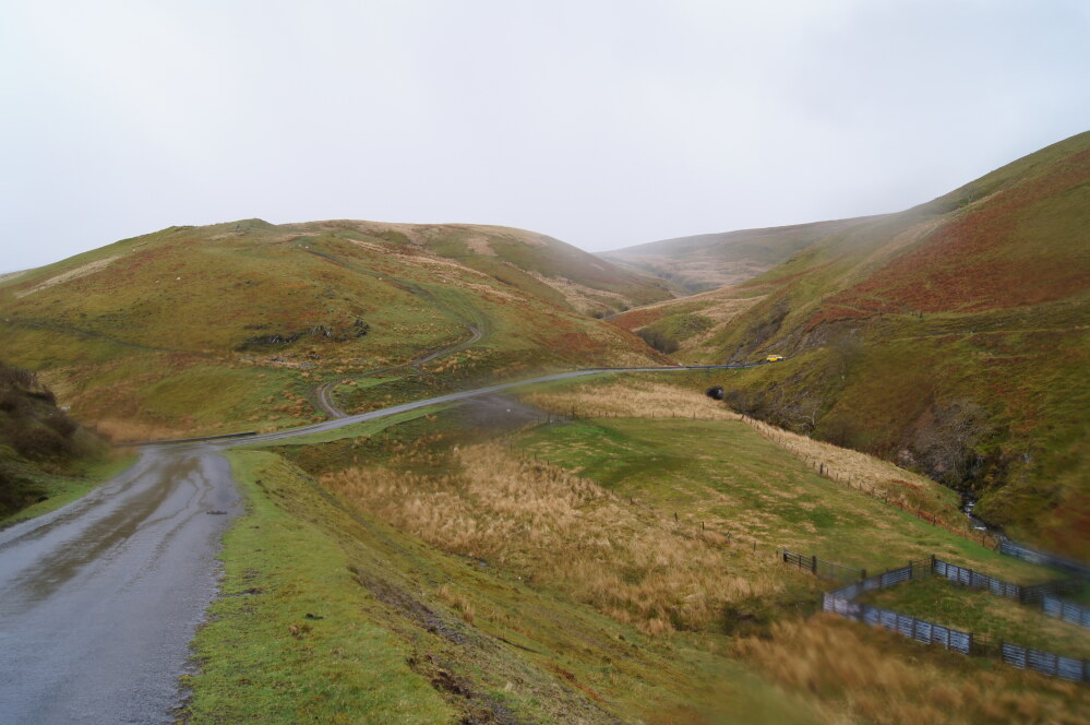 The road to Llyn Brianne
Lichen covered sessile oaks survive on the steepest hillsides, and in deep dells around Abergwesyn. These are remnants of the thick forest that once covered almost all of Wales. These woods, with their floor of mossy boulders, ferns and bracken, are enchanting all year round.
Much of the original oak forest was thinned by medieval charcoal burners, then finally cleared in the 18th century to rid the area of cover for the two main menaces that the drovers encountered; wolves and brigands. The first attacked sick or weak members of the herds. The second sought the cash being carried back to local farmers by drovers returning from the English markets. These twin evils were seen as such a threat to the commerce of the region that the land was stripped bare and was thencefore known as the desert of Wales.
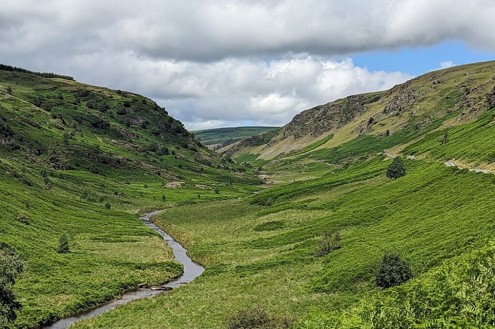
The bleak but majestic valley that runs between Abergwesyn and Mynydd Trawsnant is an excellent example of surviving Welsh desert. The route follows close to the bottom of the valley and has been cut into the hillside in some sections to make the going easier.
This narrow track suited the drovers of hogs and its Welsh name means 'the pigs way'. Fattened hogs move slowly, so their drovers took advantage of short-cuts too narrow for sheep or cattle. The animals had to be muzzled when driven to curb their natural instinct to stop and root for food. Their feet were shod with leather booties designed to protect their tender trotters.
In the days of the drovers, Llyn Brianne did not exist. However, the tarmac road on this side follows a wide main droving route along the false crest of the hills. The crest sheltered the animals from harsh weather on the exposed heights above, but still allowed them to be seen and heard by the farmers below. In dry seasons, when the water level of Llyn Brianne drops, you can sometimes see the sunken farms, roads and chapel that were lost to this enormous reservoir.
 Llyn Brianne and Dalarwen
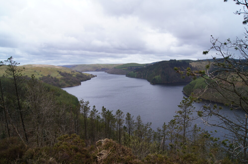 Llyn Brianne
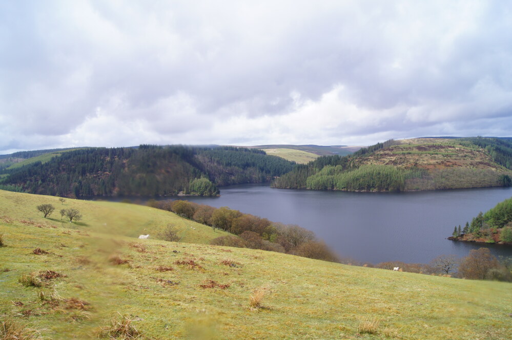
The huge dam of Llyn Brianne, rising to a height of 300 feet (91 metres) above the level of the original river is the tallest in Britain. It was designed to power the turbines of a South Walian industrial revival that never came. Today the waters of the lake are cold, deep and unable to support fish, due to an excess of acid rain. Further casualties of the scheme were the chasms and headwaters of the River Towy, once one of the finest salmon rivers in South Wales. Few salmon now bother to fight their way upstream to the spawning pools below the dam. Naturalists and anglers alike have cursed Llyn Brianne since its construction in the 1960's but it has a powerful presence and is an unforgettable sight.
The finest views come on the return leg of the walk, on the path up the high ground of Cefn Blaencwmhenog and Cefn Uchaf, more than 1,600 feet (490 metres) above sea level. To the west is a grand view of the mountains which Daniel Defoe once described as 'impassable' While the Brecon Beacons and Carmarthen Fans rise to the south. As you descend towards Abergwesyn, you can see the dramatic cliffs of Esgair Irfon, which tower over the pass and the modern road into the village from the north.
This road was built along the course of the same drovers route encountered on the banks of Llyn Brianne. It has gone the long way around the mountain of Cefn Coch, which means the 'Red Hill' in Welsh, but is now blue, green with forestry conifers. There is one final view of oak trees just before you join a road beside a winding and cascading river and follow it back into Abergwesyn.
Acknowledgment: Text derived from the Out and Out Series; Discovering the Countryside on Foot. Pictures courtesy of Wikipedia.


