Old Radnor, Yardro, New Radnor and Kinnerton
A ramble through the heartland of the old county of Radnorshire
Google Maps Open Source Maps| Statistics and Files | ||
|---|---|---|
| Start: Old Radnor | Distance: 9.2 miles (14.8 km) | Climbing: 302 metres |
| Grid Ref: SO 24923 59057 | Time: 4 hours | Rating: Moderate |
| GPX Route File | Google Earth File | About Radnorshire |
| Statistics | |
|---|---|
| Start: Old Radnor | Distance: 9.2 miles (14.8 km) |
| Climbing: 302 metres | Grid Ref: SO 24923 59057 |
| Time: 4 hours | Rating: Moderate |
| GPX Route File | Google Earth File |
Ordnance Survey Explorer Map (1:25,000)
The Walk: The ancient towns of Old Radnor and New Radnor, which today are little more than villages, are on opposite flanks of a tranquil valley. Old Radnor is the in the shadow of St Stephen's church, 840 feet (254 metres) above sea level. The breathtakingly beautiful interior of the church features a medieval oak wagon roof enriched with heavily carved bosses, while an exquisite 15th century screen runs across its entire width. The organ case is the oldest in Britain, but perhaps the greatest treasure is the stone font, over 1,200 years old and probably put to sacred use in pre-Christian times.
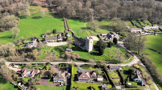 Old Radnor
 New Radnor
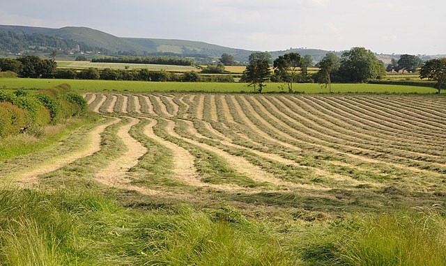
The route heads gently down, up, and then down again, between hedgerows, which yield an abundant harvest of blackberries, rose hips and elderberries, and sometimes meet overhead to create a green corridor.
Lanes from Old Radnor, via the tiny settlement of Yardro, leads you to New Radnor and one of the finest examples of a Victorian memorial in the country. Towering nearly 80 feet (24 metres) high, it commemorates the politician Sir George Cornewall-Lewis. He was a prolific British politician in his time, a member of the Liberal Party, and had he lived longer, it is thought he would have led the Liberal Party into reform rather than William Gladstone.
Above the shaded graveyard of Victorian St Mary's Church are the grassy mounds of New Radnor Castle, overlooking what was a main route into central Wales. Harold, last Saxon King of England, is credited with building the once sizable castle as an outpost against the understandably hostile Welsh. In 1401, Owain Glyndwr, the self proclaimed Prince of Wales, who led the last major rebellion against the English, ransacked the town. The castles 600 strong garrison was killed, and the castle ceased to be effective.
 Countryside around Kinnerton
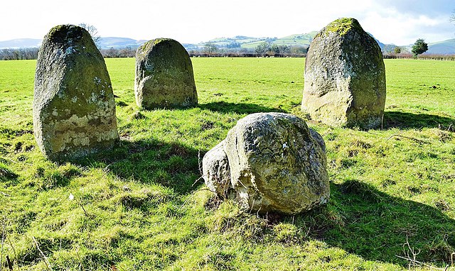 Four Stones, Radnorshire
From New Radnor the route continues on the side of the quiet country road leading to the village of Kinnerton which first appears in records as Kynardton in 1304, meaning "Cyneheard's farm or settlement". As with New Radnor there was once a castle here. All that remains is the raised earthworks of the motte and ditch, dating to the medieval period.
From Kinneton, narrow twisting lanes lead back to Old Radnor. In a field by the roadside, four massive standing stones supposedly marked the burial site of four warrior kings. Legend has it that they wait for the peal of St Stephens Bell, the signal for them to lumber down to nearby Lake Hindwell for a cooling drink.
Back in Old Radnor you can visit yet another site of a long gone castle. It seems every settlement around the old county had one. In the case of Old Radnor Castle, historians have long argued as to its original date. Most impressive of the remains is the encircling ditch.
Acknowledgment: Text derived from the Out and Out Series; Discovering the Countryside on Foot. Pictures courtesy of Wikipedia.


