Lampeter and Castell Allt-goch
Explore the countryside around the oldest university town in Wales
Google Maps Open Source Maps| Statistics and Files | ||
|---|---|---|
| Start: Lampeter | Distance: 5.5 miles (8.9 km) | Climbing: 178 metres |
| Grid Ref: SN 57646 47937 | Time: 2-3 hours | Rating: Easy |
| GPX Route File | Google Earth File | About Lampeter |
| Statistics | |
|---|---|
| Start: Lampeter | Distance: 5.5 miles (8.9 km) |
| Climbing: 178 metres | Grid Ref: SN 57646 47937 |
| Time: 2-3 hours | Rating: Easy |
| GPX Route File | Google Earth File |
Ordnance Survey Explorer Map (1:25,000)
The Walk: Lampeter is an ancient market town at the confluence of the River Teifi and the River Dulas. The rivers meander through meadows beside old railway embankments that blaze in season with the profusion of wild flowers. More than 400 feet (120 metres) above the valley floor, an Iron Age Hill Fort affords panoramic views of the rolling green hills of central Dyfed.
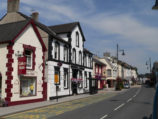 Lampeter High Street
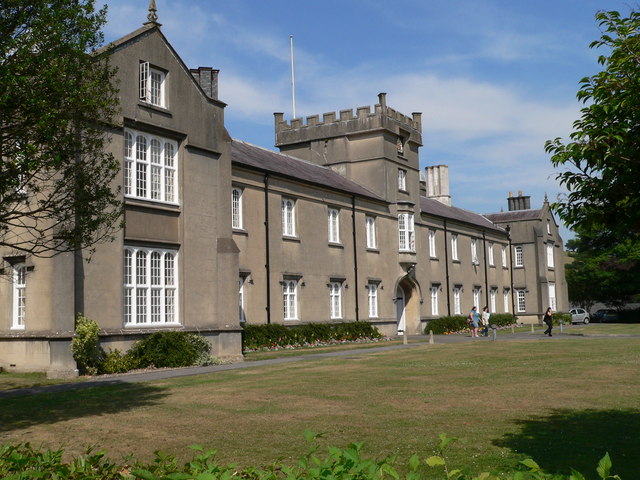 St David's College, Lampeter
The walk begins in St Thomas's Square, originally an area of common land owned by the freemen of the borough. In 1285, Edward I granted the Lord of Dryslwyn his permission to hold a fair and market in the town. By 1800 there were eight fairs a year, trading in horses, cattle, sheep and pigs.
The weekly market is still held here, though it is a far cry from the 18th century when corn, butter, cheese and poultry were bought and sold. Dogs and rats raked through piles of refuse and the destitute wandered between haggling traders bearing on their right sleeves the badge of pauper L.P. (Lampeter Poor).
The High Street, dominated by the Victorian Town Hall and St Peter's Church, has been a bustling thoroughfare for centuries. It was the main drove road to England. Inns and ale houses sprang up along the route, and town life was coloured by 'bloody frays and assaults, drunkenness and blaspheming'. Retribution was swift - six hours in the stocks cooled most tempers and the whipping post, which stood near the town hall, was the source of endless entertainment.
St David's University College, now part of the University of Wales, was founded in 1822 by Bishop Burgess, the Bishop of St Davids, for the education of the clergy. It was granted a charter to confer Bachelor of Arts degrees in 1863.
The earliest buildings on the site are the Neo Gothic Chapel, and the students accommodation, set around a quadrangle with a fountain. The secluded beauty of the college setting on the banks of the River Dulas provides an intimate and peaceful academic atmosphere.
The mound to the east of the quadrangle is a Norman Motte and Bailey, thought to have been built by King Stephen. It was destroyed in 1137, and subsequently rebuilt in 1403. It survived the guerrilla warfare of Owain Glyndwr.
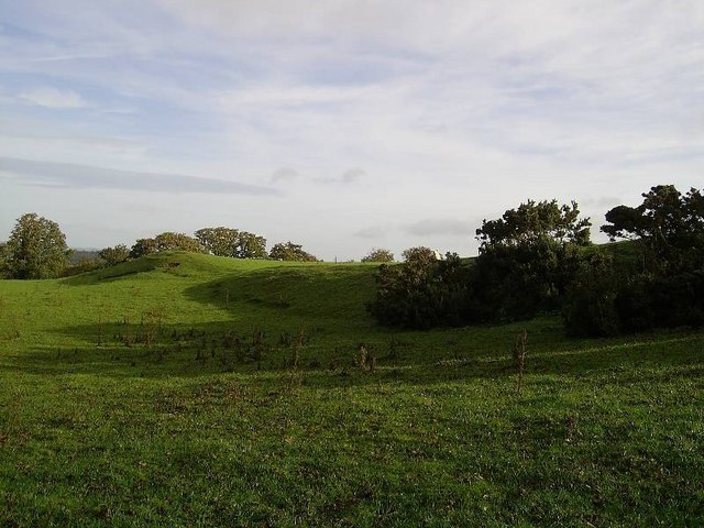 Castell Allt-goch
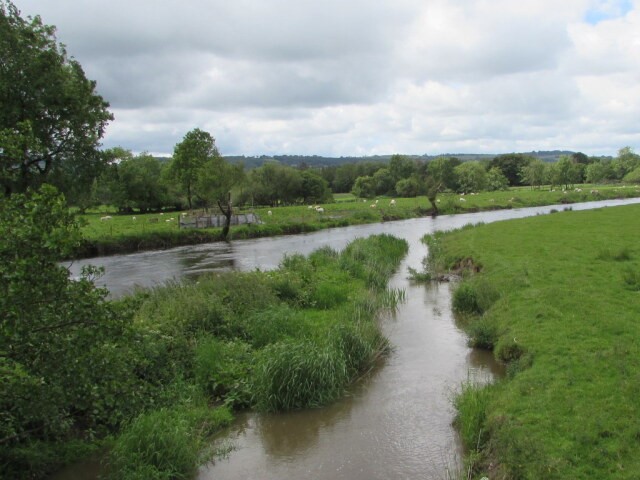 Confluence of River Dulas and River Teifi
Leaving Lampeter behind, the route leads up through Mount Pleasant Wood, mixed woodland of beech, oak, larch and Douglas firs. Among the birds found here are coal tits, willow tits, marsh tits, long tailed tits, bullfinches, greenfinches and redstarts, which are instantly recognisable by their fiery red tails.
Castell Allt-goch, at just over 800 feet (240 metres) above sea level, is an impressively sighted fort defended by two enclosed banks and ditches. Within these ramparts, circular huts with thatched roofs and walls of basketwork wattle, or rough stone, would have provided shelter for a people who spoke the Brythonic language, a forerunner of Welsh.
The way back downhill follows the route along which their farm carts once trundled over deeply rutted tracks.
The lane from Llanfair Clydogau, which returns you to the town, runs parallel with the River Teifi, a famous trout and salmon river, which rises in the mountains to the north-east. Light beech hedges, entwined with honeysuckle and wild roses, line the lane and on their banks grow foxgloves, campions, violets, woundwart and stitchwort. On entering Lampeter, a little to the south of the path at Pont Stephen, is the confluence of the two rivers; Teifi and Dulas.
Acknowledgment: Text derived from the Out and Out Series; Discovering the Countryside on Foot. Pictures courtesy of Wikipedia.


