Kinder Scout and the Great Ridge
This walk is the most popular and most challenging day walk in the Peak District, linking the two most popular high level ranges of the National Park, namely Kinder Scout and the Great Ridge. The challenging circuit which covers almost fifteen miles begins with a breathtaking climb from Edale village to the Edale Moor and Kinder Scout plateau by way of beautiful Grindsbrook Clough. Once on the high ground of Kinder the walk follows a route via Kinder Gates to the famous Downfall before tracking south along the Pennine Way path to the ironically named Kinder Low where a trig point marks the highest point of the entire Peak District National Park. Thereafter we descend to Brown Knoll while enjoying breathtaking views west to Macclesfield and the most westerly fells of the area before reaching the west side of Rushup Edge which marks the start of the Great Ridge traverse. This rollercoaster thrill is enjoyed to the full, all the way to Lose Hill before enjoying a bounding back to Hollin's Cross and descending from there to the Vale of Edale and back to the starting point of this spectacular circuit.
Google Maps Open Source Maps| Statistics and Files | ||
|---|---|---|
| Start: Edale | Grid Ref: SK 12299 85976 | Distance: 14.8 miles (23.8 km) |
| Climbing: 845 metres | Time: 6-7 hours | Rating: Hard |
| GPX Route File | Google Earth File | About Kinder Scout |
| Statistics | |
|---|---|
| Start: Edale | Grid Ref: SK 12299 85976 |
| Distance: 14.8 miles (23.8 km) | Climbing: 845 metres |
| Time: 6-7 hours | Rating: Hard |
| GPX Route File | Google Earth File |
Ordnance Survey Explorer Map (1:25,000)
The Walk:
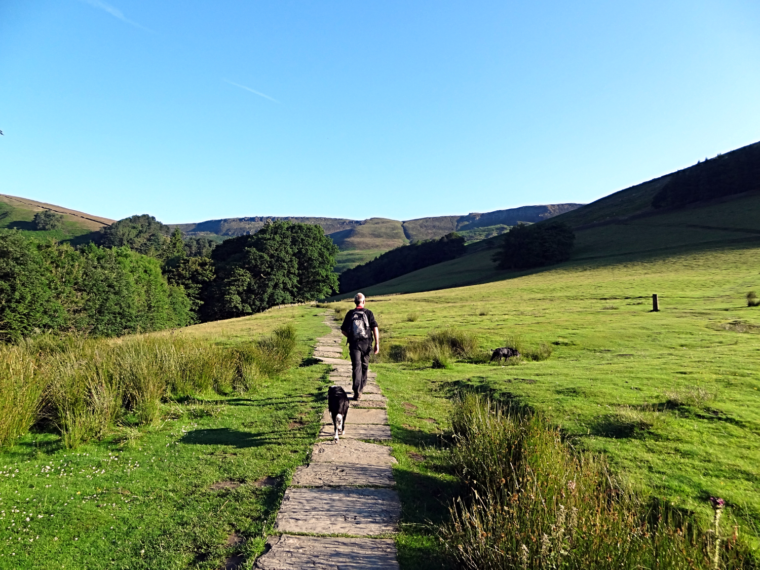 Walking northwards to Grinds Brook
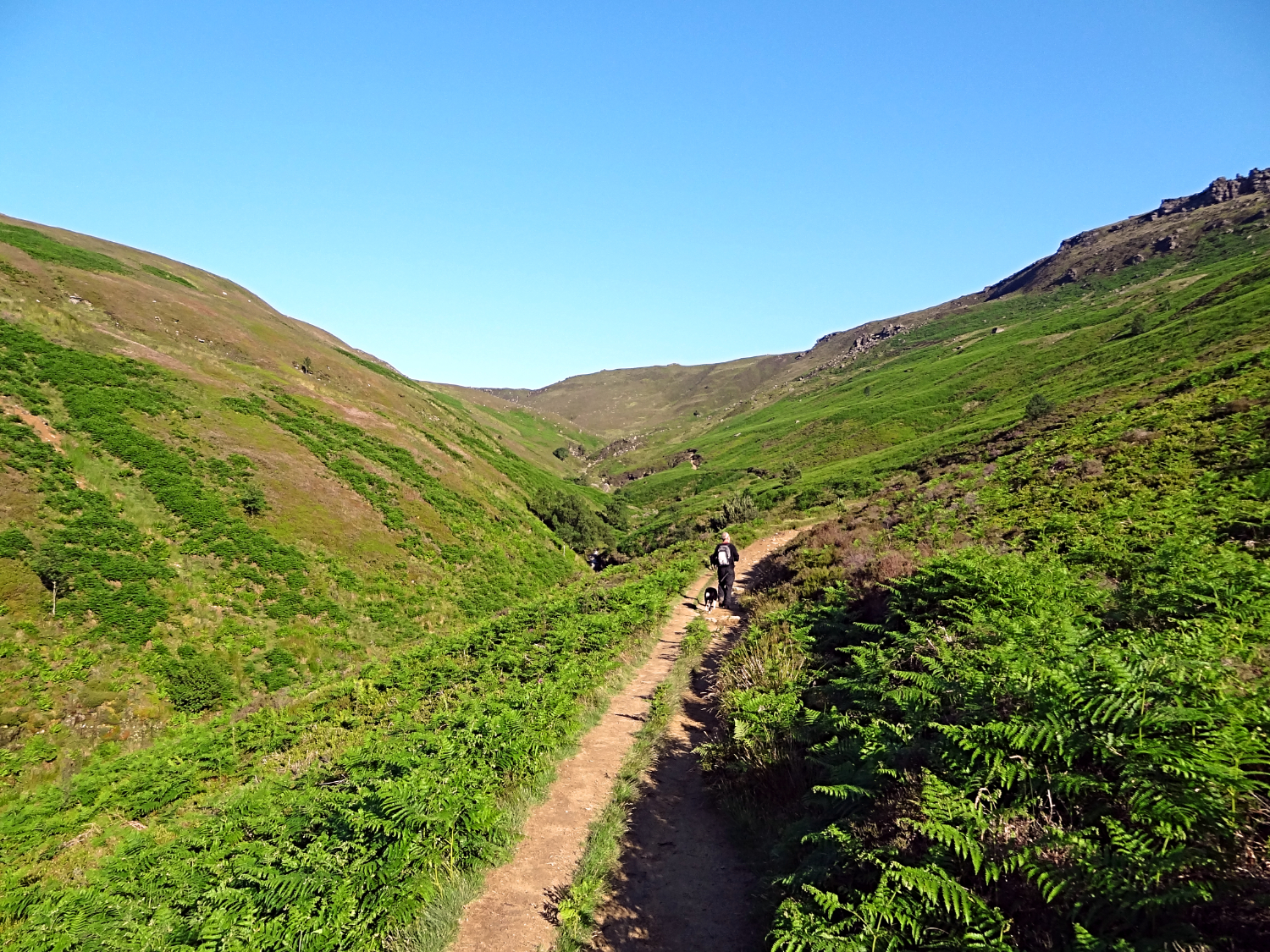 Grindsbrook Clough
It was a beautiful morning which greeted me as I emerged from my tent in Newfold Farm campsite at just before five o'clock in the morning. The sun was just rising over the Great Ridge into the clear blue sky of the early July morning as I brushed the sleep from my eyes. An inspirational sight indeed. Not long after I roused Steve from his camper van slumber and by a quarter past five we were walking through a silent Edale village, heading due north, parallel to Grinds Brook. We had planned this very early start to our much anticipated epic walk during evening beers while sat around the camp before retiring to bed last night. And with still fuelled by the late supper we had enjoyed, we agreed on a breakfast break after climbing through Grindsbrook Clough.
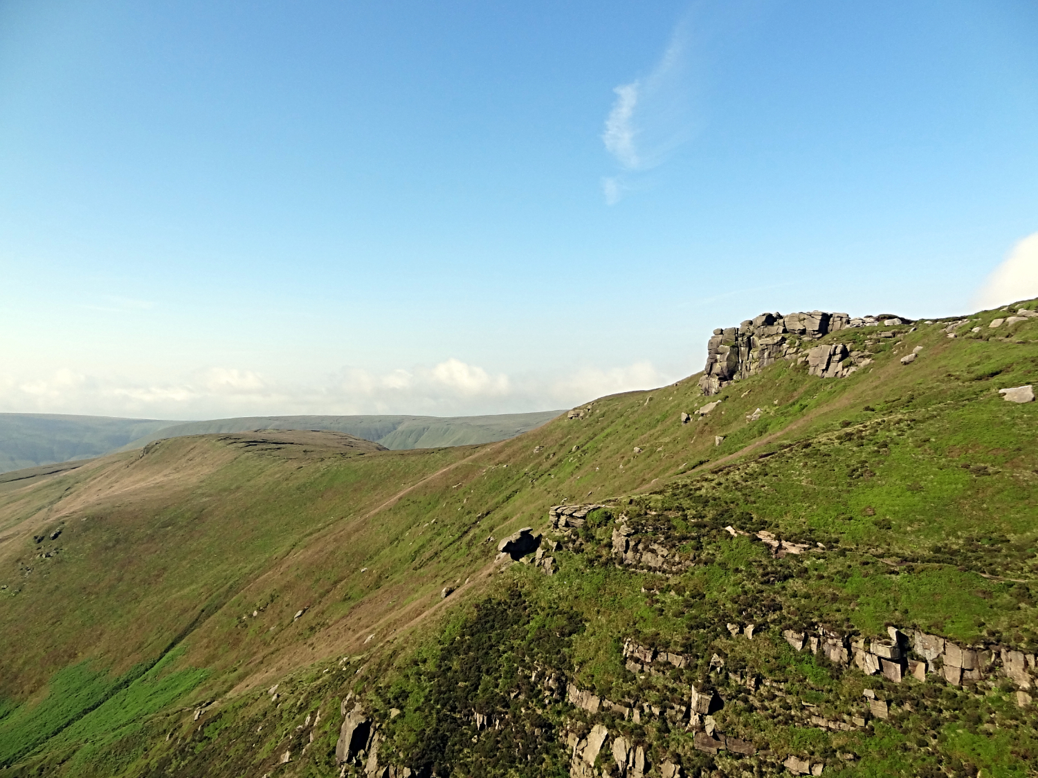
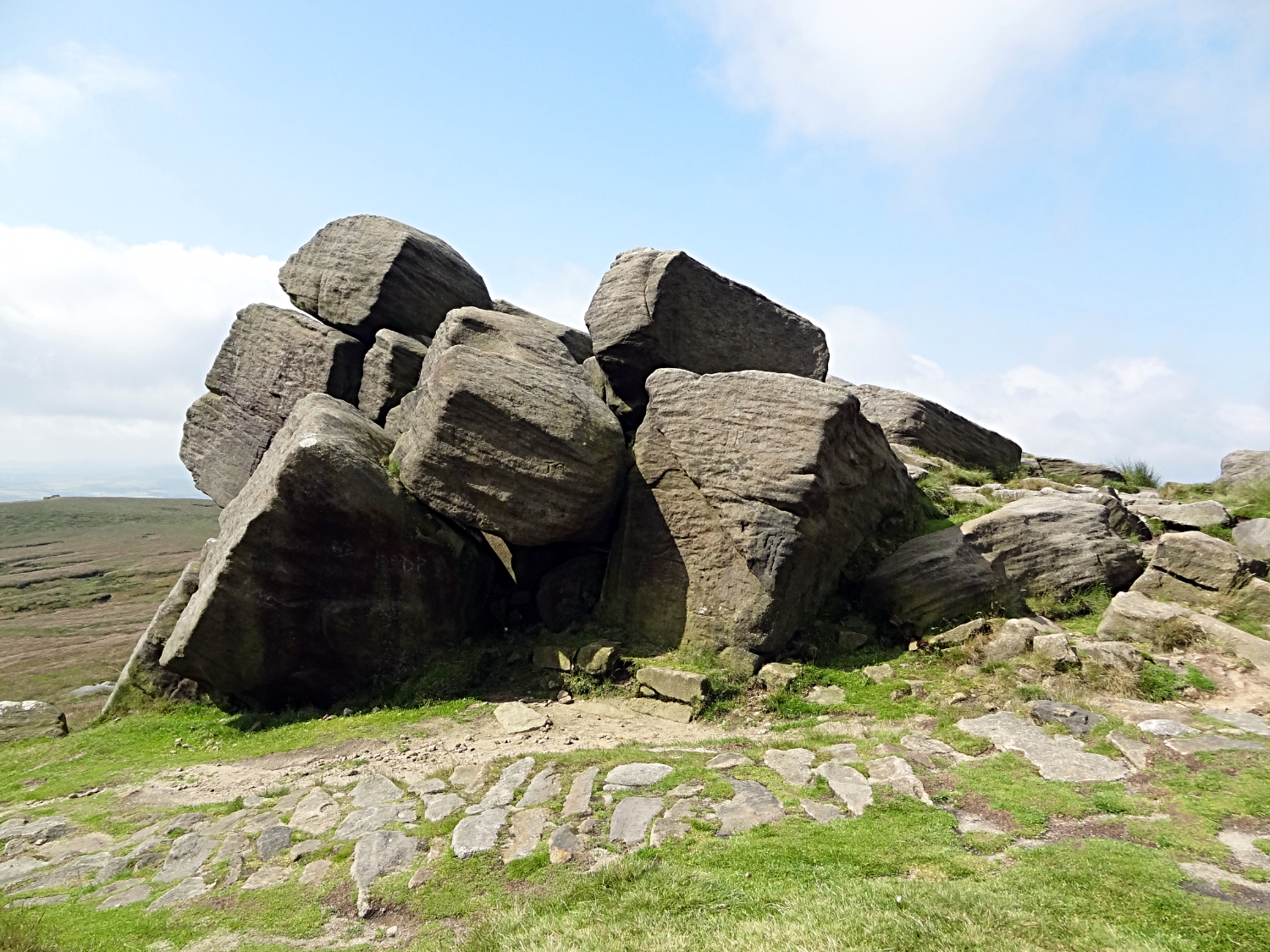
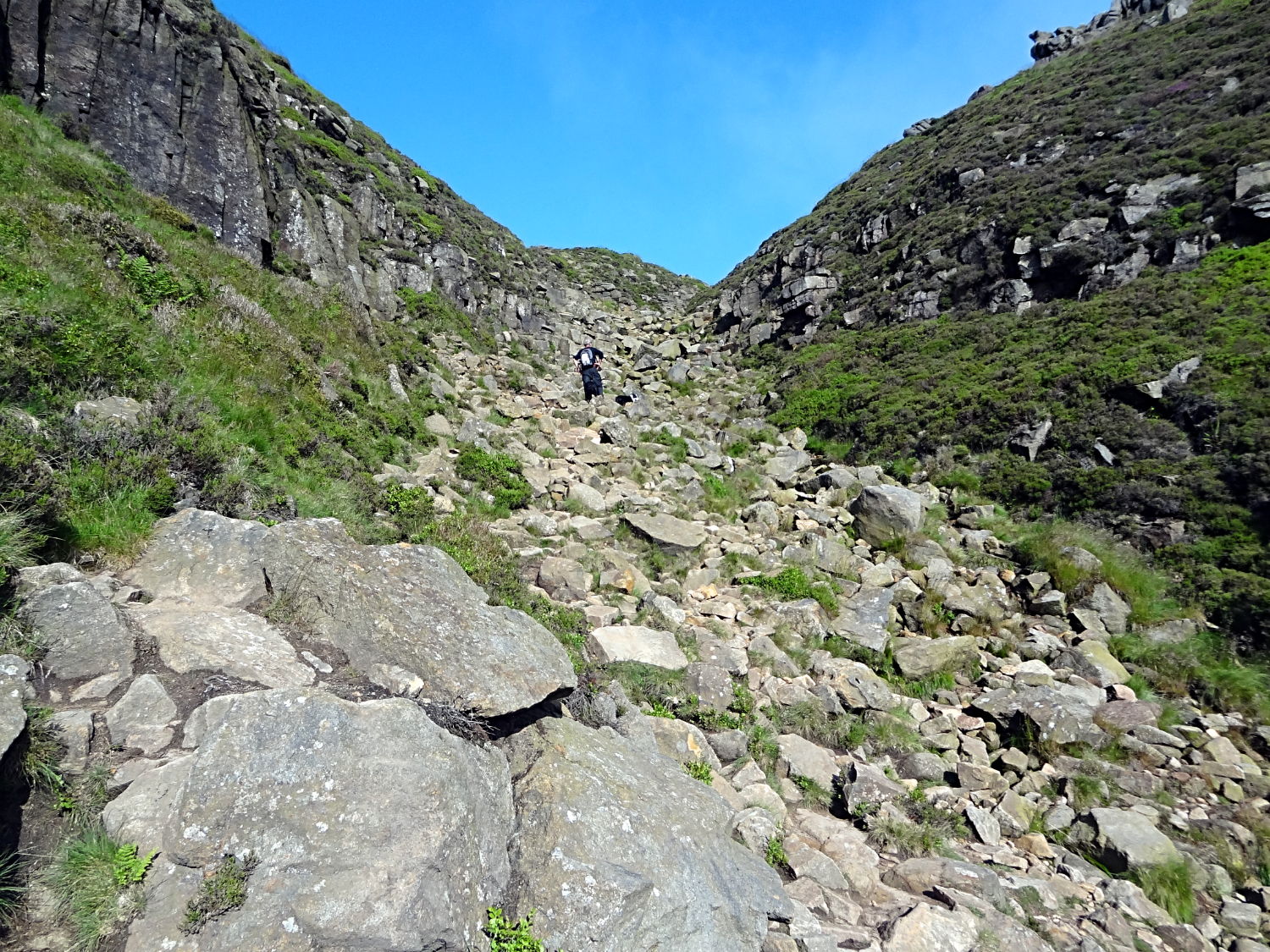 The Fox Holes scramble to Edale Moor
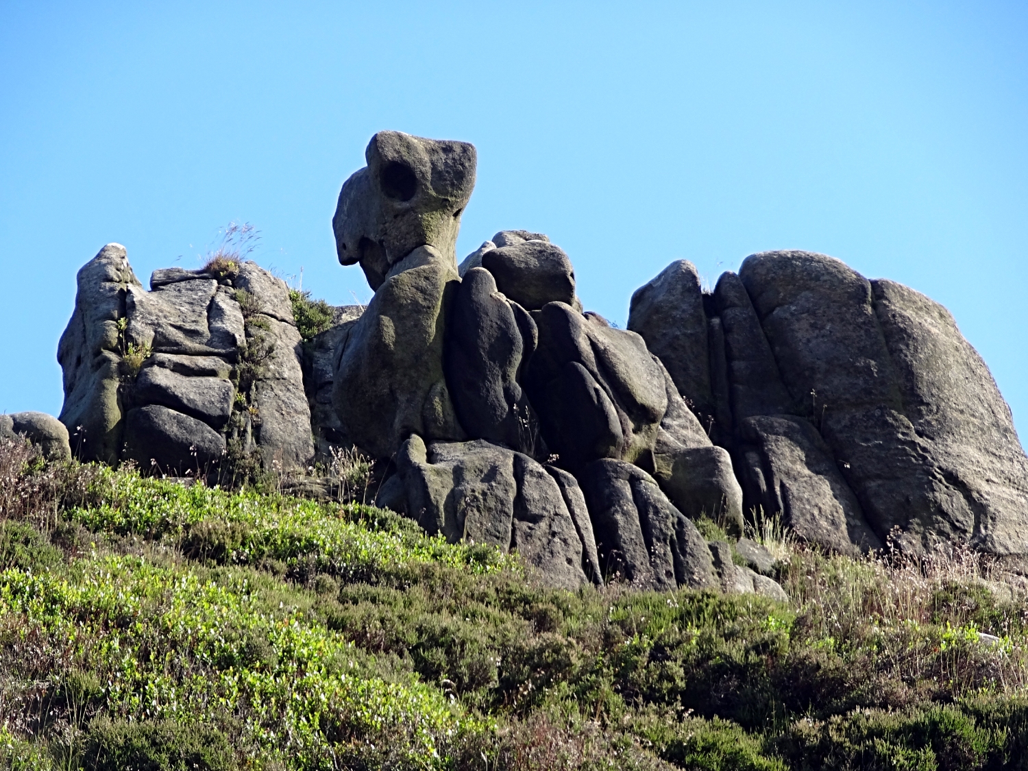 Gritstone sentinels on Edale Moor
Steve's dogs Keira and Ziggy were as enthusiastic as we were as we headed through the paddock fields and then on the fern edged path leading up Grinds Brook. Every time there was a rustle in the ferns or a scent of adventure the dogs were off, discovering and chasing a fair number of the unfortunate inhabitants from cover. Never quick or clever enough to harm the locals though, which was good. Just daft enough to tire themselves out. Which would become apparent later. As for me and Steve, we soldiered on up Grindsbrook Clough to the final steep ascent of the rock stairway at Fox Holes, recalling our last adventure up here, nearly two decades earlier when we were definitely younger but probably not as fit for our age. As young pensioners now, this climb did not daunt us. Relentlessly upwards we went, soon reaching the top for our first stop, short breather and promised bite of breakfast. We had practically done all the climbing in just one hour of walking. It was a quarter past six in the morning.
 Along the path on the south edge of Kinder Scout
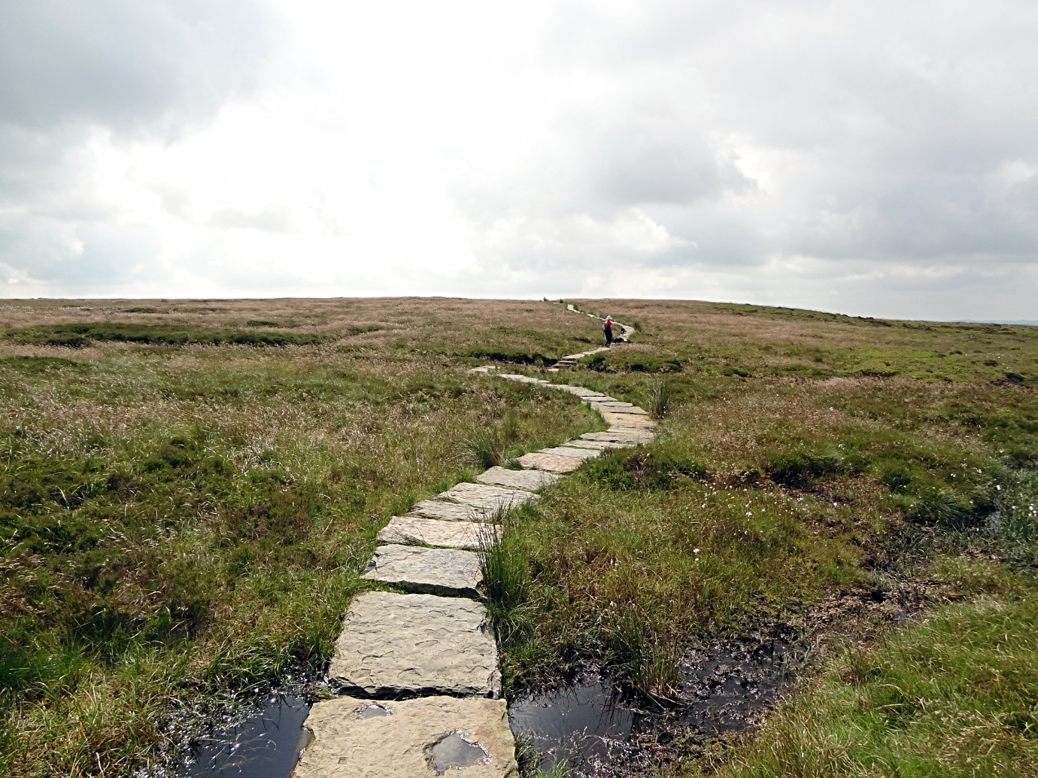
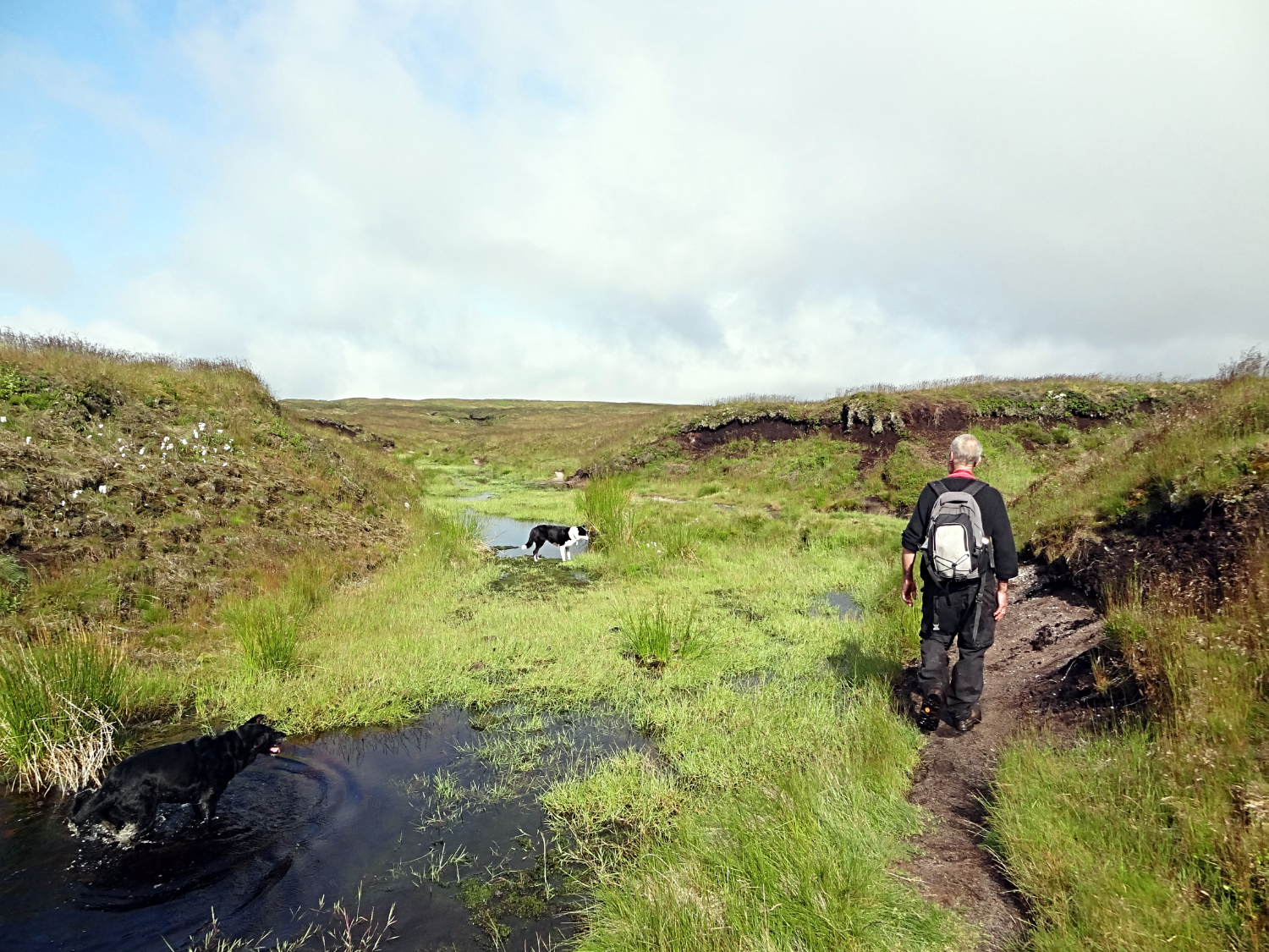 Source of River Kinder near Crowden Edge
Steve and I continued on our way along the path across the south tip of Kinder Scout until the path turned from westbound to northbound near to the gritstone outcrop of Crowden Tower. From here the path, which had been so clear to follow thus far, decided to come and go. One moment it was straight and clear to see. The next it was gone as walkers prior to us had lost the signs and guessed the route over indistinct boggy ground which can change character overnight. Trodden down tufts of grass may have bounced back up and fooled the next walker to step left. And the next one after that walker to step right. The simple fact was the path disappeared quite often and then reappeared some time later. Steve and I were forced to follow GPS apps and/ or reaffirm our location with map and compass. As a result we got there in the end, to the source of the River Kinder at Kinder Gates. After an hour meandering and path finding on the high plateau that is the real Kinder Scout. It was brilliant fun.
 Kinder Downfall and Kinder Reservoir
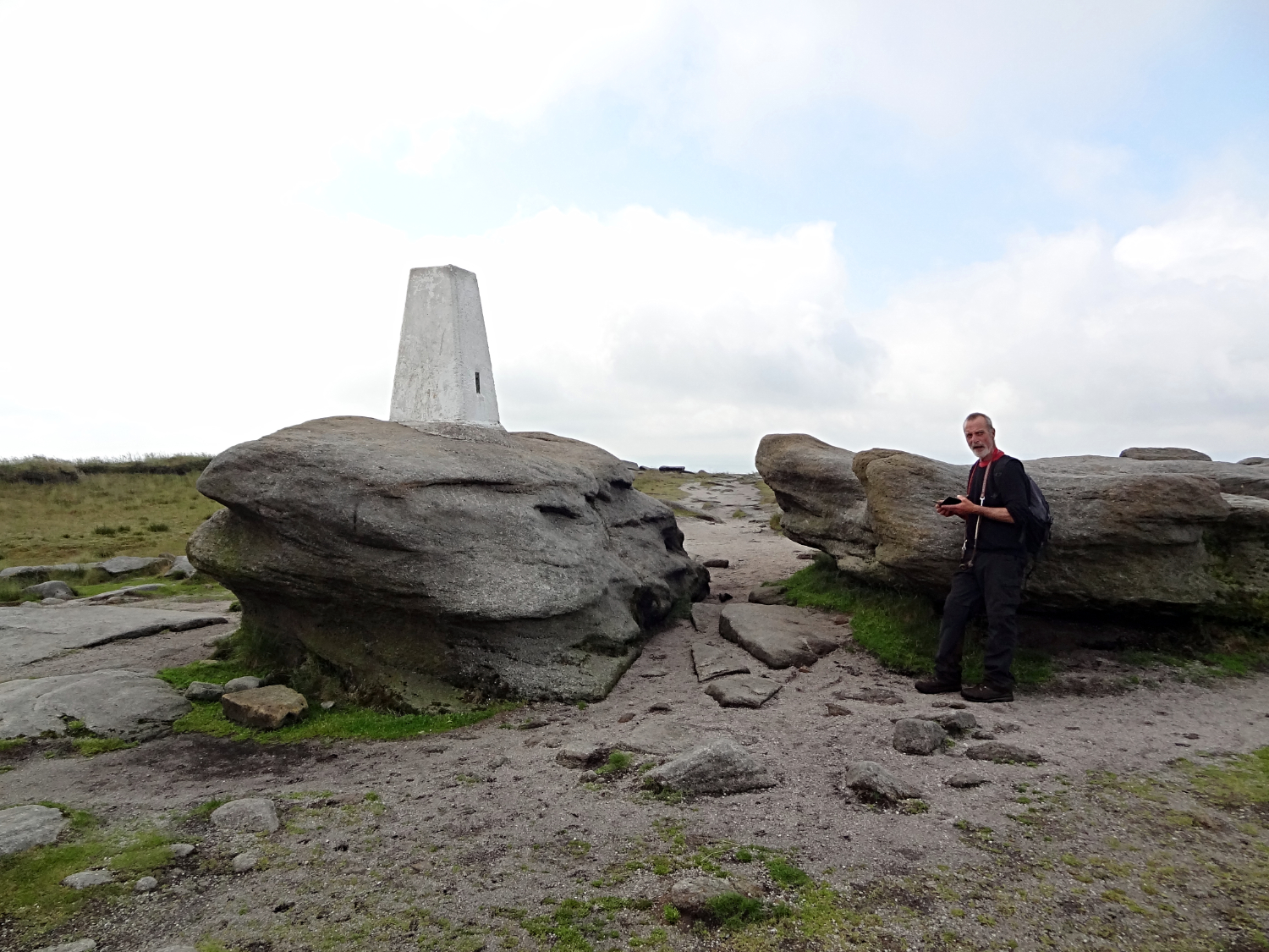 Trig Point at Kinder Low
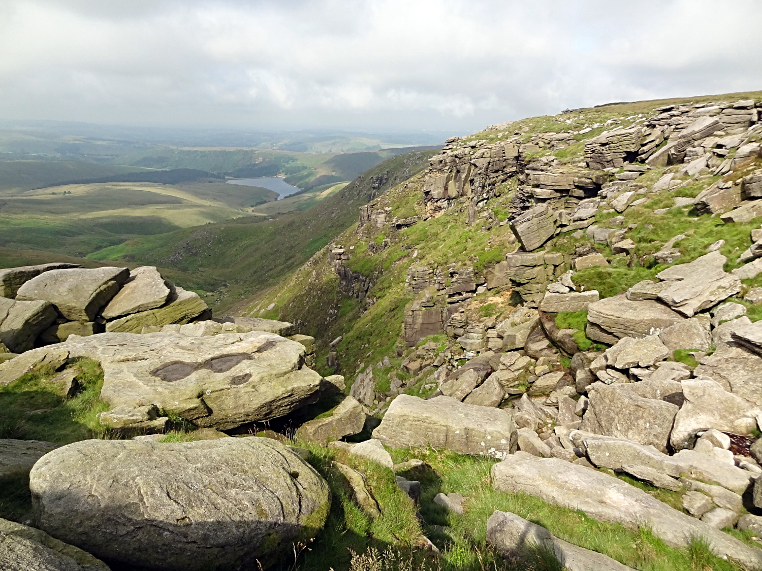
As we had crossed Kinder Scout early morning cloud had filtered in from the west. The cloud cover was not too bad though and never enough to fill the sky. Although it was a bit annoying as the cooling of denied sunshine came at the time we took a second short break to enjoy the moment at Kinder Downfall which we had to ourselves. I sought a spot out of the wind which wasn't too much of a problem to find. Despite the irritation of cloud suddenly settling over us, the next few minutes chilling out were just ideal. Gloriously so. Our times spent at the downfall had always been bustling with people on earlier visits. It is one of the most visited places in all of the Peak District. Rightly so, the setting is unique and the views due west from the plateau edge truly sensational. Especially the one down to Kinder Reservoir with the popular village of Hayfield beyond. And we had it uninterrupted by others. The magic of that. After the thrill of enjoying the downfall we followed the Pennine Way path for the long mile southwards to the highest point of the Peak District at Kinder Low. Yes, the highest point of all on this walk was to be at a place marked 'low' on the map. Strange but true. And a trig point marks the spot, sat on an isolated gritstone stood on high ground which is forever getting lower. Incrementally by millimeters over millennia but lower all the same. Oh, by the way, the long mile walk from Kinder Downfall to Kinder Low is such fun, weaving in a out of gritstone passages, up and down over natural gritstone staircases, and past natural gritstone statues and sentinels. It is an awesome mile of thrills and spills to walk.
 Kinder Rocks
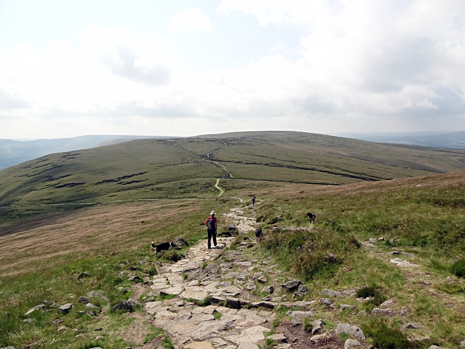 The way south from Swines Back to Brown Knoll
From the trig-point the walk continued via a pleasant and gradual one hundred metre descent past the pretty Edale Rocks and Swines Back to a crossroad of paths, at which point we left the Pennine Way Path, continuing southbound to Brown Knoll, an unimpressive upturned saucer of high ground which has been blessed with a trig-point of its own, 569 metres high, to give the place some merit. After the thrills of Grindsbrook Clough and Kinder Scout we were now entering a phase of the walk which was pretty bleak. A thorn between two roses so to speak. But on peering into the heart of the big nothingness we were crossing I found some intrinsic beauty all the same.
 The long path from Brown Knoll to Rushup Edge
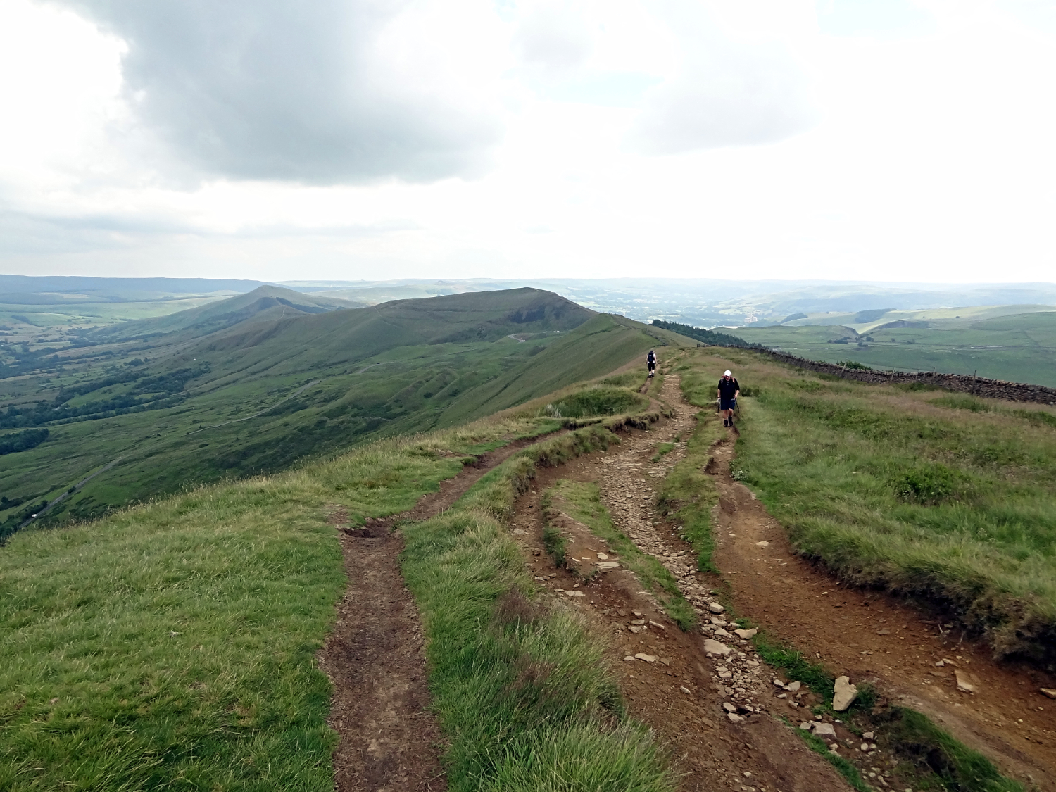 Rushup Edge
The route from Brown Knoll to Rushup Edge, a two mile tramp over seemingly featureless ground, is conducted entirely on a paved path. Even in the driest season, as we were walking, there were still patches of mud, sludge and brown peaty water by the path side. Certainly a morass of squelch to avoid in winter. But now the bog grasses were interspersed with acidic wet ground loving plants. Cotton grass was prolific all over the place and sprays of wispy flowering grasses delighted too. And, for the first mile of the crossing at least, there were spectacular views to the Macclesfield Forest and to the Shining Tor ridge. There was beauty if you looked. It is just that the paved path was constant, unchanging and unrelenting. We were glad to get off it as we reached that crossroads of paths which granted us arrival on Rushup Edge.
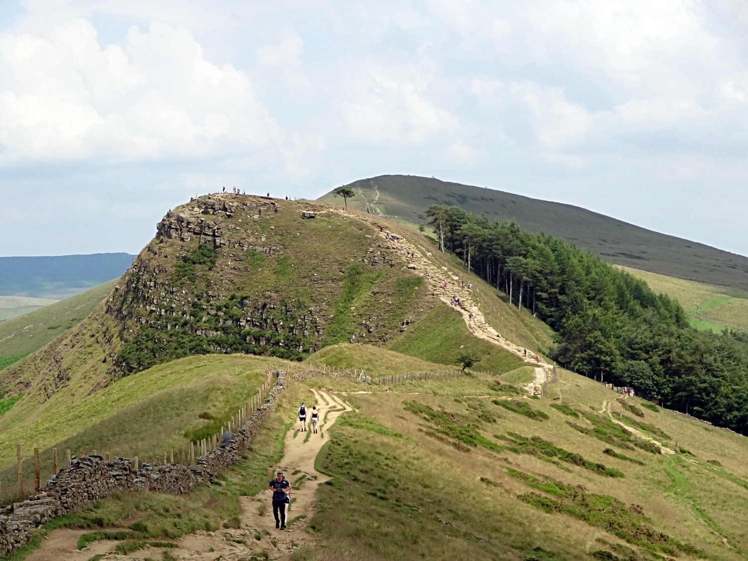
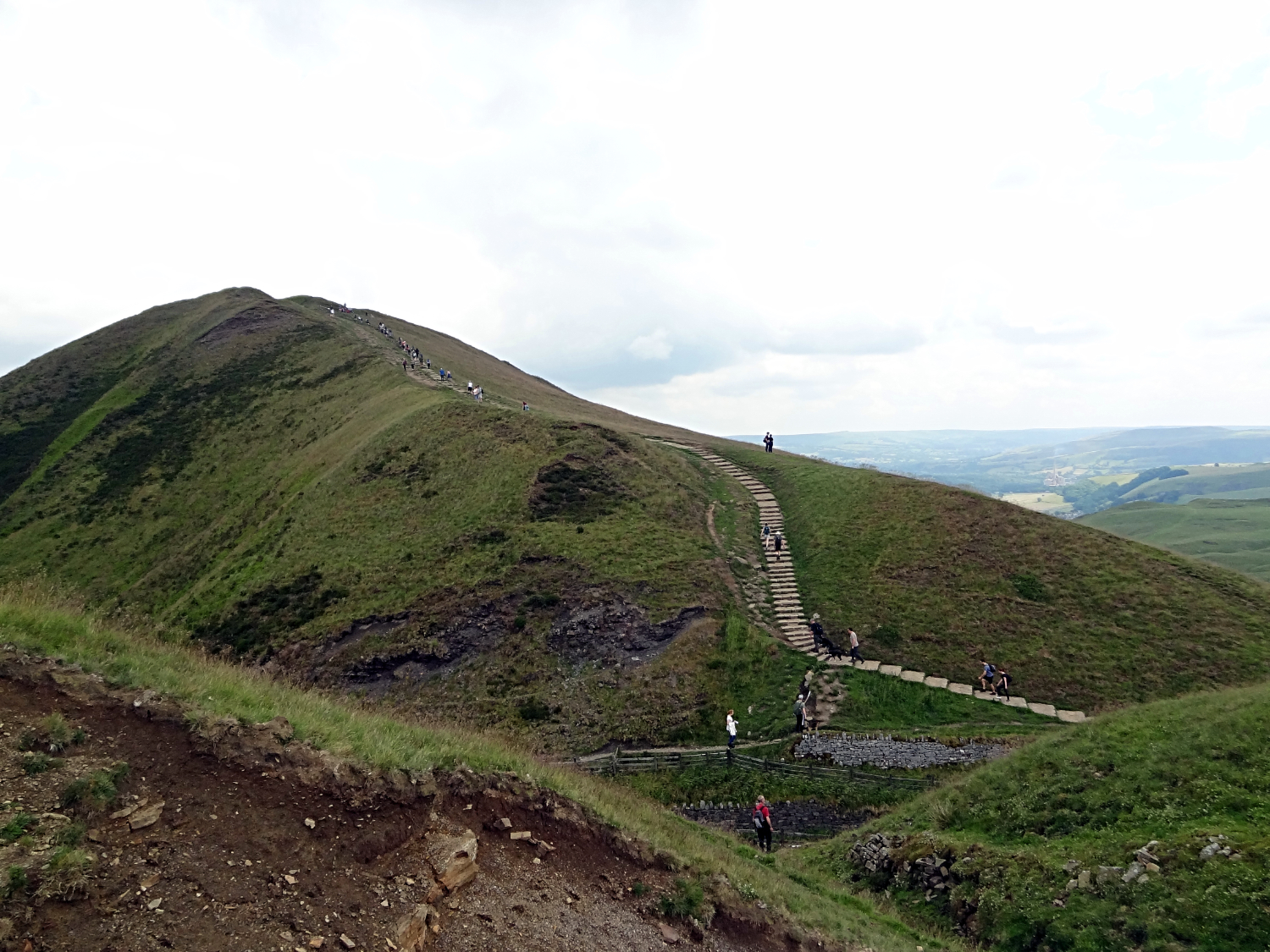 View from Rushup Edge to Mam Tor
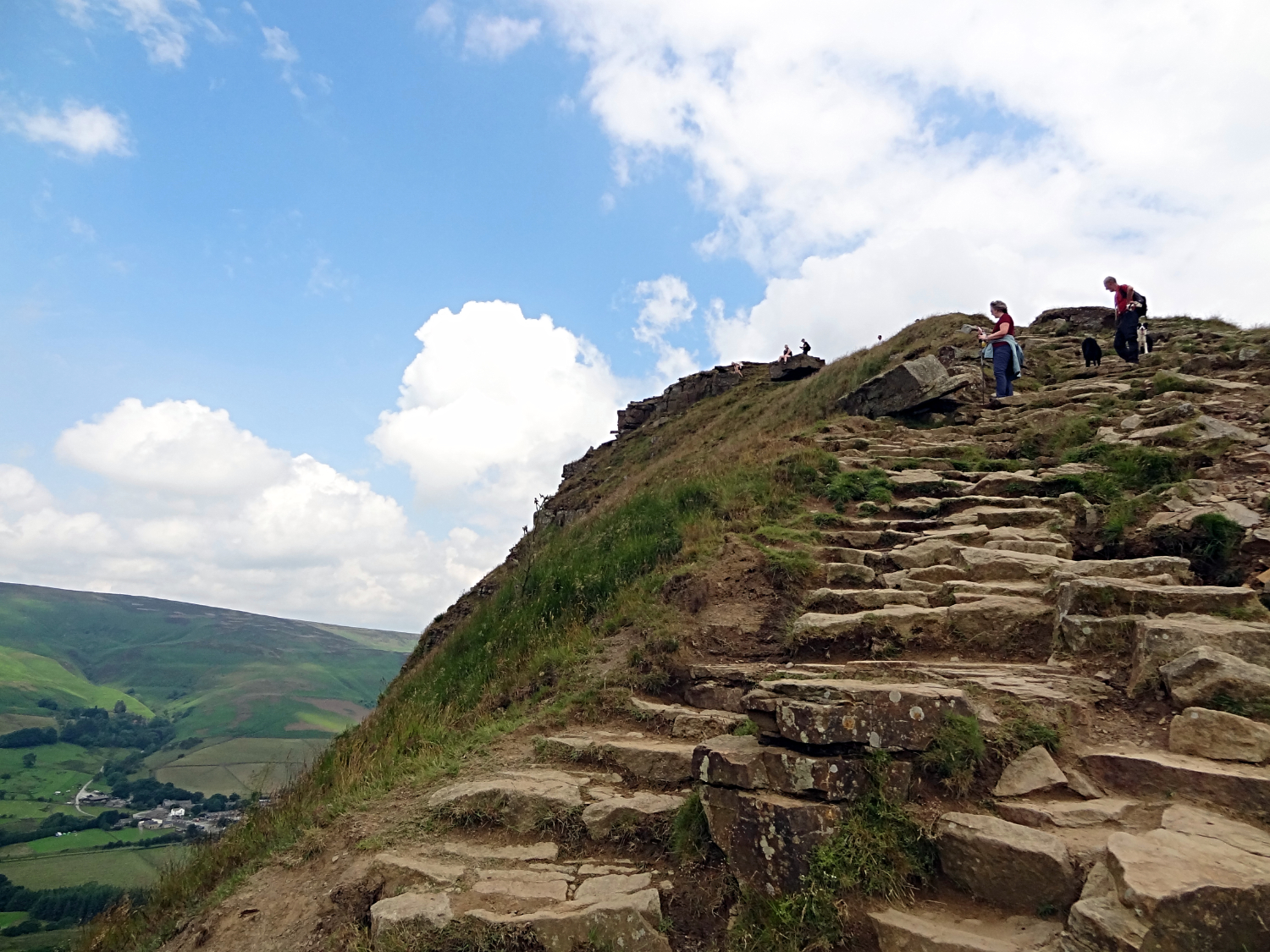
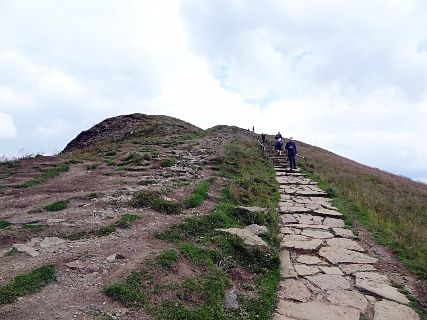 Climbing the steps to Mam Tor
Rushup Edge is the poor relation. The part of the Great Ridge which is forsaken by most who visit and walk this spectacular line of hills. Most people, and you can include me and Steve in this, tend to climb from Castleton to Mam Tor, walk the ridge to Lost Hill and then track back down to Castleton via Hope. It is a classic route we have done several times. One of my favourite walks in all of the Peak District. One of most people's favourites to boot. And yet here was Rushup Edge, quite and yet strikingly beautiful to be on. Steve, me and the dogs crossed Rushup Edge west to east, peaking at Lord's Seat halfway along its shapely spine before descending towards Mam Tor, all while eyeing the continuing Great Ridge on its procession of Hollins Cross, Backtor and Lose Hill. Rushup Edge was a rite of passage which had to be done and now it had been done. Pleased as punch was I on the 'I am out of breath' climb to Mam Tor. A climb nearly always done on a busy path where most people stop, pretending not to be puffed, but stopping the climb to turn and just to enjoy the view. We all do it don't we.
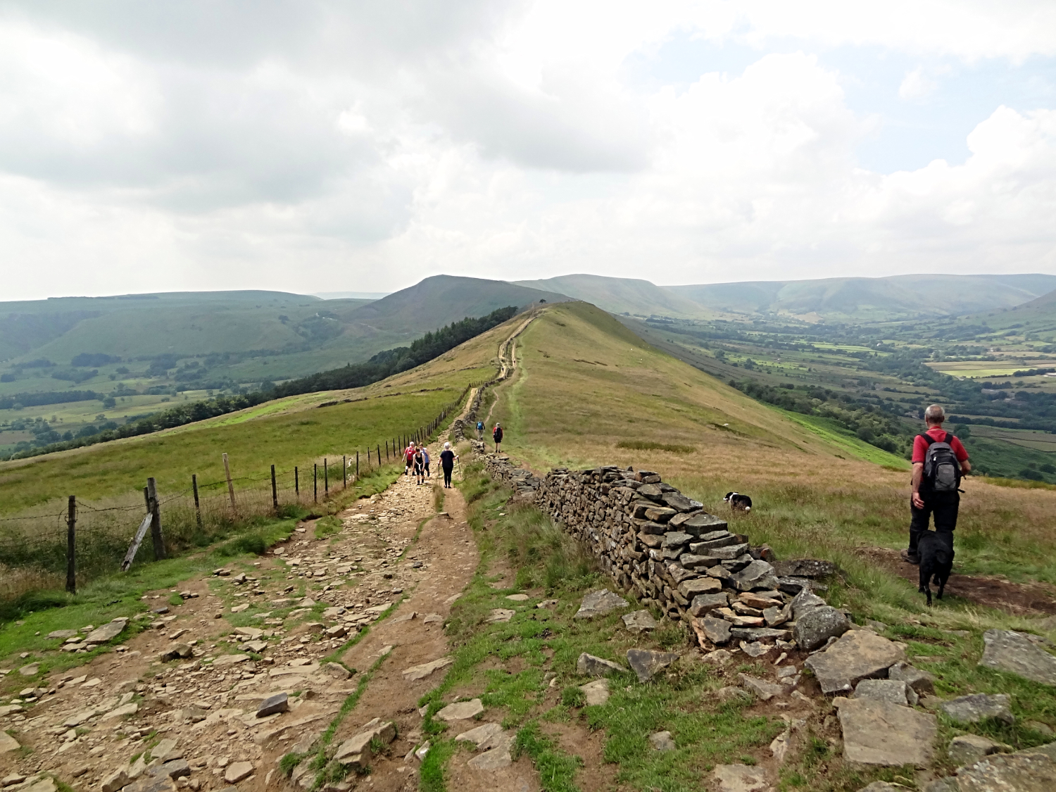
 Heading from Mam Tor along the Great Ridge
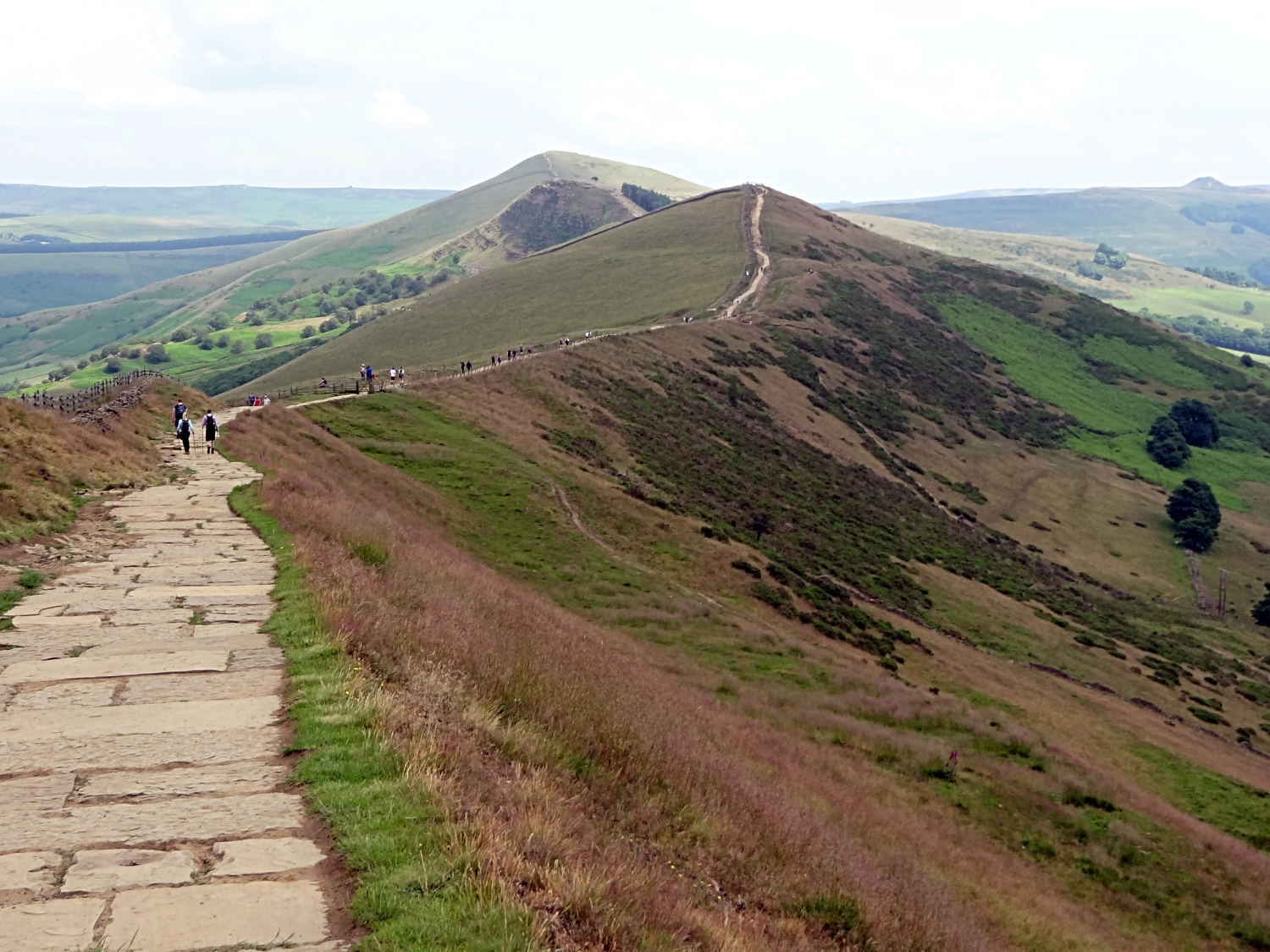 The Great Ridge
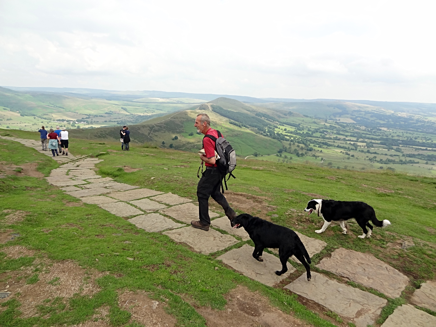
From a walk enjoyed in peace and solitude since the very early start in the morning we were suddenly walking with the crowds. It was quite a change of atmosphere but not unpleasureable at all. Everyone were enjoying themselves, something you cannot fail to do on the Great Ridge. We had been walking over five hours and yet it was only 10.30am as we stepped off the summit of Mam Tor to walk the busy part. In five hours, Steve and me, accumulated age of 135, had covered over ten miles of walking. And we still felt sprightly. Funnily enough it was Keira and Ziggy who were starting to show signs of tiredness. They were not running off in chase of anything now, instead sticking close to us. We walked with the procession down from Mam Tor to Hollins Cross, full of beans.
 Steep climb to Backtor
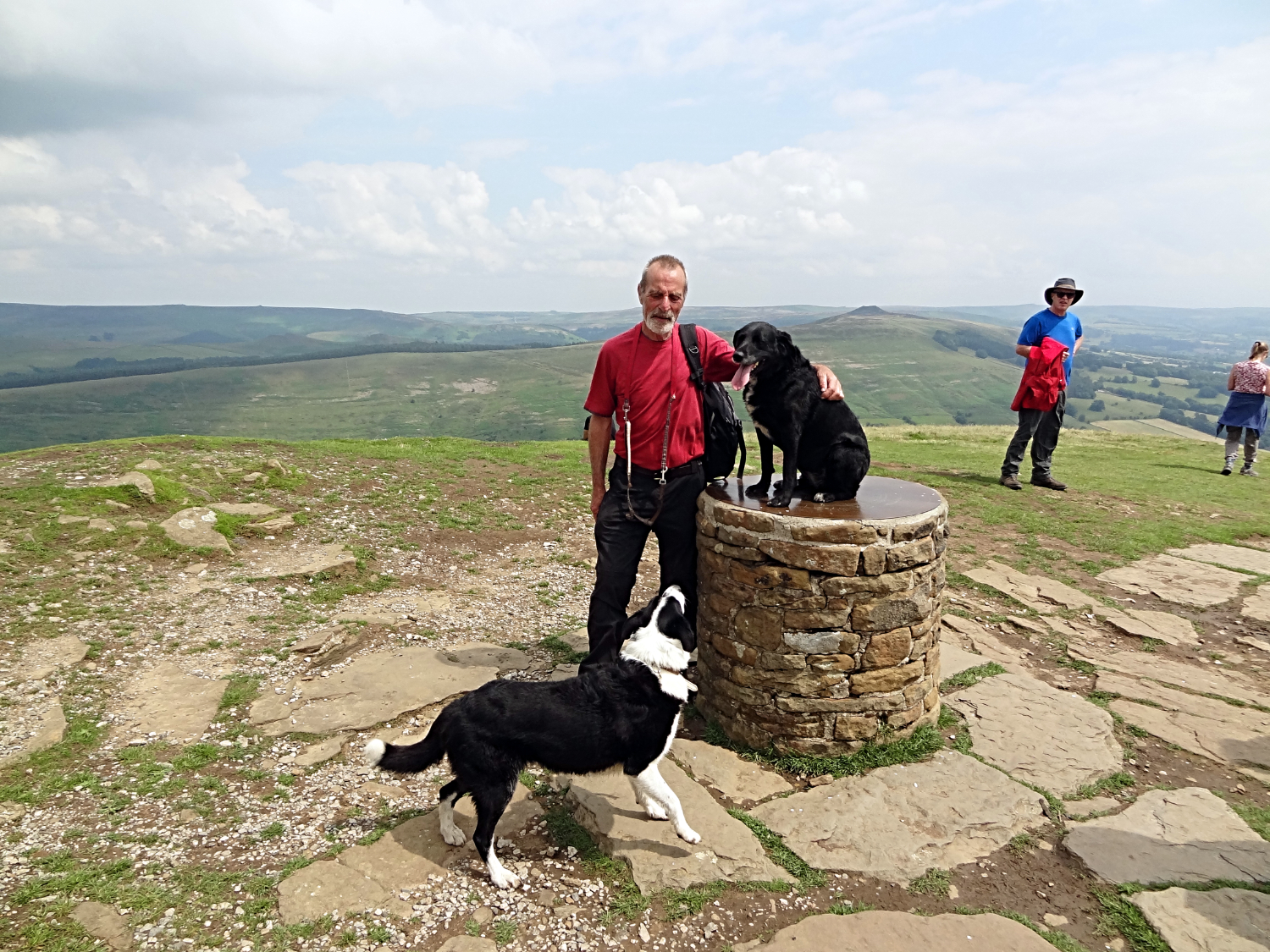 Steve, Keira and Ziggy on Lose Hill
"Let's go up to Backtor" I said to Steve. We did not have to, having scaled it before but Steve was as keen as me. "Why not" he replied. And so we left the Great Ridge line to hurtle on the short steep stepped climb to summit Backtor, the eye catching spur of the Great Ridge which attracts all to its peak at least once. (Although not shown on the gpx track and maps you will have to detour up and back down the same stepped path to enjoy cresting the Backtor summit. Give yourself at least thirty minutes to do so). Having done the obligatory detour of Backtor we resumed the Great Ridge line, making the final ascent of the day to Lose Hill, a steady eighty five metre climb. At the top we celebrated the completion of all the climbing to be done. Around 850 metres of it. Not bad for two pensioners. Keira and Ziggy perked up a little and seemed pleased too. They must have sensed at least the climbing was done.
 View west along the Great Ridge from Lose Hill
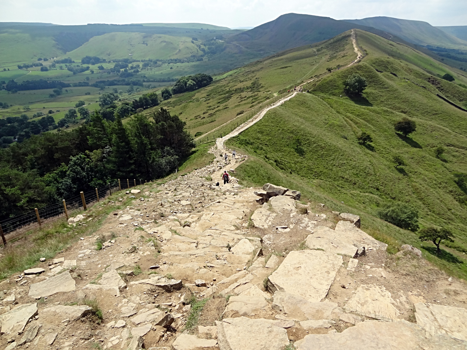 View west along the Great Ridge from Backtor
From Lose Hill we had to return along the Great Ridge to Hollins Cross, a little over a mile but now downhill instead of up. It was now around noon, the sun was high in the sky and burning the remaining patches of cloud out of the sky. It was getting hot and only now did we start to feel our bodies straining to the earlier effort. "Good job it is downhill and that we can amble" I said. Steve agreed, having cast a top layer and donning his sun hat for the remainder of the walk. It was getting hotter by the minute as we returned to Backtor and then as we headed back towards Hollins Cross. We could see heat haze forming over in the direction of Winnats Pass as we walked.
 Looking back from Hollins Cross to Backtor
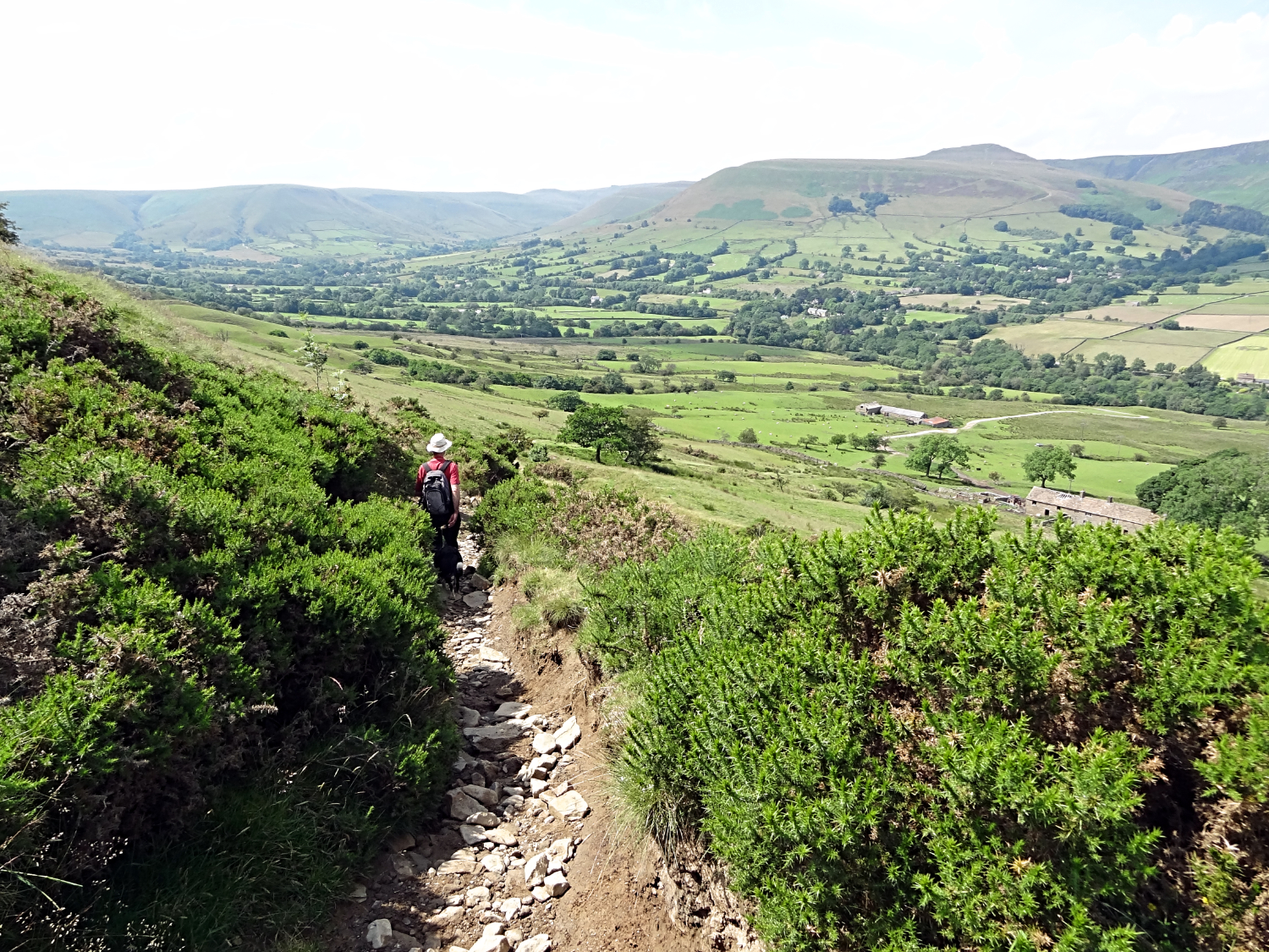 Descending from Hollins Cross to Vale of Edale
Past Backtor we went and then to Hollins Cross where it seemed everyone on the ridge had stopped for lunch. There was quite an assembly of people at this point on the Great Ridge where another path crosses linking the Vale of Edale to the Hope Valley. Family and group picnics were being enjoyed on the spread of ground all around Hollins Cross. We stepped between the groups and found our path leading down to the Vale of Edale. Almost immediately the hot became hotter. Very hot in fact as we were away from any breeze the ridge top could provide. In the closeness of thicket beside the part sunk path coming off the ridge we were literally frying. It was uncomfortably hot for sure. Heat drains us all when walking. It is the biggest cause of exhaustion and now after over twelve miles of walking over six hours we were both feeling it. And more so were the dogs. Luckily on coming off the moor side path we found them a sheltered section of the River Noe to bathe in. Which they plunged into without a seconds hesitation.
 Vale of Edale
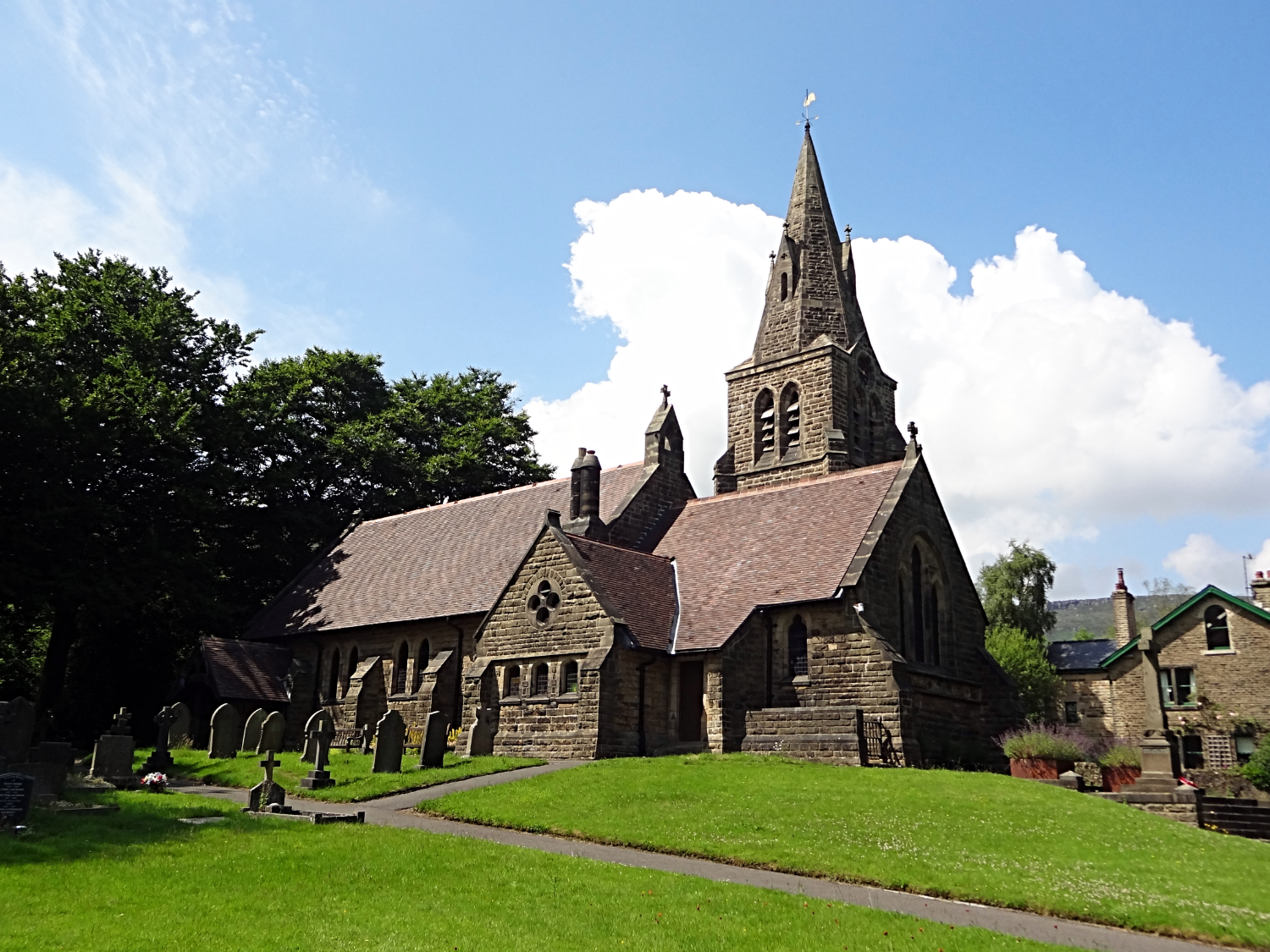 Edale Parish Church
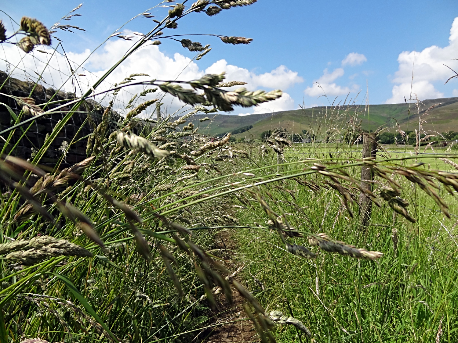
After crossing the River Noe by a small packhorse bridge and then crossing the Edale to Hope road we ambled by a couple of field sides to pass under a railway bridge and then cross three more fields to reach Edale. My, those last couple of fields were hard work with the temperature now approaching the thirties. Still, it was not even one o'clock in the afternoon and we could chill at the campsite for the rest of the day before a few beers and meal at the pub in the evening. And so there you have it, stunning walk done and still time to rest and then enjoy ourselves It was a perfect day.
Oh, in the evening Steve could not get Keira out of the campervan to go for a short covenience walk. She was completely jiggered. But thankfully back to walking fit by the next morning.


