Rochester and Hoo St Werburgh Saxon Shore Walk
For me this is a very rewarding walk on a sunny day and must be done at low tide or else the coastal section between Upnor and Port Werburgh is not accessible (although you don’t need to lose much height of water until the path is accessible). The walk starts in Central Rochester certainly the nicest of the Medway towns before heading up to Frindsbury. Soon however the route completely changes character to become a charming coastal walk with excellent views of the surprisingly scenic Chatham dockyard and St Mary’s Island. The route then moves back inland to a very quiet rural path before rejoining itself at Upnor.
Story by Steven Spall
Google Maps Open Source Maps| Statistics and Files | ||
|---|---|---|
| Start: Rochester Castle | Distance: 10.8 miles (17.4 km) | Climbing: 200 metres |
| Grid Ref: TQ 74237 68274 | Time: 4-5 hours | Rating: Moderate |
| GPX Route File | Google Earth File | About Rochester |
| Statistics | |
|---|---|
| Start: Rochester Castle | Distance: 10.8 miles (17.4 km) |
| Grid Ref: TQ 74237 68274 | Time: 4-5 hours |
| Climbing: 200 metres | Rating: Moderate |
| GPX Route File | Google Earth File |
Ordnance Survey Explorer Map (1:25,000)
The Walk:
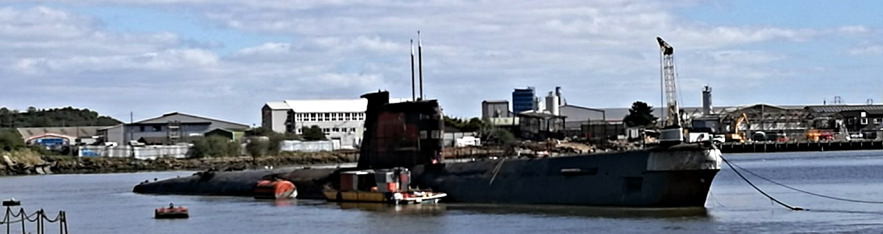 Soviet Foxtrot class submarine ex Baltic Fleet formerly the B-49
From central Rochester head past the glorious Castle (tallest castle keep in England) and Cathedral (second oldest Cathedral in England) and cross over the Medway Bridge. Immediately after crossing head off the right and once past the Russian submarine make your way up the steep bank to Frindsbury Church where, if you’re lucky, you may be able to steal a view into the Historic Dockyard on the opposite bank. Following the path down cross over the dual carriage way (there are lights at a pedestrian crossing) and leave the towns behind.
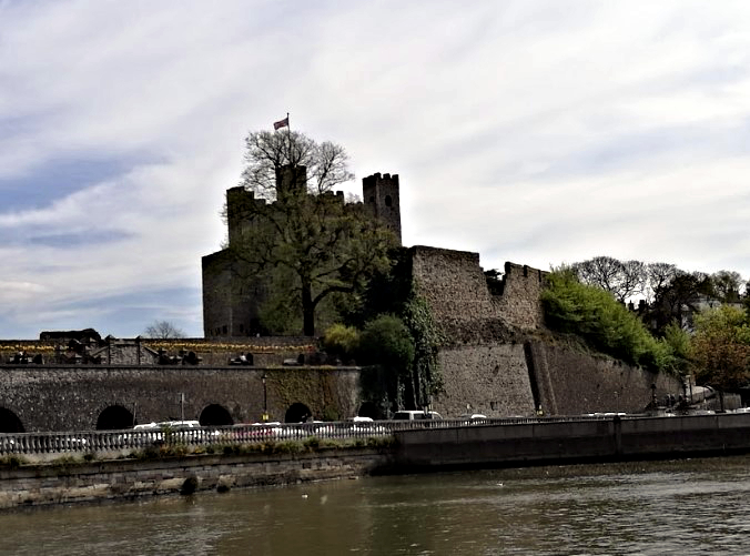 Rochester Castle
 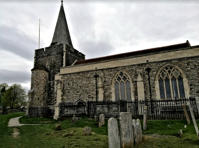 Frindsbury Church
Continuing on, a small wooded path leads you past Whitewall Creek Wastewater Treatment Works and behind the Royal Engineers training facility, staying behind the trees and off the road you emerge onto a boggy section on the banks of the Medway right in front of Upnor Castle (which failed to do anything useful when the Dutch sailed up the Medway). The path leads on through Upnor, which is a delightful throw back to a bygone age, and continues both on, off and beside the roads down to lower Upnor and the HMS Arethusa. Going past the pill box you now begin the coastal walk affording great views over the Medway estuary.
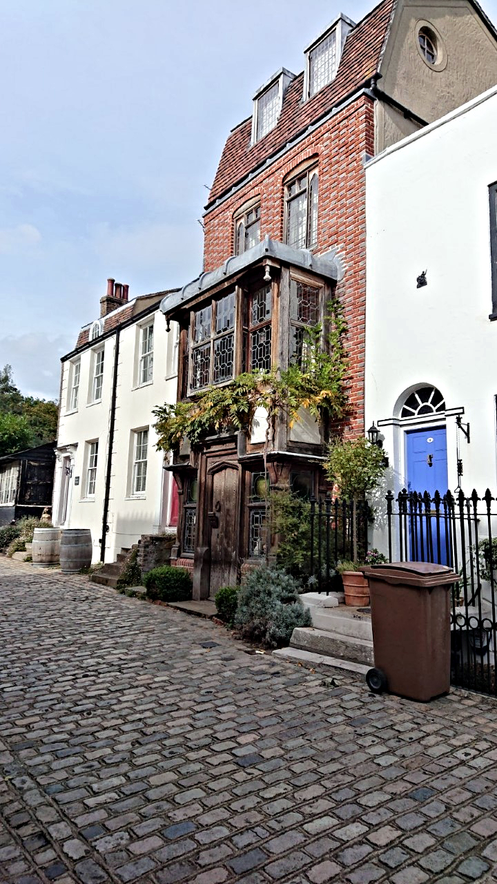 Stylish houses in Upnor
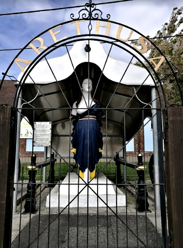 Once a ship figurehead now a waymarker
The coastal route is not too difficult although the terrain is quite variable. A ruined fort similar to the one at Grain is found just before coming off the coast at port Werburgh. Follow the path on through Hoo Marine Park and stay on the coastal side. Eventually you will find more pill boxes specifically a large pill box built to house an anti-tank gun facing inland (the inland is now home to some fishing lakes).
 Yachts moored at Lower Upnor
Heading up and toward the town of Hoo St Werburgh there is a route through town leading past the church (although there are also some pubs and shops here if you need to replenish essential supplies) where a track leading through farmers fields and past Cockham farm can be picked up. When housing is rejoined drop downhill through the woods to refind HMS Arethusa and head back to Rochester.
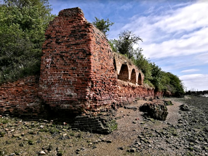 Ruined Fort near Hoo St Werburgh
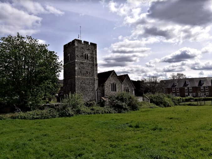 Hoo St Werburgh Church
Pictures courtesy of Kate Cash.


