Wales Coast to Coast
A record of the Walking Englishman's 246 miles Coast to Coast journey from Conwy in North Wales to Cardiff in South Wales. With maps, statistics, pictures, gps files and personal journals for each stage of the walk.
Stage Eight: Machynlleth to Ponterwyd
Google Maps Open Source Maps| Statistics and Files | ||
|---|---|---|
| Start: Machynlleth | Distance: 15.5 miles (24.9 km) | Climbing: 800 meters |
| Grid Ref: SH 74542 00803 | Time: 7-8 hours | Rating: Hard |
| GPX Route File | Google Earth File | About Ceredigion |
| Statistics | |
|---|---|
| Start: Machynlleth | Distance: 15.5 miles (24.9 km) |
| Grid Ref: SH 74542 00803 | Time: 7-8 hours |
| Climbing: 800 meters | Rating: Hard |
| GPX Route File | Google Earth File |
Ordnance Survey Explorer Map (1:25,000)
Summary: Today the character of my Wales Coast to Coast changed. I sensed it yesterday on the walk through Dulas valley but the continued good weather and enclosure of the narrow valley shielded me from the transformation on the ground. Now I was well and truly into softer and more rounded country. Gone were the angles of rock and crag of Snowdonia and gone were the big climbs and knee jerking descents over hard ground. The greys and whites of exposed rock were also behind me. Now all was the green of tilled field or forest plantation or the light and darker browns of moorland. And it was also grey. The weather had changed with the change of natural environment. Quite appropriate in a way. I was now walking in the hinterlands of Wales.
The Walk:
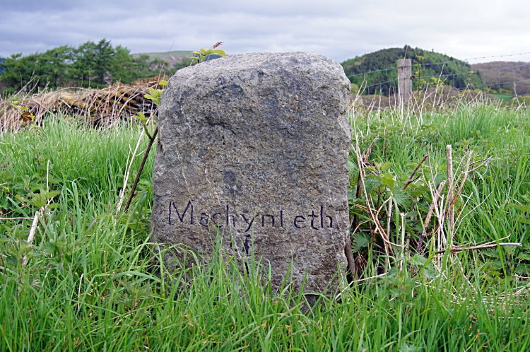 Machynlleth milestone
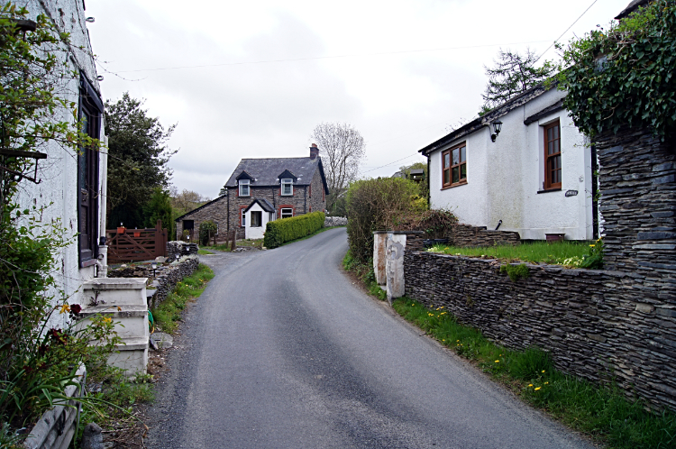 The village of Forge
Fifteen and a half miles of what not to expect lay ahead of me as I walked from Machynlleth. It was an overcast start to my walk but at least it was dry. After the wonderful weather I had enjoyed in the first week of my walk I could hardly complain. Still I grumbled. The short term forecast was not good with heavy rain expected tonight and tomorrow. I thought positive "At least the waterfalls of Devil's Bridge should be spectacular". Machynlleth is a lovely town. I was impressed with my stay and promised myself to return one day. A good base for a Cambrians walking holiday perhaps? Anyway, fixing my attention on the walk ahead I followed the A489 from the center of town, turning right at a junction to follow Glyndwr's Way south-east on a road bisecting Machynlleth Golf Course and leading to the village of Forge. There were no golfers out playing at eight thirty in the morning as I walked past the fairways. The grass of the fairways was being kept short though by a flock of sheep. I found it funny that the sheep decided to walk into the road just as a couple of cars drew towards Machynlleth. The car travellers had to wait a while until all the sheep had crossed. They took their time. Soon after I walked on the road through Forge. No one was about. Just me.
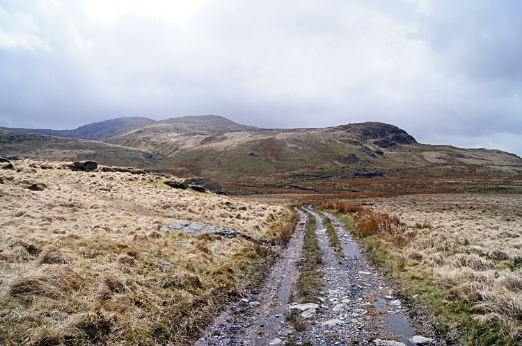
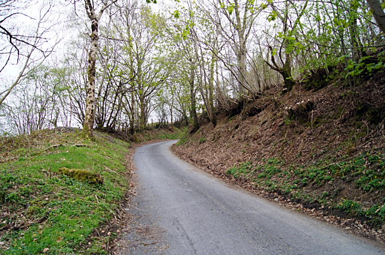 The road to nowhere
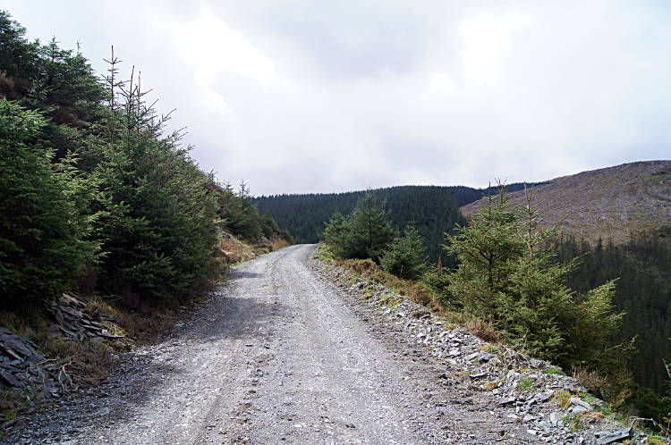 Climbing to Mynydd Bychan
I continued following the road leading due south through Forge, having parted with Glyndwr's Way which I would come across a few more times during my long walk to Cardiff. The road walk was three and a half miles of tarmac leading absolutely nowhere. I felt it had no connections, no purpose, other to convey me to where I wanted to go. In fact it served isolated houses I passed and most likely heavy forestry plant for that is where the road was leading. To a massive plantation forest on the slopes of Mynydd Bychan and outlier hills of the North Ceredigion Hills. My road to nowhere was actually delivering me from Powys and into Ceredigion. After beginning my walk in Gwynedd I was now about to arrive in my third county of Wales. Three and a half miles after walking through Forge I came to the end of the tarmac and looked into the vast forest. I could see the far end, high up in the hills. It looked closer than it was. It would take me over an hour on a walk of three miles with 250 meters of climbing to exit the far end of it. I walked and walked through avenue of avenue of evergreen. At least the sun got through a couple of times to warm the day. I did not expect that. Towards the end of my forest walk I came to a rock of Quartz placed by the track side. It was festooned with a bunch of red roses and read 'Er Cof Am David Richards. Hyddgen. A Fu Farw Mawrth 28ain 1901. YN 46 Mlwydd OED'. (Translated as ' In Memory of David Richards. Hyddgen. Died March 28th 1901. At 46 years age').
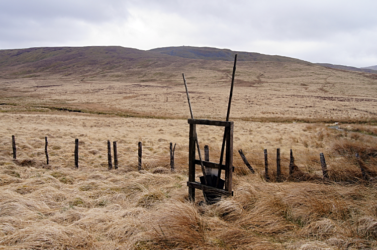 Fire beating equipment on the moor
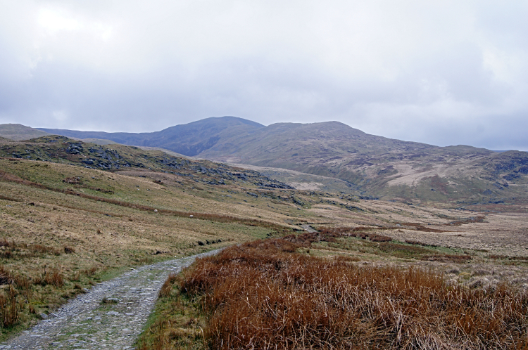 A view of Plynlimon
Not long after paying my respects at the memorial I emerged from the trees and arrived at a huge expanse of moorland. The picture was vast. A sea of bright brown course grass with the higher exposed grasses rocking in the wind like waves in a sea. Cloud filled the sky and scuttled across giving the scene I was looking at a magnificent moody feel. Just like a JMW Turner classic landscape. I was instantly attracted. Having done the climbing of this stage I was now at a height of 400 meters which I would stay with for the next six miles of walking in the hinterland I had hoped for. so I could walk with free abandon. It was a glorious feeling despite the cloud and increasing chance of rain later on in the day. Back to the picture in frame I was now taking in. The star of the show was Plynlimon, the brilliant fabled hill where two of Britain's greatest rivers start their journeys. The River Severn and the River Wye both source on Plynlimon, or Pumlumon as it is written in Welsh. "Shall I climb it now?" I thought to myself. I was within striking distance but I decided against the idea. The weather was not good and worsening. And I would have to climb 350 meters more and also adding more miles to the 15.5 I was already committed to. "No Mike, save it for another day. When you can pay it more respect and take your time finding the rivers". was the right answer.
 The track running alongside Afon Hyddgen
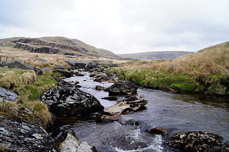 Afon Hengwm
Still, as I walked on the track running due south alongside Afon Hyddgen I kept looking up at Plynlimon. I was getting closer to the mountain with every step. "Shall I? Shan't I?" I kept muttering to myself. I was sorely tempted. I arrived at a crossroads where Afon Hyddgen and Afon Hengwm converge, the resulting water flowing into Nant-y-moch Reservoir. At the convergence of rivers there is a crossroads of footpaths too. Mine was to keep on southwards and past the east side of the reservoir. Another headed east and then north. The final one led straight up Plynlimon via Nant y Llyn to Llyn Llygad Rheidol Reservoir and then to the summit via Nant y Graig-las. Again I was tempted to Plynlimon's summit. Again caution won over ambition. I continued south toward Nant-y-moch Reservoir.
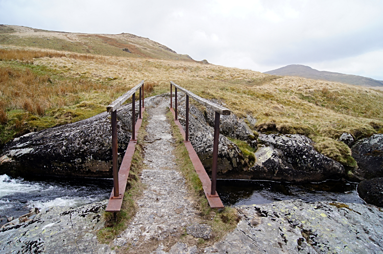 Footbridge over Afon Hengwm
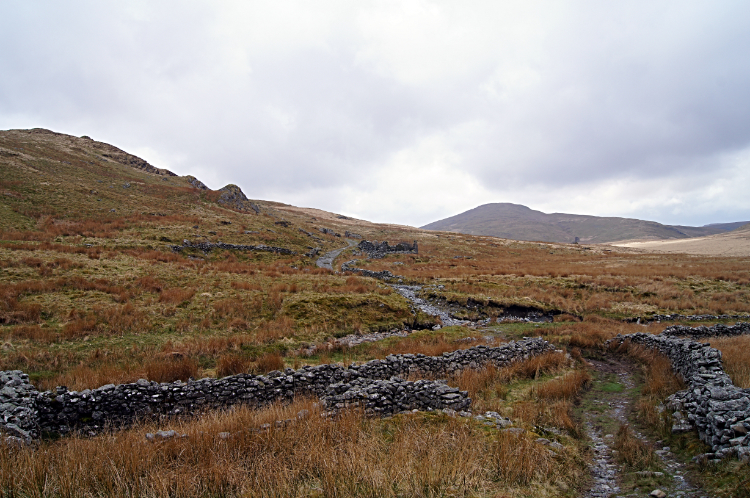 Beautiful mid Wales upland
The west-side breast of Pumlumon Fach which was directly to my left now shielded the larger sibling Pumlumon Fawr from my view. While the English attribute just one name to the mountain, the Welsh familiarity of greater and lesser, Fawr and Fach, still applied. Lesser hills began to capture my attention, the most attractive being the rounded and pyramidal Drosgol. My view of the shapely hill with twin cairns which crown its summit lay directly across the waters of Nant-y-moch Reservoir. Thus in my minds eye Drosgol and the reservoir complimented each other to make a very pretty picture.
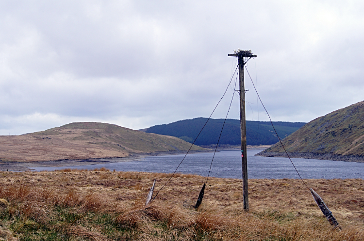 Exposed Heron nest at Nant-y-Moch Reservoir
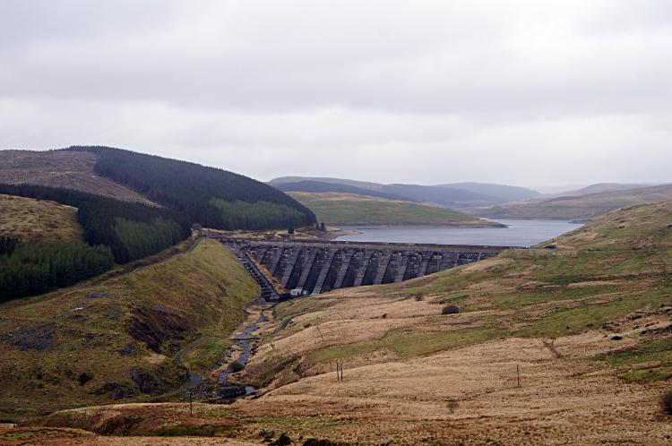 The Dam of Nant-y-Moch Reservoir
At the reservoir another feature in the landscape caught my eye. A solitary telegraph pole, redundant of its original purpose and still standing when all around it had fallen, was being utilised as a nesting site. The large nest, possibly made by a pair of Heron's was in good order. But not occupied. Heron's do tend to nest early in the season so it may have been used earlier in the spring. Anyhow, if it had been used to bring up a family successfully the young birds will have developed into hardy youngsters. I could not think of a more exposed site. It was the last place I would choose with no protection from the weather at all. Wind, rain, hail, snow, gale. Anything in the nest would have felt the full brunt of it. Continuing on around the reservoir I experienced a little of what the birds will have felt. It started to rain around the time I gained a view of the reservoir dam and spillway. Incidentally I was on to tarmac again now, halfway along the reservoir in fact. With the onset of the first rain of my entire walk, the first in over a week of walking, I stepped off the road and up a bank to the shelter of a small outcrop with woodland behind. Once out of the rain I hunkered down for my dinner. It was one thirty in the afternoon. I had walked almost twelve miles in five and a half hours without a break so I reckoned I had earned it.
 Dinas Reservoir
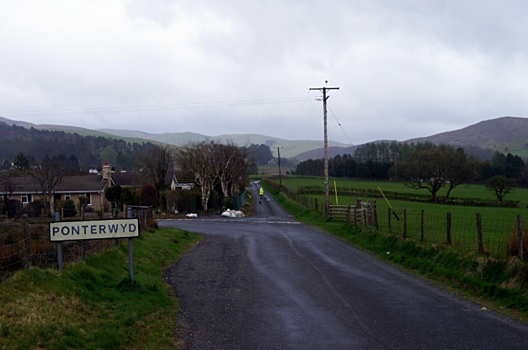 Ponterwyd
A funny thing happened on the way to Ponterwyd. After my lunch break it was a simple case of following the reservoir access road down to my stage eight finishing point. All was quiet and relatively uneventful but for one moment of craziness. As I approached a roadside farmstead called Lle'r-neuaddau there was one sheep stood in the road ahead of me. It must have got out of a field nearby. As I walked towards it I expected it to move to one side. There was plenty of room before fencing on either side so it could have easily done that. But no, the sheep decided to run straight down the middle of the road. I did not spook it, that choice was all its own. Anyway the problem with its choice of direction is that it was heading straight toward a cattle grid. As is with cattle grids, the verge sides narrowed to nothing, forcing the sheep to the grid. No problem for the sheep apparently, it just kept going. And then the funniest sight I have seen. The sheep stepped on to the cattle grid, front feet into thin air, and it tumbled. Somehow it then did a complete roll, or two, clearing the grid and getting to its feet. How it did not break its legs I cannot imagine. One very lucky sheep. Anyway, I then crossed the cattle grid myself. The sheep this time stayed by the side and let me pass. As I did so I said to it "Now that was very clever wasn't it. Tell me one thing. How on earth are you going to get back?".
Half an hour later I arrived in Ponterwyd. I found my accommodation just in time, as the heavens opened. It poured down all late afternoon into the evening. Apart from the rain shower up by Nant-y-moch Reservoir I had got lucky. It was not going to continue that way.


