Buckden, Cray, Yockenthwaite and Hubberholme
A walk in the pretty dales of Upper Wharfedale and Langstrothdale which visits the villages and hamlets of the area
Google Maps Open Source Maps| Statistics and Files | ||
|---|---|---|
| Start: Buckden | Grid Ref: SD 94260 77384 | Distance: 7.7 miles (12.4 km) |
| Climbing: 315 metres | Time: 3-4 hours | Rating: Moderate |
| GPX Route File | Google Earth File | About Langstrothdale |
| Statistics | |
|---|---|
| Start: Buckden | Grid Ref: SD 94260 77384 |
| Distance: 7.7 miles (12.4 km) | Climbing: 315 metres |
| Time: 3-4 hours | Rating: Moderate |
| GPX Route File | Google Earth File |
Ordnance Survey Explorer Map (1:25,000)
Summary: This walk which begins and ends in Upper Wharfedale and which also visits Langstrothdale is scenic from start to finish. It is a very popular walk which visits four pretty hamlets. First is Buckden, sheltered to the north by Cray Moor and to the east by the massive upland bulk of Buckden Pike. Next visited is Cray, reached by way of Buckden Rake and an interesting waterfalls walk. Third up, via an airy walk above the valley is a visit to Yockenthwaite in Langstrothdale, a settlement of isolated farmsteads which has one of the most iconic packhorse bridges in the Yorkshire Dales. The final hamlet on the circuit is Hubberholme, the village on the cusp of where Langstrothdale ends and Wharfedale begins.
The Walk:
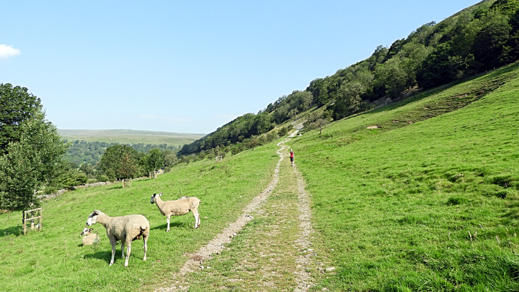 The way from Buckden
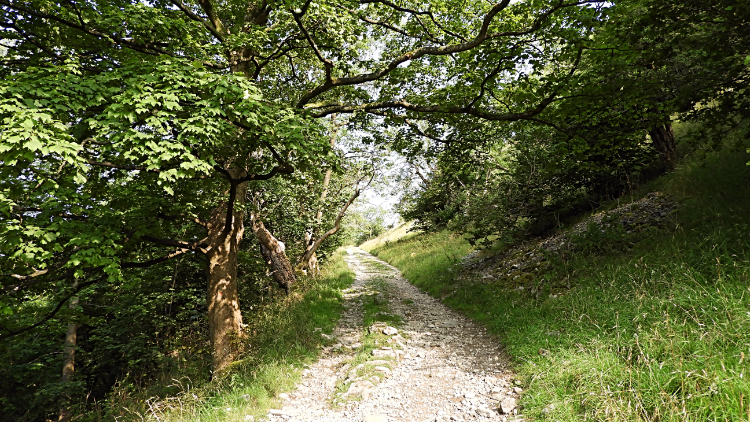 Buckden Wood
It was a cracking mid September day which took me and my brother Dave on an ad-hoc trip from Harrogate to Buckden in Upper Wharfedale. I personally had wanted to do this particular walk for a long time, having done a shorter version of this walk as a mistake over twenty years earlier!. Back then Dave had been with me too, as had our good mate Steve on a wild winter's day. And I had walked most of the paths we were to follow today many times since, twice on Dales Way walks and more besides. But this was to be different, specifically planned to visit the four splendid hamlets of the region and to explore the flora and fauna of the Langstrothdale and Wharfedale bridge. We eagerly set off from the car park in the village of Buckden, steadily climbing up the bank fringing the west tip of Buckden Pike, first up open pasture being grazed by sheep and then in the enclosure of Buckden Wood. We gained height steadily.
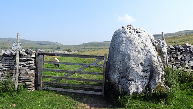 Gateway to Buckden Rake
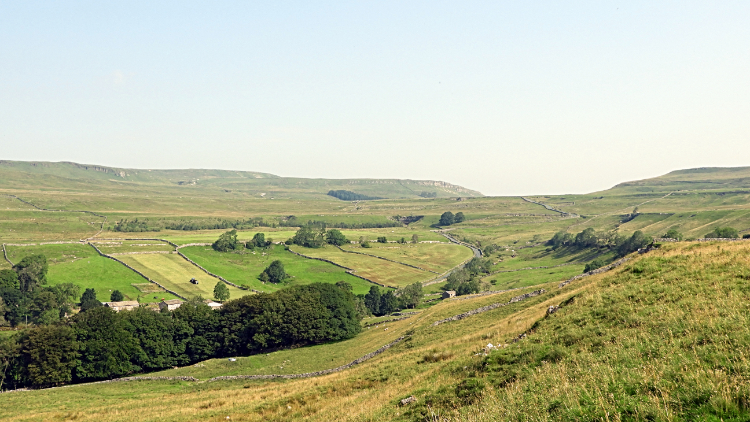 The view from Buckden Rake to Kidstones
The first mile of walking saw off the longest sustained climb of the walk. Which suited both me and Dave. By the time we had transited the path through Buckden Wood, passed the junction of paths where the right hand fork leads up to Buckden Pike and crossed one more field to reach a gate bordered by a huge limestone boulder we had climbed 120 metres to reach Buckden Rake. And all that climbing had been done in covering just the first kilometre. The reward for the effort was the gain of gorgeous views of the surrounding countryside. To our left we were looking down to the convergence of two high valleys which together create Wharfedale. For here we were looking right to Kidstones where Cray Gill begins to flow down south and west into the Wharfe at a point between Hubberholme and Buckden. We would pass that convergence point later on. Looking straight over the village of Cray led our eyes to Langstrothdale. Like Wensleydale with the enigma of a river called something different, in that case the Ure; here Langstrothdale carried the River Wharfe through it. But the River Wharfe only enters Wharfedale at that Cray Gill convergence. Strange but true.
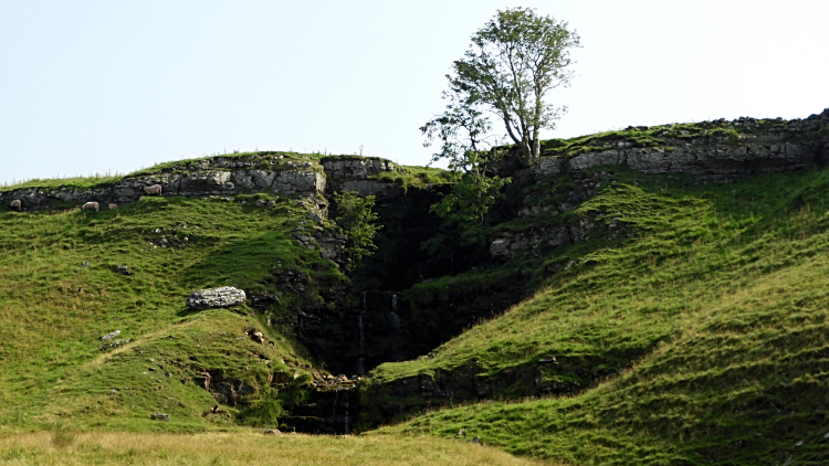 Cow Close Gill Waterfall
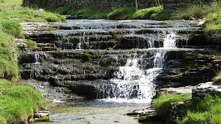 Cray Gill Waterfall
Dave and I continued our merry way along Buckden Rake, ambling northwards across the level ground. Almost level, we lost twenty metres of the earlier gain crossing the rake to our immediate destination of Cray High Bridge on the road linking the major Yorkshire Dales of Wharfedale to Wensleydale by way of the minor dale which is Bishopdale. As I looked across to Kidstones I recalled the only time I have walked through Bishopdale and up to Kidstones during the seventh stage of my Dales Celebration Way in 2004. Then I had arrived at Cray High Bridge for the first time on a walk. Now was the second time. Back to the now, Buckden Rake and Cray High Bridge is a great area for finding and admiring minor waterfalls. There are quite a few little beauties to be admired as they cascade over layers of gritstone. Cow Close Gill Waterfall is found coming down from Buckden Pike and best viewed when walking along the rake while Cray High Bridge has a pretty waterfall of its own. That one is in Cray Gill as is the next one. The premier Cray Gill Waterfall is most delightful to watch as it cascades over about a dozen distinct gritstone sheets.
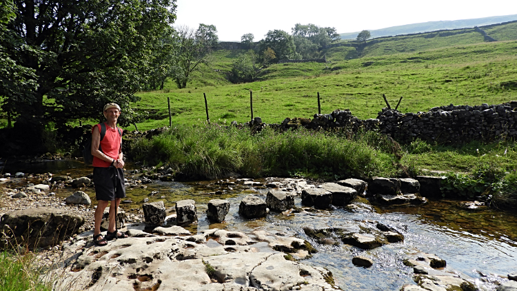 Cray Gill Stepping Stones
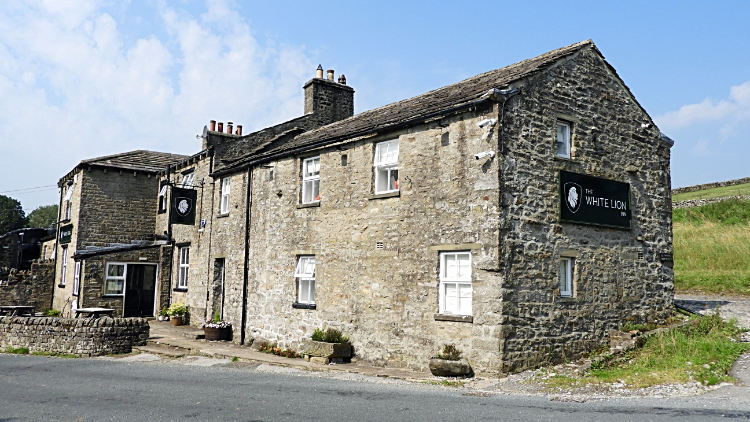 The White Lion Inn, Cray
We had a bit of fun after walking down the road from Cray High Bridge into the hamlet of Cray. Near the White Lion Inn, which is a popular pub for walkers, cyclists and motorists alike, is a series of stepping stones set across Cray Gill. In high summer there will be queues of youngsters waiting to make the crossing while adults watch on from the grassy banks on the side of Cray Gill. Being just a little after ten o'clock in the morning Dave and I had the scene to ourselves. So we had our bit of fun crossing the stepping stone water bridge. Just as we had in Cod Beck near Os-motherley as young boys with mum and dad watching over us almost sixty years earlier! You are never too old for fun.
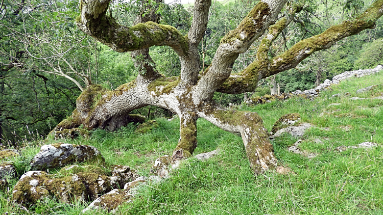 The Incredible Spider Tree
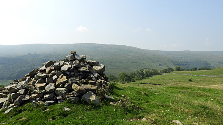 View to Langstrothdale and Horse Head
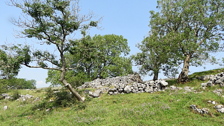
After the fun during playtime in Cray Gill we got back to work by climbing from Cray on the path leading west across Hay Close towards the crossing of Crook Gill and further to the high side of Todd's Wood. The climbing, which would be about forty metres in total was not significant and hardly noticeable though it did take us back to a high line at around 360 metres of great views. First though we had an overload of flora to enjoy. Being the second week in September there was a proliferation of wild flowers on show. Thistles were blossoming in vivid pinks and purples and many native wild flowers were in full colour too. The best of them was yet to come though. Now we arrived beside a fallen tree which instead of giving up had spread its branches out in all directions towards the light. I titled it 'The Incredible Spider Tree'. Soon after, on crossing the path above the top edge of Todd's Wood I spotted a cairn on Slades hill. I had to run up and climb it, on doing so enjoying superb views down young Wharfedale and also across Langstrothdale to Kirk Gill Moor and Horse Head.
 Limestone pavement at Scar House
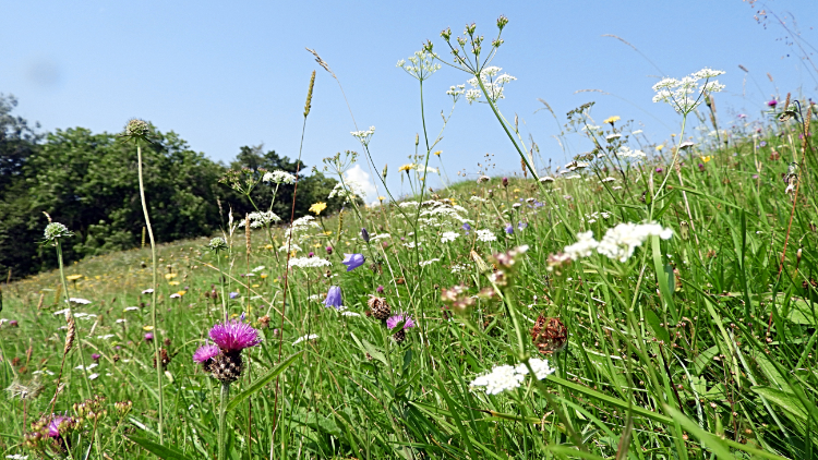 Wildflower meadow near Rais Wood
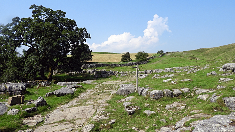
The sun continued to shine as it had all day which heightened the sumptuous colours on show. Despite heading into mid September the trees were showing no signs of giving up their summer lustre. Everything was perfect for Dave and me. After a couple of miles walking along the tree tops of Todd's Wood and Hubberholme Wood we arrived at the junction of paths at Scar House. Here we could have headed straight down to Hubberholme but that was not our plan, instead continuing on the same west course towards Yockenthwaite. Notably at Scar House we also passed exposed limestone pavements. Noticeably, with the huge limestone boulder at the gate on Buckden Rake and the gritstone waterfalls of Cray we were obviously in a area of anticline change between the two notable rock types which typify the Yorkshire Dales. If we had gone up Buckden Pike we would have been gritstone dominated and even in high summer enjoying some moorland splodge. But by going this way, more limestone orientated, bar the watercourses, we kept to the dry line. And typical of limestone land we came to the gorgeous land of Yockenthwaite meadows. First were the upland many splashes of colour wildflower meadows just higher than the change from Rais Wood to Strans Wood.
 Strans Wood
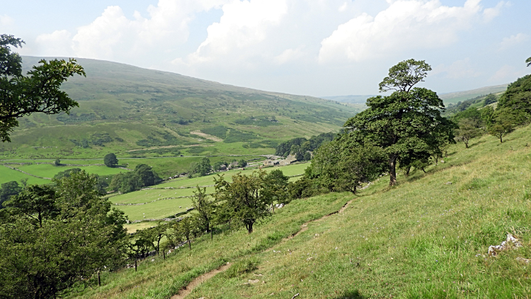 Langstrothdale
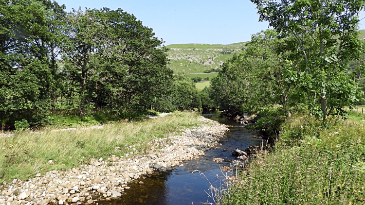
From above the trees which had been the walk since Cray and past the series of woodlands which is Todd's Wood, Hubberholme Wood, Rais Wood and Strans Wood, a transit of two and a half miles into the heart of Langstrothdale, Dave and I finally descended to the valley floor. We did that by heading down from Little House through the west edge of Strans Wood to meet the track which leads down from Yockenthwaite Moor to Top Farm. My walk on the quagmire that is Yockenthwaite Moor, that is another story for another day. After I go back and photograph it... Now, Dave and I passed Top Farm and walked on down to Yockenthwaite Bridge. To find a bit of shelter in order for us to enjoy lunch.
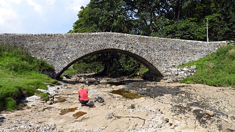 Dry riverbed at Yockenthwaite Bridge
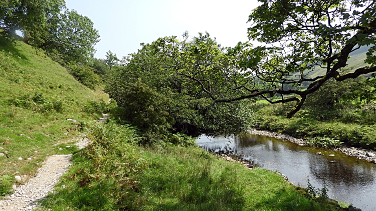 River Wharfe
It was just eleven thirty on one of the hottest days of the year when we reached Yockenthwaite Bridge but as we had walked for two and a half hours in unrelenting sunshine it was time enough for a sit down, bite to eat, and refreshing drink. Before eating though we had one question to ask ourselves. "Where is the River Wharfe?". We knew of course. Though the river bed was dry and no visible water running, as it is limestone we knew it would be running as normal below our feet. In one of the many porous cavities typical of limestone watercourses. Just another 100 metres downstream the water appeared from underground and the river ran as true as normal but here and now we could wander on the riverbed with ease, sidestepping the small pools formed on the bed. True enough, after lunch and soon after resuming the walk from Yockenthwaite to Hubberholme following the Dales Way path we came to that point where the flowing water reappeared. From there we followed the path through and besides the yellow blushed flowering buttercups of Yockenthwaite meadows to where Langstrothdale meets Wharfedale. It is a superb walk between the two hamlets, one Dave and I had enjoyed many times in the past and one we hope to enjoy many more times in the future.
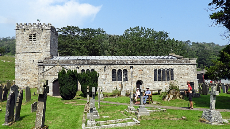 St Michael And All Angels, Hubberholme
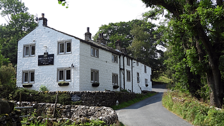 The George Inn, Hubberholme
On the one and a half mile walk of thorough enjoyment to Hubberholme we met some other walkers who were also enjoying their walk in the sun. One couple had travelled across the Pennines from Lancashire to do the walk and another couple had followed the Pennine line down from the north-east. We all agreed we could not be enjoying a better day for walking, particularly so as we were taking advantage of the relaxation of travelling rules between the first and second lockdowns of the dreadful Covid-19 pandemic. The though of that bad thing could not be further from our minds though as we rejoiced in the perfection of nature right now. Everyone had a smile, all smiling with what seemed to be no worries in the world. Which is exactly the medicine a walk like this brings. There was just one slight worry on the way from Yockenthwaite to Hubberholme though as the path passed through the middle of a field filled with cattle. Cows and calves. A Bull too which spotted us at about the same time we spotted him. Fortunately he was hidden in the trees at the field edge and showing no interest in coming out into the glare of the sun. Panic over, walk resumed. (Note: Though some of the cattle were curious, none were aggressive) Eventually we reached the village of Hubberholme. There we met and chatted for a while with a couple resting on a bench in Hubberholme churchyard before crossing Hubberholme Bridge, passing by the George Inn, and heading down the road to the finale of our walk.
 River Wharfe and Buckden Pike
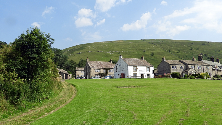 The village green in Buckden
The last stage of our walk from Hubberholme began with a 400 preamble on the edge of Dubb's Lane, the road linking Hubberholme to Buckden, before we left the road, turning left through a gate to follow a path on a field edge. This path led us back to the River Wharfe and to the point where Cray Gill falls into the river. The very point where Langstrothdale officially ends and Wharfedale officially begins. There should be a marker stone or post to signify this but there is nothing to show the great and important change. Anyway, we knew and with our walk in Langstrothdale now over we continued through the first part of Wharfedale to the finish in Buckden. It was still nice and hot so I treated me and Dave to an ice cream each from the village shop. Having enjoyed the walk, we sat on a bench on the village green to enjoy our refreshments before heading home. After a great day out walking in this most special of places.


