Hartsop, Kidsty Pike, High Raise, Rampsgill Head, The Knott, Rest Dodd, Angletarn Pikes and Boredale Hause
The Far Eastern Fells have a unique feel about them. They are less craggy and generally display less exposed rock than their Lakeland relatives yet the retain the grandeur of Lakeland giants. Of them Wainwright said "the walker along this eastern fringe constantly finds himself passing from the exciting beauty that is typically Lakeland to the quieter and more sombre attractiveness that is typically Pennine". This walk visits six of the thirty six Far Eastern Fells and each have different characteristics ranging from rounded hills on rolling fell to knolls, as much exposed rock as of grass. There are also two significant waters to visit, entirely different to each other. One was once tamed and served as a reservoir for 97 years before being reverted to its natural state. The other is as wild as a tarn can be and is possibly the most beautiful of all in the Lake District.
Google Maps Open Source Maps| Statistics and Files | ||
|---|---|---|
| Start: Hartsop | Distance: 9.8 miles (15.7 km) | Climbing: 979 metres |
| Grid Ref: NY 41003 13026 | Time: 4-5 hours | Rating: Hard |
| GPX Route File | Google Earth File | About Hartsop |
| Statistics | |
|---|---|
| Start: Hartsop | Distance: 9.8 miles (15.7 km) |
| Climbing: 979 metres | Grid Ref: NY 41003 13026 |
| Time: 4-5 hours | Rating: Hard |
| GPX Route File | Google Earth File |
Ordnance Survey Explorer Map (1:25,000)
The Walk:
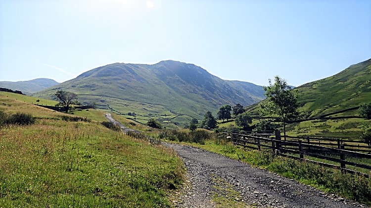 Setting off from Hartsop
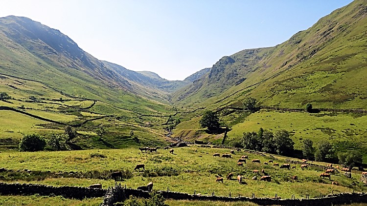 Pasture Bottom
The last time I had been in Hartsop the weather was not good. I was with Chris, Dave and Steve walking a circuit to High Street, Thornthwaite Crag and Stony Cove Pike. Cloud was filling the sky and by the time we had climbed to High Street we were thoroughly drenched. This time, all by myself, I had the best of conditions. The sun was shining and there was not one cloud in the sky. What a contrast to last time. I set off from the car park and climbed via the vehicular bridleway which follows Hayeswater Gill upstream. It is a steady unremitting climb up to Hayeswater Reservoir, 260 metres of ascent in two kilometers of walking. With hills closing me in to the left and right it could easily have been a head down 'get the job done' job but not so. There are interesting moments to enjoy on this approach to the open fells walk. First is the spectacular north face profile of Hartsop Dodd to enjoy and then there is the joy of looking to Pasture Bottom and the Pasture Valley which is flanked by Hartsop Dodd to the west and Gray Crag to the east. At the head of the valley are Threshthwaite Crag and Stony Cove Pike. I remember the rain stopping and skies clearing on that last walk from Hartsop as we climbed to Stony Cove Pike and once at the summit enjoying lunch while drying off.
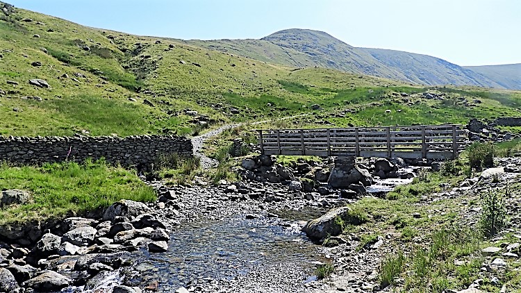 Hayeswater Gill
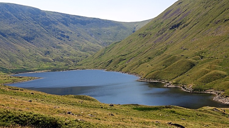 Hayeswater
The journey following Hayeswater Gill continued to provide the occasional thrill as I climbed the relentless climb. The gill, tumbling over rocks provided a welcoming sound as did the bursts of birdsong on this late Spring day. Skylarks sung as they climbed into the sky, gorgeous song. Rooks bawled out their raucous kaak kaak as I walked nearby to disturb them. I like their sound too. I came to a stone building, probably for sheltering stock in bad weather. Dry stone built and sheltered by trees on the open valley south side the slate roof could hardly be seen. It was covered in a rich carpet of fern. Further up I enjoyed the crashing sound and sight of the waterfalls. There are a few impressive ones in Hayeswater Gill. All these distractions helped me on the climb to Hayeswater which after nearly a century of serving as a reservoir has now been restored to its natural state. The dam is gone, it is back to its natural form. What a delight.
 Following the Coast to Coast path
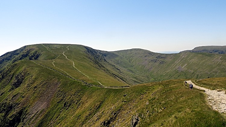 Straits of Riggindale
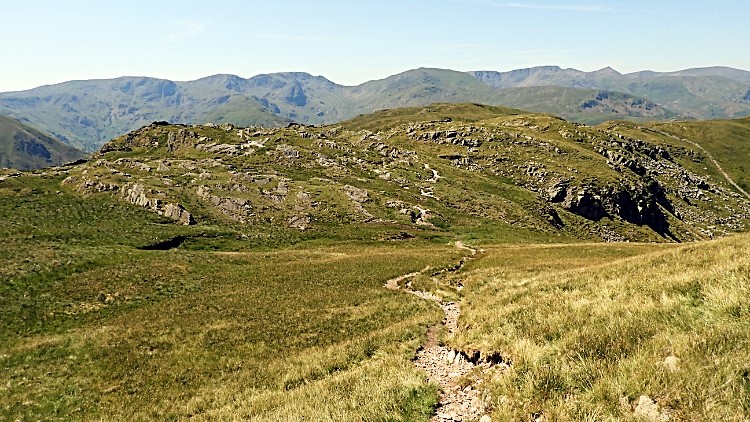
From Hayeswater I continued my climb to the high fells, now by way of a meandering path across the open ground of the west facing hill slopes. About 200 metres ahead of me I could see a couple of walkers also heaving themselves upwards. I did not catch them and nor did they make distance from me. One hundred metres of climbing further up though and they were gone, crested on to the Coast to Coast path and walking away in which direction I did not know while I continued to haul myself up to the same point of psychological comfort. Once I did get to the Coast to Coast path though the gradient had not eased. I could see a stiff climb was still required to reach the Knott. I could now see plenty of walkers, most in groups and most on the most popular long distance walk of all, Wainwright's Coast to Coast. Having done it myself, way back in 1994 and in 1999, westbound the first time and eastbound the second time, I tried to recognise the ground and recapture the moments I was here during those walks while watching the eastbound Coast to Coast walkers struggling up the steep path to the Knott. I hauled myself up too, meeting some groups as I did so. As is normally the case, and often appreciated in order to catch a breather, we talked of our walks. Long enough to be courteous and recover for the next part of the climb. It helped us all up to the shoulder of the Knott from where the gradient dramatically eased. I had climbed over 500 metres since Hartsop. There were only 40 and a bit more metres to Kidsty Pike. First part of that was following the Straits of Riggindale, a lovely passage of walk with the mass of High Street a lovely picture to enjoy as I strolled along.
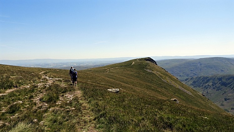 Approaching Kidsty Pike
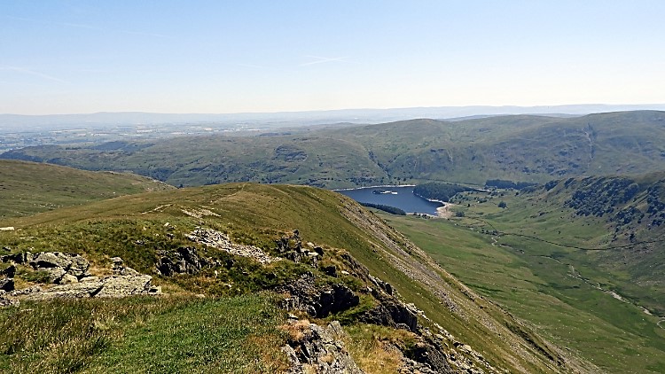 The view from Kidsty Pike to Haweswater
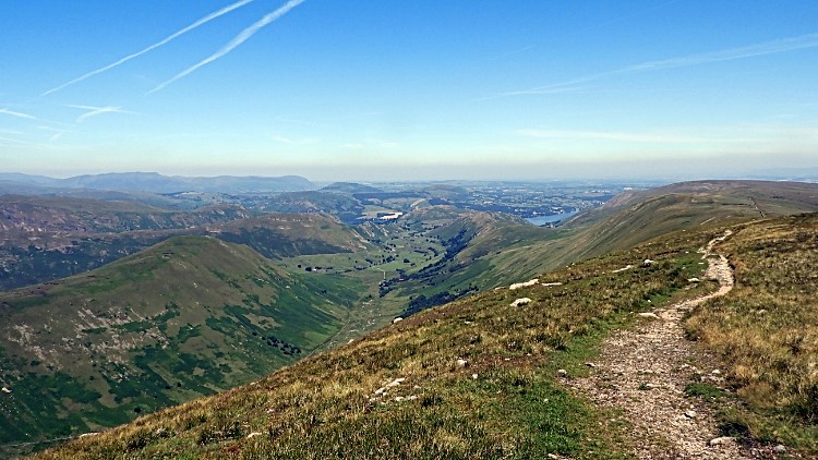
The walking was dead easy now. I was on top of the fells and rather than face a relentless climb I knew my remaining day was undulation all the way, a natural roller coaster. Still, I knew I had six Wainwright Fells to accomplish so it was not going to be an easy ride. But it was going to be a thrilling one which started for me once I had turned the corner at the south end of Straits of Riggindale and walked towards the impressive and welcoming peak of Kidsty Pike. Coast to Coast to walkers headed towards the Pike too, a bittersweet moment for them as part from Kidsty Howe this would be their last experience of the Lakeland fells during their epic walk. Soon they would fall from height to the shores of Haweswater and then head east out of the Lake District. I arrived at Kidsty Pike, my third time there. This time, by myself I could stay a while and take in the view. Before, with friends who had wanted to get on, we did not stay and dwell on the peaks. Here, this time I took it all in. Wainwright called the summit of Kidsty Pike "an eyrie perched high over Riggindale". The view from the summit itself is best looking east to Selside Pike, Branstree and Haweswater with Gatesgarth Pass to the right and Harter Fell standing aloft besides. Southward Riggindale Crag and High Street dominate the scene. North and west, well I was going that way. First to High Raise which I set my sights on, due north across a lovely shallow grassy bowl. I looked forward to that.
 The view to High Raise from Kidsty Pike
 High Raise view to Scafells, Fairfield & Great Gable
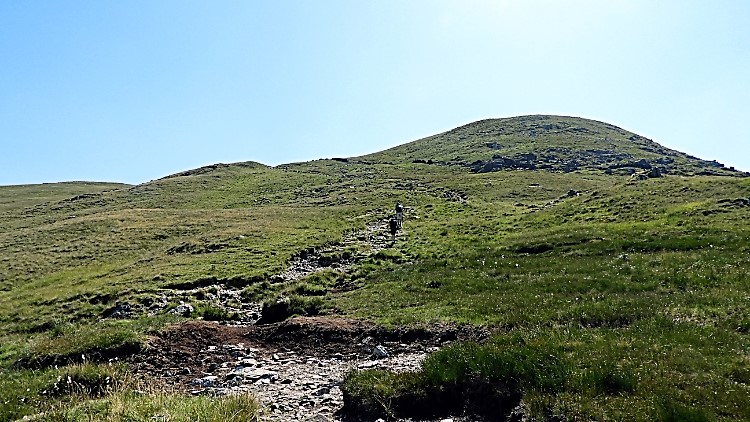
Imagine you have done all the work asked of you and now it is time to enjoy all the sweets. From reaching the summit of Kidsty Pike I was tucking in. After taking my leave of the Coast to Coast walkers I ambled away across the easy rolling and grassy uplands of the Far Eastern Fells of the Lake District to High Raise. In a kilometer of walking I dropped from the pike into the bowl and then climbed 50 metres to the summit cone of High Raise, at 802 metres my highest point of the walk. I can honestly say those 50 metres were hardly noticeable, such ease it was. While High Raise has no significant feature to its bulk or its flanks the summit is a nice assembly of erratic rocks of which Wainwright gave favourable note. The best thing for me though is the summit view. It is remarkable. To the north and east the Pennines show themselves with notable sight of the Eden Valley, Cross Fell and Mickle Fell. About due east the Howgill Fells can be identified. West is best, at least for me, especially the stunning view of Great Gable rising from behind Deepdale Hause. There are many more peaks to be seen too, most of the big boys including Crinkle Crags, Bowfell, Scafell, Scafell Pike, Skiddaw and Blencathra. High Raise hits all the high notes.
 The path to Rampsgill Head
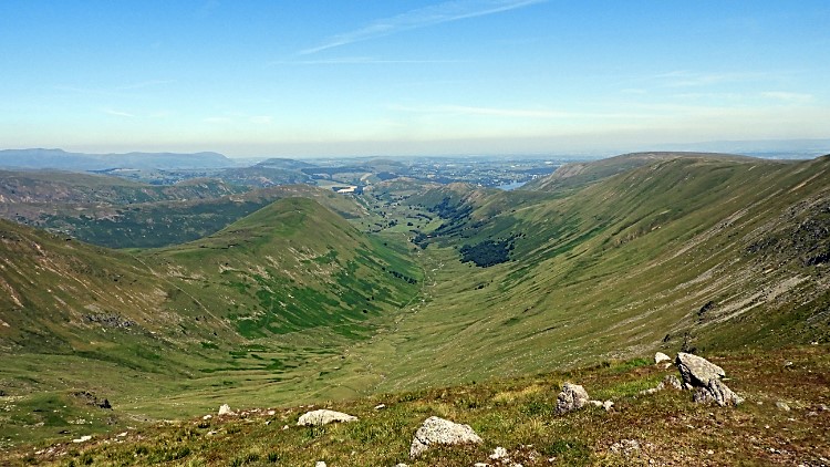 Ramps Gill Dale
From High Raise I set off southwards, back to where I had just come from. At least until I reached the Knott. There was a little deviation to the return route though. This time I kept a line parallel but slightly north of the one walked between Straits of Riggindale and Kidsty Pike. This course, south west bound from High Raise took me to Rampsgill Head, my third Wainwright of the walk. It took no effort whatsoever. Though I did climb 35 metres from the depression between the two Wainwrights I hardly noticed it. Such was the ease. In fact the only hard part of reaching the summit point of Rampsgill Head was finding it. The height and grandeur of Rampsgill Head is to be admired and enjoyed from a northern approach. Here, ascending by Ramps Gill it is everything a fine mountain climb is, with steep slopes and a craggy summit. From my eastern approach it is a doddle. The joy was in the view from the summit area though, a breathtaking one looking due north down the throat of Ramps Gill Dale, as fine a glacial valley as can be. Ullswater appeared too, showing its centre.
 The Knott
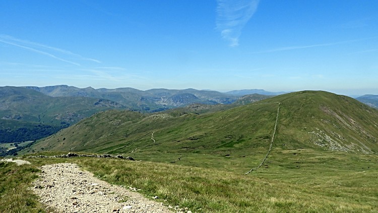 Rest Dodd
From Rampsgill Head I returned to the course of the Coast to Coast path and followed Straits of Riggindale back to the Knott. I could have climbed it earlier to claim it as my first Wainwright Fell of the day but instead I had left it for now, making it my fourth. The climb from the path was a short sharp pull up 15 metres or so. I tried a short sharp sprint, puffing the last few steps which betrayed my 62 years of going. Still, I felt good for trying and once at the top of the Knott I sat down for five minutes, motionless while looking at the enormous bulk of High Street. From the south it looks immense. I looked at the path I took to it last time, all the time walking into a storm which drenched me thoroughly once I stood on top of the mountain. Now it was calm and inviting. A shame I was going the other way. Turning my head to the right I looked down the line of Hayeswater Gill, the very same gill I had followed up to the fells from my start in Hartsop. I eyed the creation of the gill from just below Thornthwaite Crag and its straight course down the steep slopes to where it falls into Hayeswater. With my fill of the view and with breath fully recovered I stood and turned, knowing I had one more decent climb to do.
 Satura Crag
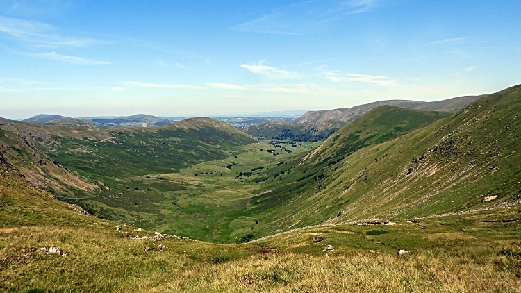 Martindale
I took a beeline from the Knott straight across the Coast to Coast Path and down to cross Well Gill following close to the wall leading me up Rest Dodd. I descended about 140 metres from the Knott before bottoming out and beginning the climb to the summit. I had 100 and a bit metres of climbing ahead of me. "Nowt much, I have already climbed five times that" I thought to myself. But, as I should have known, fatigued by the climbing earlier this 100 and a bit metres was the hardest of all day. It was pretty featureless on the climb, apart from the proximity of the wall and so I climbed in phases of 30 steps, short break, thirty steps, short break. As I do when the going gets tough. Only the 30 steps were shorter and shorter as the climb went on while the short breaks got longer and longer. I was really puffed when I reached the top of Rest Dodd. Oh, it was a blooming hot day if that helps as an excuse. I threw off my backpack and laid flat on my back near the summit of Rest Dodd, gasping for air. "I need not have done this one" I thought to myself. Deke and I had detoured up Rest Dodd on the Coast to Coast of 1999 so it was not my first time on the top of the mountain. That time it had been cloudy though, we had walked up and ran down without taking anything in. This time I looked. "Been there. And there. Going there. Let's go". Westbound I descended to Satura Crag, a lovely passage of walking past rocky outcrops and areas of cotton grass in the diminishing bogs of this parched dry Spring. I passed a group of walkers who said they had seen the local Red Deer Herd in Martindale a little earlier. They eluded me.
 Angle Tarn and Angletarn Pikes
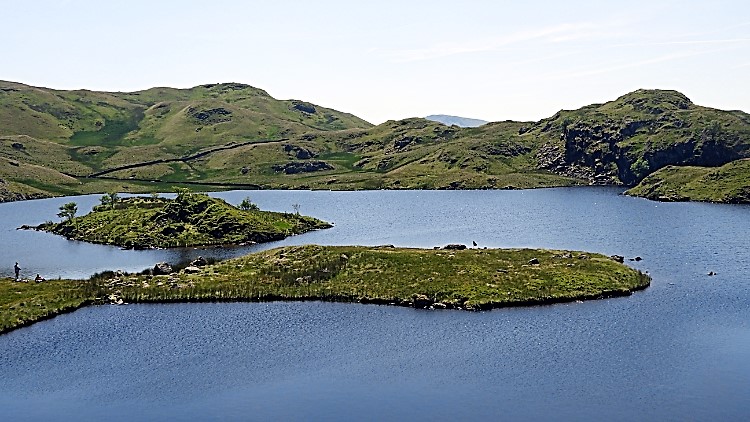 My break time view across Angle Tarn
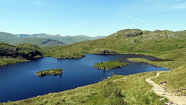
One of the highlights of my walk and the one I had most looked forward to was not a Wainwright Fell at all, it was Angle Tarn. I had walked to it twice, on both the Coast to Coast walks but while I retained a sense of its beauty from those fleeting occasions this time I had promised myself I would stop at Angle Tarn and enjoy the experience to the full. As soon as I sighted it after rounding Buck Crag I was beguiled by its beauty. I closed in as quickly as I could, wanting to be there. As I got nearer I found I would not have it all to myself, some people were enjoying the surrounds. A few were bathing, others just resting by the tarn side. Quite right too, what a good spot to enjoy the day. Not just people either, a group of sheep were grazing by the tarn. One was paddling in the water while chomping grass from the waterside. There are a couple of small islands in Angle Tarn. One was temporarily inhabited by the folk enjoying themselves. I settled down by the tarn side on a peninsula of land. Resting a enjoying lunch it was the best of times. After lunch, having already removed my footwear I went for a paddle. It was lovely.
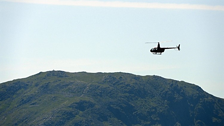 Helicopter over Angletarn Pikes
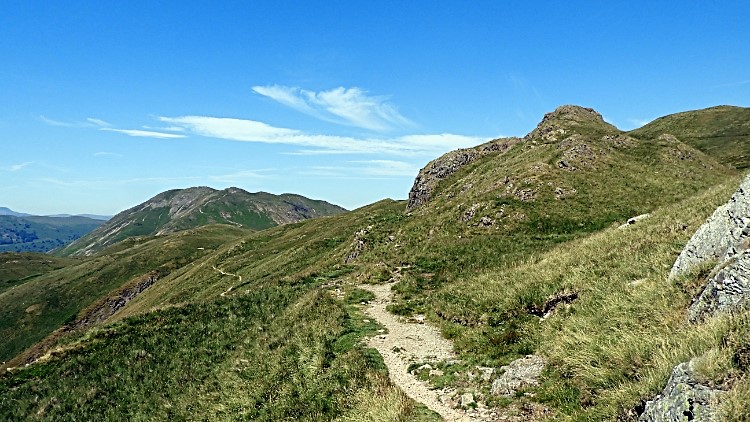 Stony Rigg
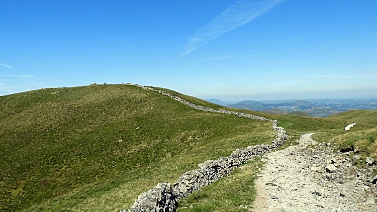
After lunch and after putting my socks and boots back on I set off to make the short scramble up Angletarn Pikes. A scramble never tires me like a climb does, I am always in my element, adrenaline rushed. As I clambered up to scramble a drone sound becoming louder drew my eyes to the sky. A mini helicopter passed just over the pikes, pilot clearly visible. Gone as quickly as he had come I made the scramble, enjoying the use of hands and feet immensely. I hope I stay the big kid as long as I can do these walks. These moments are as much a thrill as they were in my teenage years. The thrill helped me climb the 50 metres without noticing. Nothing like the exhausting haul up Rest Dodd earlier on. From Angletarn Pikes I returned to the Coast to Coast Path and rounded Stony Rigg on a heading north towards Boredale Hause. It was all downhill now.
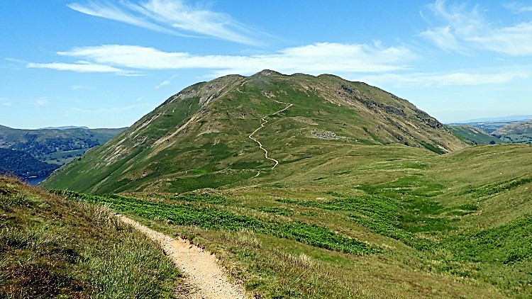 Place Fell
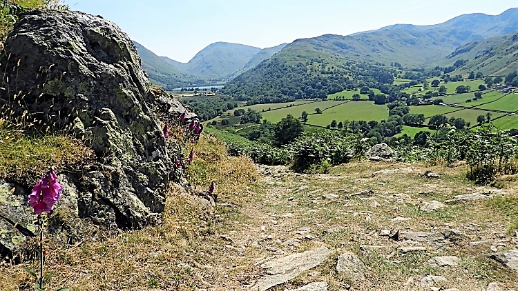 On the descent from Boredale Hause
The walk home from the fells is usually a time for relaxing and for contemplation, taking in all of the events of the walk. Not this time though, not entirely. First, not long after passing Stony Rigg and on the approach to Boredale Hause I was taken in by the attraction of Place Fell. From my view on the south side Place Fell is very impressive and the path leading to the summit from Boredale Hause via Steel Edge is a very inviting one. "I must climb this, but not today" I thought to myself. "I shall make a proper walk of it". And so another challenge was set. I looked to the slopes of Place Fell and across Boredale for the Red Deer. Again, no luck. "Not this time". I headed home from Boredale Hause on the steep path back to Hartsop. This was still no time for relaxing, the steepness of the path down required my full concentration. At 20% gradient I had to keep the brakes on. All the way to Dubhow where thankfully the path levelled off into the Patterdale valley. Now I could relax and contemplate.
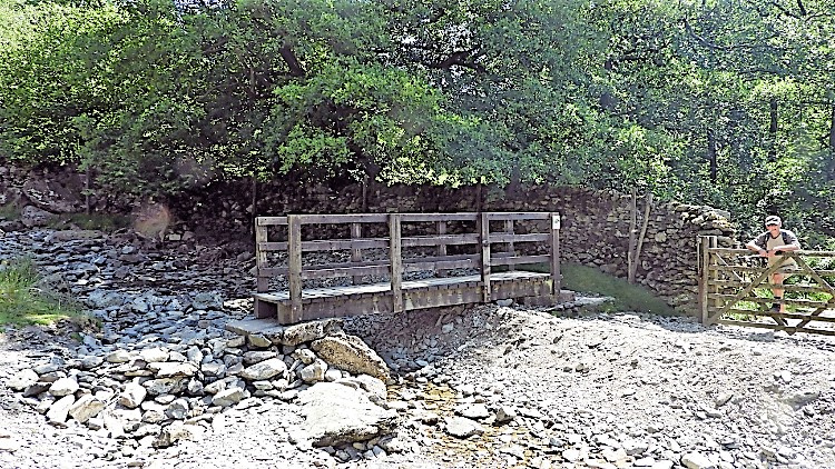 Footbridge over Dubhow Beck
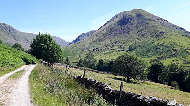 Hartsop Dodd
I crossed Dubhow Beck by way of the footbridge. More for convenience than for necessity as the beck was almost dry. Still there was enough flow of the crystal clear water for me to refresh my water bottle. I did so and quaffed the water down. It was a hot afternoon now and quite stifling in the valley. Sheep were resting by the path and taking all the shade they could. I tried to too but as soon as I took shade the flies took to me. I put my handkerchief on my head to ward the critters off. It was a constant battle with the flies from thereon. Once they had sensed my presence they kept close attention, waiting for any lapse in my defences to land and take a bite. I craved for a breath of wind to blow the flies away and I was glad once I climbed from the hollow of the path to the brow of a small hill north of Hartsop which did just that. Unhindered at last, a fine view of Hartsop Dodd unveiled on the brow of the hill which I enjoyed on the short walk back into the village. My last thought... "WOW, what a day I have enjoyed".