The Great British Walk
A personal record of my three month walk of the full length of Great Britain from north to south with written journal and photographs. Tracklogs for GPS units and for use with Google Earth are available for download for each stage.
Stage 47: Glossop to Peak Forest
Google Maps Open Source Maps| Statistics and Files | ||
|---|---|---|
| Start: Glossop | Finish: Peak Forest | Distance: 15.5 miles (25.0 km) |
| Time: 7-8 hours | Climbing: 920 metres | Total Distance: 625.9 miles |
| GPX Route File | Google Earth File | About Glossop |
| Statistics | |
|---|---|
| Start: Glossop | Finish: Peak Forest |
| Distance: 15.5 miles (25.0 km) | Time: 7-8 hours |
| Climbing: 920 metres | Total Distance: 625.9 miles |
| GPX Route File | Google Earth File |
Ordnance Survey Explorer Map (1:25,000)
Summary
This stage took me to the conclusion of my Pennine journey which serves as part of this Great British Walk. I had reached the Pennine chain near Pen-y-ghent in the Yorkshire Dales and followed it all the way south to Glossop. A few miles into this stage in Edale I would see the Pennines fall into obscurity when the familiar gritstone disappears and gives way to the limestone of the Peak District. Yet the Pennines were to have a final flourish on Kinder Scout, the mountain of revered status to the Ramblers movement. After Kinder Steve and I enjoyed a few miles of limestone hills and slopes walking to our overnight stay in Peak Forest.(Note: My walk of the South Pennines and Peak District was a part of my Great British Walk from the north coast of Scotland to the south coast of England)
Stage Report
It had been a lovely evening in Glossop. Steve and I had enjoyed a few beers in the local hostelries in the knowledge we had accommodation to return to after drinks and in knowing we would be in more austere circumstances while camping for the next two evenings. It was a nice change sitting out in the evening sunshine people watching and chatting with a few local people too. My Great British Walk was fashioned in such a way that I would see lots of new sights in the British landscape while staying in new places overnight as much as I possibly could. Glossop being one of them. While I knew the town to drive through I had never stopped before. I am glad I did, it was a nice place and the people we met most courteous. The taxi driver who drove us back from the town centre to our digs was Italian. While chatting with him during our ride he said "I came here on a visit 20 years ago and loved the place so much I never went back". Enough said.
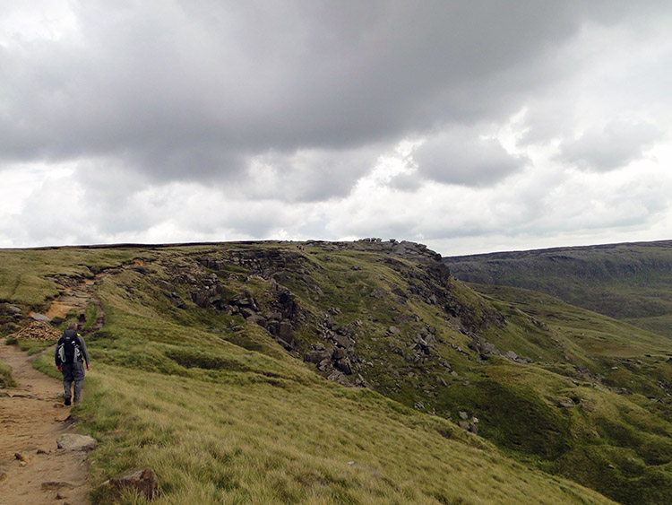
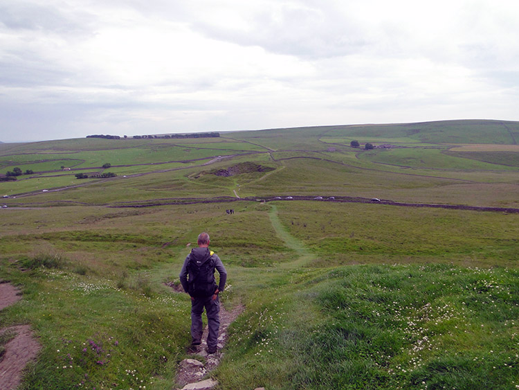
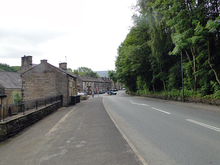 Walking out of Glossop
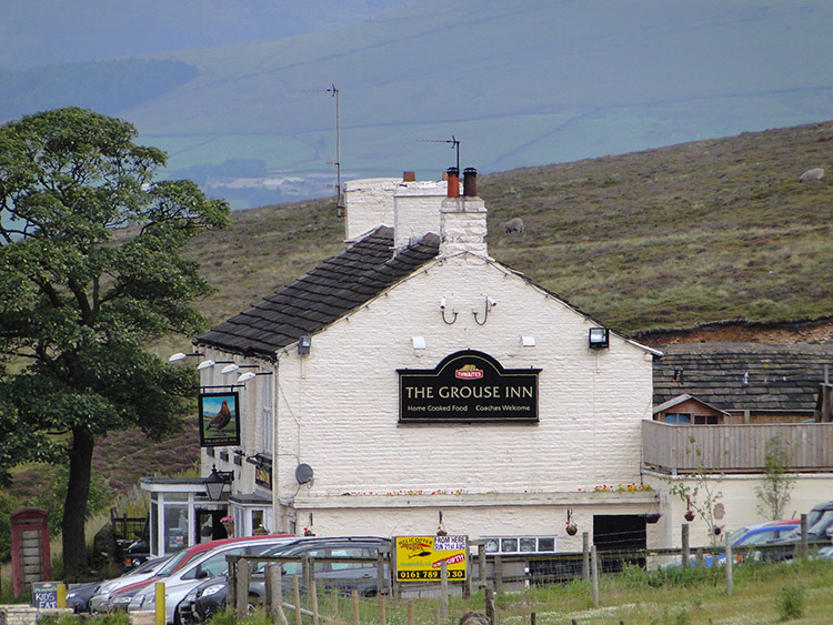 The Grouse Inn near Glossop
I left Glossop a little lighter than when I had arrived. Not that I knew at the time. A sweater my wife Lil had bought for me to keep me warm in times of need during the journey was with me no longer. I hope the finder became the keeper and appreciated it. (I must have left it in the Glossop accommodation. I was to leave or lose a few items during the walk, the first being a pair of reading spectacles which broke while commuting to the start in Inverness and the second being another pair of reading spectacles while resting on a log near Loch Lochy in Scotland).
The first six miles of today's fifteen and a bit were uphill towards the plateau of Kinder Scout. We set off on the first few along the footpaths of streets of Glossop beside the A6016 and then uphill by the side of the A624 Glossop to Hayfield road. We had an interesting diversion watching a group of people clay pigeon shooting near the Grouse Inn. Staff at the inn were catering for the shooters and as we had walked up hill to a sweat we stopped off for a glass of Orange and Lemonade each. The drinks did just the job before we left the roadside to cross moorland. (While the Grouse Inn was busy during our walk in the summer of 2011 it was closed at the time of writing in 2017. A sign of the times?).
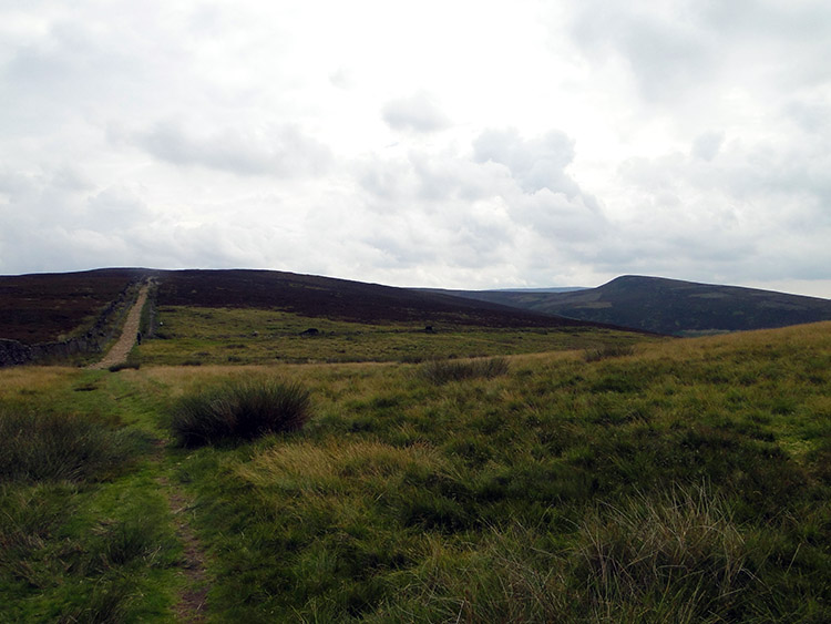 Dark Peak
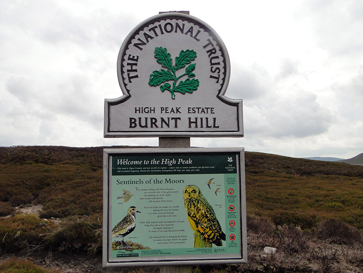 Burnt Hill
We left the roadside about 100 metres further up from the Grouse Inn by a path to our left and walked straight into the heart of Dark Peak country. The buzz of traffic was soon replaced by complete silence. Not even a Skylark broke into song through the still air. It was quite eerie. We climbed steadily towards Burnt Hill which was signed as being in the High Peak Estate. An information board invited us with the words "Welcome to the High Peak. This land is open country and you are free to explore - subject to certain conditions and occasional temporary closures for conservation management. We hope you enjoy your visit. It then told us about the 'Sentinels of the Moor' - The strange cackling call of the red grouse, the mournful wail of the golden plover, the bubbling cry of the curlew, these sounds symbolise the wild mystery of the moors. It added we may also see a Merlin or Short-Eared Owl. Not so though, nesting season was over and all was still.
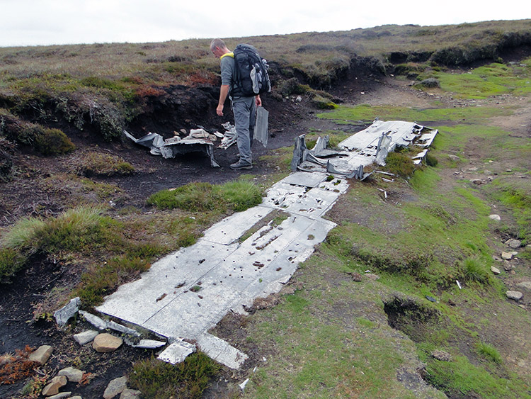 Wartime wreckage on Burnt Hill
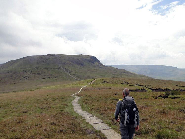 View from Mill Hill to Kinder Scout
We did take the invite to explore the moor though. Before crossing Burnt Hill I had learned there was the wreckage of a aircraft which had crashed on the moor during World War 2 and both Steve and I were determined to find it. And we did so. An American Air Force B-24J Liberator had crashed while being ferried from Burtonwood near Warrington to Hardwick in Suffolk by a two man crew on the 11th October 1944. Remarkably the two men, Creighton R. Houpt and Jerome M. Najvar survived. We diverted our attention from the walk for a few minutes to inspect the crash site and imagine what it must have been like when the plane came down. Apparently one of the crew noticed they were too close to the ground when he sighted it through a gap in cloud and the attempted climb came too late before it grounded. After the crash they managed to struggle back to the road we had just walked from and a lorry driver took them to the safety of the Grouse Inn.
After finishing our look over the crash site we reverted to the attention required to continue the walk. Walking on we crested Mill Hill which gave us the first view of our next target. As we walked across the top of Mill Hill the bulk of Kinder Scout loomed large straight ahead of us, rising from the moorland to show it was the top spot in these parts. The majesty of the sight drew us to the mountain.
 Climbing Kinder Scout
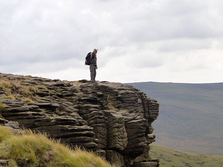 A fine view point
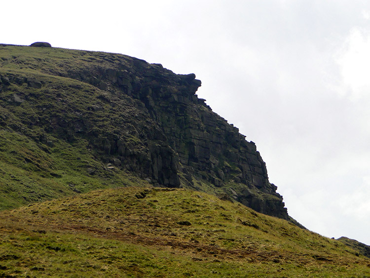
As we drew nearer to Kinder Scout we were enticed upwards by the gritstone outcrop of cliff looking out westward which form the north west extremity of the Kinder Scout formation. The feature is not named on maps but it should be, such an impressive sight it is. We scampered up to reach the top of it, a crumple of gritstone which resembled layers of melted chocolate ran over one another to form multiple layers. Steve stood on top of the cliff and looked back to from where we had walked earlier in the day.
 Walking to Kinder Downfall
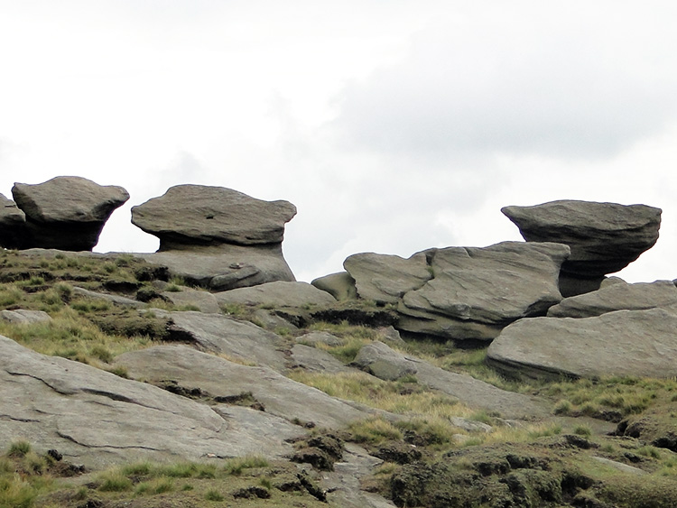 Rock sculptures on Kinder Scout
The next phase of walking was delightful. We had completed the first phase of significant climbing for the day and could enjoy a full excursion of the west side of the Kinder Scout summit while on the level. And the west side is surely the most interesting with gritstone outcrops, tables, sentinels and formations all the way along. Some of them have incredible imaginative shapes, many of which stopped me in my tracks just to gawp in awe and wonderment at them. The way in which I was pacing, stopping and wandering on this part of the walk meant it would take quite some while.
 Sun breaking through on Kinder
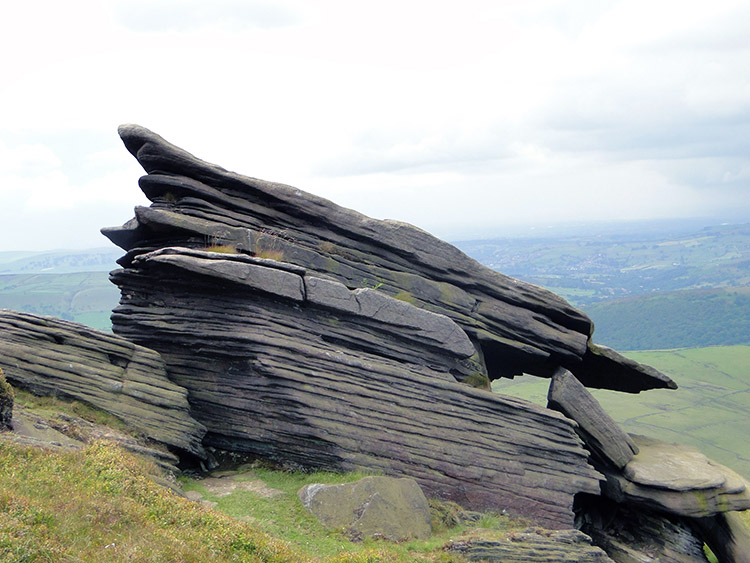 Layered gritstone
Even the weather helped in assisting me in the heightening of enjoyment while crossing the austere and erosive beauty of Kinder Scout. The sun came out and warmed up the day. It was not quite unbroken but any sight of blue sky after a slate grey morning sky is enough to help warm my mood. Which was already light in the fascination of the surroundings. Steve had walked on quite a way further along the path and stopped to sit on the edge of a corner which would have taken him out of my sight. He waited patiently for me to sate my curious wanderings. Some outcrops of gritstone were singular lumps, what one would most expect. Others were multi-layered like lines of slate. Apparently these are caused by chemical weathering where minerals have migrated through the rock as it formed. I can understand that. What I find unfathomable though as how two types can be found so near to each other as they seemed to be around this area of Kinder Scout.
 Battle of wills
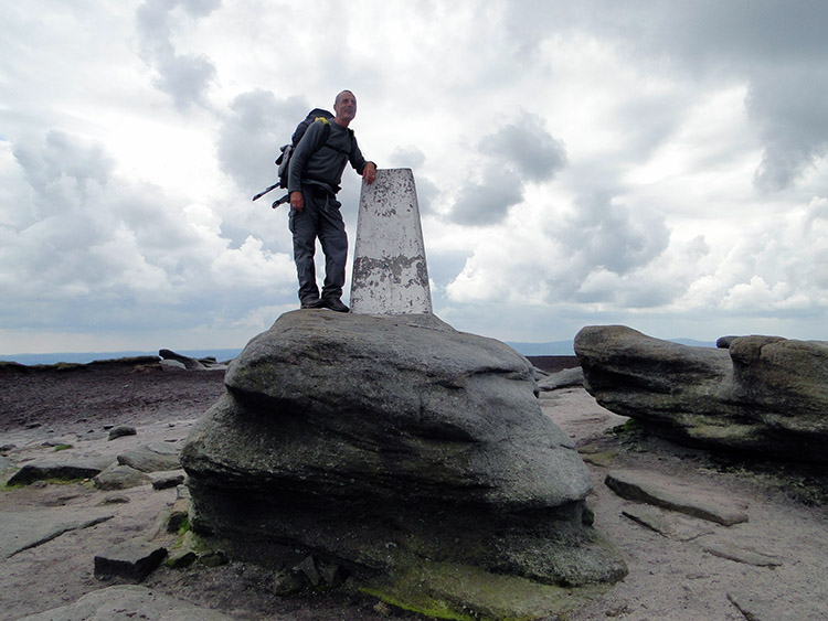 Kinder Scout accomplished
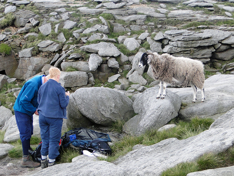
A diversion from the geology. I met up with Steve near Kinder Downfall and we stopped for a short break. As we did so we witnessed quite a humorous episode. At least for the spectators if not for some of the cast. A couple had stopped for a snack and a nearby sheep took a keen interest in them. It crossed over a postured itself on a rock to watch them get out their food. And then it rushed down to share the food. The lady remonstrated with the sheep but it was undeterred, tugging at her backpack in order to extract the prize of a snack. The lady tugged the backpack too. It was quite a tug of war. Only after a few shouts of "Get off" and "Go away naughty sheep" while grappling between lady and sheep did the intruder let go of the backpack. Even then it failed to leave the ruffled couple in peace with the lady continuing to try and shoo it away. Wonderful entertainment it was.
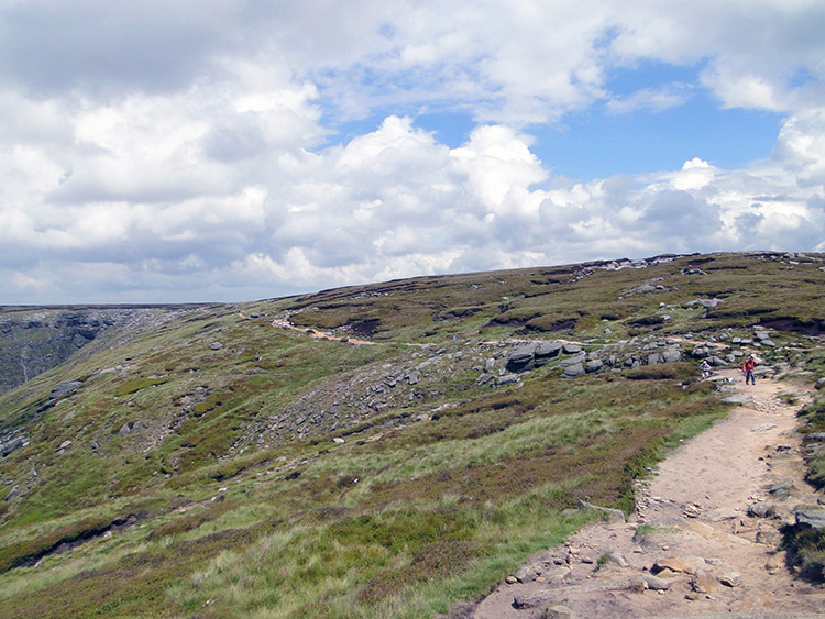
We finished our break, left the show and continued on to the trig pillar of Kinder Scout. Here the rocks were less layered, some showing no evidence of layering at all. In the melee or gritstone rocks and erosion the trig pillar was set on top of one of the larger gritstone boulders. Steve posed on top of the gritstone by the trig pillar, 633 metres high. From here it was all downhill to the Vale of Edale.
 On the descent
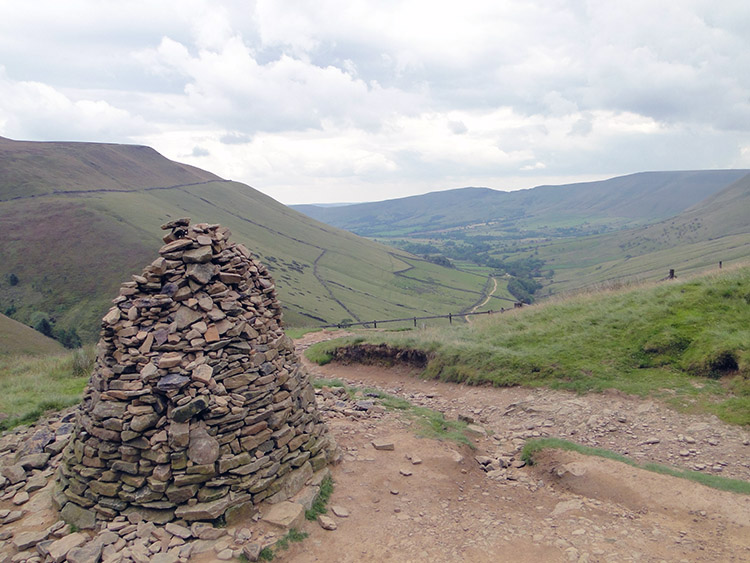 Cairn near Swine's Back
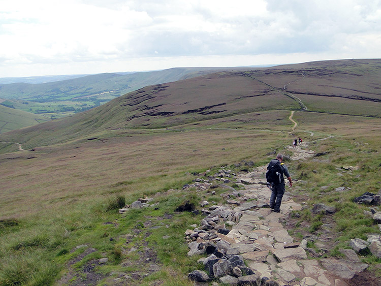
We ambled from out final Pennine mountain southbound and on the good Pennine Way path towards Edale Rock and past Swine's Back before turning eastwards to follow the sign pointing us to Jacob's Ladder. All the while we looked across Edale to the Great Ridge which we would be crossing later by climbing to Mam Tor. We passed lots of walkers on the climb as we descended, many of them cheerful in hope and anticipation of walking the Pennine Way successfully. We were near the end of our Pennine Way walk now, albeit not all of it but a fair chunk though.
 Jacob's Ladder
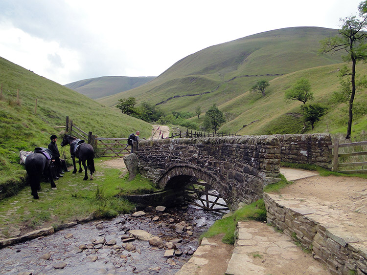 Packhorse bridge near Upper Booth
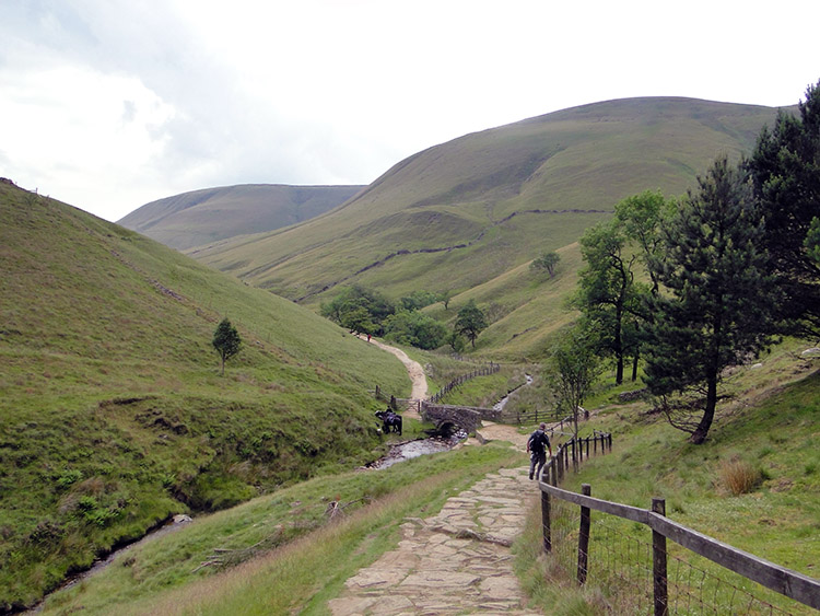
We reached Jacob's Ladder, not strictly a ladder but in fact a steep paved path, part stepped, part sloped. It is infamous to Pennine Way walkers as the first uphill obstacle on the walk. Steve and I found it nearly as tough to descend as it would be to ascend, especially as we were heavily laden with full hiking and camping gear and therefore applying the full braking system that out feet, legs and knees allowed. They all felt the full effort our caution required by them on the descent towards Upper Booth. When we got down to reach the packhorse bridge over Grain Clough at the bottom of the ladder we needed a rest as much as we would have having climbed it. We walked a little further and parked ourselves under a tree beside the clough for a lie down.
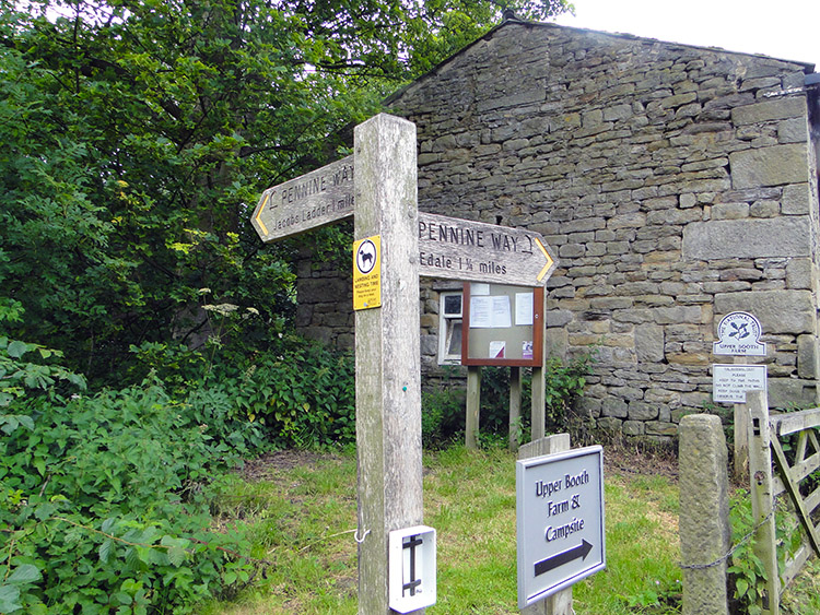 Pennine Way departure
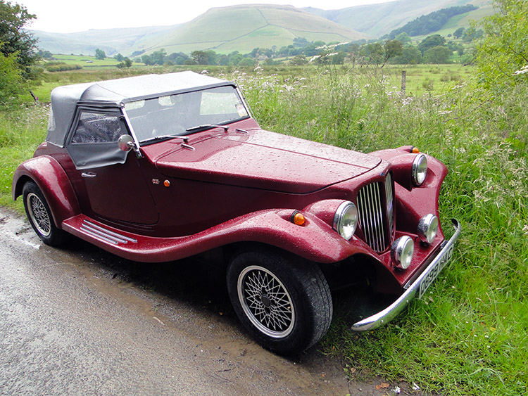 A classic
After our recovery break we stood up, laden ourselves with our walking gear and camping kit once more and strode on. We reached the tiny hamlet of Upper Booth and here parted ourselves from the Pennine Way for the last time. It would terminate in a short while in Edale anyway while we headed south-east on a path across fields and across the Hope Valley (Manchester to Sheffield) railway line to reach the village of Barber Booth. From here we continued south down the road with our sights firmly set on the climb to the Great Ridge. The road would take us all the way up, a simple get your head down and pump the legs up the hill job. Head down, 100 steps, short break... repeat, repeat until complete. That is how I do it on road climbs.
 Descending from Mam Tor
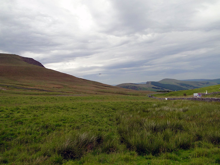 Bradwell Moor
We crossed over the Great Ridge on the road, not bothering to climb the short path to the Mam Tor summit. We had been there a few times anywhere on memorable day walks with mutual friends in the Peak District. It was 4.30pm in the afternoon anyway and we still had a way to go. So we continued down from the Great Ridge to cross the Winnats Pass Road near Oxlow House and head across the flat Peak District country of Bradwell Moor towards Old Moor. The crowds of people we had occasioned with on Kinder Scout and on the slopes of Mam Tor were now all gone. It was just the two of us.
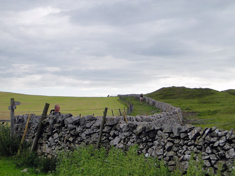 Lane near Ox Low
 Ox Low Rake
The going across the fields took a bit of care in negotiating. The path was clear enough on the map but less so on the ground as it was seldom walked. No footfall, no evidence apart from the stiles and gates at each field boundary. At Old Moor we had a bit of help by joining the path of the Limestone Way but we left it soon after to follow a path along the east edge of Ox Low hill. Eventually the path became a bridleway through the woodland of Ox Low Rake. All was easy now.
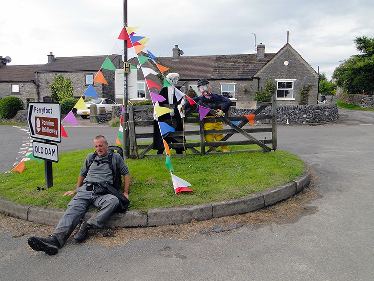 Feeling like an old man in Old Dam
 Time for bed
The bridleway led us from Ox Low Rake all the way to the Old Dam part of Peak Forest which must have been enjoying a festival. We came across straw and cloth people displayed outside properties in the village. First there was a Milkmaid and then there was a pair of Bakers, one young and one old. These were followed by a judge and a farmer entitled 'Gown and Country'. Steve slumped beside them. We then came across a drystone wall builder, a fisherman, a garage mechanic and a surgeon. There were more besides.
We looked for the place where we had booked to camp. With luck it was in a paddock very near to the village pub. So we pitched camp, rested a short while, washed and scrubbed up as best we could and then we went to the Devonshire Arms for dinner and a couple of beers. Very pleasant it was. Sat out in the back garden area after dinner we chatted with some visitors and locals alike. It was a fine end to a fine day. After retiring back to the tents we were soon out for the count. An epic walking day done and 47 stages of my Great British walk completed. Just 30 to go!


