The Great British Walk
A personal record of my three month walk of the full length of Great Britain from north to south with written journal and photographs. Tracklogs for GPS units and for use with Google Earth are available for download for each stage.
Stage 42: High Birkwith to Airton - Dave's Story
(My brother Dave had joined me for this stage of the walk. This is his story which includes photographs he took on the walk)
Route shown in multiple map formats (opens in new window)
| Statistics and Files | ||
|---|---|---|
| Start: High Birkwith | Finish: Airton | Distance: 17.3 miles (27.9 km) |
| Time: 8-10 hours | Climbing: 727 metres | Rating: Hard |
| GPX Route File | Google Earth File | About the Yorkshire Dales |
| Statistics | |
|---|---|
| Start: High Birkwith | Finish: Airton |
| Distance: 17.3 miles (27.9 km) | Time: 8-10 hours |
| Climbing: 727 metres | Rating: Hard |
| GPX Route File | Google Earth File |
Ordnance Survey Explorer Map (1:25,000)
Summary
This stage of the walk is journeyed entirely within the Yorkshire Dales National Park. The path leads directly south from High Birkwith to Horton in Ribblesdale and continues south to Stainforth before cutting south-east to Winskill via Catrigg Force. Then it is southwards again to Victoria Cave and Attermire Scar before turning due east across Kirkby Fell to Malham Cove before resuming south once again along Malham Beck and the newborn River Aire to Airton.(Note: My walk of Cumbria and the Lake District was a part of my Great British Walk from the north coast of Scotland to the south coast of England)
Dave's Stage Report
With this stage of the walk being fairly close to home I had the luxury of a night’s rest in my own bed, however it did mean an early start and after the journey back to the previous days finishing point we were off again. The start of the day was once again promising with the sun peeping through the early morning misty cloud, and it wasn’t long before that cloud broke and the warmth of the morning sun started to warm our weary limbs.
After a short farm road walk we were soon heading up with a pleasant walk across a couple of fields following a not so well trodden path to meet up with the footpath of the well-trodden Pennine Way. This short leg across the fields also gave us views of the Yorkshire Three Peaks and our conversation apart from general chit chat we also dwelt on reminiscing about our other walks across these hills and the challenge of the Yorkshire Three Peaks walk itself.
A short steady climb was soon behind us and we had warmed up nicely as we started to make our way off the first hill and descended into Horton in Ribblesdale. The village is noted for being the starting point for the 25 mile long Yorkshire Three Peaks walk over the three biggest hills in Yorkshire, Pen-Y-Ghent, Whernside and Ingleborough.
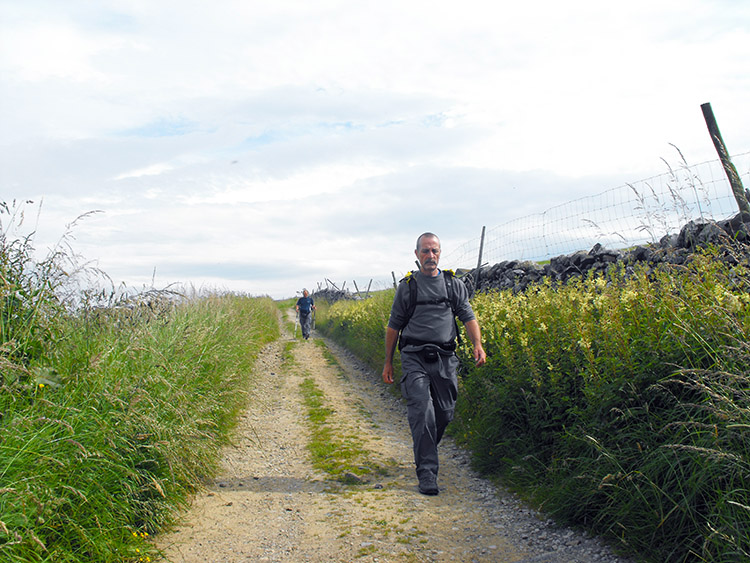
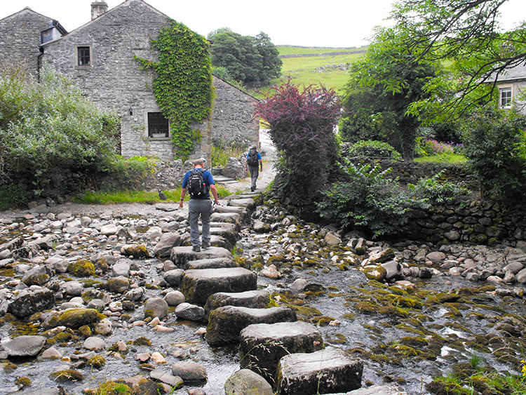
This time our walk was to take us in the other direction out of Horton in Ribblesdale and a fairly flat one as we started out towards the next village on our path, Stainforth. Our route took us over a few fields and followed The Ribble Way along a path that wove back and forth alongside the river Ribble. This part was nice but soon a short bit of road walking is to spoil the tranquillity.
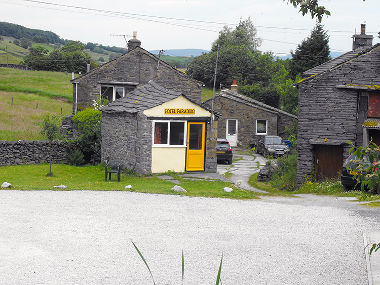
We hit the road at the Hotel Paradiso at Helwith Bridge and decided to take a five-minute break before the last couple of miles that will be mostly on the road before we reach Stainforth. The road walk was tedious and noisy with a constant stream of traffic, however we got our heads down and pushed on, Stainforth was our lunchtime spot and a pleasant place to stop for a while.
A brief stop for light refreshment in the Craven Heifer at Stainforth and we were once again on our way, this stage we knew was now going to be more strenuous with the rest of the day on the moors. We were now making our way from Stainforth to Malham and although it was going to make us work it was also going to surprise us with its hidden beauty and picturesque views, yes we were going to be rewarded for our efforts.
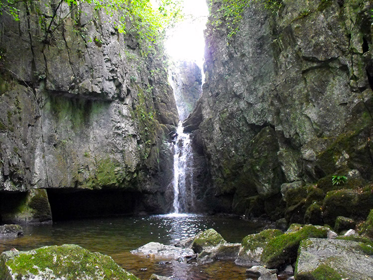
It wasn’t long and after a steep uphill out of Stainforth we reached the first of our surprises with the hidden gem of Catrigg Foss, a waterfall and pool tucked away off the main path and well worth a visit. On this visit the serenity was disrupted by a group of men whose visit included bottles of vodka and other spirits including their noisy high spirits, we exchanged generalities and as we parted I was hoping they would leave the place as tidy as they found it.
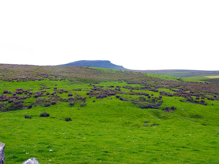
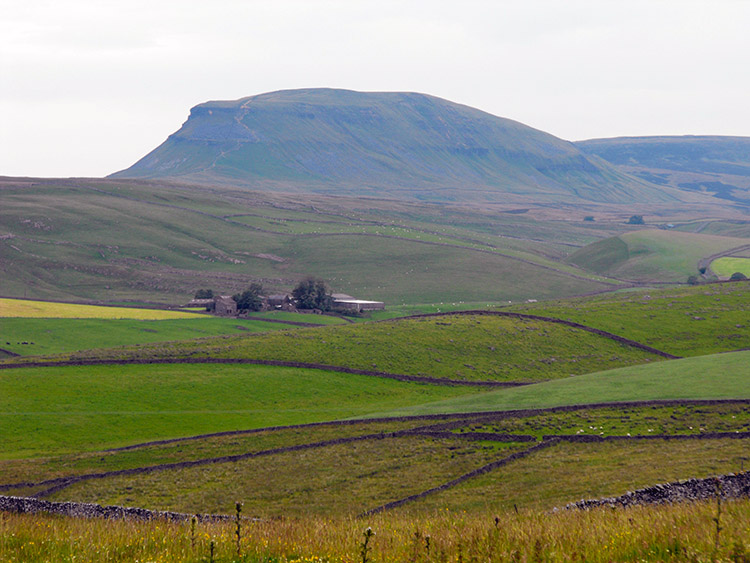
Now on the open moors the vista opened up and in the distance the view of Pen-Y-Ghent looks magnificent in profile. On to the moors and the steepest climbs have been done, the remainder of the day’s walk was expected to be steadier with less strenuous hills. The steady part was the hills however at one point a boggy path did prove to be cumbersome but this bit was short lived and soon we were back onto better ground.
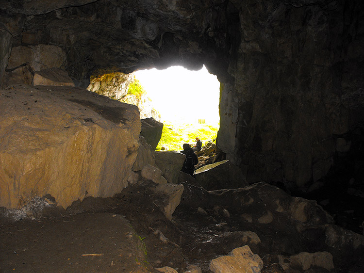
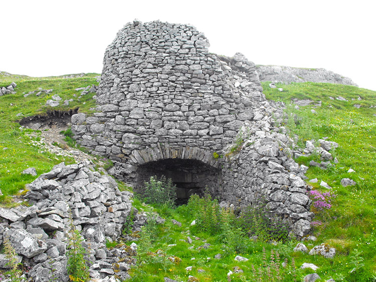
Our next surprise was again one that was a little off track, however the splendid Victoria Cave shouldn’t be missed and worth visiting if you’re passing this way, the cave on this visit also proved useful as a shelter from a passing shower. The day has been mostly sunshine but we have on a couple of occasions put on some light weight waterproofs, the odd shower did get heavy for a couple of minutes and the wind on the hill put a slight chill in the air.
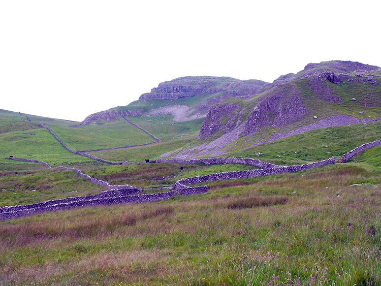
Looking ahead from Victoria Cave the path we were to take was to take us through limestone countryside and past the remote and spectacular Langcliffe and Attermire Scars.
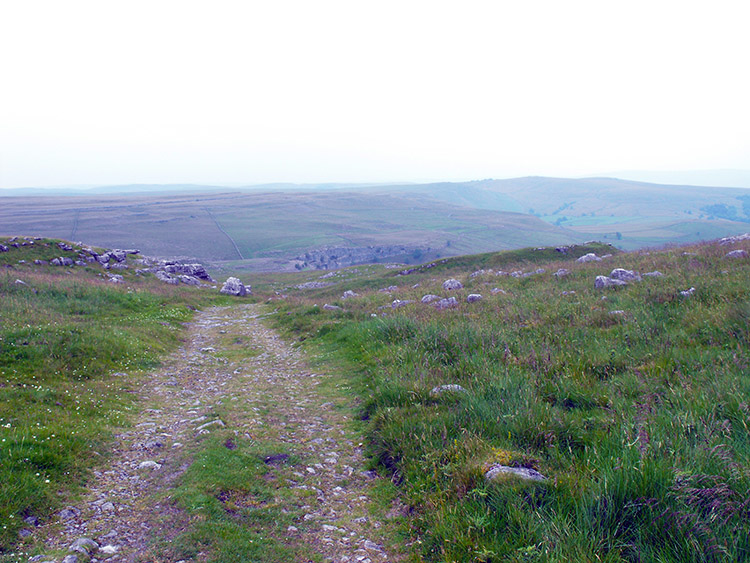
Onwards across wild grass fields, through rickety wooden gates and aside sturdy limestone walls we made our way to Malham, the path itself was well trodden with some of it being farm tracks however we did encounter one hazard with a group of aggressive cattle causing us to detour around them.
The path from Stainforth to Malham seemed a long stretch, however our next surprise and the view of a misty Malham Cove showed we were getting nearer to the village of Malham and it looks like it’s downhill all the way. The rain had gone, the mad cows had gone, the moors were turning into green valleys and streams and we were able to see Malham village and beyond Malham was Airton, our final destination of the day.
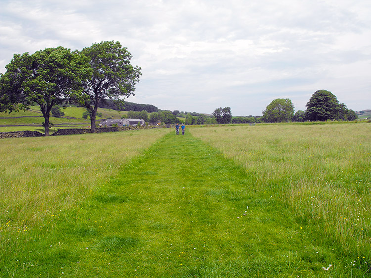
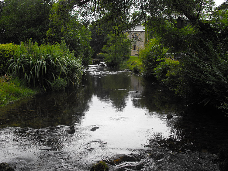
Malham and time for a brief stop to replenish with an ice cream and to reflect, now the day’s hard work is well and truly over and all that is left is the short riverside walk from Malham to Airton. The final 2-mile riverside walk wasn’t as easy as expected with well sodden ground that had the effect of slowing our steps and by this time our legs had tired enough. Finally, on the other side of the river Airton came into view and a small bridge took us across to our finishing point of the day. 15 miles with aches and also with smiles.


