The Great British Walk
A personal record of my three month walk of the full length of Great Britain from north to south with written journal and photographs. Tracklogs for GPS units and for use with Google Earth are available for download for each stage.
Stage 42: High Birkwith to Airton
Google Maps Open Source Maps| Statistics and Files | ||
|---|---|---|
| Start: High Birkwith | Finish: Airton | Distance: 17.3 miles (27.9 km) |
| Time: 8-10 hours | Climbing: 727 metres | Total Distance: 551.3 miles |
| GPX Route File | Google Earth File | About the Yorkshire Dales |
| Statistics | |
|---|---|
| Start: High Birkwith | Finish: Airton |
| Distance: 17.3 miles (27.9 km) | Time: 8-10 hours |
| Climbing: 727 metres | Total Distance: 551.3 miles |
| GPX Route File | Google Earth File |
Ordnance Survey Explorer Map (1:25,000)
Summary
This stage of the walk is journeyed entirely within the Yorkshire Dales National Park. The path leads directly south from High Birkwith to Horton in Ribblesdale and continues south to Stainforth before cutting south-east to Winskill via Catrigg Force. Then it is southwards again to Victoria Cave and Attermire Scar before turning due east across Kirkby Fell to Malham Cove before resuming south once again along Malham Beck and the newborn River Aire to Airton.(Note: My walk of Yorkshire was a part of my Great British Walk from the north coast of Scotland to the south coast of England)
Stage Report
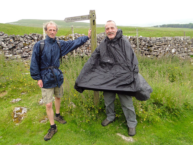
After spending the first of two evenings at home and enjoying the comfort of my own bed for the first time in weeks the breaking of morning brought the realisation that being at home was temporary. Immediately after breakfast it was back to the task in hand. Lil drove Dave, Steve and me back to High Birkwith so we could resume the walk south through the Yorkshire Dales. On arrival at High Birkwith and after giving my lovely wife a hug we were soon on our way on the 42nd stage of my Great British walk. This stage was notable in that it would get me to my nominal half way point. I had earmarked the point of passing Pen-y-ghent as the halfway mark. Though at 530 miles done it would prove to not be exactly halfway on the mileage counter I had originally calculated halfway to be achieved somewhere near Pen-y-ghent. And as Pen-y-ghent is one of my favourite Yorkshire Dales mountains the estimation was good enough for me.
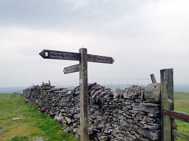
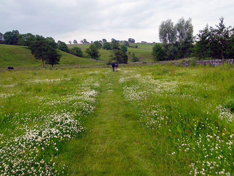
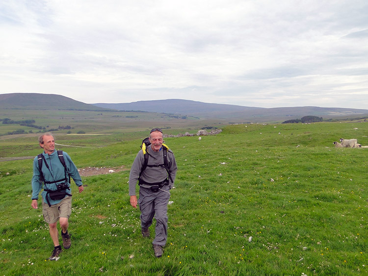 Following the Ribble Way
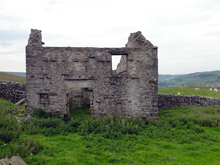 Abandoned building at Sell Gill Holes
We walked following the road which Lil had driven up to drop us off at the start. It was an unfamiliar road which I had never travelled before yesterday. Who would travel to a dead end bar the dwellers of the farm at its end and ones making farm deliveries that is. After a half mile of walking we left the road by a path heading across a field to our left. The path led us to the Ribble Way path but this again was unfamiliar to me. Though I had walked much of the Ribble Way in the Yorkshire Dales National Park I had not walked this bit. The Ribble Way path led us to Sell Gill Holes where an abandoned building stood defiantly against the elements.
 Pennine Way to Horton in Ribblesdale
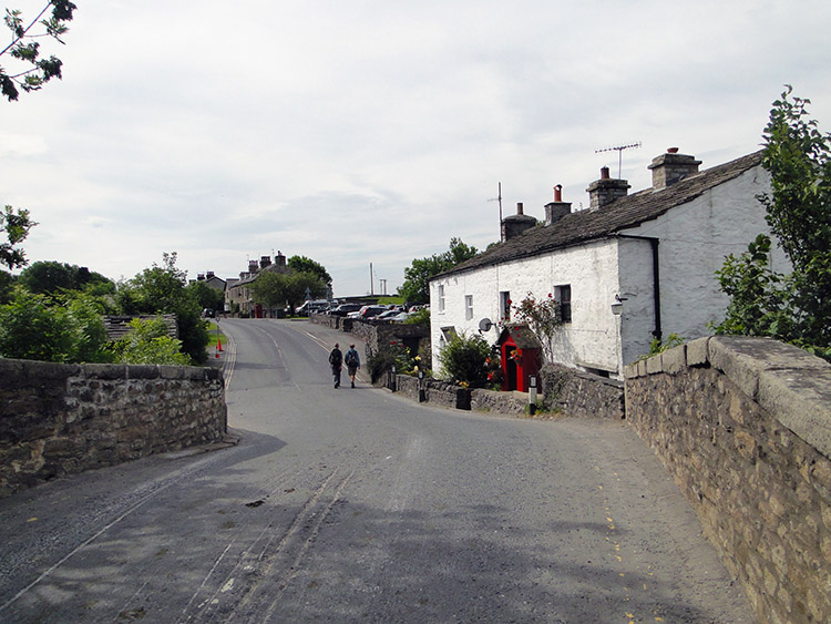 Horton in Ribblesdale
At Sell Gill Holes there was a meeting of paths. While we continued along the Ribble Way it now joined the Pennine Way which we followed to Horton in Ribblesdale. Though we were to leave the Pennine Way in the village we would rejoin it later in the day at Malham. And then the course of the Great British Walk would follow the Pennine Way all the way to its end point in Edale. Enough of that for now, there will be much more about walking on the Pennine Way as it happens. Now in Horton I had to leave it for a while.
After three miles of walking by ourselves in which time we had not met another walker things changed in Horton in Ribblesdale. The Yorkshire Three Peaks walk starts here and there were plenty of people milling around in the village preparing for the challenge. They looked fresh, early in the day and before any effort had been taken to cover the marathon distance. How would they look at the end of the day? How would we look after our particular challenge of a mere 17.3 miles this day.
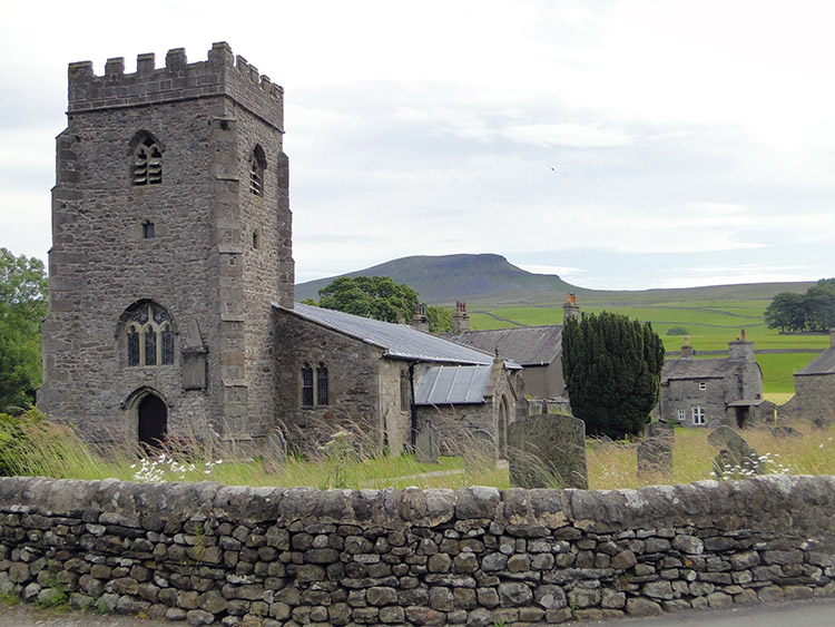 Horton in Ribblesdale Church
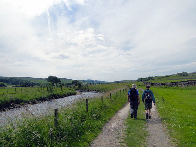 Alongside the River Ribble to Helwith Bridge
After walking the length of the village with the crowds thinning as we went along we left the roadside path by Horton in Ribblesdale Church and followed a path south-west to make acquaintance with the River Ribble. We had walked part of the Ribble Way earlier without meeting the river itself. Now we had. We followed the course of the river south to Helwith Bridge, sometimes beside the bank of the river and sometimes a field apart. As the river meandered the path maintained a straight line.
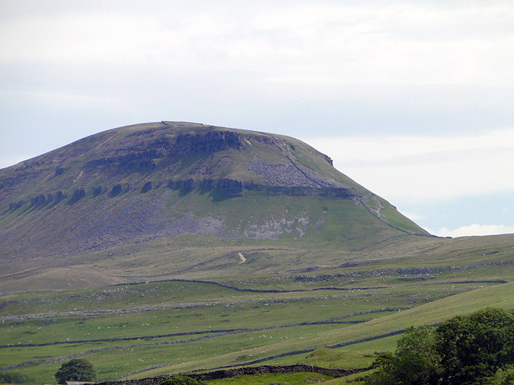 Pen-y-ghent
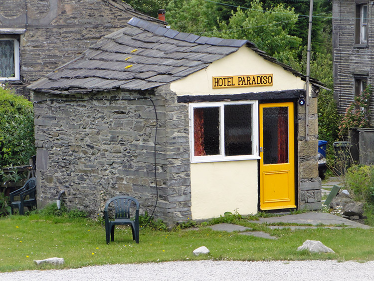 Hotel Paradiso Bunk House
As we walked the mile and a half from Horton in Ribblesdale to Helwith Bridge we were often drawn to look right to beyond the river. The sight from around here to the north-west aspect of Pen-y-ghent is magnificent. Though the mountain is shapely and a sight to behold from all sides it looks truly enormous from the near south-west. I remember once walking from Helwith Bridge to Pen-y-ghent via Churn Milk Hole and thinking "how am I going to climb that". It was an intimidating sight. Now with time bringing me hindsight the intimidation has turned to respect.
Eventually we reached the end of our walk beside the River Ribble at Helwith Bridge. We stopped for a short break and while doing so looked across to an outbuilding of the Helwith Bridge Inn called Hotel Paradiso. It is a bunkhouse which, had home not being an option while nearby, may have been the place we stayed. It looked a fun spot to bunk out in with a pub at the other side of the car park and that amazing view of Pen-y-ghent on the doorstep.
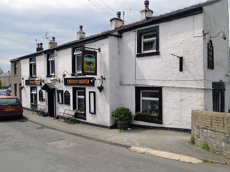 Craven Heifer, Stainforth
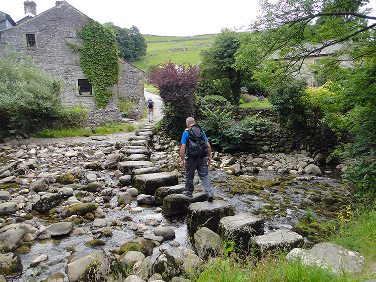 Stainforth Beck Stepping Stones
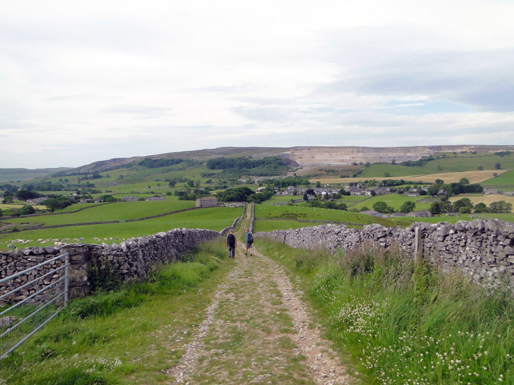
The next section of walking on my Great British Walk was akin to a pub crawl, albeit a mile and a half pub crawl between Helwith Bridge Inn and the Craven Heifer in Stainforth. Unfortunately, as with many of my pub crawls in the past, a walk along a busy road linking the two pubs was necessary. From Helwith Bridge we were obliged to walk on the side of the B6479 for one mile. Though never to motorway or A road capacity traffic did flow along the road regularly and some of the traffic were heavy wagons from the local quarries. When they approached we stepped off the roadside onto the uneven grassy verge. While safer it was difficult to walk on so as soon as the danger was passed we stepped onto the road again. We were happy to see the back of that mile.
At the end of the trafficked mile we followed a path across a few paddocked fields which led us into the gorgeous little Dales village of Stainforth. I managed water company works renewing water supplies in Stainforth some years ago and fell in love with the village then. I had visited many times since, often calling into the Craven Heifer for a drink. And to mark the visit to Stainforth during my great walk we did so again. Only this time we enjoyed tea and coffee instead of ale. After refreshments at the pub we left the village by crossing the stepping stones over the dry bed of Stainforth Beck to head for one of my all time favourite Yorkshire Dales places.
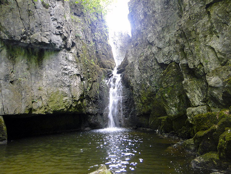 Catrigg Force
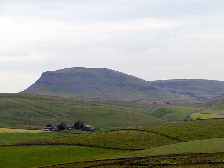 View of Pen-y-ghent from Winskill
About three quarters of a mile from Stainforth is a hidden world. It is a gem of a place and the type of setting you would find in a children's book. It is a place of adventure, a treasure secluded from the unknowing who will walk past without realising the delightful experience they are missing. It is the setting of Catrigg Force, a waterfall hidden from view in a secluded copse which you need to look for. A sign points the way from the track we followed from Stainforth. If the sign was not there and you did not know about you would walk past oblivious of the hidden treasure. From the sign we walked down the winding path to the top of the copse tree line and then from the light into the dark hidden world. The sound of the plunge of water led us to Catrigg Force. It has a vertical drop of six metres into a lovely step pool. It is said this was one of Edward Elgar’s favourite places. It evokes Pomp and Circumstance for me.
We had expected to have Catrigg Force to ourselves but sadly we found ourselves in company. Normally this would not be a problem as I would have shared the enjoyment of the place with those we met and waxed lyrical on the beauty of Catrigg Force. Only we could not do so. There were a handful of men and they could not speak English. This was obvious when they nodded at the greeting I offered. Then we noticed they were lethargic and one of them was holding an opened bottle of Vodka. Another secluded a bottle behind a rock. On the sight of what was going on we took ourselves away from the group, enjoyed a little more of Catrigg Force while wishing for a better visit and climbed out of the hidden wonder world. Though it was slightly tainted this day. Worse still as we reached the top and crossed to the top of Catrigg Force we found another of the group at a makeshift camp and cooking in a big pot. They were settling in. We headed off.
 Rain at last
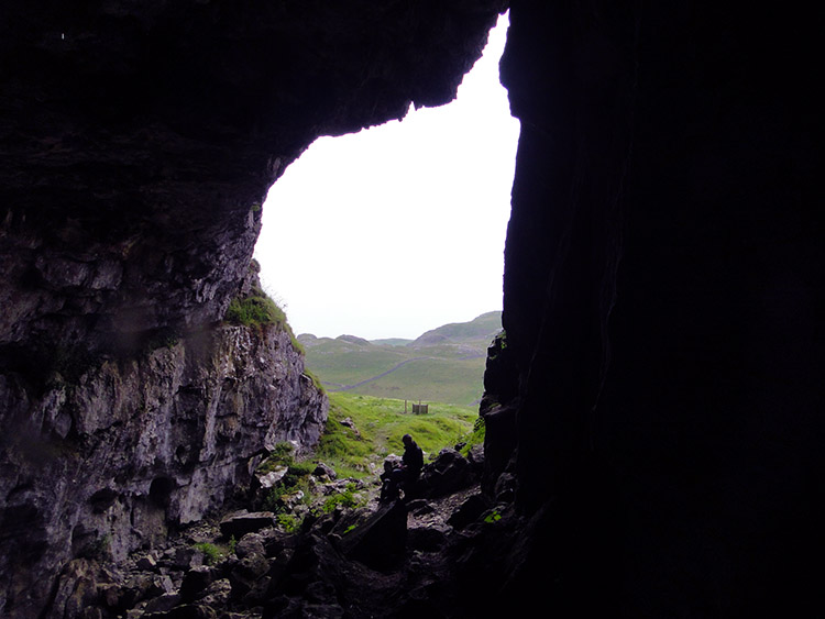 Victoria Cave
The dismal sight left behind at Catrigg Force was compounded as we passed the erratics of Winskill Stones while on the way to Victoria Cave. It rained! While rain does not usually elicit an exclamation mark this time it did. Since Steve had joined me in Scotland over a week earlier we had enjoyed wonderful weather conditions. The wet weather gear had been safely stowed away and while I had used mine quite a lot in Scotland Steve had not used his at all. Until now that is. It rained for a full five minutes!
We reached out next point of interest in the dry. Victoria Cave is the most famous of all caves in the Yorkshire Dales and simply had to be an inclusion in my long walk through the country. Victoria Cave was discovered in 1837 and since then has been completely excavated. Within the cave, scientists found an amazing record of climate change in the Dales over thousands of years, much of it in the form of animal remains. The earliest, at 130,000 years old, included those of hippos, narrow-nosed rhino, elephants and spotted hyenas. It seems as if at that time, the hyenas were using the cave as a den and dragging scavenged bones back to it. There were no hyenas today though, just the Walking Englishman and friends.
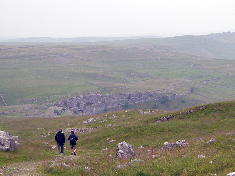
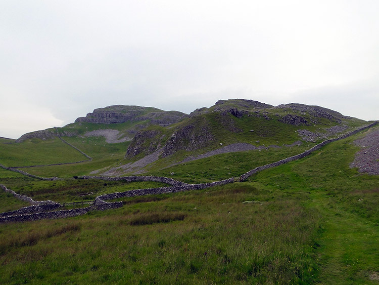 Attermire Scars
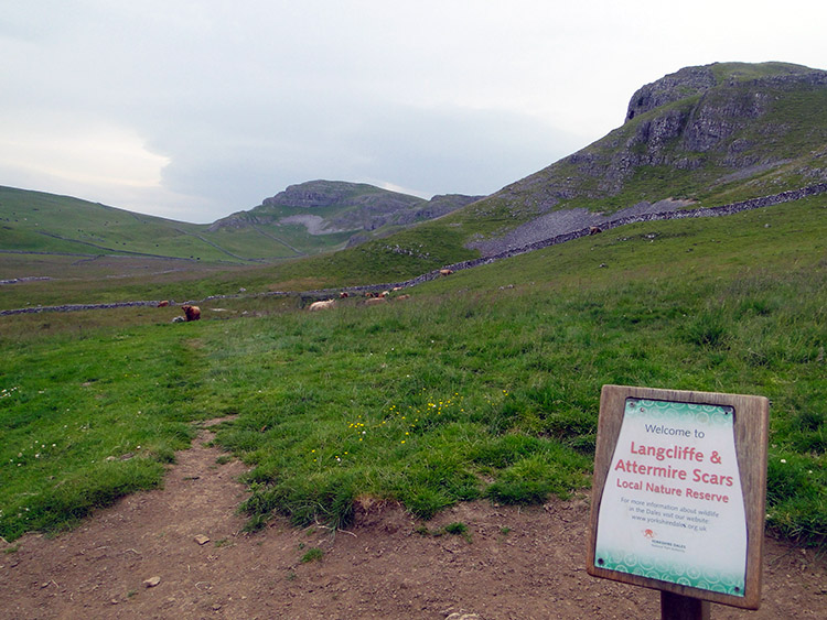 The scars as seen from Kirkby Fell
After enjoying the atmosphere of Victoria Cave we continued on through the remarkable landscape of the Yorkshire Dales. Now enveloped in limestone country we enjoyed the spectacles of the jagged white outcrops at Attermire Scar, Langcliffe Scar, Great Scar and Grizedales. Limestone breaks out of the ground everywhere around here and the imagination works its will creating imaginary shapes from the outcrops. The scene is never the same. It shifts with thought. It is magnificent walking country, my home ground, the perfect environment to accommodate the half way point on my long journey.
 Kirkby Fell junction
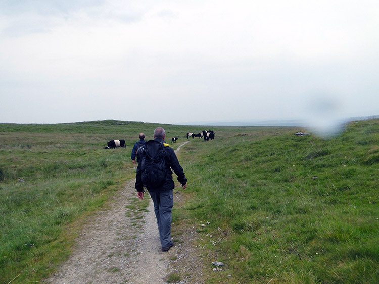 Approaching the Galloways
With minds wandering in the shifting shapes of the landscape we reached Nappa Cross without really noticing and then after passing Kirkby Fell we crossed the open ground of Fair Sleets Gate which led us towards Malham Cove. As we crossed the exposed upland a second rain shower of the day swept across the sky. As with the first it soon passed and we continued walking towards the iconic sight of Malham Cove. We were interrupted on out course. Ahead of us we saw a small herd of young Galloway Cattle and we saw that amidst them was one Highland. What happened next will stay with me in thought.
Three of the Galloway Cattle took it in turns to hassle the Highland and mount it. There were no romantic intentions here. The Galloways were aggressively bullying the Highland which kept trying to gain distance between it and the aggressors. They were persistent in harrying the besieged Highland. Only as we drew nearer to the herd did their actions change. They let the Highland go and focused their attentions on us. First they eyeballed us without moving and then they began to approach us. I know we should have held our ground and shooed them off or even whacked the lead one on the nose with my walking pole but we didn't. We panicked and scampered. They saw the panic and chased. Luckily the limestone clints and grikes all around the open fell helped us evade the harrying cattle. We stepped onto the limestone pavement and they were scuppered. Now we could gloat. We gloated. They walked off in a sulk.
 Looking to Malham Cove
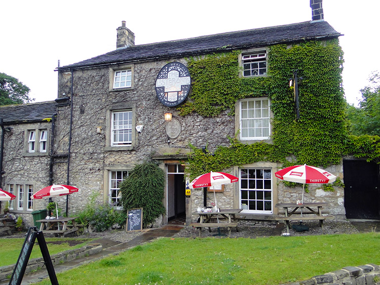 The Lister Arms in Malham
While the sulking Galloway cattle went back to grazing we continued on towards Malham Cove. Seeing the magnificent natural amphitheater was another tick in the box, another landmark of delight on the walk. Alas, as we neared Malham Cove the rain came again and this time it was heavier. We scuttled down the Malham road and found shelter. The sight of Malham Cove would have to be enough this time, no going up close in the rainstorm. Instead we scurried to a wall side on the Long Lane path and huddled under small hawthorn trees beside a wall. Only after the rain had abated did we stand up from our individual huddles in our individual makeshift shelters to walk down Long Lane into Malham village.
 Following the River Aire to Hanlith
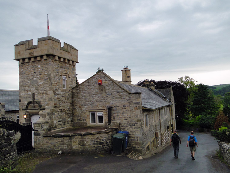 Hanlith Hall
In Malham village we rejoined the Pennine Way which we had left in Horton in Ribblesdale. Now, apart from a couple of detours for accommodation purposes, I would follow the Pennine Way fro the next 75 miles until its southern end in Edale. After the Cape Wrath Trail, West Highland Way and Dales Way it was my fourth significant walking route companion. To start our new acquaintance the section of Pennine Way walking from Malham to Hanlith and from Hanlith to Airton was expected to be a thorough delight. Pleasant riverside meandering, a perfect finale to finish the day. A warm down if you like. However, the rain must have been worse here. The ground around the Aire was covered in pools and makeshift ponds. Much irritating meandering was required which extended the length of the walking we had desired to do to finish our day.
Eventually and after the frustrating meanderings Airton was reached and the second day in the Yorkshire Dales was done. Only one more to go. Though the National Parks appear to be large this can be deceptive. I had walked through the Lake District in three days and in three days I would walk through the Yorkshire Dales. Not fair that. Anyway, at least I was near home and I could enjoy my bed one more time before the resumption of my journey to Cornwall. Lots more long distance paths, National Parks, Areas of Outstanding Beauty and natural wonders to enjoy yet. I could sleep well in my bed pondering that thought.


