Harrogate, Almscliffe Crag, North Rigton and Pannal
This walk is a personal favourite. I walk the route at least once a year, setting off from my front door which is just a hundred metres or so from the walks designated starting point at Harrogate Water Tower. I have chosen this starting point as you get the first of many tremendous views granted by the walk when looking left to the rooftops of Harrogate and to the North York Moors when walking along Nursery Lane. From west Harrogate the walk heads into countryside via Beckwith Head and continues over farmland to North Rigton with the famous Almscliffe Crag a prominent feature. The crag is visited before returning to North Rigton and then continuing along a high path to the pretty village of Pannal. From here the Harrogate Ringway path leads back to the southern edge of Harrogate before some of my familiar paths lead back to the water tower via a very popular nature reserve.
Google Maps Open Source Maps| Statistics and Files | ||
|---|---|---|
| Start: Harrogate Water Tower | Grid Ref: SE 28832 54201 | Distance: 11.4 miles (18.3 km) |
| Time: 5-6 hours | Climbing: 330 metres | Rating: Hard |
| GPX Route File | Google Earth File | About Almscliffe Crag |
| Statistics | |
|---|---|
| Start: Harrogate Water Tower | Grid Ref: SE 28832 54201 |
| Distance: 11.4 miles (18.3 km) | Time: 5-6 hours |
| Climbing: 330 metres | Rating: Hard |
| GPX Route File | Google Earth File |
Ordnance Survey Explorer Map (1:25,000)
The Walk:
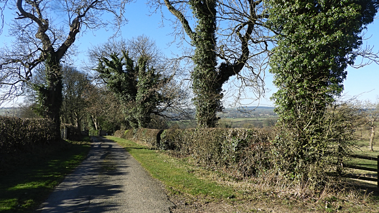 Beckwith Head Road
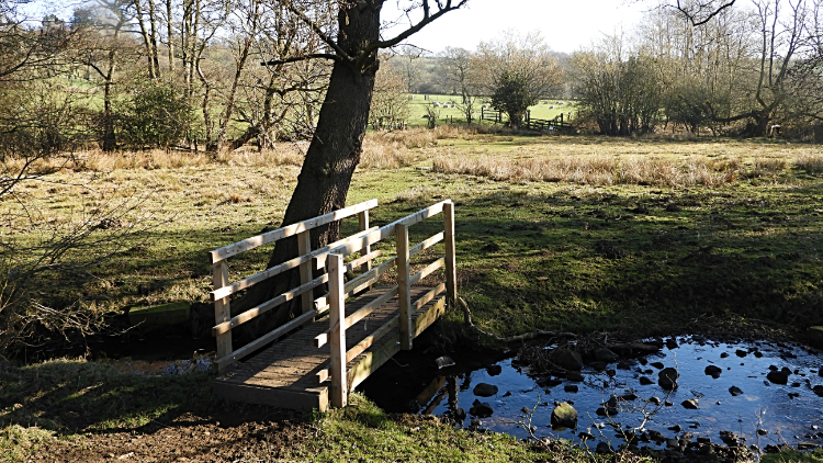 Fields near Valley Farm
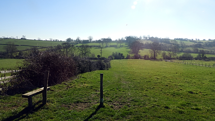
It was a lovely warm and sunny morning, a couple of days before the end of February. A magic time of the year for me as flowers such as Crocus and early Daffodils are making a show, promising that the blossoms of Spring will be following. Anyway, off I went in the warm air, thrilled to be on one of my favourite local walks. On leaving the urban of west Harrogate by way of Otley Road and Beckwith Head Road I was quickly rid of the traffic and into the quiet of countryside. The second dead-end part of Beckwith Head Lane, south of Lady Lane is a delight to walk. I often meet and greet other local walkers and farmstead residents on the quietest of roads. All usually have a broad smile making it a happy start to my day out. Soon enough I am rid of tarmac and heading down a field to a small and very pretty woodland path which leads me to Howhill Quarry Road. Just a few more paces of tarmac take me past Valley Farm and into the fields.
 Climbing to Brackenthwaite Lane
 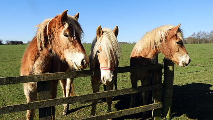 Spring House Farm Stable mates
I have been descending all the way so far and the first couple of fields help me descend further to Crimple Beck which I cross by way of a footbridge. After the beck crossing I look up to my first climb, a fifty meter ascent up a series of pasture fields to Brackenthwaite Lane. Despite now being in my mid sixties I don't baulk at the climb; I actually look forward to the work out. Walking is my method of staying healthy and keeping fit. The uphill bits do that best. From the lane crossing, climbing done for a short while, I enjoy the amble over more fields and on lanes to reach the access road from Rudding Lane to Spring House Farm Stables. It is always nice passing the stables as the horses in the fields and paddocks generally stroll over to me as I walk along. I do enjoy the attention.
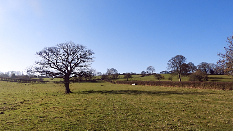
 Descending to Nor Beck
 North Rigton
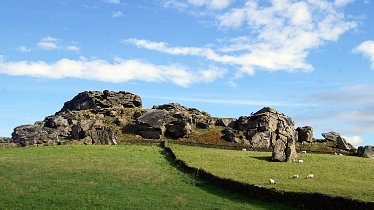
From the stables the walk enters another stretch of gorgeous countryside. Soon I drop down to cross Nor Beck but not before spotting Almscliffe Crag shimmering in the sunshine just a little over a mile away to the south-west. It excites me to know I will soon be on the famous rocks. First though I have a climb from Nor Beck, across a couple more fields and then up the roadside to reach the highest point of North Rigton village. It is a steep little 30 meters up the hill before I leave the road to turn right just after the hill top to follow a pretty lane come unofficial nature reserve to arrive on the corner of Crag Lane which leads me westward for just over 500 meters to reach the access path leading to Almscliffe Crag.
 Almscliffe Crag
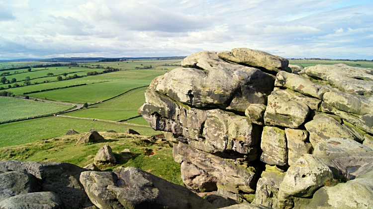 Countryside view from Almscliffe Crag
Almscliffe Crag is a very popular Millstone Grit outcrop. The site is visited all year around, mostly by the local folk of Leeds and Harrogate. The crag is sited conveniently midway between both city and spa town. Bradford is not far away either and people are drawn to the accessible crag from there too. It is easy to see why for Almscliffe Crag is a short distance from Crag Road making a walk up to the rocks easy for even the less mobile. Kids and youngsters love to climb and play on the crag. So do I. And plenty of other oldies too! I always make time to climb onto the natural millstone grit monument and frolic for a short while if visiting the site. And sometimes I make a point of finding a sheltered spot on the crag to rest and take refreshment. As I did this time around, sitting a viewing the spectacular local countryside at just over the 200 meter elevation mark, the highest point of the whole walk.
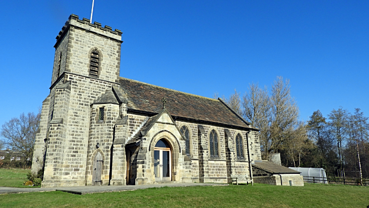 North Rigton Church
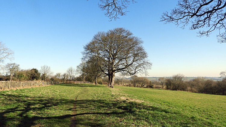 Heading off from North Rigton
After my break on Almscliffe Crag I walked back along Crag Lane to North Rigton. I made a point of taking a good look at North Rigton Church and afterwards I was tempted to pop into the village pub, the Square and Compass, for a refreshing drink. Having enjoyed my lunch break just a short while back on the crag I thought that a little too indulgent and so I walked straight past the pub and up the village hill, turning right before the top, to head on a path parallel to Beeston's Lane in a direction north eastwards across a couple of fields leading to a very pretty isolated pond.
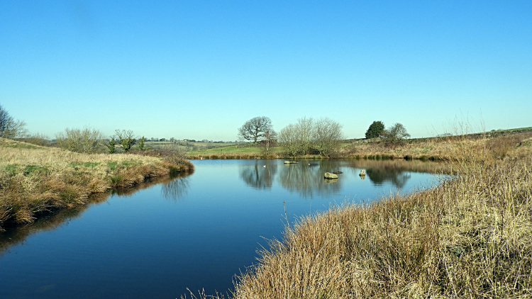 North Rigton Pond
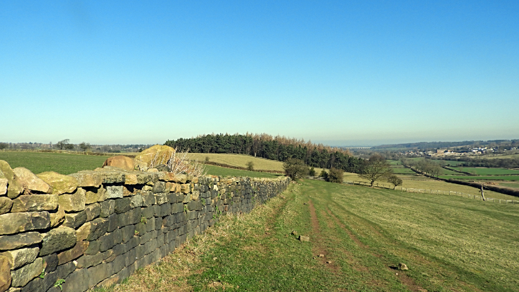 View from Horn Bank to Warren Plantation
North Rigton Pond is a most glorious place. For many years I did not know the pond was here at all, it not being marked on any maps. Nor is it mentioned on local information boards or on any websites I know but I can assure you it is there, around grid reference SE 28644 50069. t must be connected to Nor Beck in some way though the beck is about twenty meters lower and around 250 meters north of the pond. This time around the pond was being occupied by a pair of Black Headed Gulls, possibly pairing up. It was the onset of Spring after all. Just beyond the pond, in the next field and on a rise, was a bench, conveniently sited to view the picture perfect countryside to the north, centered around the village of Beckwithshaw. Norwood Tower, a communications pylon stood on top of a hill at Norwood Edge can be spotted from the viewpoint, five miles to the north-west.
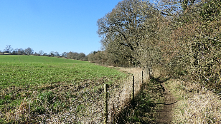
The next section of the walk is on an airy ridge for a kilometer along Horn Bank to Warren Plantation. The ridge, at around the 150 meter mark, runs parallel to the main A658 Huby to Pannal which is fifty metres lower to the right. Running alongside the road is the Leeds to Harrogate railway line so it is not uncommon to watch a train overtaking heavy traffic or light traffic overtaking the train while walking the ridge. I have seen cars win the race and on other occasions I have seen the train win the race.
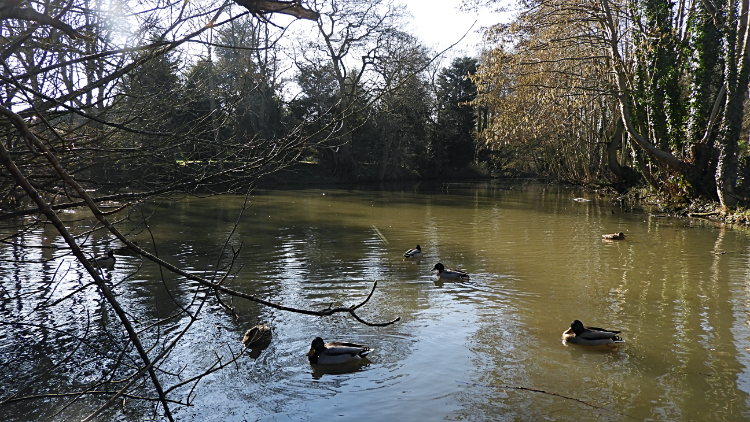 Pannal Pond
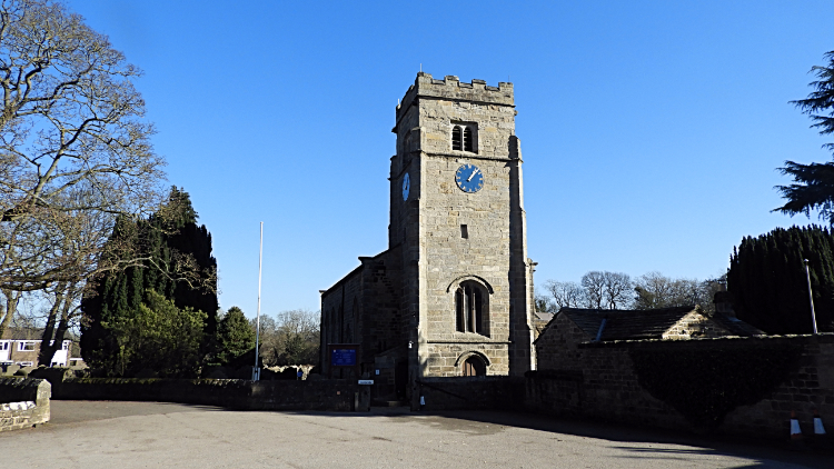 Pannal Church
On reaching Warren Plantation the path drops from the 150 meter mark of the ridge to around 100 meters at Burn Bridge, dropping to the low point of around 80 meters beyond Pannal at Stone Rings. First though, Burn Bridge to Pannal, one of my favourite built up sections o the walk. I am now joined to the Harrogate Ringway, another walk I aspire to do every year. For so long as I possibly can. From Burn Bridge I am beside or close to the line of Crimple Beck once more and on the entry to the village of Pannal I have the delight of Pannal Pond to enjoy. The pond is near the beck but not part of it, being higher by about ten meters. The village Ducks are characterful residents of the pond. After enjoying their antics for a couple of minutes I walked on the Harrogate Ringway through Pannal, exiting the village via the church and across fields to Stone Rings.
 Harrogate Ringway at Stone Rings
 Rossett Local Nature Reserve
At Stone Rings I reached the lowest part of the whole walk, around 80 meters and facing a 100 meter climb back home. Still, a final effort would get e in the right frame of mind for a sit down and drink with my feet up when finished. Still there was lots to enjoy on the walk yet. Climbing up the Ringway path alongside a narrow woodland copse to the west edge of Stone Rings Drive is always delightful. Here I leave the Ringway to follow a permissive path intersecting fields to reach Leadhall Lane and once the lane is crossed I follow the path up to the lovely place which is Rossett Local Nature Reserve. It is a peaceful place and I love it, visiting most weeks. After five minutes contemplation this time around I left the reserve and headed off to the finish. Time for putting my feet up after a thrill of a walk.


