Cockshutford, Abdon Burf and Brown Clee Hill
To a high hill and across the moorlands of south east Shropshire
Google Maps Open Source Maps| Statistics and Files | ||
|---|---|---|
| Start: Cockshutford | Distance: 5.8 miles (9.4 km) | Climbing: 346 metres |
| Grid Ref: SO 58029 85048 | Time: 3 hours | Rating: Moderate |
| GPX Route File | Google Earth File | About Brown Clee Hill |
| Statistics | |
|---|---|
| Start: Cockshutford | Distance: 5.8 miles (9.4 km) |
| Climbing: 346 metres | Grid Ref: SO 58029 85048 |
| Time: 3 hours | Rating: Moderate |
| GPX Route File | Google Earth File |
Ordnance Survey Explorer Map (1:25,000)
The Walk: Brown Clee Hill at 1,771 feet (540 metres) is just about the highest hill in the West Midlands. The only higher points are the Black Mountains and on the Welsh border. Although the summit is only 30 miles from Birmingham, the walk takes you into one of the quietest and least spoilt areas of the region. The medieval villages and ruined hill forts are a reminder that this now quiet area was once a region of thriving lost communities.
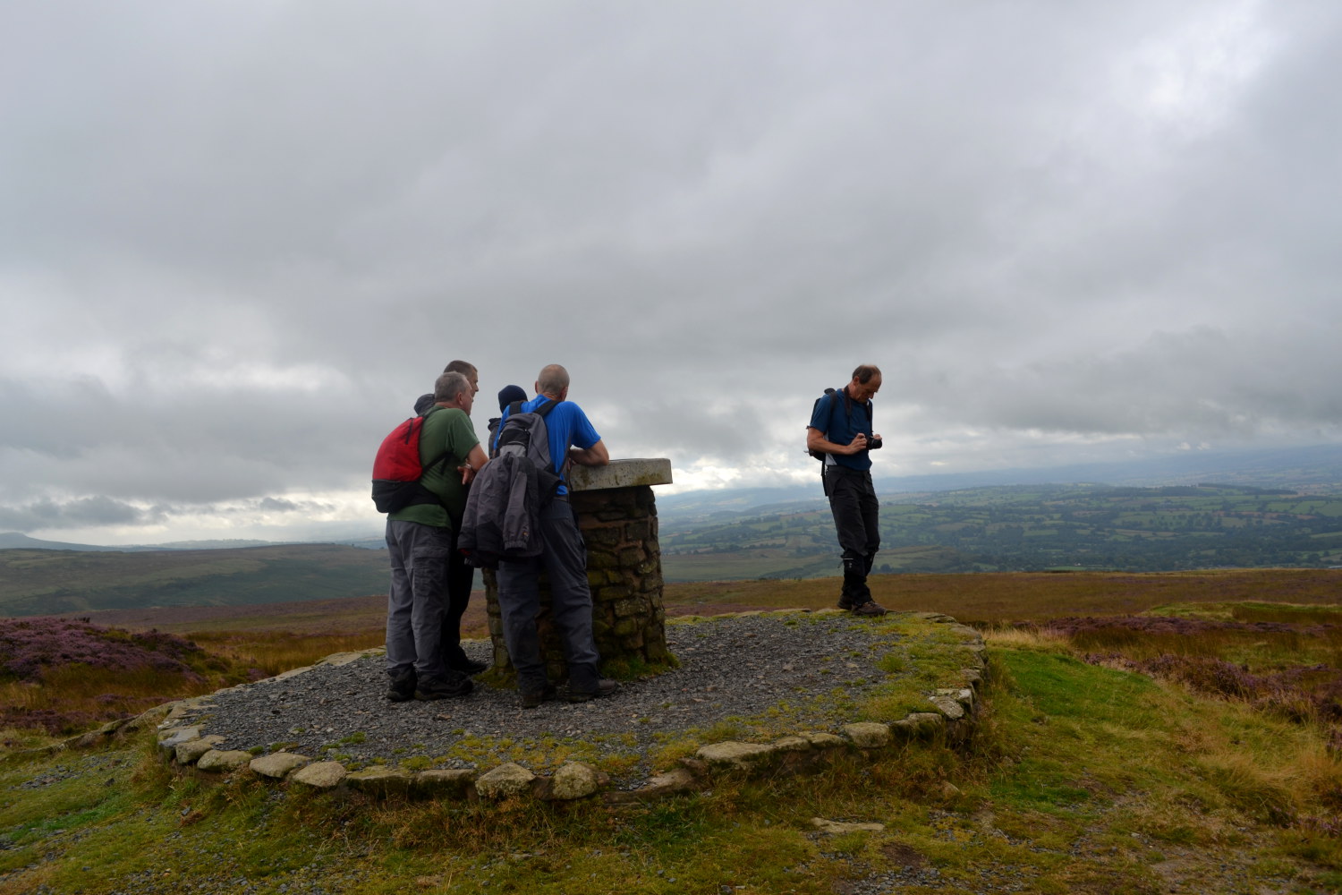 Abdon Burf
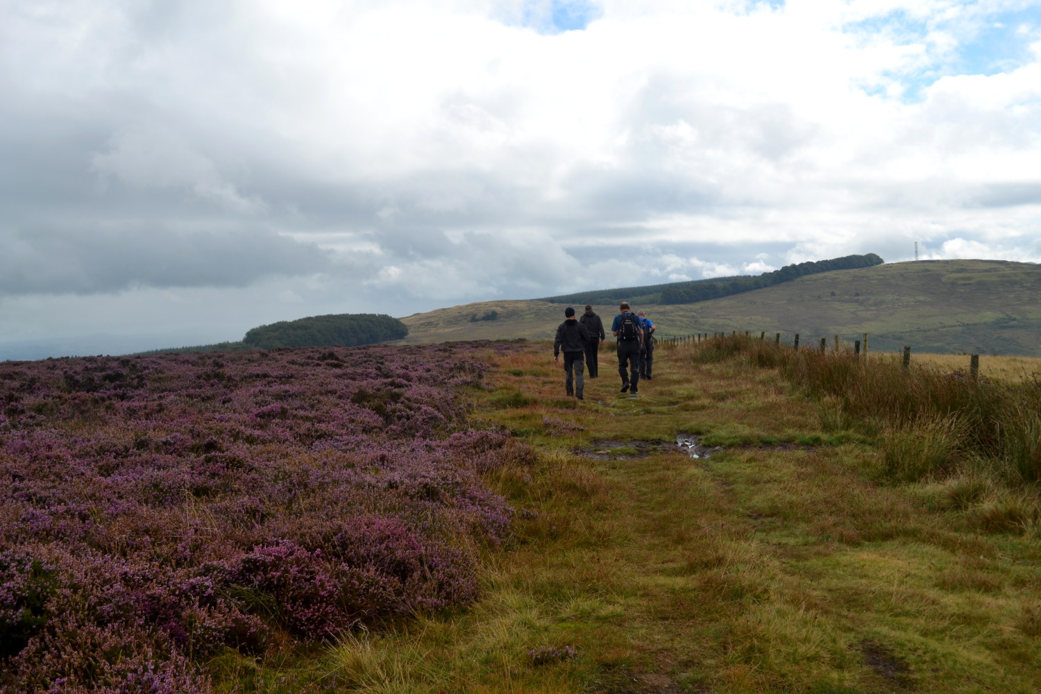 Crossing Brown Clee Hill
The walk begins by cutting across fields to the village of Abdon, now just a couple of farms but once larger. The sunken way that the path follows was one of the main streets of the village and if you climb to your left you have a view over the old village site to the now isolated church. The various bumps in the ground mark the sites of old houses. There was another medieval village just to the west at the hamlet of Heath.
From Abdon there is a steep climb up to the highest point of Brown Clee, where you are rewarded with great views. To the east, over the valley of the River Severn with industrial West Midlands beyond. To the west, over the dale of the River Corve and the Shropshire hills to the mountains of Wales. To the north are the remaining structures of the Ironbridge Power Station with the prominent hill of the Wrekin just beyond. Turing south you may be able to spy out the Malvern Hills. The remainder of the walk is over high moorland, dropping down to a pass and around the side of Clee Burf.
Brown Clee Hill contained three iron age hill forts. The largest was at Abdon Burf, the first summit. Little now remains, just a bank and a ditch, but these are 400 yards (360 metres) long, with a gateway in the middle. The second was on the summit of Clee Burf, and again relatively little survives. Finally, near the very end of the walk is the smaller but better preserved fort of Nordy Bank, probably a lookout post for the main forts.
To explore the other side of the Brown Clee Hill area see my Burwarton, Brown Clee Hill and Clee Burf walk.
Acknowledgment: Text derived from the Out and Out Series; Discovering the Countryside on Foot. Pictures courtesy of Wikipedia.


