Monks Risborough, Whiteleaf Hill and Risborough Kop
A leafy, scenic walk with history and within easy access of London
Google Maps Open Source Maps| Statistics and Files | ||
|---|---|---|
| Start: Monks Risborough | Distance: 6.1 miles (9.8 km) | Climbing: 317 metres |
| Grid Ref: SP 81469 04372 | Time: 3 hours | Rating: Hard |
| GPX Route File | Google Earth File | Monks Risborough |
| Statistics | |
|---|---|
| Start: Monks Risborough | Distance: 6.1 miles (9.8 km) |
| Climbing: 317 metres | Grid Ref: SP 81469 04372 |
| Time: 3 hours | Rating: Hard |
| GPX Route File | Google Earth File |
Ordnance Survey Explorer Map (1:25,000)
The Walk:
When the Metropolitan Railway, now the London Underground's Metropolitan line, pushed north east out of London to Chesham in the 1930's, it gave walkers easy access to the Chiltern Hills and their picturesque villages. The gentle south facing slopes of the hills are heavily wooded, predominantly by beech trees. This led to the county of Buckinghamshire being described appropriately as 'Leafy Bucks'.
The beech woods end quite sharply on the crests of the north-facing scarp slopes that drop away dramatically to the rich clay farmland of the valleys. Just below the tree line on the steep slopes, vegetation is poor, and it is interesting to note how the fields appear to be edged with the lacy frill of grass.
Across the hilltops runs the Icknield Way- part of the Great Ridgeway, a prehistoric trade route that ran from Devon to the North Sea - while the Lower Icknield Way follows a gentler route through the valleys. No one knows where the word 'Icknield' came from. Its origins have been lost in the mysteries of time. It is so old, it has no recognisable language root from which it can be dated or identified.
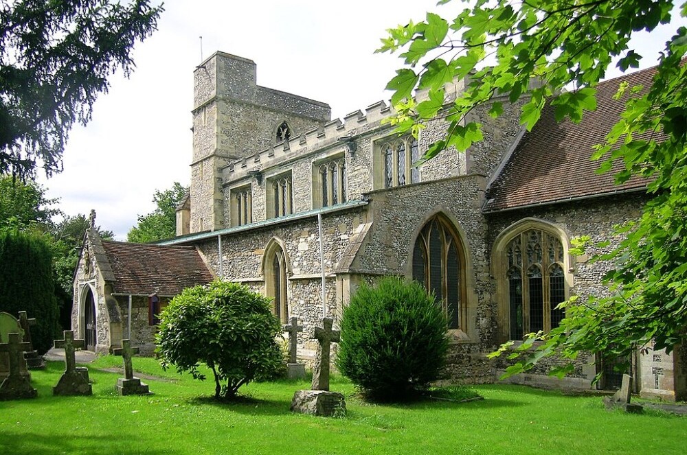 St Dunstans Church, Monks Risborough
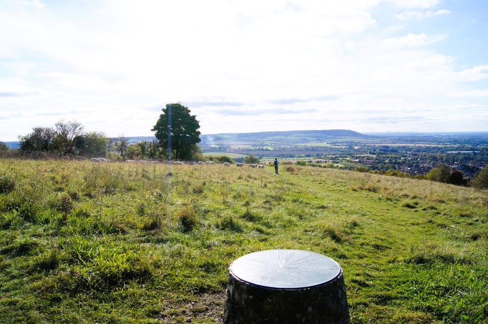 Brush Hill Local Nature Reserve
This delightful walk traverses some of the most beautiful and dramatic of the Chiltern countryside. It takes you along the Ridgeway and explores the antique village of Monks Risborough and the ancient hilltop settlement of Whiteleaf. These are both within the same parish boundary defined by a charter in 903 AD.
The walk begins alongside an old flint and brick schoolhouse. Flint was used a lot in local building because it is so abundant and easy to collect. Grey black boulders simply erupt through the soft local chalk. Knapping, the ancient art of chipping flint to manageable shapes and sizes, is reviving as a local craft in some villages. Knapped flint is once again being used in the building of new houses.
Very soon, there is a quite steep climb up the Ridgeway, through magnificent, seemingly timeless beech woods. Though much of Buckinghamshire's beech woods were damaged in the gales of 1987, 1990 and increasingly by other storms in the present century, this part seems to have remained pretty well unscathed. However, there are some bald patches on the hillside, where a particular vicious blast has felled five or six of these giant trees.
In summer, sunlight plays on the tall straight green-grey trunks of the trees. In the autumn, when the leaves are changing colour, the golds, greens, yellows and reds, are quite spectacular.
There is a deep dry valley on the left. Dry valleys are very much a feature of the chalky hills, and a number of them can be seen on this walk. Geologists believe that at the end of the Ice Age, a great surge of water poured down from the north. Meeting with a permafrost still in the chalk, it scoured these deep furrows until it found its way down to the soft, easily carved clay of the valleys, where it formed rivers.
Chalk absorbs water readily, and this surfaces usually in the form of springs, where the clear bed meets the chalk. In places along the walk you can see that the villages were built along the spring line, where there would be a plentiful supply of water for crops and livestock.
Standing above Whiteleaf village is the chalky landmark of Whiteleaf Cross, a well known 100 metre high chalk hill figure which has been carved deeply into the hillside. About six miles away to the south, on the Ridgeway above the village of Bledlow, there is another cross cut in the hillside, though it is much smaller than the one at Whiteleaf and less dramatic.
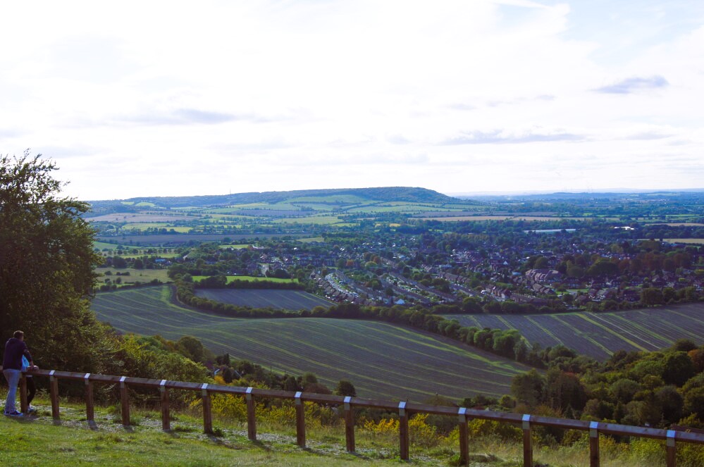 View of Princes Risborough from Whiteleaf Hill
 Icknield Way at Princes Risborough
From your position around the site of ancient Whiteleaf village, above the cross, you get a panoramic view of the broad saucer-like landscape of the Vale of Aylesbury, with its line of low hills to the north, and the bustling little town of Princes Risborough below. Later, as you descend, there is a spectacular view of the cross from the field below.
While being home to two nature reserves, Whiteleaf Hill and neighbouring Brush Hill, this upland area is also home to other interesting archaeological features including a Neolithic barrow and WW1 practice trenches.
Deep in another valley lies Pyrtle Spring. Although it would once have provided a very useful source of water for grazing cattle, strangely, there are no habitable settlements nearby these days. It is just a muddy little pond surrounded by a rather gloomy and unkempt looking group of trees. But even in the most severe droughts, Pyrtle Spring is never quite dry.
Kop Hill, home of the famous motorsport Kop Hill Climb, rises steeply with a splendid tree-girt dry valley on the right and a tall ancient scrubby hedge on the left. In springtime, the pungent smell of may blossom fills the air, and dainty white flowers overhang the bank. In summer, wild honeysuckle take over. And in the autumn, the hedge seems almost overwhelmed by the weight of great trusses of 'Old Man's Beard'.
Whiteleaf village is a hotchpotch of houses and cottages, straddling the 16th to the 21st centuries. Built along the ridge of the hill, there are some remarkably well preserved timber-framed brick cottages, and some of wattle and daub with a chalk overlay. The ed Lion pub is of 18th-century origin.
At the end of the walk, it is worth looking around the older part of Monks Risborough village and the 14th-century Church of St Dunstan. If you are lucky enough to find the church open, its cool interior is a haven of peace. Within the church, look at its tall beamed ceiling and the Norman 'Aylesbury' font. The stained glass is modern for the most part, but there are 15th-century fragments in the chancel windows.
Acknowledgment: Text derived from the Out and Out Series; Discovering the Countryside on Foot. Pictures courtesy of Wikipedia.


