Huggate, Frendal Dale and Pasture Dale
A village, farms and wildlife in Britain's most northerly chalk country
Google Maps Open Source Maps| Statistics and Files | ||
|---|---|---|
| Start: Huggate | Distance: 7.5 miles (12.0 km) | Climbing: 278 metres |
| Grid Ref: SE 88205 55145 | Time: 3-4 hours | Rating: Easy |
| GPX Route File | Google Earth File | About Huggate |
| Statistics | |
|---|---|
| Start: Huggate | Distance: 7.5 miles (12.0 km) |
| Climbing: 278 metres | Grid Ref: SE 88205 55145 |
| Time: 3-4 hours | Rating: Easy |
| GPX Route File | Google Earth File |
Ordnance Survey Explorer Map (1:25,000)
The Walk: Chalk is the underlying rock of the Yorkshire Wolds, and it has had a great influence on the landscape. Rounded, undulating hills are cut by steep sided valleys. These were gouged out by melt waters as the ice-caps of the last ice-age retreated. Today, the water table is much lower than the bottom of the valleys, and most of them no longer have any water running in them. The porousness of the chalk has meant that water has always been a precious commodity here. Piped supplies came to the villages less than a century ago. The village of Huggate, which nestles in a fold in the high Wolds, was no exception.
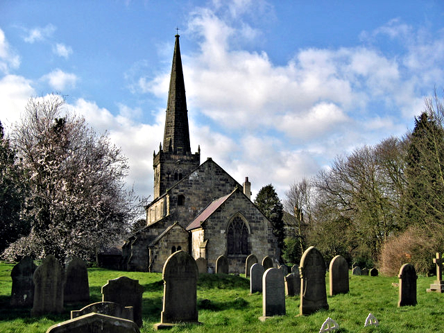 Huggate church
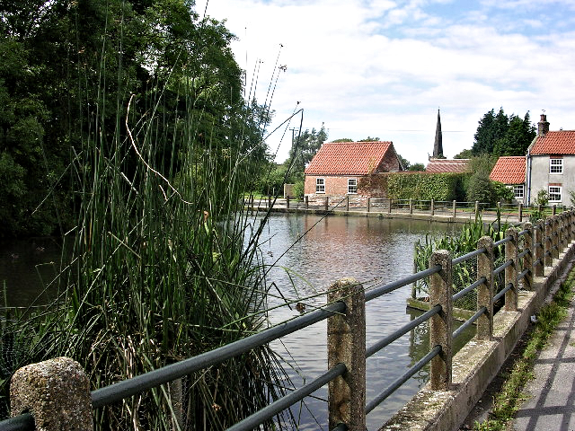 Huggate village pond
The well on Huggate village green, where the walk starts, is reputedly the second deepest in the country. According to a sign on a millstone at the site of the well, which is now capped, it is 339 feet (103 metres) deep. It took two men about half an hour to wind up a single bucket of water, though the water was very pure, having been filtered through hundreds of feet of chalk.
Across the road from the site of the well are some old clay workings. A belt of clay runs through the middle of the village, and chalk in the clay lends it a characteristic yellow colour. Bricks baked from the local clay were used in many of the village's more substantial buildings, including Kirkdale House, which was formerly the vicarage.
Downhill from the green is the village pond. In the days of horse power, ponds were vitally important, and every village on the Wolds had one; all the animals drank here, and it also provided water for domestic purposes. The one at Huggate, dug out of the local clay, is now left mostly to the ducks.
Huggate was once part of a large estate, and has many farm buildings from before the turn of the century. Date stones can still be seen in those constructed by William Jessop,owner of the estate in the late Victorian period, when the village was a thriving farming community.
St Mary's church, also known as All Saints, is at the north end of the village. It is Norman in origin,but much altered, and its finest feature is the 14th century tower, surmounted by a splendid spire.
North of the village, you climb steadily along the Wolds Way to the outlying Glebe Farm. The views from here are widespread, stretching to the North Sea on the clearest of days, and the light of Flamborough Head Lighthouse can be seen at night. By the route at Glebe Farm there is a dewpond, a vital source of water for livestock in the chalk Wolds.
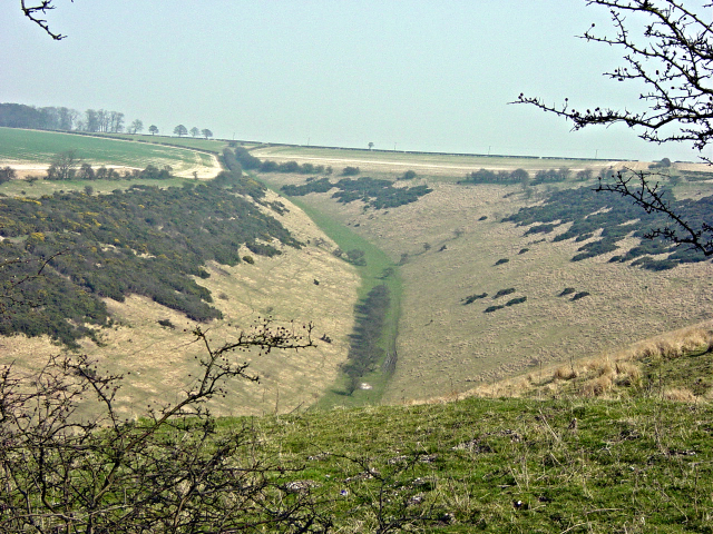 Frendal Dale
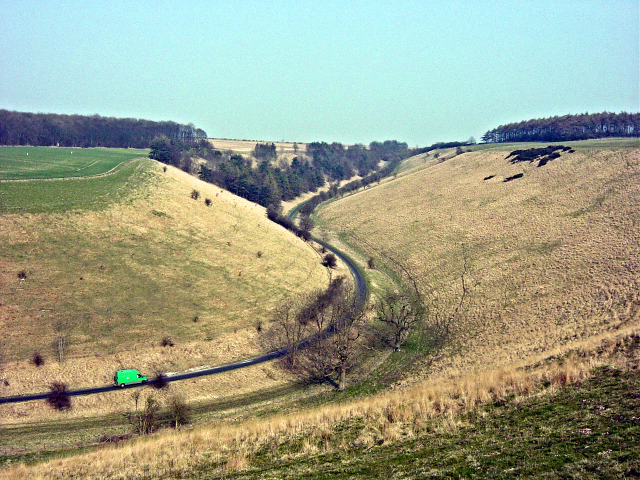 Pasture Dale
From Glebe Farm, the walk continues though high land and crosses Horse Dale, a dry valley. At the top of the steady climb, it is worth making a detour along the road to Huggate Wold Farm to see a life-size bronze statue of David Midgley, a farm foreman, who retired in 1992 after 40 years service.
The route continues along a minor road, then down a track to a woodland. The walking is easy, and the hanging wooded slopes give you a feeling of stepping back to a time when oxen hauled wooden wheeled carts up this route.
At the bottom, you walk into the open spaces of Frendal Dale. Above, and to the left, along its eastern ridges, earthworks are visible. These were made by the Parisii, an Iron Age people thought to have originated from Northern France and to have colonised the Wolds from about 300BC.
The end of the dale sweeps around Millington Pasture and reaches Nettle Dale at a pint where three long distance footpaths meet, namely the Wolds Way, Minster Way and Chalkland Way. From here the walk heads east on the south side of Pasture Dale back to Huggate. The last section is walked by following Pocklington Lane into the village.
Acknowledgments: Text derived from the Out and Out Series; Discovering the Countryside on Foot. Pictures courtesy of Wikipedia.


