Fairwarp, Duddleswell, Camp Hill and Wealdway
Walking along the southern edge of an ancient heath
Google Maps Open Source Maps| Statistics and Files | ||
|---|---|---|
| Start: Fairwarp | Distance: 4.3 miles (6.9 km) | Climbing: 166 metres |
| Grid Ref: TQ 46558 26751 | Time: 2 hours | Rating: Moderate |
| GPX Route File | Google Earth File | Ashdown Forest |
| Statistics | |
|---|---|
| Start: Fairwarp | Distance: 4.3 miles (6.9 km) |
| Climbing: 166 metres | Grid Ref: TQ 46558 26751 |
| Time: 2 hours | Rating: Moderate |
| GPX Route File | Google Earth File |
Ordnance Survey Explorer Map (1:25,000)
The Walk:
Ashdown Forest is the largest remaining wilderness in south-east England. There are large tracts of woodland, but Ashdown Forest is principally open heathland with silver birches and scattered pines. The windswept heights on its southern edge afford spectacular views to the distant South Downs.
Throughout the Middle Ages, people lived on the fringes of the forest, exercising their rights to graze their livestock and collect fuel, while landowners saw the forest as a hunting ground and source of venison. Local ore and timber supplied the Wealden iron industry, which reached its peak in the 16th and 17th centuries. Ashdown's streams are still tinted red by iron deposits, and unusual hollows betray the presence of refilled pits.
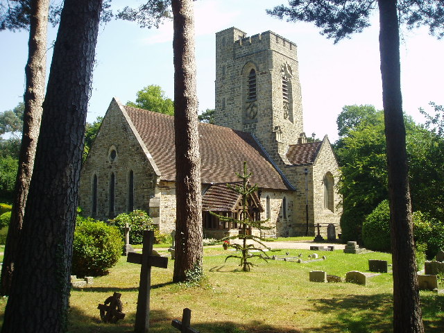 Fairwarp church
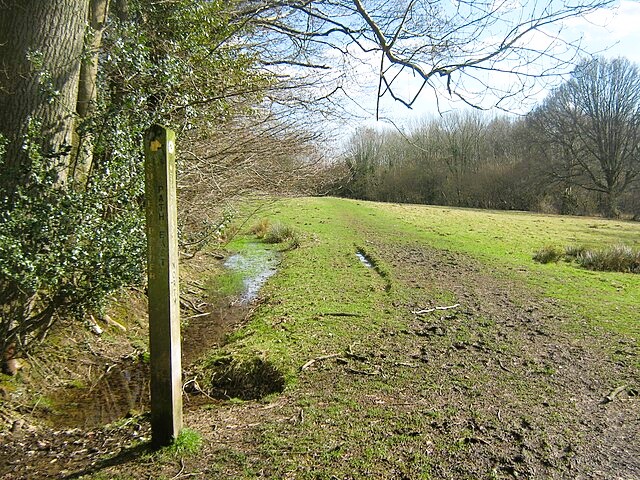 The Wealdway path
This walk on the southern fringes of the forest begins at the Victorian sandstone church of Fairwarp, which stands apart from the village, by the former Roman road between London and Lewes. You continue on to the open heath and there are superb views across the hillsides of the southern Weald. The slopes are splashed with the fresh green of birch scrub in spring, the purple of heather in late summer, and the rich brown of dying bracken in September and October.
The best views are to be had on a crisp winter's day when the pine clumps stand out sharply against the blue sky. Camp Hill, one of the highest points of the forest at 650 feet (198 metres), offers a particularly impressive panorama. On a clear day you can see as far as Eastbourne.
The Wealdway, an 82 mile footpath from Gravesend to Beachey Head, was officially opened here in 1981. Lines of so-called mystery mounds are visible on low ground just north of Camp Hill. They were once thought to have been of prehistoric origin or the remains of late medieval rabbit warrens; but it has since been established that they cover field kitchens, part of an army camp that was set up here in 1793.
A wireless mast stands within a fenced enclosure east of Camp Hill, all that remains of the forest of aerials that was the Diplomatic Wireless Service Station, which was opened in 1942 to broadcast anti Nazi propaganda. It remained in use until 1985, transmitting and receiving messages to and from embassies all over the world.
The walk follows the waymarked Wealdway southwards and enters a wooded valley which adjoins the Oldlands Hall Estate. This tranquil corner once resounded to the clanging of massive hammers, the roar of furnaces, and the hiss of steam. The estate was heavily involved in the iron industry.
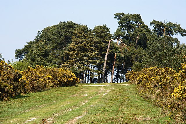 Camp Hill
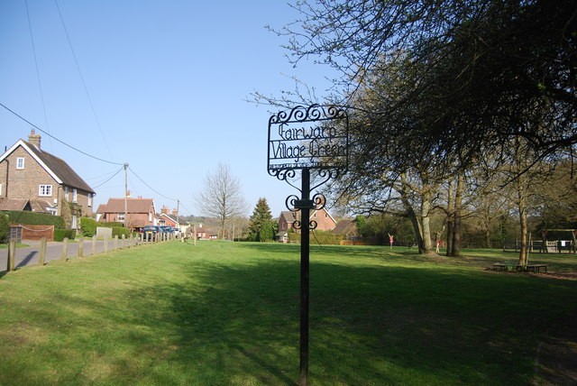 Fairwarp village green
The Romans smelted ore around here. They may have discovered it when they built the road nearby. The road would certainly have helped them to transport materials and finished iron to and from Oldlands. Remains of a Roman building have been found here, along with coins, glass fragments, numerous pieces of pottery, and human bones from the 1st century AD.
At the end of the 15th century, the first blast furnaces in England were built at nearby Newbridge. During the 16th century, several other furnaces were built in the forest.
John Levett managed a number of them, and he supplied munitions to the Crown for over 40 years. He owned land at Oldlands and there was certainly a furnace there by about 1614.
Many streams were dammed to create hammer ponds, which provided the water power to drive the bellows for the furnace and the massive hammers used in the forges. Though the woods are quiet now, the many ponds, streams, mounds, and depressions, remain as mute witnesses to the bustling iron industry that once flourished here.
The return route leads through the centre of Fairwarp, a quiet village with tile-hung cottages lining the green. Here you can enjoy a rest, or perhaps some refreshment at the aptly named Forester's Arms.
Acknowledgment: Text derived from the Out and Out Series; Discovering the Countryside on Foot. Pictures courtesy of Wikipedia.


